Approximate distance of communities, LGA and State headquarters
Community
Distance from LGA Headquarters
Distance from State Headquarters
BAMBAM
34.58KM
77.25km
BANGU
8.03KM
73.72km
DADIYA
54.72KM
79.18km
DEGRI
13.2KM
74.72km
KULANI
17.41KM
72.96km
TALASE
65.50KM- ‐ GM
65.50KM
GEOGRAPHY
Balanga LGA covers a total area of 1626 square kilometres with the average temperature of the area put at 35 degrees centigrade. The average humidity of Balanga LGA is at 17 percent while wind speed in the area averages 4 km/h.
ECONOMY
Agriculture is the economic mainstay of the people of Balanga LGA with crops such as tomatoes, Sorghum, maize, beans, and groundnut grown in the area. Balanga LGA has a number of mineral deposits such as Bentonite, limestone, granite, and topaz. Balanga LGA is also home to the economically important Balanga Dam.
Raw Materials
Tomatoes
Sorghum
Maize
Millet
Beans
Groundnut
Cotton
Livestock
Fishery
Gum Arabic
Bentonite
Limestone
Tourmaline
Topaz
Bog Iron
Calcite
Basalt
Agate
Amethyst
Mica
Granite
Tale
Coal
Vermiculite
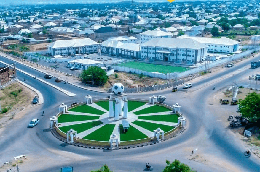
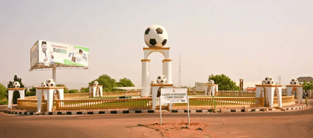
Gombe
Gombe is one of the 36 states of Nigeria. It is located in the north eastern part of the country.
The state was created out of Bauchi state on 1st October 1996 by Sani Abacha’s administration.
Its creation was a fulfilment of the aspiration of the people who for long, had passionately craved for a state of their own out of the then Bauchi state.
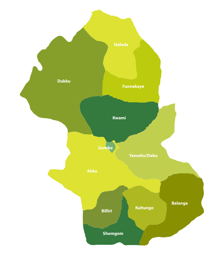
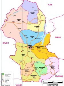
Gombe State has eleven Local Government Areas (LGA) namely, Akko, Balanga, Billiri, Dukku, Funakaye, Gombe, Kaltungo, Kwami, Nafada, Shongom, and Yamaltu Deba.
The following are administrative maps of Gombe State showing the local government areas
Historically, Gombe state is a fusion of two distinct groups of people, comprising the people of Gombe North and the ethnic grouping of Gombe South.
Gombe is located on latitude 9”30’ and 12”30’N, Longitude 8”5’and 11”45’E.
It has borders with Borno, Yobe, Adamawa, Taraba, and Bauchi states.
The State climate is generally warm, with temperatures not exceeding 300c during the months of March-May considered to be the hottest months. The following table gives other profile of the jewel state.
The Emirate government, which had its Head quarters in Gombe Abba, was formed to effectively control what constitutes a larger part of the Gombe State, until the advent of the British in the early 20th century.
Under the British, the state was administered through the mechanism of two administrative units, i.e. Gombe Native Authority and Tangale Waja Native Authorities. The two Authorities constituted Gombe Division during the Colonial era. However, with independence in 1960 and the subsequent military administration, many changes occurred which led to the emergence of local government authorities. Thus, between 1976 and the present, the then two authorities had metamorphosed into the present 11 local governments.
Capital: Gombe
Land area: The State occupies a total land area of about 20,265sqkm.
Climate: Warm, exceeding 40″c during the hottest month (March – May)
Topography: Mainly mountainous, undulating and Hilly to the South-East and flat open plains in the Central, North, North-East, West and North-West.
Location: Latitude 9”30’ and 12”30’N, Longitude 8”5’and 11”45’E. The state lies in the centre of North east Geopolitical Zone of Nigeria. It shares common boundaries with Adamawa and Taraba State to the South, Bauchi State to the West, Borno State to the East and Yobe State to the North.
Power: The State is served by the PHCN National grid through the North-East PHCN substation located in Gombe State capital
Roads: Five(5) Federal trunk “A” roads connect the State Capital with all parts of the Country. Twonship roads have been constructed in the State capital and all the major towns.
Airport: The State has an International Airport which is also surrounded by four (4) International Airport, located in Kano, Jos, Yola and Maiduguri.
Major towns :Gombe the capital, Bajoga, Billiri, Kaltungo, Kumo, Dukku and Deba.
Ethnic CompositionMulti-ethnic, mainly made up of Fulani, Tangale, Waja, Bolawa, Tera,Jukun, Jara, Pero, Tula, Cham, Lunguda, Dadiya, Kamo, Awak, Kanuri, Hausa, Yoruba and Igbo.
Language spoken: English is the official language, but as much as Hausa remain the commercial language amongst the people of the state, Fulfulde, Tangale, Tera, Waja, and Kanuri are commonly spoken.
Vegetation: Gombe is generally a Guinea Savannah grassland with concentration of wood lands in the South East and South West.
Rainfall: Annual Average of 850mm.
More
Balanga markets and their days The markets and the market days in Balanga Local Government Area of Gombe State are: • BambamMONDAY • BalangaTUESDAY •…
MARKET DAYS IN MAJOR TOWNS, NIGER STATE Some important markets and their days in Niger State is as follows: DAYSMARKETSDailyBidaKontagoraNew-BussaMinna (Main)SulejaSunAgaieKuchiT/KawoBaroGuffantiZumbaG/BokaShafiniZungeruGuniS/PawaBassaGwadaSobaUregiMonAunaSahonramiWarariKakihumBabannaGadaMajeBobiKuduGabaDukkuZagoKutaTueAdunuKagaraTakumaBabannaLapaiT/MagajiyaBobiMaitoYangaluDukkuS/PawaWedBakogi, BejiLummaWuya SumaDandauduKabojiZungeruGaratuKwana, LumaK/GarbaGibbo, GuluNaskoIssua, KabboGwari Market…
Lagos markets and their locations, commodities, market days Lagos numerous markets are located in the administrative divisions of the state as follows: BADAGRY Market NameLocationCommodityMarket Days1Agbalata MarketBadagryGeneral Goods9…
Major market days in Adamawa Some major market days in Adamawa State are as follows: DAYTOWNSCOMMONDITIES AVAILABLESundayDong, Gereng, Kiri, M/Farang, Song, Fufore, Kojoli, Michika, Shuwa,…
Taraba market days Market days in Taraba State, Nigeria, arranged by LGA and town, are: LGATOWNMARKET DAYSArdo KolaSunkaniTuesdayIwareTuesdayGarin MallumMondayMayo-RenewoSaturdayKasuwan LahadiSundayKantielMonday & FridayBaliBaliFridayMaihulaSaturdayGarba-ChedeThursdayPamangaSundayDakkaSaturdayDongaDongaFridayAnannumSaturdaySuntaiThursdayMararrabaMondayFaliFridayGashakaSertiFridayJamtariSundayGarbabiFridayGassolMutum-biyuFridayTellaSundayKwararrafaSaturdaySabon-gidaMondayNamnaiWednesdayMararraba GassolWednesdayTutare/BembalSaturdayIbiIbiSundayGindin…
Market days in Adamawa State, Nigeria Adamawa markets: The days of those markets, towns where the markets are located and the commodities available are as follows:…
BALANGA LOCAL GOVERNMENT Balanga local government area is located in Gombe state, Northeast geopolitical zone of Nigeria. Balanga LGA headquarters is Tallase. The…
Dantokpa Market, Cotonou Dantokpa is Cotonou’s open-air international market. The Dantokpa Market, or simply Tokpa (Fon: Dantɔkpa), is the largest open-air market in…
Rumuwoji (Mile One) Market The Rumuwoji (Mile One) Market is an architectural masterpiece, with very modern facilities to aid trading in a very conducive…
Kurmi Market Kurmi Market is one of the biggest and oldest markets in Nigeria. It was founded by the Emir of Kano,…
Kwari Market Kantin Kwari Market is the biggest textile market in Africa. The market is known mainly for Clothing, Lifestyle, Sample Materials…
Dawanau Market Dawanau Market is the largest grain market in Africa. No one has ever disputed this claim perhaps because of the…
Kurmi Market (Kasuwar Kurmi) The Kurmi Market is a large market in the city of Kano, Kano State, Nigeria. Founded by Muhammad Rumfa, a…
 Granite
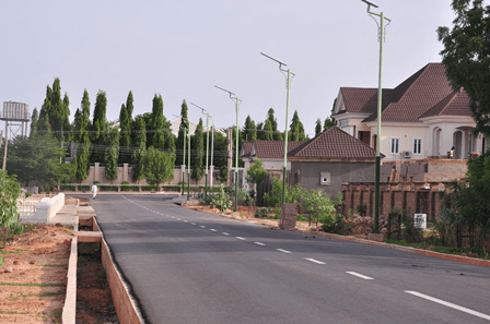


 Market and Fruit Garden Market, Port Harcourt")


")