Indonesia’s Provinces: From Largest to Smallest by Land Area
Province
Area (Km2)
Indonesia
1,890,179.78
Kalimantan Tengah
153,430.36
Kalimantan Barat
147,018.06
Kalimantan Timur
126,951.76
Papua Selatan
117,858.97
Riau
89,900.78
Sumatera Selatan
86,771.92
Papua
81,383.32
Sumatera Utara
72,437.76
Kalimantan Utara
69,900.89
Sulawesi Tengah
61,496.98
Papua Tengah
61,079.59
Papua Barat
60,308.59
Aceh
56,835.02
Papua Pegunungan
52,508.66
Jambi
49,023.04
Jawa Timur
48,055.88
Nusa Tenggara Timur
46,378.11
Maluku
46,133.83
Sulawesi Selatan
45,323.98
Sumatera Barat
42,107.67
Papua Barat Daya1
39,103.06
Kalimantan Selatan
37,125.43
Jawa Barat
37,053.33
Sulawesi Tenggara
36,139.30
Jawa Tengah
34,347.43
Lampung
33,570.76
Maluku Utara
31,465.98
Bengkulu
20,122.21
Nusa Tenggara Barat
19,631.99
Kepulauan Bangka Belitung
16,670.23
Sulawesi Barat
16,590.67
Sulawesi Utara
14,488.43
Gorontalo
12,024.98
Banten
9,355.76
Kepulauan Riau
8,170.38
Bali
5,582.83
DI Yogyakarta
3,170.36
DKI Jakarta
661.53
Indonesia’s Provinces Ranked by Land Area: From Largest to Smallest
As the world’s largest archipelagic state, Indonesia spans thousands of islands across Southeast Asia and Oceania. To manage this massive maritime nation, the country is divided into 38 first-level administrative provinces.
Because Indonesia encompasses major portions of the world’s largest islands—such as New Guinea, Borneo, and Sumatra—the land area of its provinces varies dramatically. From expansive resource-rich territories spanning over 150,000 square kilometers down to dense urban capital regions measuring less than 1,000 square kilometers, this article explores Indonesia’s provinces ranked by land area.
Provincial Land Areas
The total land area of Indonesia’s 38 provinces covers approximately 1,890,179.8 $\text{km}^2$, with an average provincial size of roughly $49,767.9\text{ km}^2$. However, this average masks extreme disparities:
The Largest Province: Central Kalimantan spans over $153,430\text{ km}^2$.
The Smallest Province: Jakarta (the Special Capital Region) covers just $661.53\text{ km}^2$.
Top 10 Largest Provinces in Indonesia
The largest provinces are primarily concentrated on the sprawling outer islands of Kalimantan, Western New Guinea, and Sumatra, where vast tracts of rainforest, river systems, and mountainous terrain dominate.
Rank
Province
Major Island / Region
Land Area (km2)
Capital City
1
Central Kalimantan
Borneo
153,430.36
Palangka Raya
2
West Kalimantan
Borneo
147,018.06
Pontianak
3
Papua
New Guinea
Varies (Largest eastern province)
Jayapura
4
East Kalimantan
Borneo
126,951.76
Samarinda
5
Riau
Sumatra
89,900.78
Pekanbaru
6
North Kalimantan
Borneo
69,900.89
Tanjung Selor
7
South Sumatra
Sumatra
86,771.92
Palembang
8
North Sumatra
Sumatra
72,437.76
Medan
9
Central Sulawesi
Sulawesi
61,496.98
Palu
10
Aceh
Sumatra
56,835.02
Banda Aceh
Regional Breakdown of Land Area Distribution
1. The Kalimantan Region (Borneo)
The provinces on the Indonesian portion of Borneo (Kalimantan) occupy some of the top spots for total land area. Central Kalimantan leads the nation, closely followed by West Kalimantan and East Kalimantan, reflecting the sheer scale of Borneo’s interior jungles and wetlands.
2. Western New Guinea
Encompassing the western half of New Guinea—the world’s second-largest island—the eastern provinces (including Papua, West Papua, and newer subdivision provinces like South and Central Papua) feature expansive, rugged terrains filled with dense highland forests and remote river basins.
3. Sumatra and Sulawesi
Sumatra houses large territorial heavyweights like Riau, South Sumatra, and North Sumatra, which combine mainland river basins with rich agricultural plains. Meanwhile, Sulawesi’s provinces—led by Central Sulawesi—feature unique, rugged peninsulas shaping deeply indented coastlines.
4. Java and the Smaller Island Provinces
Java, though densely populated and economically vital, consists of smaller, highly fragmented provincial sizes (such as East Java, West Java, and Central Java) compared to the giant outer-island territories. At the bottom of the scale are compact administrative zones like Yogyakarta, Bali, and the Special Capital Region of Jakarta ($661.53\text{ km}^2$), which prioritize high-density urban infrastructure over sprawling geographic landmass.
Smallest provinces of Burundi by land area The 10 smallest provinces of Burundi by size of land area are: Bujumbura Mairie Muramvya Mwaro Bujumbura Rural Rumonge Bubanza…
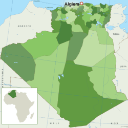
Algeria smallest provinces by land area The 10 smallest provinces by land area in km2 (kilometers square) in Algeria are: Algiers Boumerdès Annaba Blida Tipaza Oran…
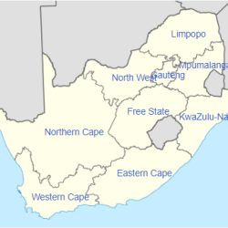
5 smallest provinces of South Africa by land area The 5 smallest provinces of South Africa by land area are: GautengMpumalangaKwaZulu-NatalNorth-WestLimpopo List of South Africa provinces by land area.…
Tehsils of Balochistan, Pakistan, by Land Area, From Largest to Smallest TehsilLand Areain km²Nok Kundi Tehsil16,092Awaran Tehsil13,075Mashkel Tehsil11,663Turbat Tehsil9,742Zhob Tehsil9,322Taftan Tehsil9,318Gichk Tehsil8,387Dalbandin Tehsil7,791Yakmach7,572Washuk Tehsil7,494Aranji Tehsil7,456Jhal Jhao Tehsil6,381Tohumulk Tehsil6,347Khuzdar Tehsil6,112Besima Tehsil6,014Karkh Tehsil5,352Pasni…
List of Lagos LGAs by land area. From smallest to largest The 10 smallest LGAs (Local Government Areas) in Lagos by land area are: Lagos IslandAgegeShomoluAjeromi-IfelodunMushinLagos MainlandSurulereApapaIfako-IjayeOshodi-Isolo Full list of Lagos…
List of Lagos LGAs by land area. From largest to smallest The top 10 largest LGAs (Local Government Areas) in Lagos by land area are: EpeBadagry DivisionIbeju-LekkiBadagryIkoroduEti-OsaAlimoshoOjoAmuwo-OdofinKosofe Full list of Lagos…
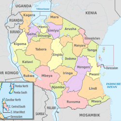
List of Tanzania regions by land area. From largest to smallest Regions of Tanzania by land area. From largest to smallest RegionArea (Km²)Tabora76,151Morogoro70,799Rukwa68,635Lindi67,000Ruvuma63,498Mbeya60,350Iringa56,864Shinyanga50,781Singida49,341Manyara46,359Dodoma41,311Kigoma37,037Arusha33,809Pwani32,407Kagera28,388Tanga26,808Mwanza19,592Mara19,566Mtwara16,707Kilimanjaro13,309Dar es Salaam1,393Zanzibar South and Central854Pemba North574Zanzibar North470Pemba South332Zanzibar…
List of districts of Tanzania by land area. From largest to smallest The districts of Tanzania by land area from largest to smallest are: DistrictArea (Km²)Mpanda45,843Liwale36,084Songea Rural33,825Manyoni28,620Chunya27,065Ulanga23,681Urambo21,299Sikonge21,000Tabora Urban20,104Iringa Rural19,898Simanjiro18,851Tunduru18,778Kiteto16,305Mbarali16,000Kibondo15,722Kilosa14,245Monduli14,070Dodoma Rural14,004Kilwa13,920Kilombero13,577Ngorongoro13,460Rufiji13,339Kondoa13,210Sumbawanga Rural12,836Singida Rural12,164Morogoro…
Largest provinces of Burundi by land area The 10 Largest provinces of Burundi by size of land area are: Ruyigi Gitega Cankuzo Makamba Rutana Muyinga Kirundo Bururi…
Algeria largest provinces by land area The 10 largest provinces by land area in km2 (kilometers square) in Algeria are: Tamanrasset Adrar Illizi Ouargla Tindouf Ain…
World’s Smallest Countries by Land Area While land area often reflects a country’s physical scope and influence, many of the world’s smallest nations pack significant historical,…