States of Nigeria: Details on how and when created
State Creation in Nigeria
At independence in October 1, 1960, Nigeria has three (3) regions: 1) Northern Region 2) Western Region 3) Eastern Region
In 1963, a new region, the Mid-Western Region, was created from the Western Region.
Then four years later in 1967, the regions were replaced by 12 states by military decree by the then Head of State General Yakubu Gowon, namely;
In 1976, seven new states were created by military decree by the then Head of State General Murtala Mohammed bringing the total to 19 states, including the Federal Capital Territory Abuja.
Abuja was carved from parts Kwara, Niger, Kaduna and Plateau States with the bulk of landmass carved out of Niger State
In 1987, the then military President General Ibrahim Babangida created two new states were created – Akwa Ibom State from Cross River State and Kastina State from Kaduna State, bringing the number to 21 States.
Four years later (1991), General Babangida created an additional nine (9) states bringing the total to 30 States. Finaly in 1996, the then military Head of State General Ibrahim Abacha created six (sixe more states, bringing the total to 36 states, which remains till present date.
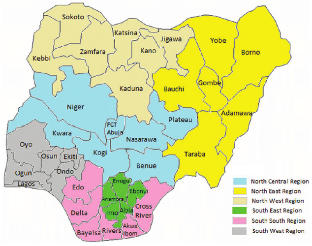
Map of Nigeria showing states and senatorial zones
1960 – 1963 (4 Regions)
1967 (12 States)
1976 (19 States)
NORTHERN REGION
North-Western State North-Eastern State Kano State North Central State Benue-Plateau State Kwara State
Bauchi State Benue State Borno State Gongola State Kaduna State Kano State Kwara State Niger State Plateau State Sokoto State
WESTERN REGION
Western State Lagos State
Lagos State Ogun State Ondo State Oyo State
MID WESTERN REGION
Mid-Western State
Bendel State
EASTERN REGION
East Central State Rivers State South-Eastern State
Anambra State Cross River State Imo State Rivers State
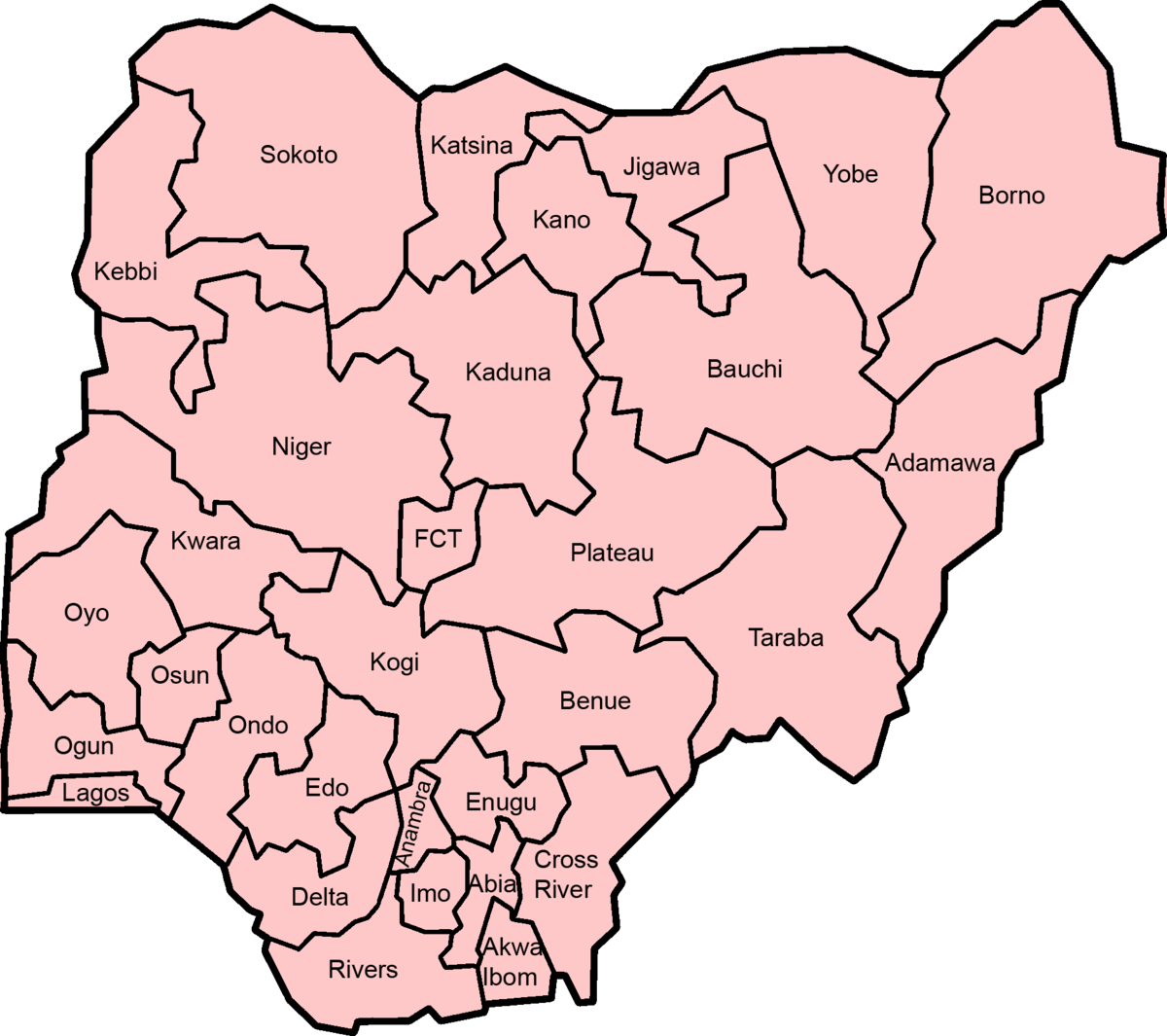
Map of Nigeria showing states
1976 (19 States)
1987 (21 States)
1991 (30 States)
1996 (36 States)
Bauchi State Benue State Borno State Gongola State Kaduna State Kano State Kwara State Niger State Plateau State Sokoto State
Bauchi State Benue State Borno State Gongola State Kaduna State Kano State Katsina State Kwara State Niger State Plateau State Sokoto State
Adamawa State Bauchi State Benue State Borno State Jigawa State Kaduna State Kano State Katsina State Kebbi State Kogi State Kwara State Niger State Plateau State Sokoto State Taraba State Yobe State
Adamawa State Bauchi State Benue State Borno State Gombe State Jigawa State Kaduna State Kano State Katsina State Kebbi State Kogi State Kwara State Nasarawa State Niger State Plateau State Sokoto State Taraba State Yobe State Zamfara State
Lagos State Ogun State Ondo State Oyo State
Lagos State Ogun State Ondo State Oyo State
Lagos State Ogun State Ondo State Osun State Oyo State
Ekiti State Lagos State Ogun State Ondo State Osun State Oyo State
Bendel State
Bendel State
Edo State Delta State
Edo State Delta State
Anambra State Cross River State Imo State Rivers State
Anambra State Akwa Ibom State Cross River State Imo State Rivers State
Abia State Anambra State Akwa Ibom State Cross River State Enugu State Imo State Rivers State
Abia State Anambra State Akwa Ibom State Bayelsa State Cross River State Ebonyi State Enugu State Imo State Rivers State
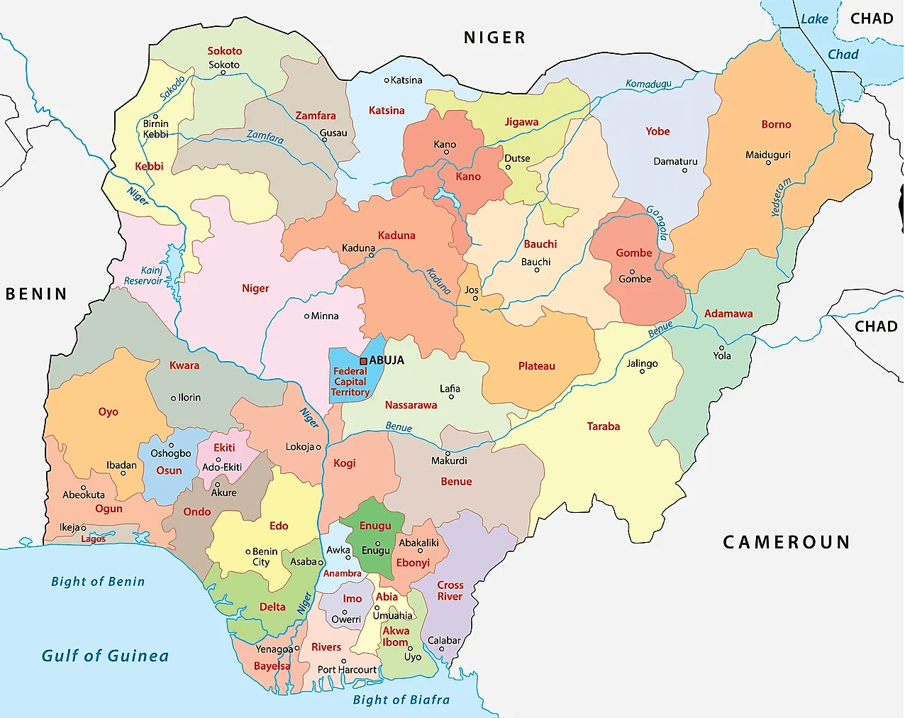
Map of Nigeria showing states and neighbouring countrues
More
How and when states were created in Nigeria List of Nigeria’s 36 states and the Federal Capital Territory AbiaAdamawaAkwa IbomAnambraBauchiBayelsaBenueBornoCross RiverDeltaEbonyiEdoEkitiEnuguFederal Capital Territory, AbujaGombeImoJigawaKadunaKanoKatsinaKebbiKogiKwaraLagosNasarawaNigerOgunOndoOsunOyoPlateauRiversSokotoTarabaYobeZamfara By the time that…
Lists of Nigerian states created at various times List of Nigeria’s 36 states and the Federal Capital Territory AbiaAdamawaAkwa IbomAnambraBauchiBayelsaBenueBornoCross RiverDeltaEbonyiEdoEkitiEnuguFederal Capital Territory, AbujaGombeImoJigawaKadunaKanoKatsinaKebbiKogiKwaraLagosNasarawaNigerOgunOndoOsunOyoPlateauRiversSokotoTarabaYobeZamfara By the time that…
How Mbaise was created There are many oral traditions as regards the origin of Mbaise people. Nfunala by Ekwerazu and Ahiara, claim that the…
States creation in Nigeria: List with details List of Nigeria’s 36 states and the Federal Capital Territory AbiaAdamawaAkwa IbomAnambraBauchiBayelsaBenueBornoCross RiverDeltaEbonyiEdoEkitiEnuguFederal Capital Territory, AbujaGombeImoJigawaKadunaKanoKatsinaKebbiKogiKwaraLagosNasarawaNigerOgunOndoOsunOyoPlateauRiversSokotoTarabaYobeZamfara List of 5 states…
Inner North – District 2 Details The Inner North, also known as District 2, is one of the most vibrant and historically rich areas of the…
Gelephu Mindfulness City: Key Details How Gelephu Mindfulness City is redefining sustainable development through mindful prosperity, progressive governance, and investor-friendly policies in Bhutan. Gelephu Mindfulness…
Aliyah to Jerusalem: Key Details Aliyah to Jerusalem Aliyah (עלייה) refers to Jewish immigration to Israel, and Jerusalem is a top destination for many Olim…
Kenzo Tange details Kenzo Tange was born on September 4, 1913, in Osaka, Japan. He spent his early years moving between different cities…


 Key Details")


