Northern Cape Free State North-West Mpumalanga Limpopo
Population size of South Africa provinces. From smallest to largest
Province
Population
Northern Cape
1,145,861
Free State
2,745,590
North-West
3,509,953
Mpumalanga
4,039,939
Limpopo
5,404,868
Western Cape
5,822,734
Eastern Cape
6,562,053
KwaZulu-Natal
10,267,300
Gauteng
12,272,263
Provinces of South Africa
South Africa is divided into provinces and provinces into municipalities.
South Africa provinces are governed, in different ways, on a national, provincial and local level.
At the national level there is the National Council of Provinces which is one of the houses of Parliament.
There is also the provincial government and, below that, the administration of district and metropolitan municipalities.
National Council of Provinces
South Africa has two houses of parliament: the National Assembly, and the National Council of Provinces.
The second exists to ensure that the interests of each province are protected in the laws passed by the National Assembly.
Each one of South Africa’s nine provinces sends 10 representatives to the National Council of Provinces. Six of these are permanent members of the council, and four are special delegates.
Provincial government
Each province is governed by a unicameral legislature.
The size of the legislature is proportional to population, ranging from 30 members in the Northern Cape to 80 in KwaZulu-Natal.
The legislatures are elected every five years by a system of party-list proportional representation.
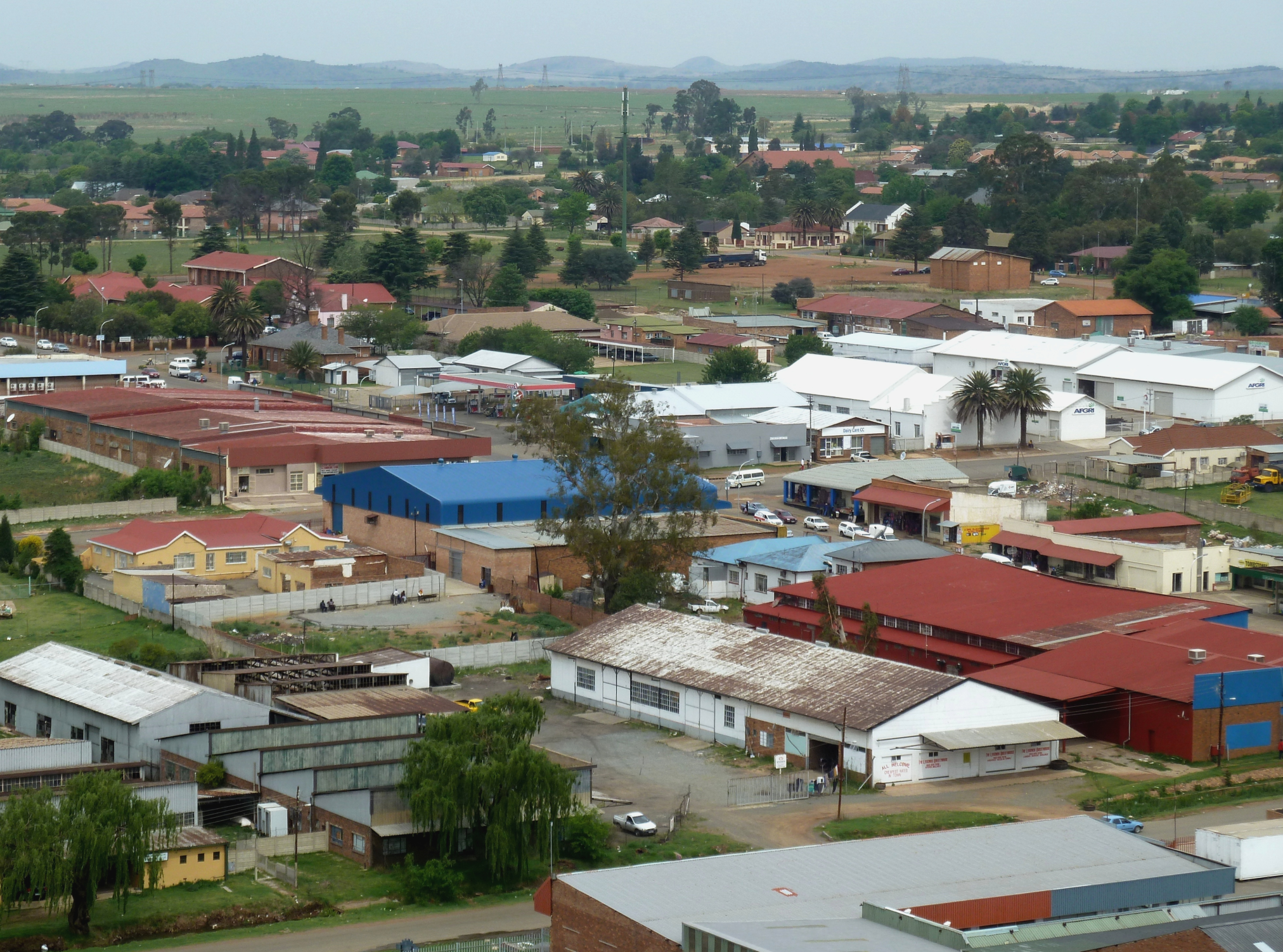
Eastern Cape
The Eastern Cape is one of the provinces of South Africa. It is the second largest province in the country (at 168,966 km2) after Northern Cape. The capital of the province is Bhisho, but its two largest cities are East London and Gqeberha.
The Eastern Cape is a diverse province with a rich history and culture. It is home to the Xhosa people, who are the second largest ethnic group in South Africa. The province is also home to a number of other ethnic groups, including the Zulu, Sotho, and Tswana.
The Eastern Cape is a beautiful province with a variety of landscapes. The province is home to the Drakensberg Mountains, the Indian Ocean coast, and the Karoo desert. The Eastern Cape is also home to a number of national parks, including Addo Elephant National Park, Mountain Zebra National Park, and Tsitsikamma National Park.
The Eastern Cape is a popular tourist destination. The province offers a variety of activities for visitors, including hiking, fishing, surfing, and game viewing. The Eastern Cape is also home to a number of historical sites, including the Battle of Isandlwana and the Robben Island Museum.
Here are some of the things you can do in the Eastern Cape:
Visit Addo Elephant National Park, home to over 600 elephants.
Go hiking in the Tsitsikamma National Park, known for its dramatic cliffs and waterfalls.
Surf at Jeffreys Bay, one of the best surfing spots in the world.
Visit the Nelson Mandela Museum in Mthatha, the birthplace of Nelson Mandela.
Take a boat trip to Robben Island, where Nelson Mandela was imprisoned for 18 years.
The Eastern Cape is a beautiful and diverse province with a lot to offer visitors. If you are looking for a place to experience the best of South Africa, the Eastern Cape is the perfect place for you.
Gauteng
Gauteng is the smallest of South Africa’s provinces, covering an area of 18 178km² or approximately 1.4% of the total surface area of South Africa. It is bordered by the Free State, North West, Limpopo and Mpumalanga provinces. While being the smallest province, it is also the most populous, being home to 13 399 725 people – 24.1% of the national population. Gauteng lies on the highest part of the interior plateau on the rolling plains of South Africa’s Highveld.
Its capital is Johannesburg and it also contains the city of Pretoria, as well as the East Rand, West Rand and Vaal areas.
Gauteng continues to serve as the economic engine room of the country and the subcontinent, responsible for over 34.8% of the country’s GDP. Gauteng is the powerhouse of South Africa and the heart of its commercial business and industrial sectors. The most important sectors contributing to GDP are finance, real estate and business services; manufacturing; and general government services. Gauteng is also the financial services capital of Africa. More than 70 foreign banks have their head offices here, as do at least the same number of South African banks, stockbrokers and insurance giants.
The major gold and diamond mining houses all have their headquarters in Johannesburg, the biggest being Anglo American and De Beers. Gold mining constitutes 80% of Gauteng’s mineral production output.
Gauteng is divided into three metropolitan municipalities, the City of Ekurhuleni, City of Johannesburg and City of Tshwane Metropolitan Municipalities, as well as two district municipalities, which are further subdivided into six local municipalities.
Gauteng Municipalities
City of Ekurhuleni Metropolitan City of Johannesburg Metropolitan City of Tshwane Metropolitan
Sedibeng District Emfuleni Local Lesedi Local Midvaal Local
West Rand District Merafong City Local Mogale City Local Rand West City Local
KwaZulu-Natal
KwaZulu-Natal is located in the south-east of South Africa bordering the Indian Ocean. It also borders on the Eastern Cape, Free State and Mpumalanga provinces, as well as Lesotho, Swaziland and Mozambique. The ‘Garden Province’ of South Africa stretches from the lush subtropical east coast washed by the warm Indian Ocean, to the sweeping savanna in the east and the majestic Drakensberg Mountain Range in the west.
It covers an area of 94 361km², the third-smallest in the country, and has a population of 11 065 240, making it the second most populous province in South Africa. The capital is Pietermaritzburg. The largest city is Durban. Other major cities and towns include Richards Bay, Port Shepstone, Newcastle, Estcourt, Ladysmith and Richmond.
The province’s manufacturing sector is the largest in terms of contribution to GDP. Richards Bay is the centre of operations for South Africa’s aluminium industry. The Richards Bay Coal Terminal is instrumental in securing the country’s position as the second-largest exporter of steam coal in the world. The province has undergone rapid industrialisation owing to its abundant water supply and labour resources.
Map of South Africa showing KwaZulu Natal
Agriculture is also central to the economy. The sugar cane plantations along the coastal belt are the mainstay of KwaZulu-Natal’s agriculture.
The coastal belt is also a large producer of subtropical fruit, while the farmers inland concentrate on vegetable, dairy and stock farming. Another source of income is forestry in the areas around Vryheid, Eshowe, Richmond, Harding and Ngome.
KwaZulu-Natal is divided into one metropolitan municipality (eThekwini Metropolitan Municipality) and 10 district municipalities, which are further subdivided into 43 local municipalities.
KwaZulu-Natal municipalities
eThekwini Metropolitan
Amajuba District Dannhauser eMadlangeni Newcastle
Harry Gwala District Dr Nkosazana Dlamini Zuma Greater Kokstad Ubuhlebezwe Umzimkhulu iLembe District KwaDukuza Mandeni Maphumulo Ndwedwe
King Cetshwayo District City of uMhlathuze Mthonjaneni Nkandla uMfolozi uMlalazi Ugu District Ray Nkonyeni Umdoni Umuziwabantu Umzumbe
uMgungundlovu District Impendle Mkhambathini Mpofana Msunduzi Richmond uMngeni uMshwathi
uMkhanyakude District Big 5 Hlabisa Jozini Mtubatuba uMhlabuyalingana
uMzinyathi District Endumeni Nquthu uMsinga Umvoti
uThukela District Alfred Duma Inkosi Langalibalele Okhahlamba
Zululand District AbaQulusi eDumbe Nongoma Ulundi uPhongolo
Free State
The Free State is located in the geographical centre of South Africa, bordered by the Northern Cape, Eastern Cape, North West, Mpumalanga, KwaZulu-Natal and Gauteng provinces, as well as Lesotho. The Free State is a rural province of farmland, mountains, goldfields and widely dispersed towns.
Although the Free State is the third-largest province in South Africa, it has the second-smallest population and the second-lowest population density. It covers an area of 129 825km² and has a population of 2 834 714 – 5.1% of the national population. Its capital is Bloemfontein, which is South Africa’s judicial capital. Other important towns include Welkom, Kroonstad, Sasolburg and Bethlehem.
The economy is dominated by agriculture, mining and manufacturing. Known as the ‘bread basket’ of South Africa, about 90% of the province is under cultivation for crop production. It produces approximately 34% of the total maize production of South Africa, 37% of wheat, 53% of sorghum, 33% of potatoes, 18% of red meat, 30% of groundnuts and 15% of wool. The province is the world’s fifth-largest gold producer, with mining the major employer. It is a leader in the chemicals industry, being home to the giant synthetic-fuels company, Sasol.
The Vredefort Dome, 10km in diameter, about 100km south-west of Johannesburg, is South Africa’s seventh World Heritage Site.
The Free State is divided into one metropolitan municipality (Mangaung Metropolitan Municipality) and four district municipalities, which are further subdivided into 18 local municipalities.
Free State Municipalities
Mangaung Metropolitan
Fezile Dabi District Mafube Metsimaholo Moqhaka Ngwathe
Lejweleputswa District Masilonyana Matjhabeng Nala Tokologo Tswelopele
Thabo Mofutsanyana District Dihlabeng Maluti-A-Phofung Mantsopa Nketoana Phumelela Setsoto
Xhariep District Kopanong Letsemeng Mohokare
Limpopo
Limpopo, South Africa’s northernmost province, borders onto Mozambique, Zimbabwe and Botswana. It also borders the Mpumalanga, Gauteng and North West provinces. Named after the Limpopo River, which flows along its northern border, it is a region of contrasts, from true Bushveld country to majestic mountains, primeval indigenous forests, unspoiled wilderness and patchworks of farmland. In the eastern region lies the northern half of the magnificent Kruger National Park.
Limpopo ranks fifth in South Africa in both surface area and population, covering an area of 125 754km² and being home to a population of 5 779 090. The capital is Polokwane (previously Pietersburg). Other major cities and towns include Bela-Bela (Warmbad), Lephalale (Ellisras), Makhado (Louis Trichardt), Musina (Messina), Thabazimbi and Tzaneen.
Mining is the primary driver of economic activity. Limpopo is rich in mineral deposits, including platinum-group metals, iron ore, chromium, high and middle-grade coking coal, diamonds, antimony, phosphate and copper, as well as mineral reserves such as gold, emeralds, scheelite, magnetite, vermiculite, silicon and mica. The province is a typical developing area, exporting primary products and importing manufactured goods and services.
The climatic conditions in the province allow for double harvesting seasons, which results in it being the largest producer of various crops in the agricultural market. Sunflowers, cotton, maize and peanuts are cultivated in the Bela-Bela–Modimolle area. Bananas, litchis, pineapples, mangoes and pawpaws, as well as a variety of nuts, are grown in the Tzaneen and Makhado areas. Extensive tea and coffee plantations create many employment opportunities in the Tzaneen area. The Bushveld is cattle country, where controlled hunting is often combined with ranching.
Limpopo is divided into five district municipalities, which are further subdivided into 22 local municipalities.
Limpopo municipalities
Capricorn District Blouberg Lepelle-Nkumpi Molemole Polokwane
Mopani District Ba-Phalaborwa Greater Giyani Greater Letaba Greater Tzaneen Maruleng
Sekhukhune District Elias Motsoaledi Ephraim Mogale Fetakgomo Tubatse Makhuduthamaga
Vhembe District Collins Chabane Makhado Musina Thulamela
Waterberg District Bela-Bela Lephalale Modimolle-Mookgophong Mogalakwena Thabazimbi
Mpumalanga
Mpumalanga, the second-smallest province in South Africa after Gauteng, is located in the north-eastern part of the country, bordering Swaziland and Mozambique to the east. It also borders Limpopo, Gauteng, Free State and KwaZulu-Natal within South Africa. It covers an area of 76 495km² and has a population of 4 335 964, making it the sixth most populous in the country. It is situated mainly on the high plateau grasslands of the Middleveld, which roll eastwards for hundreds of kilometres. In the north-east, it rises towards mountain peaks and terminates in an immense escarpment. In some places, this escarpment plunges hundreds of metres down to the low-lying area known as the Lowveld.
Mbombela (previously Nelspruit) is the capital of the province and the administrative and business centre of the Lowveld. Other major cities and towns include eMalahleni (previously Witbank), Standerton, eMkhondo (previously Piet Retief), Malalane, Ermelo, Barberton and Sabie.
The best-performing sectors in the province include mining, manufacturing and services. Tourism and agro-processing are potential growth sectors. Agriculture in Mpumalanga is characterised by a combination of commercialised farming, subsistence and livestock farming, and emerging crop farming. Crops such as subtropical fruits, nuts, citrus, cotton, tobacco, wheat, vegetables, potatoes, sunflowers and maize are produced in the region.
Mpumalanga is rich in coal reserves and home to South Africa’s major coal-fired power stations. eMalahleni is the biggest coal producer in Africa and is also the site of the country’s second oil-from-coal plant after Sasolburg. Most of the manufacturing production in Mpumalanga occurs in the southern Highveld region. In the Lowveld sub-region, industries are concentrated around the manufacturing of products from agricultural and raw forestry material.
Mpumalanga is divided into three district municipalities, which are further subdivided into 17 local municipalities.
Mpumalanga municipalities
Ehlanzeni District Bushbuckridge City of Mbombela Nkomazi Thaba Chweu
Gert Sibande District Chief Albert Luthuli Dipaleseng Dr Pixley Ka Isaka Seme Govan Mbeki Lekwa Mkhondo Msukaligwa
Nkangala District Dr JS Moroka Emakhazeni Emalahleni Steve Tshwete Thembisile Hani Victor Khanye
Northern Cape
The vast and arid Northern Cape is the largest province in South Africa, taking up nearly a third of the country’s land area. It covers an area of 372 889km² and has a population of 1 193 780, the least populous of South Africa’s provinces. It is bordered by Namibia and Botswana to the north, and also by the North West, Free State, Eastern Cape and Western Cape provinces. The cold Atlantic Ocean forms the province’s western boundary.
The capital city is Kimberley. Other important towns are Upington, centre of the karakul sheep and dried-fruit industries, and the most northerly winemaking region of South Africa; Springbok, in the heart of the Namaqualand spring-flower country; Kuruman and De Aar, the second most important junction of South Africa’s railway network. Sutherland is host to the southern hemisphere’s largest astronomical observatory, the multinational sponsored Southern African Large Telescope.
The Northern Cape is rich in minerals. Alluvial diamonds are extracted from the beaches and the sea between Alexander Bay and Port Nolloth. The Sishen Mine near Kathu is the biggest source of iron ore in South Africa, while the copper mine at Okiep is one of the oldest mines in the country. Copper is also mined at Springbok and Aggeneys. The province is rich in asbestos, manganese, fluorspar, semi-precious stones and marble.
The province has fertile agricultural land in the Orange River Valley, especially at Upington, Kakamas and Keimoes, where grapes and fruit are cultivated intensively. The interior Karoo relies on sheep farming, while the karakul-pelt industry is one of the most important in the Gordonia district of Upington. Wheat, fruit, peanuts, maize and cotton are produced at the Vaalharts Irrigation Scheme near Warrenton.
The Northern Cape is divided into five district municipalities and further subdivided into 26 local municipalities.
Northern Cape municipalities
Frances Baard District Dikgatlong Magareng Phokwane Sol Plaatje
John Taolo Gaetsewe District Ga-Segonyana Gamagara Joe Morolong
Namakwa District Hantam Kamiesberg Karoo Hoogland Khai-Ma Nama Khoi Richtersveld
Pixley Ka Seme District Emthanjeni Kareeberg Renosterberg Siyancuma Siyathemba Thembelihle Ubuntu Umsobomvu
ZF Mgcawu District !Kheis Dawid Kruiper Kai !Garib Kgatelopele Tsantsabane
North West
North West lies in the north of South Africa on the Botswana border, fringed by the Kalahari Desert in the west, Gauteng province to the east and the Free State to the south. It covers an area of 104 882km² and has a population of 3 748 436. Much of the province consists of flat areas of scattered trees and grassland. The Vaal River flows along the southern border of the province.
Mahikeng (previously Mafikeng) is the capital. The city lies near the Botswana border and forms a single urban area with its neighbouring town, Mmabatho. Potchefstroom and Klerksdorp are the biggest cities in the province. Other main towns are Brits, Rustenburg, Klerksdorp and Lichtenburg.
Most economic activity is concentrated in the southern region between Potchefstroom and Klerksdorp, as well as Rustenburg and the eastern region. Mining is the major contributor to the North West economy and represents almost a quarter of South Africa’s mining industry as a whole. The Rustenburg and Brits districts produce more platinum than any other single area in the world. North West also produces a quarter of South Africa’s gold, as well as granite, marble, fluorspar and diamonds. North West has a number of major tourist attractions, including the internationally famous Sun City, the Pilanesberg National Park, the Madikwe Game Reserve and the Rustenburg Nature Reserve.
North West is well known for cattle farming, while the areas around Rustenburg and Brits are fertile, mixed-crop farming land. Maize and sunflowers are the most important crops, and the province is the major producer of white maize in the country.
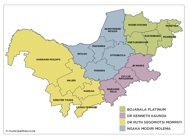
North West is divided into four district municipalities, which are further subdivided into 18 local municipalities.
North West municipalities
Bojanala Platinum District Kgetlengrivier Madibeng Moretele Moses Kotane Rustenburg
Dr Kenneth Kaunda District City of Matlosana JB Marks Maquassi Hills
Dr Ruth Segomotsi Mompati District Greater Taung Kagisano-Molopo Lekwa-Teemane Mamusa Naledi
Ngaka Modiri Molema District Ditsobotla Mahikeng Ramotshere Moiloa Ratlou Tswaing
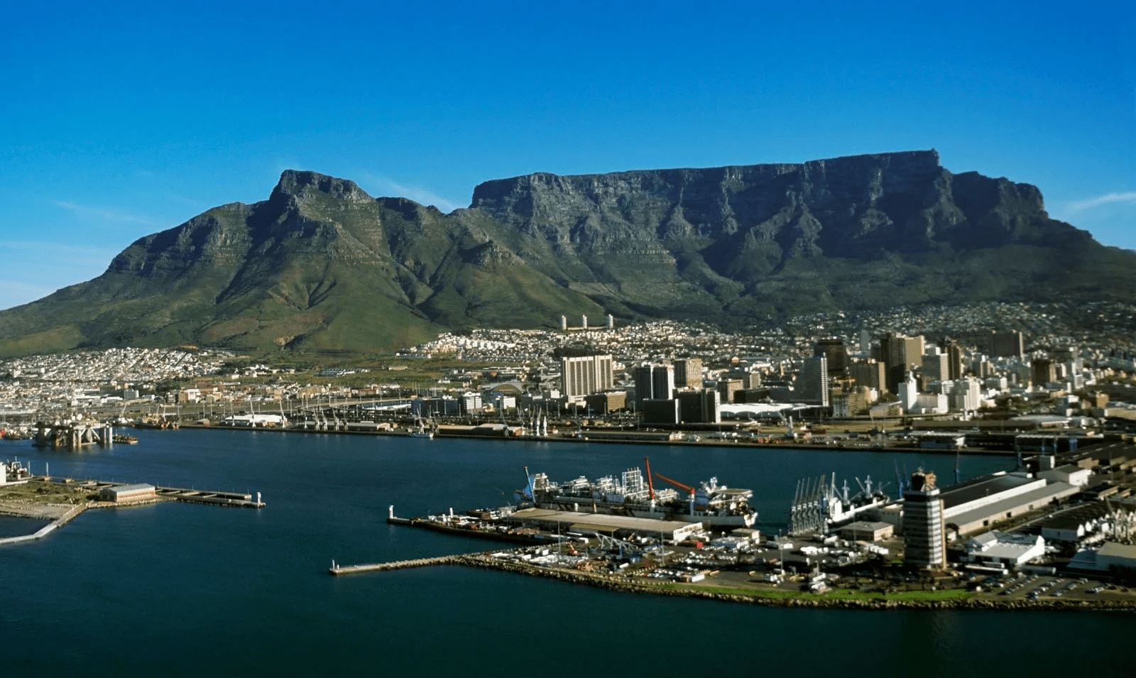
Western Cape
The Western Cape is located on the southern tip of the African continent between the Indian and Atlantic Oceans. It is bordered by the Northern Cape and Eastern Cape provinces. The Western Cape’s natural beauty makes the province one of the world’s greatest tourist attractions. The region is topographically and climatically diverse. It has a temperate southern coastline fringed with mountains. To the north it stretches deep into the Karoo plateau, while the west coast is extremely dry.
It covers an area of 129 462km² and has a population of 6 279 730. It is the fourth-largest province in South Africa by surface area and also ranks fourth in population. The capital is Cape Town. Other major cities and towns include George, Knysna, Paarl, Swellendam, Oudtshoorn, Stellenbosch, Worcester, Mossel Bay and Strand.
The Western Cape is rich in agriculture and fisheries. The climate of the peninsula and the mountainous region beyond it is ideal for grape cultivation, with a number of vineyards producing excellent wines. Other fruit and vegetables are also grown here, and wheat is an important crop to the north and east of Cape Town. Fishing is the most important industry along the west coast and sheep farming is the mainstay of the Karoo. The province has a well-established industrial and business base, and the lowest unemployment rate in the country. Sectors such as finance, real estate, ICT, retail and tourism have shown substantial growth, and are the main contributors to the regional economy. Many of South Africa’s major insurance companies and banks are based in the Western Cape. The majority of the country’s petroleum companies and the largest segment of the printing and publishing industry are located in Cape Town.
The Western Cape is divided into one metropolitan municipality (City of Cape Town Metropolitan Municipality) and five district municipalities, which are further subdivided into 24 local municipalities.
Western Cape municipalities
City of Cape Town Metropolitan
Cape Winelands District Breede Valley Drakenstein Langeberg Stellenbosch Witzenberg
Central Karoo District Beaufort West Laingsburg Prince Albert
Garden Route District Bitou George Hessequa Kannaland Knysna Mossel Bay Oudtshoorn
Overberg District Cape Agulhas Overstrand Swellendam Theewaterskloof
West Coast District Bergrivier Cederberg Matzikama Saldanha Bay Swartland
More
5 most populated provinces of South Africa South Africa’s top 5 most populated provinces are: GautengKwaZulu-NatalEastern CapeWestern CapeLimpopo Population size of South Africa provinces. From largest to…
Least populated provinces in Algeria The 10 least populated provinces in Algeria are: Ain Guezzam Bordj Badji Mokhtar Djanet Illizi Tindouf Béni Abbès Ain Salah…
Least populated provinces of Angola The 10 least populated provinces of Angola are: Bengo Cuanza Norte Namibe Cuando Cubango Lunda Sul Zaire Cabinda Moxico Lunda…
Least populated provinces in Burundi The 10 least populated Burundi provinces are: Cankuzo Mwaro Muramvya Bururi Rutana Bubanza Rumonge Ruyigi Makamba Karuzi List of Burundi…
Provinces of South Africa South Africa comprises 9 provinces, namely: Eastern CapeFree StateGautengKwaZulu-NatalLimpopoMpumalangaNorthern CapeNorth-WestWestern Cape Administration South Africa’s provinces are governed, in different ways,…
South Africa Provinces and Municipalities South Africa comprises 9 provinces and several municipalities. List of the provinces Eastern CapeFree StateGautengKwaZulu-NatalLimpopoMpumalangaNorthern CapeNorth-WestWestern Cape Administration South Africa’s…
List of South Africa Provinces South Africa’s 9 provinces are: Eastern CapeFree StateGautengKwaZulu-NatalLimpopoMpumalangaNorthern CapeNorth-WestWestern Cape Administration South Africa’s provinces are governed, in different ways, on…
List of South Africa provinces and capitals South Africa provinces and their capitals are as follows: Eastern Cape …. BhishoFree State …. BloemfonteinGauteng …. JohannesburgKwaZulu-Natal …. PietermaritzburgLimpopo…
Previous names of South Africa provinces The former names of provinces in South Africa ProvincePrevious nameEastern CapeCape of Good HopeFree StateOrange Free StateGautengTransvaalKwaZulu-NatalNatal, Cape of Good…
5 smallest provinces of South Africa by land area The 5 smallest provinces of South Africa by land area are: GautengMpumalangaKwaZulu-NatalNorth-WestLimpopo List of South Africa provinces by land area.…
Events timeline: Provinces of South Africa Orange Free State became a British colony 1902-05-31 Orange Free State became the British colony of Orange River Colony. Northern…
List of Provinces of South Africa The 9 provinces of South Africa are: Eastern CapeFree StateGautengKwaZulu-NatalLimpopoMpumalangaNorthern CapeNorth-WestWestern Cape Administration South Africa’s provinces are governed, in different…
10 least populated districts of Ghana Ghana’s 10 least populated districts are: KadjebiSouth TonguAhafo Ano NorthBuilsaAsuogyamanZabzugu TataleBongoBawku WestEjura SekyedumaseSene DistrictPopulationKadjebi52,001South Tongu64,852Ahafo Ano North71,856Builsa75,376Asuogyaman75,948Zabzugu Tatale77,496Bongo77,894Bawku West80,575Ejura Sekyedumase81,119Sene81,468…
10 least populated states in Nigeria The 10 least populated states of Nigeria are: Federal Capital Territory (FCT), AbujaBayelsaNasarawaEbonyiTarabaYobeGombeKwaraEkitiAbia Full list of population size of Nigeria…
10 least populated districts in Tanzania The 10 least populated districts in Tanzania are: KusiniMafiaLindi UrbanPanganiKaskazini ‘B’KatiLiwaleBukoba UrbanChakeMicheweni list of Tanzania districts by population size. From…
Least populated state in Nigeria The least populated state in Nigeria by population is Bayelsa. Abuja, the Federal Capital Territory, is actually the least populated…