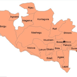
Niger is a State in Nigeria. It consists of 25 Local Government Areas.
It was formed out of the defunct North Western State in February 1976 and is made up of the old Nupe and Kontagora Kingdoms, Abuja (now Suleja), Zauzau kingdom and other political entities.

The major cities are Minna, Bida, Kontagora and Suleja.
- Capital: Minna
- Area: 76,363 square km (29,484 square miles)
- Date created: 3 February 1976
Location
Niger State is located in the Middle West Central of Nigeria and is bounded by Kaduna State in the North East, Kebbi State in the North West, Kwara State in the South West, Kogi in the South, Zamfara in the North and the Republic of Benin in the West. The Federal Capital Territory, Abuja, is on the state’s Southeastern border.
People
The three principal cultural/ethnic groups of the state are the Nupes, the Hausa and the Gwari. Other groups include the Abishiwa, the Ayadi, the Bassa, the Bauchi, the Dukawa, the Dibo, the Fulani, the Gade, the Godara, the Gulengi, the Ganagana, the Ingwai, the Koro, the Kadara, the Kambari, the Kamuku, the Kadanda, the Mauchi, the Pangu, and the Shigini.
The Nupes are found in Gboko, Lavun, Lapai, Agaie and parts of Mariga Local Government Areas in the southern part of the state, while the Gwari, Kadara and Koro are in Chanchaga, Suleja, and Shiroro in the east. The Kambari and Kamuku occupy Mariga, Magama and Rafi Local Government areas in the north. Most of the groups have instituted a king or chieftaincy system of political leadership. The predominant religions in the state are Islam and Christianity.
Local Government Areas
There are 25 Local Government Areas, namely – Agaie, Agwara, Bida, Borgu, Bosso, Chanchaga, Edati, Gbako, Gurara, Katcha, Kontagora, Lapai, Lavun, Magama, Mariga, Mashegu, Mokwa, Muya, Pailoro, Rafi, Rijau, Shiroro, Suleja, Tafa, Wushishi.
Climate
The State experiences two seasons, the wet and dry seasons. The average annual rainfall is about 1,400mm. The duration of the rainy season is approximately 180 days. Mean average temperature hovers around 32°F, particularly in March and June. December and January have the mean lowest temperatures due to the influence of the tropical continental air mass which blows from the north. Dry season commences in October.
Industry
More than 80 percent of the population is engaged in agricultural activities. Niger State has one of the largest and most fertile agricultural lands in the country. The Nupe are the major rice producers, while the Gwari, Koro, Kadara and Kambari are famous for yam and guinea corn production. The Hausa and Fulani in Mariga Local Government area are noted for animal husbandry. There is a National Cereals Research Institute and Agricultural Research Station at Badeggi, near Bida and an Agricultural College at Mokwa. Brass work, pottery, raffia articles, dyed cloth, glass manufacture are locally consumed and exported. Niger State has or share three dams which generate hydroelectric power and sustain irrigation projects and fishing. These dams are (1) The Kainji Dam (1969), (2) Shiroro Gorge Dam on the Kaduna river and (3) The Jebba Dam. Kainji National Park, the largest National Park of Nigeria is also in Niger State.
Tourism
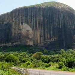
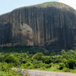
Some of the attraction centers of the state are (1)Brass/Glass Works, Bida Arts & Crafts/ Souvenirs, (2) Gurara Falls, Gurara LGA Natural/Physical, (3) Kainji Lake National Park Wildlife/Eco-Tourism, (4) Zuma Rock, Near Suleija Natural/Physical, (5) Shiroro Dam Tourist Resort Natural/Man-made, (6) Mayanka Water Falls Natural.
Education
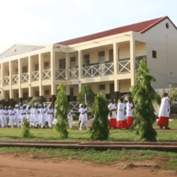
Niger State has over 1,165 primary schools, 250 secondary schools and a number of vocational training centers. There are also about 15 tertiary institutions which include Federal College of Education, Kontagora, the Federal Polytechnic at Bida and the Federal University of Technology at Minna. Others include the state owned Technical Teachers Training Colleges, State College of Education at Minna, etc.
