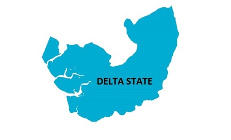
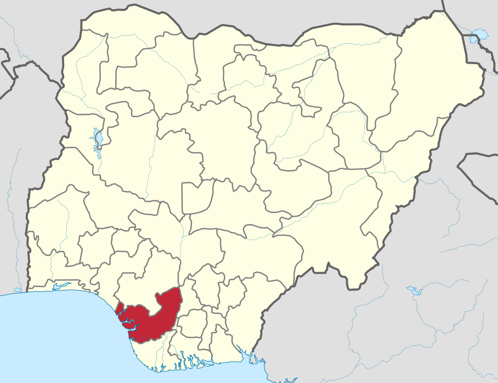
Delta is an oil and agricultural state in Nigeria. It is situated in the region known as the South-South geo-political zone and bordered on the north by Edo State, the east by Anambra and Rivers States, and the south by Bayelsa State while to the west is the Bight of Benin which covers about 160 kilometres of the state’s coastline.
Name: Delta State of Nigeria Founded: 27Aug, 1991 Administrative capital: Asaba Commercial capital: Warri
The area called Delta State was once an integral part of the old Western Region of Nigeria. It became an autonomous entity on August 27, 1991 after having been part of the old Midwestern State (1963 1976) and the defunct Bendel State (1976 1991).
Delta State started with twelve local government areas. These were split further into nineteen local governments on September 27, 1991, and to twenty five LGAs in 1997. Asaba, located at the northern end of the state, is the capital. A master plan for Asaba Capital Territory, with an estimated area of 762 sq. km and designed to transform Asaba into a modern metropolis is being pursued by the state government.
Location: Delta State lies roughly between longitudes 5°00 and 6°45’E and latitudes 5°00 and 6°30’N. It has a total land area of 16,842 sq. km. The states bordering Delta State are Edo to the north, Ondo to the northwest, Anambra to the east and Bayelsa and Rivers to the southeast. On its southern flank is 160 km of the coastline of the Bight of Benin.
Administrative Areas
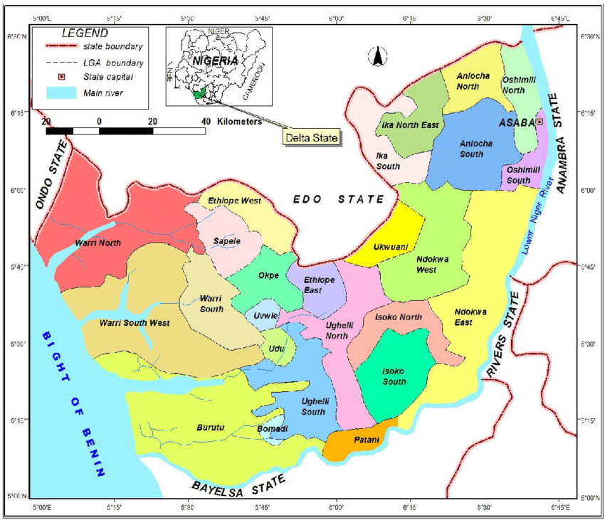
Delta State currently has twentyfive local government areas. They are: Aniocha North, Aniocha South, Bomadi, Burutu, Ethiope East, Ethiope West, lka North East, lka South, Isoko North, Isoko South, Ndokwa East, Ndokwa West Okpe, Oshimili North Oshimili South, Patani, Sapele, Udu, Ughelli North, Ughelli South, Ukwani, Uvwie, Warri North, Warri South and Warri South West.
Ethnic Composition
The major ethnic groups in Delta State are Urhobo, lgbo, lzon, Isoko and Itsekiri. Many of the people claim a common ancestry; consequent ly, their cultures are similar. These similarities are manifested in their religious worship, music, dance, festivals, and arts and crafts. The practice of Christianity, Islam and traditional worship like lgbe and Ebura, flourishes in varying degrees among the people of Delta state.
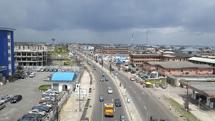
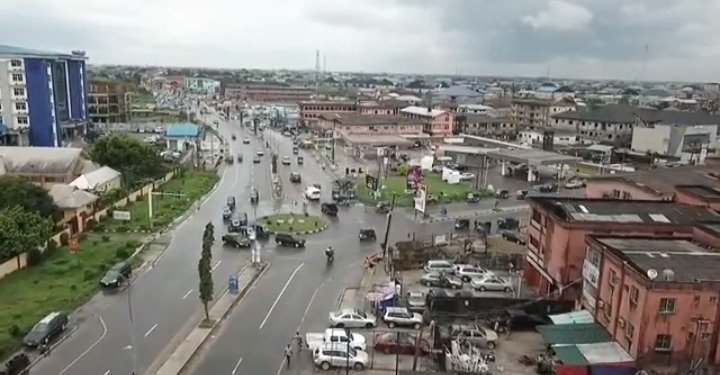
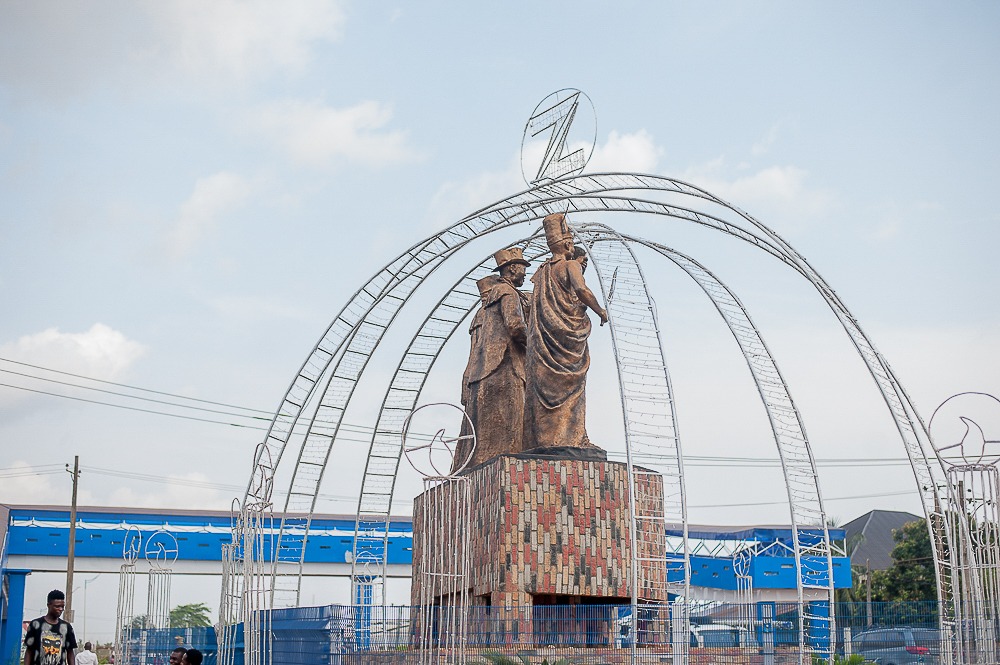
Asaba roundabout, Asaba, Delta state
Christianity, which has the largest followership, came through contact with the Portuguese in the 15th century. With Christianity, came a number of complimentary western institutions, the most important of which was western education, hence missionary schools sprang up in Delta State. Modem health care delivery establishments, such as hospitals and maternity centers, were also introduced.
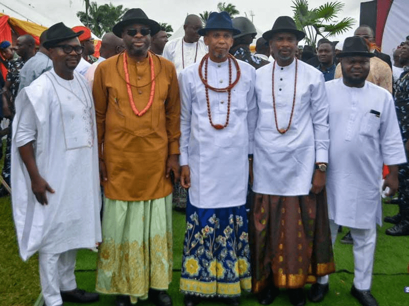
Identical features of the mode of dressing common to the four tribes of Urhobo, Isoko, Itsekiri and lzon include a pair of wrapper on which you have a shirt like attire, topped with a bowler hat. Coral beads or gold chain around the neck is complemented with a walking stick.
Women, in addition to coral beads or gold chain, wear what is known as ‘up and down’ (called “Osiba Gba aniku” among the Urhobos). The music, which is in the form of singing and drumming, dictates the dance steps. These include: Ulu Omi Masquerade dance, such as Oda (Itsekiri) and Mmanwu (Ndokwa); Regatta, a canoe dance among the Itsekiri, and various social dances such as Itsekiri Omoko dance, lka moonlight dance, Urhobo dance of the maidens and lsele Uku Egwu Oshusku. Others include, war and rituals dances.
The characteristic festivals of Delta state include Okere Juju (Itsekiri), Ikenga and Ukunta (Aboh), lwuyi and Osoezi (Agbor) Aborebele Oge and Sogbein festivals (lzon). These festivals mark the harvest seasons, appeals to gods for purification of the town, commemoration of ancient expeditions or reminiscences of or tribute to tribal heroes.
Delta has many ethnic groups. Top on the list are Ijaw and Igbo
Besides oil, Delta State is an agricultural producing state with large harvests of cassava and other crops.
It is situated in the region known as the South-South geo-political zone with a population of over 7 million persons.
The capital of Delta State is Asaba, located at the northern end of the state, with an estimated area of 762 square kilometres (294 sq mi).
Warri is the economic nerve center of the state and also the most populated. It is located in the southern end of the state.
Delta state has a total land area of 16,842 square kilometres (6,503 sq mi).
There are various solid mineral deposits within the state – industrial clay, silica, lignite, kaolin, tar sand, decorative rocks, limestone, etc.
These are raw materials for industries such as brick making, ceramics, bottle manufacturing, glass manufacturing, chemical/insulators production, chalk manufacturing and sanitary wares, decorative stone cutting and quarrying. But these minerals are under-utilized.
Delta state also has huge deposits of crude oil and is also one of the largest producers of petroleum products in Nigeria. Sales of petroleum products is what majorly drives its economy.
Delta State has some historical, cultural and socio-political tourist centers that attract visitors from around the globe. Some of these sites of tourism include:
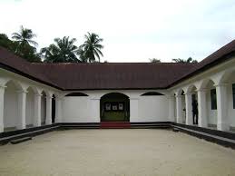
Nana’s Palace built by Chief Nana Olomu of Ebrohim.
Nana’s palace
He was a powerful 19th century indigenous entrepreneur who traded with the British. The relationship eventually turned sour.
Later, he surrendered (not without putting up a fight) and was exiled to Ghana. His personal effects are housed in this grand palace.
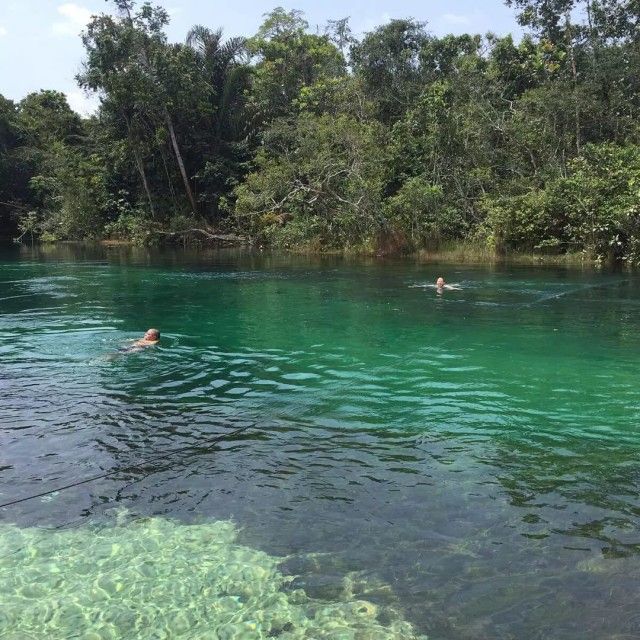
River Ethiope which is reputed to be the deepest inland waterway in Africa (at 176 km).
River Ethiope
Its source is at the foot of a giant silk-cotton tree at Umuaja in Ukwuani Local Government Area of the state and flows through seven Local Government Areas in the State. It is a place of worship for Olokun traditional religion and also a common site for faithfuls of the Igbe Religious Movement.
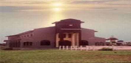
Araya Bible Site which houses a copy of the Holy Bible. It is believed that the bible descended to this spot miraculously from heaven around August, 1914.
Araya Bible Site
The bible dropped on rain-soaked yam and it didn’t get wet. The site now attracts thousands of Christians yearly.
Demas Nwoko Edifice which was built using traditional materials, designs and construction techniques of the Igbo civilization and the Benin Empire by Demas Nwoko, an architect, builder and artist of international repute from Idumuje-Ugboko, in Aniocha North Local Government Area, Delta State.
Mungo Park House which is now the site of the National Museum, Asaba. The house was constructed by the Royal Niger Company (RNC) in 1886 and was used as a colonial administrative headquarters, a military house, the colonial administrative divisional headquarters, the RNC Constabulary building, and the seat of the Urban District Council at different times.
Niger Bridge which connects Delta State (by extension, western Nigeria) to the Eastern part of Nigeria. It is a beauty to behold. It was completed in 1965 and cost £5 million. It was damaged during the civil war, but later repaired.
Ghana districts. Population, size of land area and capitals of districts The districts of Ghana and their population, land area and capitals are as follows: DistrictPopulationArea (km.²)CapitalAbura-Asebu-Kwamankese90,093324Abura-DunkwaAccra1,659,136185AccraAdansi East129,3251,380New EdubiaseAdansi West235,680828ObuasiAfigya Sekyere117,653770AgonaAfram…
EFCC ARRESTS EX DELTA STATE GOVERNOR OKOWA The Economic and Financial Crimes Commission (EFCC) recently detained former Delta State Governor Ifeanyi Okowa over allegations of diverting approximately…
Delta State NYSC orientation camp address The address of the NYSC orientation camp in Delta State is: NYSC Permanent Orientation Camp Former Martins TTC, Issele-Uku, Aniocha…
Delta State Commissioners, 2011 List of Commissioners in Delta State, 2011 NAMESPORTFOLIODr. Joseph OtumaraHealthRt. Hon. Solomon FunkekemeWorksDr. Anthonia Ashiedu Min. of Poverty AlleviationMr. Frank Omare EnvironmentProf.…
Delta State Judicial Divisions The Judicial Divisions in Delta State are: Asaba Warri Effurun Bomadi Ughelli Oleh Kwale Sapele Orerokpe Isiokolo Ogwashi-Uku Agbor Issele-Uku…
LIST OF POLITICAL APPOINTEES, DELTA STATE, 2010 Delta State politically appointed persons SECRETARY TO THE STATE GOVERNMENT1. Office of Secretary to the State GovernmentDr. Ifeanyi Okowa CHIEF OF…
Delta State Senators, 2007 Members of the National Assembly, House of Senate, from Delta State, as of 2007 Sen. James Manager Party: People’s Democratic…
Delta State House of Reps members, 2007 House of Representatives members from Delta State as of 2007 with their constituencies, date elected, political party, education and occupation…
HOTELS AND RESTAURANTS IN DELTA STATE ABRAKA 1. Abraka River Resort, Ekrejeta-Abraka. Tel: 054-66140. AGBOR 2. Leads Guest House, No. 64 Melekwe Street, Boji-Boji-Owa, Agbor. Tel:055-259^7 3. Pace Hotel , No. 35 Charles Street, Agbor. 4. Penthouse Hotel, 11…
Delta State festivals Festivals of Delta state include Ikenga and Ukunta (Aboh), Okere Juju (Itsekiri), lwuyi and Osoezi (Agbor) Aborebele Oge and Sogbein…


 Community in Warri North Local Government Area, Delta State: A People at the Crossroads of Rich Heritage and Existential Challenges")


