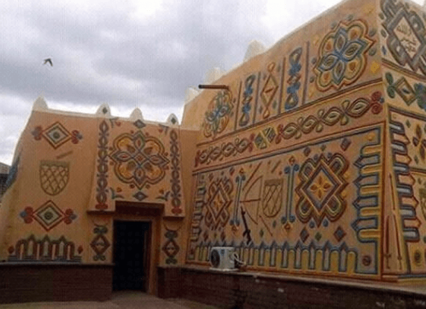
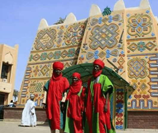
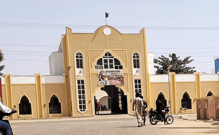
The Emir Palace in Bauchi was built in 19th century and is notable for being the palace with arched balconies and windows.
The Emir of Bauchi’s palace was built by the famed Babban Gwani, real name Muhammadu Durugu; a 19th century master builder from Zaria. He built mosques and palaces in Kano, Katsina, Bauchi and Zaria and the Bauchi palace was built entirely with mud.
It was a fortress built with the intention of providing effective protection to the Emir and his officials. It has tall defence walls and designs that provide a large space for people during important state activities like Friday prayer or the Durbar.
Bauchi
Bauchi State has gone through a much transformation since it was created. During the colonial era up to independence, it formed part of the Bauchi-Plateau of the then Northern Region, until the 1967 state creation exercise, when the Bauchi, Borno, and Adamawa provinces constituted the former North-Eastern State.
With the creation of Bauchi state in 1976, then comprising present Bauchi and Gombe states, it included 16 Local Government Areas. The number of Local Government Areas in the then Bauchi State was increased to 20 and later to 23. However, in 1997 when Gombe state was created out of Bauchi and additional local governments were created in the country, Bauchi State was left with 20 Local Government Areas.
Bauchi Local Governments Areas (LGAs)
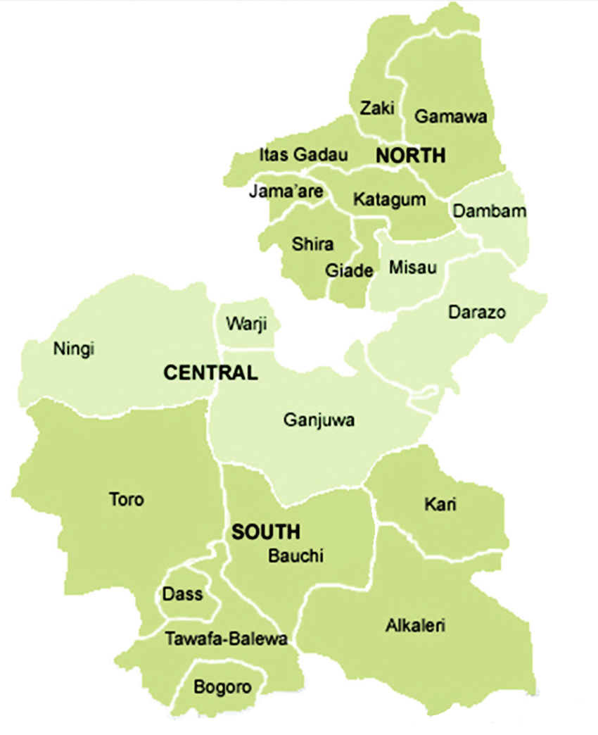
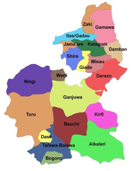
Bauchi State has 20 (twenty) Local Governments Areas (LGAs), namely: Alkaleri, Bauchi, Bogoro, Dambam, Darazo, Dass, Gamawa, Giade, Ganjuwa, Jama’are, Itas – Gadau, Katagum, Kirfi, Misau, Ningi, Shira, Tafawa Balewa, Toro, Warji, and Zaki.
Alkaleri
Bauchi
Bogoro
Damban
Darazo
Dass
Gamawa
Ganjuwa
Giade
Itas/Gadau
Jama’are
Katagum
Kirfi
Misau
Ningi
Shira
Tafawa-Balewa
Toro
Warji
Zaki
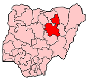
Map of Bauchi State showing Local Government Areas and senatorial districts (North, Central and South)
List of Bauchi State’s 20 Local Governments Areas, headquarters and land area
SN
LGA
Area (km2)
Headquarters
1.
Alkaleri
5,918
Alkaleri
2.
Bauchi
3,687
Bauchi
3.
Bogoro
894
Bogoro
4.
Damban
1,077
Damban
5.
Darazo
3,015
Darazo
6.
Dass
535
Dass
7.
Gamawa
2,925
Gamawa
8.
Ganjuwa
5,059
Kafin Madaki
9.
Giade
668
Giade
10.
Itas/Gadau
1,398
Itas
11.
Jamaare
493
Jamaare
12.
Katagum
1,436
Azare
13.
Kirfi
2,371
Kirfi
14.
Misau
1,226
Misau
15.
Ningi
4,625
Ningi
16.
Shira
1,321
Yana
17.
Tafawa Balewa
2,515
T/Balewa]
18.
Toro
6,932
Toro
19.
Warji
625
Warji
20.
Zaki
1,476
Katagum
Bauchi State is located between latitudes 9° 3′ and 12° 3′ north of the equator with a total land area of 49,119 km² representing about 5.3% of Nigeria’s total land mass. The state is bordered by seven states; namely Kano and Jigawa to the north, Taraba and Plateau to the south, Gombe and Yobe to the east and Kaduna to the west.
Bauchi state has two distinctive vegetation zones, namely, the Sudan Savannah and the Sahel Savannah. Sudan savannah vegetation covers the southern part of Bauchi state where the vegetation gets richer and richer towards the south, especially along water sources or rivers, but generally, the vegetation is less uniform and grasses are shorter than what grows even farther south, that is, in the forest zone of the middle belt.
Other languages of Bauchi State are Ajawa, Beele, Berom, Kanuri, Kwaami, Manga, Pero, and Piya-Kwonci.
Sahel type of the savannah, which is also known as the semi-desert vegetation, becomes manifest from the middle of the state as one moves from the state’s south to its north. This type of vegetation comprises isolated stands of thorny shrubs. On the other hand, the southwestern part of the state is mountainous as a result of the continuation of the Jos Plateau, while the northern part is generally sandy.
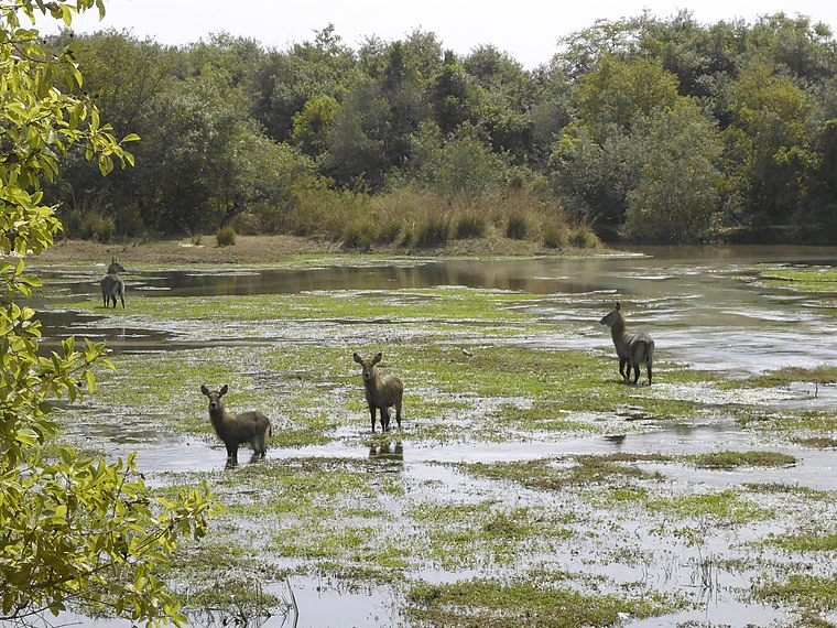
Yankari has become the most developed wildlife park in Nigeria with a lot of attractions for visitors with a wide variety of flora fauna. The park is famous for its variety of animals available for viewing around the year, though the animals are better watched between November and May period of the dry season when the animals converge around the Gaji River in the park.
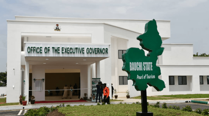
Bauchi is a city in northeast Nigeria, the capital of Bauchi State, of the Bauchi Local Government Area within that State, and of the traditional Bauchi Emirate. It is located on the northern edge of the Jos Plateau, at an elevation of 616 m. The city has a population of 316,173 (2004). The Local Government Area covers an area of 3,687 km2 and had a population of 493,810 at the time of the 2006 Census.
The city was founded by Yaqub ibn Dadi, the only non-Fulani flag-bearer of the Sokoto Empire. The name was derived from a hunter called Baushe, who advised Yaqub to build his city west of the Warinje Mountain. In return Yaqub promised to name his city after the hunter. Abubakar Tafawa Balewa is buried in the city, while the Yankari National Park is 110 KM from the state capital. The city lies on the Port Harcourt – Maiduguri railway line. The Bauchi State Library Board was established-in-1976.
Bauchi state is a heterogeneous state, with predominant tribes like, Hausa, Fulani, Jarawa, Tangale, Waja, Balewa, Sayawa and Tarewa. It is made up of 20 local government areas, namely: Bauchi, Tafawa Balewa, Bogoro, Katagum, Alkaleri, Dambam, Giade, Ganjuwa, Darazo, Dass, Ningi, Shira, Gamawa, Itas/Gadau, Jam’are, Kirfi, Toro, Warji, Zaki, Misau.
Bauchi state is an agricultural state. Its vast fertile soil is an added advantage for agricultural products, which include maize, rice, millet, groundnut and guinea corn. Irrigation fanning is practiced and supported by the use of dams like Balanga dam, etc. Cattle and other livestock are also reared in the state.
The state has industries like the Bazamri PVC – Wire Limited, Kuda Nails Factory, Yankari Natural Water Company, Zaki Flour Mills and Arewa Ceramic Industry and others.
EMIR OF BORGU Alhaji Haliru Dantoro was born in 1938 at old Bussa. He commenced his early education at old Bussa Elementary school…
EMIR OF KONTAGORA: Saidu Namaska Alhaji Saidu Namaska was born in Kontagora on 31st, December 1937. He began his educational carrier at Kontagora Elementary School…
Ras el-Tin Palace, Alexandria, Egypt The historic Ras el-Tin Palace is considered one of the oldest palaces existing in Egypt and Alexandria today. It is…
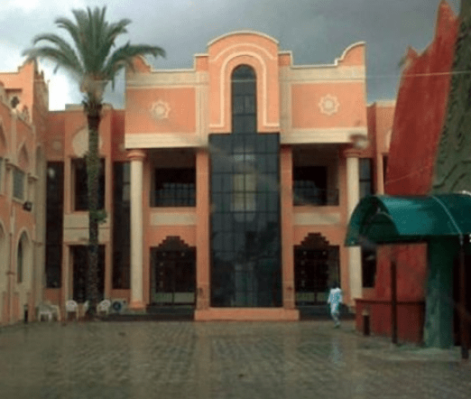


 in Alexandria, located in the Zizinia /Gleem neighborhood in the palace that formerly belonged to one of the princesses of the Mohamed Ali dynasty")


: A Jewel of Amer Fort in Jaipur")

