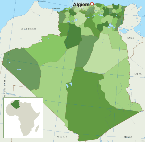
The largest province in Algeria by land area is Tamanrasset. It has a land size of 336,839 km2 (kilometers square) out of 2,381,741 km2, the country total.
Beside Tamanrasset other large provinces are:
Adrar
Illizi
Ouargla
Tindouf
Ain Salah
Algeria provinces by land area. From largest to smallest
Province
Land area (km2)
Tamanrasset
336,839
Adrar
254,471
Illizi
198,815
Ouargla
194,552
Tindouf
159,000
Ain Salah
131,220
Bordj Badji Mokhtar
120,026
Béni Abbès
101,350
Ain Guezzam
88,126
Djanet
86,185
El Bayadh
78,870
Djelfa
66,415
Timimoun
65,203
El Menia
62,215
Béchar
60,850
El Oued
45,738
Naâma
29,950
Laghouat
25,057
Ghardaïa
23,890
Tiaret
20,673
M’Sila
18,718
Touggourt
17,428
Tébessa
14,227
Batna
12,192
Ouled Djellal
11,410
Khenchela
9,811
Biskra
9,576
Sidi Bel Abbès
9,096
Tlemcen
9,061
Médéa
8,866
El M’Ghair
8,835
Oum El Bouaghi
6,783
Saïda
6,764
Sétif
6,504
Mascara
5,941
Aïn Defla
4,891
Relizane
4,870
Chlef
4,795
Souk Ahras
4,541
Bouïra
4,439
Bordj Bou Arréridj
4,115
Guelma
4,101
Skikda
4,026
Mila
3,407
El Tarf
3,339
Béjaïa
3,268
Tissemsilt
3,152
Tizi Ouzou
2,956
Jijel
2,577
Aïn Témouchent
2,379
Constantine
2,187
Mostaganem
2,175
Oran
2,121
Tipaza
1,605
Blida
1,575
Annaba
1,439
Boumerdès
1,356
Algiers
1,190
List of 58 provinces of Tunisia
The 58 provinces (wilayas) of Tunisia are:
Adrar
Aïn Defla
Ain Guezzam
Ain Salah
Aïn Témouchent
Algiers
Annaba
Batna
Béchar
Béjaïa
Béni Abbès
Biskra
Blida
Bordj Badji Mokhtar
Bordj Bou Arréridj
Bouïra
Boumerdès
Chlef
Constantine
Djanet
Djelfa
El Bayadh
El Menia
El M’Ghair
El Oued
El Tarf
Ghardaïa
Guelma
Illizi
Jijel
Khenchela
Laghouat
Mascara
Médéa
Mila
Mostaganem
M’Sila
Naâma
Oran
Ouargla
Ouled Djellal
Oum El Bouaghi
Relizane
Saïda
Sétif
Sidi Bel Abbès
Skikda
Souk Ahras
Tamanrasset
Tébessa
Tiaret
Timimoun
Tindouf
Tipaza
Tissemsilt
Tizi Ouzou
Tlemcen
Touggourt
More on the provinces of Tunisia
Algeria is divided into 58 provinces (wilayas), since December 18, 2019.
By 1984 the number of Algerian provinces was 48.
In 2019, 10 new provinces were added making te current total of 58..
The 58 provinces are divided into 1,541 municipalities (baladiyahs).
In the provinces are districts and municipalities.
Provinces (wilayas)
Districts (dairas)
Municipalities
The name of a province is always that of its capital city.
A wilaya is a territorial collectivity enjoying economic and diplomatic freedom.
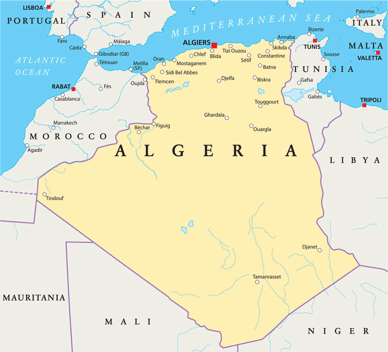
Algeria
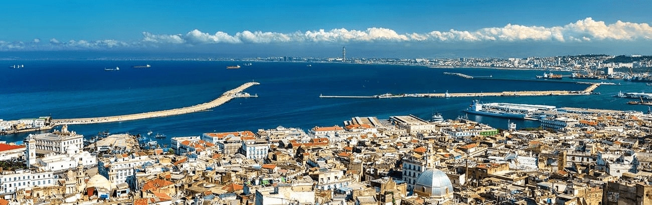
Algeria is country in North Africa. It is the largest country on the continent and the tenth-largest in the world by area, covering more than 2.3 million square kilometers.
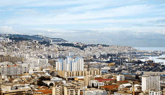
Capital: Algiers (El Djazaïr) Official languages: Arabic, Tamazight Government: Semi-presidential system Currency: Algerian Dinar Area: 2,382,000 sq km Total Population (2017): 41.1 Million Urban Population (2017): 73.50% Female Population (2017): 49.70%
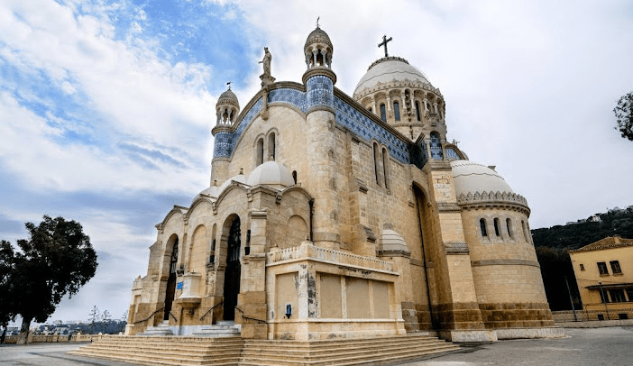
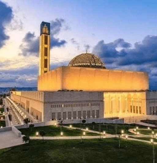
Church of Notre Dame of Africa, Algeria
It has a coastline of about 1,200 kilometers along the Mediterranean Sea, and shares borders with Tunisia, Libya, Niger, Mali, Mauritania, Morocco, and Western Sahara.
It has a Mediterranean coastline of over 1200 km and a contrasting relief made up of plains, high plateaus, mountain ranges and a desert expanse of 2 million km² which is rich in natural and historical elements that represent the preserved memory of the southern Algerian region.
Algeria has:
1557 hotel establishments with a capacity of 143811 beds, including about 20000 beds, are in the public sector (HTT Group), which are currently being rehabilitated and modernised,
609 beaches listed, of which 427 are authorised for swimming,
10 national parks including Tassili National Park (100,000 ha) and Ahaggar National Park (Hoggar 000 ha), wetlands, 51 of which are classified by the Ramsar Convention, as well as a rich thermal potential.
7 Algerian monuments and sites are listed as World Heritage Sites: Tassili n’Ajjer, in the wilayas of Tamanrasset and Illizi, Djamila in the wilaya of Setif, the M’Zab valley in the wilaya of Ghardaïa, the Kasbah of Algiers, the Kalaa of Beni Hamad in the wilaya of M’sila, Timgad in the wilaya of Batna, Gourraya in the wilaya of Tipaza.
36 airports, including 16 international airports.
80 dams and 20 seawater treatment plants, in addition to 15 large power plants.
A road network of nearly 127,000 kms.
Railway tracks reaching 6300 km, in addition to the metro and tramway network at the level of 07 wilayas.
A telecommunications network covering most of the country.
Algeria gained its independence in 1962 after a war of liberation that lasted eight years.
The country has a rich and diverse history, culture, and geography, with influences from various civilizations such as Berbers, Phoenicians, Romans, Arabs, Turks, and French.
The country was part of the Ottoman Empire until the early 19th century, when it was colonized by France.
Algeria is a member of the African Union, the Arab League, OPEC, and the United Nations, and has diplomatic relations with many countries around the world. It plays an important role in regional and international affairs, especially in Africa and the Middle East. Algeria is also a founding member of the Arab Maghreb Union, a regional organization that aims to promote cooperation and integration among its members.
The country has a population of about 44 million people, most of whom are Arab-Berbers or Amazighs, who speak Arabic and Tamazight as official languages. Algeria is a multiethnic and multicultural society, with other ethnic groups such as Tuaregs, Sahrawis, Mozabites, Chaouis, and Kabyles. Algeria also has a religious diversity, with Islam being the state religion and the majority faith, but also having minorities of Christians, Jews, and other beliefs.
It has a mixed economy, with a large public sector and a growing private sector. The main sectors are hydrocarbons, agriculture, industry, services, and tourism. Hydrocarbons account for about 60% of the government revenues and 30% of the GDP. It is one of the largest producers and exporters of natural gas and oil in the world. Agriculture employs about 14% of the workforce and contributes to 12% of the GDP. The main crops are wheat, barley, potatoes, dates, olives, citrus fruits, grapes, and almonds. Industry accounts for 37% of the GDP and includes sectors such as petrochemicals, metallurgy, textiles, food processing, electronics, and construction. Services make up 51% of the GDP and include sectors such as banking, telecommunications, transportation, education, health care, and retail. Tourism is a potential source of income and employment for Algeria, with its natural and cultural attractions such as the Sahara desert, the Atlas mountains, the Roman ruins of Timgad and Djemila, the Casbah of Algiers, and the M’Zab Valley.
Algeria faces many challenges and opportunities in the 21st century, such as political and social reforms, economic diversification, environmental protection,regional stability and international cooperation. It has experienced political unrest and social protests in recent years, demanding more democracy, accountability and transparency from the government.
It seeks to diversify its economy and reduce its dependence on hydrocarbons which are vulnerable to price fluctuations and depletion. The country has moves deal with environmental issues such as desertification, water scarcity, pollution, and climate change which threaten its natural resources and human well-being. Also it seeks to maintain its security and stability in a volatile region, facing threats from terrorism, extremism and armed conflicts in neighboring countries. Algeria is determined to enhance its cooperation and integration with other countries and regional organizations to foster trade, investment, development and peace.
Algeria largest provinces by land area The 10 largest provinces by land area in km2 (kilometers square) in Algeria are: Tamanrasset Adrar Illizi Ouargla Tindouf Ain…
Population of Algeria by province While the most populated province in Algeria is Algiers with 2,988,145 people the least populated province is Ain Guezzam with…
Land area of Algeria provinces Land size in km2 (kilometers square) of Algeria provinces ProvinceArea Km2Adrar254,471Chlef4,795Laghouat25,057Oum El Bouaghi6,783Batna12,192Béjaïa3,268Biskra9,576Béchar60,850Blida1,575Bouïra4,439Tamanrasset336,839Tébessa14,227Tlemcen9,061Tiaret20,673Tizi Ouzou2,956Algiers1,190Djelfa66,415Jijel2,577Sétif6,504Saïda6,764Skikda4,026Sidi Bel Abbès9,096Annaba1,439Guelma4,101Constantine2,187Médéa8,866Mostaganem2,175M’Sila18,718Mascara5,941Ouargla194,552Oran2,121El Bayadh78,870Illizi198,815Bordj Bou Arréridj4,115Boumerdès1,356El Tarf3,339Tindouf159,000Tissemsilt3,152El…
Land area is sq mi of Algeria provinces The land area is sq mi (square miles) of Algeria provinces is as follows: Provincesq mi Adrar98,252Chlef1,851Laghouat9,675Oum El Bouaghi2,619Batna4,707Béjaïa1,262Biskra3,697Béchar23,490Blida608Bouïra1,714Tamanrasset130,054Tébessa5,493Tlemcen3,498Tiaret7,982Tizi Ouzou1,141Algiers460Djelfa25,643Jijel995Sétif2,511Saïda2,612Skikda1,554Sidi…
Total land area of Algeria The total land size of Algeria is 2,381,741 km2 (kilometers square). The largest province in Algeria by land area is…
Algeria smallest provinces by land area The 10 smallest provinces by land area in km2 (kilometers square) in Algeria are: Algiers Boumerdès Annaba Blida Tipaza Oran…
Smallest Angola province by land size The smallest province in Angola by land area is Luanda with 2,417 km2. 10 smallest provinces in Angola by land…
Total land size of Algeria The total land area of Algeria is 2,381,741 km2 (kilometers square). Algeria provinces by land area (largest to smallest) ProvinceLand…
10 largest districts of Ghana by land area Ghana’s largest districts by land area are: West GonjaBoleEast GonjaSissalaSeneKintampoWaGushiegu KaragaWassa Amenfi DistrictArea (km²)West Gonja17,317Bole9,631East Gonja9,351Sissala7,781Sene6,657Kintampo6,566Wa5,859Gushiegu Karaga5,761Wassa Amenfi4,987Wenchi4,939 Full list…
10 largest states of Nigeria by land area The 10 largest states of Nigeria by land area are: BornoNigerTarabaBauchiYobeKadunaAdamawaKebbiKwaraZamfara Full list of Nigeria states land size. From largest…
10 largest districts of Tanzania by land area Tanzania’s top 10 largest districts by land area are: MpandaLiwaleSongea RuralManyoniChunyaUlangaUramboSikongeTabora UrbanIringa Rural List of Tanzania largest districts by land…
List of districts of Tanzania by land area. From largest to smallest The districts of Tanzania by land area from largest to smallest are: DistrictArea (Km²)Mpanda45,843Liwale36,084Songea Rural33,825Manyoni28,620Chunya27,065Ulanga23,681Urambo21,299Sikonge21,000Tabora Urban20,104Iringa Rural19,898Simanjiro18,851Tunduru18,778Kiteto16,305Mbarali16,000Kibondo15,722Kilosa14,245Monduli14,070Dodoma Rural14,004Kilwa13,920Kilombero13,577Ngorongoro13,460Rufiji13,339Kondoa13,210Sumbawanga Rural12,836Singida Rural12,164Morogoro…