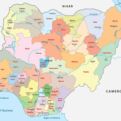
A postal code is a group of characters (usually numbers) meant to help post offices send mails and parcels to the right destinations.
The codes have come to be of great use not only for post offices but also for delivery companies and any person that wants to locate an area for parcel delivery or other purposes.

Postal codes enable delivery companies send parcels to correct destinations easier and faster.
The code is usually part of a postal address.
In Nigeria postal codes consists of six digits.

NIPOST (Nigerian Postal Service) divides the country into nine regions which make up the first digit of the code. The second and third digits, combined with the first, are the dispatch district for outgoing sorting. The last three digits represent the delivery location. A delivery location can be any of the following; a post office facility, a rural area, or an urban area.

The main post office or postal head office in each region will has a postal code ending in 0001, so Garki head office in Abuja has the postal code 900001, Ikeja head office in Lagos has 100001, Lokoja in Kogi has 270001 and Port Harcourt has 500001.
The lowest postcode is 100001 and the highest is 982002.
Postal/ZIP code
Postal code is also referred to as ZIP code. The term ZIP code is often used in US.
ZIP being the short form of
Z: Zone
I: Improvement
P: Plan code
ZIP code is a system of postal codes used by the United States Postal Service (USPS).
Introduced on July 1, 1963, the basic format consisted of five digits. In 1983, an extended code was introduced, called ZIP+4 ; it included the five digits of the ZIP code, followed by a hyphen and four digits that designated a more specific location.
US delivery system uses a ZIP code for the items shipped to and from overseas and within the country.


