Gaborone areas list according to total population (highest to lowest), showing rank, area name and population.
Gaborone Areas by Population Size (Descending)
Rank
Area
Population
1
Gaborone City (Total)
246,325
2
Old Naledi
18,050
3
Gaborone West Extension 48 (Block 7)
9,794
4
Broadhurst (Extension 27)
6,638
5
Gaborone North (Extension 98)
6,024
6
Ledumang (Extension 48)
5,901
7
Gaborone West Extension 36 (Block 8)
5,817
8
Gaborone West Extension 3 (Phase 1)
5,131
9
Gaborone West Extension 6 (Phase 1)
5,088
10
Gaborone West Extension 69 (Block 10)
5,037
11
Gaborone West Extension 4 (Phase 1)
4,917
12
Extension 15 (Village)
4,809
13
Bontleng
4,736
14
Gaborone West Extension 43 (Block 5)
4,689
15
University of Botswana
4,306
16
Broadhurst (Extension 25)
4,180
17
Gaborone West Extension 35 (Block 8)
4,133
18
New Stance
4,054
19
Tsholofelo East (Extension 72)
4,056
20
Extension 16A (Broadhurst)
3,909
21
Glen Valley
3,132
22
Gaborone West Extension 11 (Phase 2)
3,093
23
Phiring (Extension 43)
3,216
24
Extension 7 (Sekgwa)
3,203
25
Gaborone West Extension 12 (Phase 2)
3,301
26
Broadhurst (Extension 26)
3,347
27
Maruapula (Extension 23)
2,911
28
Gaborone West Extension 39 (Block 6)
2,807
29
Tawana
2,745
30
Gaborone West Extension 30 (Block 3)
2,701
31
Gaborone West Extension 17 (Phase 4)
2,516
32
Gaborone West Extension 49 (Block 5)
2,480
33
Gaborone West Extension 25 (Block 9)
2,034
34
Segodi Park
2,023
35
Kgale Hill Township Extension 1
2,075
36
Babusi
2,109
37
Talana Park
2,121
38
Teto Estate
2,180
39
Gaborone West Extension 40 (Block 6)
2,076
40
Gaborone West Extension 41 (Block 6)
2,189
41
Maruapula Extension (Universal Estate)
2,194
42
Gaborone West Extension 10 (Phase 2)
1,520
43
Tsholofelo East (Extension 71)
1,566
44
Gaborone West Extension 20 (Phase 4)
1,597
45
Gaborone West Extension 38 (Block 8)
1,649
46
Ginger (Extension 22)
1,721
47
Taung
1,750
48
Sebele
1,804
49
Maruapula Extension
1,808
50
Acacia Park
1,380
51
Golf Estate
969
52
Kgale Hill Township (Extension 28)
506
53
Gaborone Dam Area
49
54
Foreign Missions
247
55
Conservation Area
61
56
Industrial Area
4
Gaborone City (Total) represents the aggregate population and is shown for reference.
Extremely small counts (industrial, institutional, or special-use zones) remain listed for completeness.
Extensions with identical names but different phases are treated as distinct census areas, consistent with your source data.
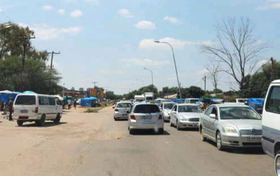
Gaborone
Gaborone is the largest city and administrative capital of Botswana, located in the southeastern part of the country near the South African border. It serves as the political, economic, and cultural hub, hosting government offices, corporate headquarters, educational institutions, and international organizations.
Total Population: 246,325
Major Urban Areas and Extensions
Old Naledi
Population: 18,050
One of the oldest settlements in Gaborone, originally a township area.
Ledumang / Extension 48
Population: 5,901
Primarily a residential area with significant urban growth.
Gaborone West Extensions (Blocks 3–10, Phases 1–4)
Population: ~60,000
Series of planned residential and industrial extensions
Includes major Blocks like 5, 6, 7, 8, 9, and 10.
Broadhurst (Extensions 16–27)
Population: ~25,000
Mixed residential and commercial area with industrial zones.
University of Botswana and Academic Institutions
Population: 4,306
The University campus contributes a mix of student and staff population.
Glen Valley
Population: 3,132
Residential estate area with schools and community facilities.
New Stance & Tsholofelo Areas
Population: ~8,200
Planned residential estates, mostly in southern Gaborone.
Acacia Park, Talana Park, Golf Estate, Teto Estate
Population: ~6,700
High-end residential neighborhoods with modern amenities.
Industrial Zones & Commercial Areas
Include Gaborone International Commerce Park, Industrial Extensions, and other minor industrial areas
Population: relatively small residential component but key for employment.
Urban Characteristics
Residential: Highly segmented into extensions, blocks, and phases reflecting Botswana’s urban planning model.
Commercial: Central Business District (CBD) concentrated in Gaborone West and Old Naledi areas.
Industrial: Industrial areas distributed across Broadhurst and Gaborone West extensions.
Educational & Institutional: University of Botswana and government offices anchor the north-central areas.
Population Distribution: More densely populated in western extensions and older townships; high-end estates are less dense.
Significance
Gaborone is the economic engine of Botswana, hosting most corporate headquarters, banks, and service industries.
The city has experienced rapid growth due to rural-urban migration, with new extensions built to accommodate residential and commercial demand.
Planning and expansion are ongoing, with several extensions designed to provide housing, industrial opportunities, and recreational amenities.
More
10 most populated Local Government Areas in Abia The top 10 most populated Local Government Areas in Abia State are: Aba NorthAba SouthOhafiaUmuahia NorthOsisioma NgwaBendeObi NgwaArochukwuUmu-NneochiIsiala-Ngwa North List…
10 most populated Local Government Areas in Adamawa The top 10 most populated Local Government Areas in Benue State are: DemsaFuforeYola NorthYola SouthSongGuyukHongJadaGanyeMichika List of LGAs in Adamawa…
Largest areas in Gaborone The largest area in Gaborone by population size is Mogoditshane, a fast growing suburb.. Mogoditshane has a population of 88,098,…
List of Tanzania districts by population size. From least to most populated Tanzania districts by population size from least to most populated are: DistrictPopulationKusini31,853Mafia40,557Lindi Urban41,075Pangani43,920Kaskazini ‘B’52,492Kati62,391Liwale75,128Bukoba Urban80,868Chake82,998Micheweni83,266Kaskazini ‘A’84,147Mtwara Urban92,156Mkoani92,473Kisarawe95,323Wete102,060Makete105,775Iringa Urban106,371Musoma Urban107,855Ileje109,847Singida Urban114,853Mwanga115,145Ruangwa124,009Ludewa128,155Ngorongoro129,362Songea…
List of Tanzania districts by population size. From most to least populated Tanzania districts by population size from most to least populated are: DistrictPopulationKinondoni1,083,913Temeke768,451Geita709,078Ilala634,924Kasulu626,742Bariadi603,604Kahama594,891Arumeru514,651Mbozi513,600Sengerema498,993Tarime490,731Kigoma Rural489,271Kilosa488,191Masasi440,987Dodoma Rural438,866Kondoa428,090Karagwe424,287Njombe419,115Lushoto418,652Nzega415,203Magu415,005Kibondo413,777Mpanda410,452Biharamulo409,389Mbinga403,819Moshi Rural401,369Singida Rural400,377Bukombe395,298Bukoba Rural394,020Muleba385,184Sumbawanga Rural371,749Urambo369,329Iramba367,036Ngara334,409Musoma Rural329,824Igunga324,094Dodoma Urban322,811Kilombero321,611Kwimba314,925Rungwe306,380Maswa304,402Babati302,253Mufindi282,071Arusha281,608Uyui281,101Muheza278,405Shinyanga…
List of Tanzania regions by population size. From most to least populated Tanzania regions by population size. From most to least populated RegionPopulationDar es Salaam4,364,541Mwanza2,772,509Mbeya2,707,410Kagera2,458,023Tabora2,291,623Morogoro2,218,492Kigoma2,127,930Dodoma2,083,588Tanga2,045,205Mara1,743,830Geita1,739,530Arusha1,694,310Kilimanjaro1,640,087Simiyu1,584,157Shinyanga1,534,808Manyara1,425,131Ruvuma1,376,891Singida1,370,637Mtwara1,270,854Pwani1,098,668Rukwa1,004,539Iringa941,238Lindi864,652Njombe702,097Zanzibar West593,678Katavi564,604Pemba North211,732Pemba South195,116Zanzibar North187,455Zanzibar South and Central115,588…
List of Chad regions by population, from least to most populated Regions of Chad according to size of population, from least to most populated are: RegionPopulation (2023)Tibesti52,626Ennedi-Ouest109,753Borkou154,865Ennedi-Est175,321Bahr el Gazel407,256Salamat470,256Kanem505,839Lac509,258Sila591,300Batha748,395Wadi Fira792,394Guéra824,161Mayo-Kebbi Ouest858,593Hadjer-Lamis870,231Chari-Baguirmi884,924Moyen-Chari902,311Mandoul1,002,346Tandjilé1,007,812Logone…
List of Oruro Most Populated Municipalities List of municipalities and autonomous indigenous territories in the Department of Oruro, ordered from most populated to least populated Oruro…
List of Gaborone Villages, Surrounding Cities and Towns Gaborone comprises 14 Large Villages, Surrounding Cities and Towns, namely: Mogoditshane Tlokweng Ramotswa Mmopane Gabane Kopong Metsimotlhabe Oodi Bokaa Modipane Kumakwane Ramotswa Station Rasesa Morwa…
Tanzania most populated districts Tanzania’s top ten most populated districts are:KinondoniTemekeIlalaGeitaSengeremaMulebaKahamaNzegaLushotoMoshi Kinondoni Kinondoni Municipal Council,Dar es Salaam Region(1,775,049 inhabitants) Temeke Temeke Municipal Council,Dar es…
10 most populated districts of Ghana The 10 most populated districts of Ghana are: AccraKumasiGaTemaShama Ahanta EastBawku EastTamaleJuabeso BiaKetuAdansi West DistrictPopulationAccra1,659,136Kumasi1,171,311Ga548,011Tema506,637Shama Ahanta East366,579Bawku East307,907Tamale293,879Juabeso Bia242,121Ketu235,852Adansi West235,680…
10 most populated states in Nigeria Nigeria’s top 10 most populated states are: KanoLagosKadunaKatsinaOyoRiversBauchiJigawaBenueAnambra Population size of Nigeria states. From largest to smallest Based on 2006…
Most populated state in Nigeria Nigeria’s most populated state is Kano. Kano Kano Kano is a city in northern Nigeria and the capital of Kano…
10 most populated districts of Tanzania The 10 most populated districts of Tanzania are: KinondoniTemekeGeitaIlalaKasuluBariadiKahamaArumeruMboziSengerema Full list of Tanzania districts by population size. From most to…
10 most densely populated LGAs in Nigeria Nigeria’s top 10 densely populated LGAs (Local Government Areas) in Nigeria are: Ajeromi-IfelodunLagos IslandShomoluAgegeMushinDalaKano MunicipalSurulereIbadan South EastLagos Mainland List of…