A guide to the kecamatan of Jambi Province, with key details
List of Districts (Kecamatan)
Jambi Province is divided into 9 regencies and 2 cities. The list below is alphabetical and names the regency or city each district belongs to. It contains 144 districts.
Air Hangat — Kerinci Regency
Air Hangat Barat — Kerinci Regency
Air Hangat Timur — Kerinci Regency
Air Hitam — Sarolangun Regency
Alam Barajo — Jambi City
Bahar Selatan — Muaro Jambi Regency
Bahar Utara — Muaro Jambi Regency
Bajubang — Batang Hari Regency
Bangko — Merangin Regency
Bangko Barat — Merangin Regency
Batang Asai — Sarolangun Regency
Batang Asam — West Tanjung Jabung Regency
Batang Masumai — Merangin Regency
Batang Merangin — Kerinci Regency
Bathin II Babeko — Bungo Regency
Bathin II Pelayang — Bungo Regency
Bathin III — Bungo Regency
Bathin III Ulu — Bungo Regency
Bathin VIII — Sarolangun Regency
Batin XXIV — Batang Hari Regency
Berbak — East Tanjung Jabung Regency
Betara — West Tanjung Jabung Regency
Bram Itam — West Tanjung Jabung Regency
Bukit Kerman — Kerinci Regency
Bungo Dani — Bungo Regency
Cermin Nan Gedang — Sarolangun Regency
Danau Kerinci — Kerinci Regency
Danau Kerinci Barat — Kerinci Regency
Danau Sipin — Jambi City
Danau Teluk — Jambi City
Dendang — East Tanjung Jabung Regency
Depati Tujuh — Kerinci Regency
Geragai — East Tanjung Jabung Regency
Gunung Kerinci — Kerinci Regency
Gunung Raya — Kerinci Regency
Gunung Tujuh — Kerinci Regency
Hamparan Rawang — Sungai Penuh City
Jambi Luar Kota — Muaro Jambi Regency
Jambi Selatan — Jambi City
Jambi Timur — Jambi City
Jangkat — Merangin Regency
Jelutung — Jambi City
Jujuhan — Bungo Regency
Jujuhan Ilir — Bungo Regency
Kayu Aro — Kerinci Regency
Kayu Aro Barat — Kerinci Regency
Keliling Danau — Kerinci Regency
Kota Baru — Jambi City
Koto Baru — Sungai Penuh City
Kuala Betara — West Tanjung Jabung Regency
Kuala Jambi — East Tanjung Jabung Regency
Kumpeh — Muaro Jambi Regency
Kumpeh Ulu — Muaro Jambi Regency
Kumun Debai — Sungai Penuh City
Lembah Masurai — Merangin Regency
Limbur Lubuk Mengkuang — Bungo Regency
Limun — Sarolangun Regency
Mandiangin — Sarolangun Regency
Mandiangin Timur — Sarolangun Regency
Margo Tabir — Merangin Regency
Maro Sebo — Muaro Jambi Regency
Maro Sebo Ilir — Batang Hari Regency
Maro Sebo Ulu — Batang Hari Regency
Mendahara — East Tanjung Jabung Regency
Mendahara Ulu — East Tanjung Jabung Regency
Merlung — West Tanjung Jabung Regency
Mersam — Batang Hari Regency
Mestong — Muaro Jambi Regency
Muara Bulian — Batang Hari Regency
Muara Papalik — West Tanjung Jabung Regency
Muara Sabak Barat — East Tanjung Jabung Regency
Muara Sabak Timur — East Tanjung Jabung Regency
Muara Siau — Merangin Regency
Muara Tabir — Tebo Regency
Muara Tembesi — Batang Hari Regency
Muko-Muko Bathin VII — Bungo Regency
Nalo Tantan — Merangin Regency
Nipah Panjang — East Tanjung Jabung Regency
Paal Merah — Jambi City
Pamenang — Merangin Regency
Pamenang Barat — Merangin Regency
Pamenang Selatan — Merangin Regency
Pangkalan Jambu — Merangin Regency
Pasar Jambi — Jambi City
Pasar Muara Bungo — Bungo Regency
Pauh — Sarolangun Regency
Pelawan — Sarolangun Regency
Pelayangan — Jambi City
Pelepat — Bungo Regency
Pelepat Ilir — Bungo Regency
Pemayung — Batang Hari Regency
Pengabuan — West Tanjung Jabung Regency
Pesisir Bukit — Sungai Penuh City
Pondok Tinggi — Sungai Penuh City
Rantau Pandan — Bungo Regency
Rantau Rasau — East Tanjung Jabung Regency
Renah Mendaluh — West Tanjung Jabung Regency
Renah Pamenang — Merangin Regency
Renah Pembarap — Merangin Regency
Rimbo Bujang — Tebo Regency
Rimbo Ilir — Tebo Regency
Rimbo Tengah — Bungo Regency
Rimbo Ulu — Tebo Regency
Sadu — East Tanjung Jabung Regency
Sarolangun — Sarolangun Regency
Seberang Kota — West Tanjung Jabung Regency
Sekernan — Muaro Jambi Regency
Senyerang — West Tanjung Jabung Regency
Serai Serumpun — Tebo Regency
Singkut — Sarolangun Regency
Sitinjau Laut — Kerinci Regency
Siulak — Kerinci Regency
Siulak Mukai — Kerinci Regency
Sumay — Tebo Regency
Sungai Bahar — Muaro Jambi Regency
Sungai Bungkal — Sungai Penuh City
Sungai Gelam — Muaro Jambi Regency
Sungai Manau — Merangin Regency
Sungai Penuh — Sungai Penuh City
Sungai Tenang — Merangin Regency
Tabir — Merangin Regency
Tabir Barat — Merangin Regency
Tabir Ilir — Merangin Regency
Tabir Lintas — Merangin Regency
Tabir Selatan — Merangin Regency
Tabir Timur — Merangin Regency
Tabir Ulu — Merangin Regency
Taman Rajo — Muaro Jambi Regency
Tanah Cogok — Kerinci Regency
Tanah Kampung — Sungai Penuh City
Tanah Sepenggal — Bungo Regency
Tanah Sepenggal Lintas — Bungo Regency
Tanah Tumbuh — Bungo Regency
Tebing Tinggi — West Tanjung Jabung Regency
Tebo Ilir — Tebo Regency
Tebo Tengah — Tebo Regency
Tebo Ulu — Tebo Regency
Telanaipura — Jambi City
Tengah Ilir — Tebo Regency
Tiang Pumpung — Merangin Regency
Tungkal Ilir — West Tanjung Jabung Regency
Tungkal Ulu — West Tanjung Jabung Regency
VII Koto — Tebo Regency
VII Koto Ilir — Tebo Regency
Key Details
Districts by regency and city
Regency or city
Seat
Districts
Area (km²)
Population (est.)
Kerinci Regency
Siulak
18
3,445.20
272,832
Merangin Regency
Bangko
24
7,679.00
373,409 (2024)
Sarolangun Regency
Sarolangun
11
5,935.89
310,679
Batang Hari Regency
Muara Bulian
8
5,804.83
320,281
Muaro Jambi Regency
Sengeti
11
5,158.14
430,246
West Tanjung Jabung Regency
Kuala Tungkal
13
5,544.57
344,033
East Tanjung Jabung Regency
Muara Sabak
11
5,087.07
244,905 (2024)
Bungo Regency
Muara Bungo
17
4,659.00
386,114
Tebo Regency
Muara Tebo
12
6,103.74
359,638
Jambi City
Jambi (provincial capital)
11
169.89
642,264
Sungai Penuh City
Sungai Penuh
8
364.92
102,708
Total
144
Population figures are mid-2025 estimates unless marked otherwise.
Quick facts
Jambi Province has 9 regencies (kabupaten) and 2 cities (kota). The provincial capital is Jambi City.
Merangin has the most districts (24). Batang Hari and Sungai Penuh have the fewest (8 each).
The most populous district in the list is Alam Barajo in Jambi City (about 118,000 people). The largest by area is Kumpeh in Muaro Jambi (about 1,641 km²). The smallest by area is Pasar Jambi (about 1.7 km²).
Jambi City is an enclave inside Muaro Jambi Regency. Sungai Penuh City is an enclave inside Kerinci Regency, which it left on 24 June 2008.
All of Jambi City’s subdistricts are urban kelurahan. Rural regencies are made up mostly of desa (villages), with a small number of kelurahan in district centres.
Mount Kerinci, in Kerinci Regency, is the highest volcano in Indonesia and Southeast Asia, at 3,805 m.
The Muaro Jambi Temple Compounds, a major Srivijaya-era archaeological site, lie in Muaro Jambi Regency and are on UNESCO’s tentative World Heritage list.
How Jambi’s Districts Fit Together
Jambi sits on the east coast of central Sumatra and stretches west to the Barisan Mountains. It borders Riau to the north, West Sumatra to the west, Bengkulu to the southwest and South Sumatra to the south. Its land area is a little under 49,000 km², and the latest official estimate puts its population at roughly 3.8 million.
The administrative ladder
Indonesia is governed in layers. A province is divided into regencies (kabupaten) and cities (kota). Regencies and cities are divided into districts, called kecamatan, each headed by a camat, a civil servant who answers to the regent or mayor. Districts are then divided into villages: desa in rural areas and kelurahan in urban ones. For a reader outside Indonesia, the kecamatan is the closest equivalent to a county subdivision or a township: large enough to have its own administrative centre and postal codes, small enough to be a local community.
Why the numbers keep changing
District counts in Indonesia are not fixed. Local governments regularly split large districts in a process called pemekaran, usually to bring administration closer to residents. Jambi shows this clearly:
Jambi Province began in 1957 with three regencies and one city. Two more regencies were added in 1965, four more in 1999, and Sungai Penuh became a separate city in 2008.
Kerinci Regency had 12 districts in 2010, added four in 2013 and two more in 2020, reaching 18.
Muaro Jambi grew from 8 districts to 11, and Jambi City from 8 to 11.
Sarolangun gained Mandiangin Timur in 2022, taking it from 10 districts to 11.
A national moratorium on creating new regencies has been in place since 2013, which is why a proposed Tabir Raya Regency, which would take eight northern districts out of Merangin, has not gone ahead.
Three landscapes
The districts fall roughly into three zones.
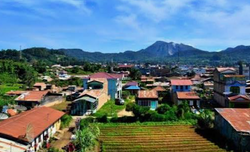
The western highlands include Kerinci Regency and Sungai Penuh City. This is volcanic, cool-climate country within and around Kerinci Seblat National Park. Mount Kerinci rises above the Kayu Aro plateau, Lake Kerinci covers about 46 km², and Lake Gunung Tujuh sits in a caldera at about 1,950 m. Many district names here, such as Gunung Kerinci, Danau Kerinci and Sitinjau Laut, are taken directly from the landscape.
The central river plains include Merangin, Bungo, Tebo, Sarolangun, Batang Hari and Muaro Jambi. The Batang Hari, the longest river in Sumatra at roughly 1,700 km, runs through this zone and through Jambi City. Settlement, farming and transport have followed the rivers for centuries, from the ancient Melayu kingdom to today. Merangin is also home to a geopark with 300-million-year-old fossil trees.
The eastern coast includes West and East Tanjung Jabung. Here districts such as Nipah Panjang, which includes the Batang Hari estuary and seven offshore islands, and Kuala Tungkal and Muara Sabak, river-mouth port towns, face the sea.
Names places
Many district names follow patterns that make them easier to decode:
Ilir and Ulu mean downstream and upstream. Tebo Ilir lies downriver of Tebo Ulu, with Tebo Tengah (middle) between.
Barat, Timur, Selatan and Utara mean west, east, south and north. Muara Sabak Barat and Muara Sabak Timur are the western and eastern halves of an older Muara Sabak district.
Muara means river mouth, as in Muara Bulian and Muara Tembesi. Pasar means market, which is why Pasar Jambi and Pasar Muara Bungo are the old commercial cores of their towns.
Names that look alike are different places: Kota Baru is in Jambi City, while Koto Baru is in Sungai Penuh City. Sungai Penuh is both a city and one of its own districts. Maro Sebo is in Muaro Jambi, while Maro Sebo Ilir and Maro Sebo Ulu are in Batang Hari.
Two cities, two enclaves
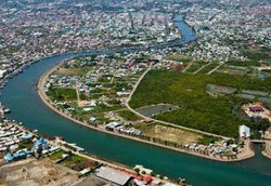
Jambi City is the economic and political centre of the province, a busy river port that is surrounded on all sides by Muaro Jambi Regency. Because the city is small, many of its suburbs fall in Muaro Jambi, most notably in the district named Jambi Luar Kota, meaning Jambi outside the city. Sungai Penuh is the highland counterpart: a small city that was part of Kerinci until 2008 and is still almost entirely surrounded by it.
Districts (Kecamatan) of Riau, Indonesia A numbered list of all 172 districts, the regency or city each one belongs to, key details Listed alphabetically. Format:…
Districts of North Sumatra, Indonesia List of districts (kecamatan) of North Sumatra with the regency or city each belongs to. List of North Sumatra Districts…
Districts (Kecamatan) of Aceh, Indonesia List of Districts (Kecamatan) of Aceh, Indonesia No.DistrictRegency/City1Arongan LambalekAceh Barat2BubonAceh Barat3Johan PahlawanAceh Barat4Kaway XVIAceh Barat5MeureuboAceh Barat6Pante CeureumenAceh Barat7Panton ReuAceh Barat8SamatigaAceh…
Ghana districts. Population, size of land area and capitals of districts The districts of Ghana and their population, land area and capitals are as follows: DistrictPopulationArea (km.²)CapitalAbura-Asebu-Kwamankese90,093324Abura-DunkwaAccra1,659,136185AccraAdansi East129,3251,380New EdubiaseAdansi West235,680828ObuasiAfigya Sekyere117,653770AgonaAfram…
List of Indonesia’s Ministers The Cabinet of Indonesia—officially known as the Red and White Cabinet (Kabinet Merah Putih)—is led by President Prabowo Subianto and…
List of Botswana Districts List of the 28 Districts of Botswana Barolong Central Bobonong Central Boteti Central Kgalagadi Game Reserve Central Mahalapye Central Serowe/Palapye…
List of Botswana Villages and their Districts NGWAKETSE DISTRICT Kanye Ranaka Lotlhakane West Gasita Lorolwana Kgomokasitwa Pitseng Lekgolobotlo Seherelela Lotlhakane Sese Sesung Magotlhwane Segwagwa Manyana Dipotsana Diabo…
List of Belize Districts and Capitals Administrative Subdivisions in Belize Belize is divided into six main administrative districts. These districts serve as the highest-level subdivisions for…
List of Belarus Districts and Regions Belarus is divided into six regions (voblasts), each comprising numerous districts that serve as the fundamental administrative units of local…
List of Uganda Districts by Region Uganda has 135 districts plus Kampala, grouped into four major regions. Central Region (Including Kampala) Buikwe Bukomansimbi Butambala Buvuma Gomba…
List of Uganda Districts, Regions and Subregions Uganda’s administrative classification into regions, sub-regions, and districts reflects the country’s diversity: administratively, culturally and geographically. Classification of Uganda into…
List of Botswana’s 17 Districts Botswana is divided into 17 major areas: 10 administrative districts, 2 cities, and 5 towns. These are administered by local…
List of largest cities, towns and districts in Botswana The largest cities, towns and districts in Botswana according to population size are: RankNameCity, Town or DistrictPopulation 20221GaboroneGaborone246,3252FrancistownFrancistown103,4173MogoditshaneKweneng District88,0044MaunNorth-West District85,3505MolepololeKweneng…