Originally settled by the Kebbawa, a subgroup of the Hausa people, the town was named for the surrounding gandu (“royal farmlands”) that formerly belonged to Muhammadu Kanta, who founded the Kebbi kingdom in the 16th century.
Although Fulani herdsmen had grazed their cattle in Kebbi territory for centuries, not until the era (1804–12) of the Fulani jihad did Gwandu become an important Fulani town. In 1805, Usman dan Fodio, the jihad leader, moved the jihad headquarters from Sabongari to Gwandu. Muhammad Bello, his son and successor (1817), began construction of the town’s walls in 1806. After the Fulani victory over the Gobirawa at Alkalawa in 1808, Usman split his vast empire, which then extended over most of what is now northern and central Nigeria, into two spheres of influence. He made his brother Abdullahi dan Fodio emir of Gwandu and overlord of the western and southern emirates (1809) and placed Bello in charge of the eastern emirates. From 1815 Abdullahi maintained Gwandu as one of the two capitals of the Fulani empire.
The Gwandu emirate received tribute from its vassal emirates, including Nupe, Ilorin, Yauri, Agaie, Lafiagi, and Lapai in Nigeria, until the British arrived in 1903. The town had by then become a caravan centre for desert products from the north and forest products, notably kola nuts, from the south. Gwandu offered no military resistance to the British occupation. The Gwandu emirate was considerably reduced in size by British cessions to French West Africa in 1907. Its emir, however, remains the third most important Muslim traditional leader in Nigeria, following only the sarkin musulmi of Sokoto and the shehu (sultan) of Bornu.
The town of Gwandu remains a collecting point for peanuts (groundnuts), tobacco, and rice; it also serves as a major local market centre in millet, sorghum, onions, bananas, cotton, goats, cattle, skins, and kola nuts.
Kebbi
Kebbi is a state in Nigeria. It is located in the northern part of the country. Kebbi comprises 21 Local Government Areas.
The capital is Birnin Kebbi.
It has 4 Emirates Councils each under a first class Emir. They are Gwandu, Argungu, Yauri and Zuru.
Emir of Gwandu is the Chairman of Kebbi State Council of Chiefs.
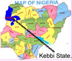
Kebbi State was carved out of the former Sokoto State on Tuesday, 27th August 1991 as one of the additional nine new States created by the then Head of the Military Government of Nigeria.Located on the extreme north west corner of Nigeria, it occupies a total landmass of about 36,229 sq. Km (about 3.92% of Nigeria)

Kebbi State has diverse ethnic composition with the following as the major tribes; Hausas, Dakarkari (Lalna), Kambari, and Zabarmawa.
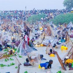
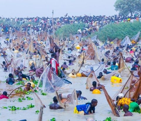
In terms of cultural festivals and artifacts, the state is famous with the Argungu Fishing and the Zuru annual Uhola Cultural Festivals. In addition, Kanta Museum Argungu, the tomb of Sheik Abdullahi Dan Fodio (Hubbare) at Gwandu; and Girmache Shrine at Zuru provide tourist attraction sites.
HISTORICAL OVERVIEW
Kebbi State has a historical background both in relation to the Hausa State and the Sokoto Caliphate.
Most of the area comprising Kebbi State was dominated by the Kingdom of Kebbi carved out of the old Songhai Empire by the warrior Muhammadu Kotal Kanta. Other areas are the Yauri Kingdom and the Zuru confederation.

Following the Fulani jihad and the establishment of Sokoto Caliphate in the early part of 19 century, the area became the south-western part of the caliphate under Abdullahi Dan Fodio, the brother of leader of the caliphate, Sheik Usmanu Dan Fodio.
As a result of the colonial conquest of the Sokoto Caliphate in 1893, the area became part of the protectorate of northern Nigeria. After Nigeria’s independence in 1960 and following the state creation, the area was first, part of the North-western state (1967-1976), Sokoto state (1976-1991) and with Birnin Kebbi as the State, created on 27th August 1991 with Birnin Kebbi as the state capital. It currently has twenty-one local Government Areas.
GEOGRAPHICAL BACKGROUND
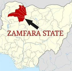
Kebbi State is located on the north western part of Nigeria between latitudes 10¬0 and 130N and longitudes 3030’ and 60E. It has a total landmass of about 37,699 square kilometers out of which 36.46% is made up of farmland. However, about one third of the state is situated in desert prone environment thus making it one of the front-line states for the menace of drought and desertification. The state shares an extensive border with Niger Republic to the North and Benin Republic to the west with many inter-cultural and ethnic linkages. It is internally bordered to the North-East by Sokoto State to the East by Zafara State and to the south by Niger State.
The landscape of Kebbi State is dominated by extensive flood plains (Fadama) of the inland river valley systems. The Niger River flows southwest across part of the state and the Rima River flows southerly through the center of the state to join the Niger. Both rivers have broad flood plains. The flow of River Rima is, however, perennial which reaches its peak during the short wet season that last between June and September. The largest sources of surface water, however, is in Yauri and Ngaski Local Government Areas where the River Niger forms large body of water several square kilometers in size known as Kainji Lake; which is 80% located in Kebbi State.
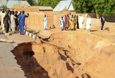
The geology of Kebbi State is characterized by thick and vast sequences of sedimentary deposits of the Sokoto Rima-basin, which underline about 50% of the area. The rest being underlain by Precambrian Basement complex rocks. The predominant soil type in Kebbi State, however, is the ferrugirious tropical soils. Their main features include a sandy surface horizon underlain by weakly developed clayey, mottled and sometimes concreting subsoil. Although, they are generally considered to be high in natural quality, they are very sensitive to erosion because ones the vegetation cover is removed, the sandy topsoil are easily washed away by rain water and wind. The soil show low water holding capacity and are therefore susceptible to drought.
Another type of soil that occurs in the state is the alluvial or fadama soil mostly found in Rima and Niger River Valleys. This soil is suitable for crop production. Farming in Kebbi State indeed depends to some extent on the fadama land that are sometimes several kilometers in width.
In terms of rainfall, however, the mean annual in the state varies significantly from the northern part (733mm) to the southern area (1045mm). Total number of rain days also varies from the north to the south (50 days to 80 days respectively). The wet season starts from June to September in the northern parts and April to October in the southern parts, with a characteristic intense local thunderstorm wither a short period.
SOCIO-CULTURAL BACKROUND
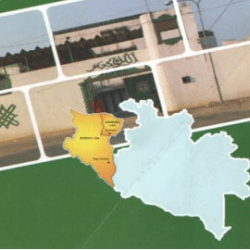
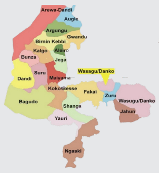
Kebbi State with a total population of 3,238,628 as per 2006 National census comprises of 21 Local Government Areas and 4 Emirates Councils each under a first class Emir. They are Gwandu (with headquarters at Birnin Kebbi), Argungu, Yauri and Zuru. Emir of Gwandu is the Chairman of Kebbi State Council of Chiefs. Of the total population, however, males account for 1,617, 498 or 49.9% while the females are 1,621,130 or 50%.
Like all other State in the country, Kebbi State has diverse ethnic composition with the following as the major tribes and the Local Governments they are mostly domiciled. These are Hausa All over the state but dominant in areas like Birnin Kebbi, Argungu, Jega, koko, Gwandu, Maiyama, Arewa and Augie Local Government Areas; Dakarkari (Lalna) Zuru, Danko-Wasagu and Sakaba Local Government Areas; Kambari Yauri, Ngaski, Danko-Wasagu and Sakaba Local Government Areas; Zabarmawa Dandi, Argungu, Bagudo and Birnin Kebbi Local Government Areas.
In terms of Cultural Festivals and Artifacts, the state is famous in the Argungu international Fishing and the Zuru annual Uhola Cultural Festivals. In addition, Kanta Museum Argungu, the tomb of Sheik Abdullahi Dan Fodio (Hubbare) at Gwandu; the first ruler of Gwandu Emirate and Girmache Shrine at Zuru provide important tourist attraction sites.
ECONOMIC SITUATIONAL ANALYSIS
Prior to independence and during the period immediately after independence, the economy of the North-West; which Kebbi State belongs, was largely dependent on production and trading in primary agricultural crops and commerce. Production of large quantities of agricultural cash crops such as ground nut, cotton, Gum Arabia, tobacco leaves ad cowpeas, along with huge quantities of grains ensures a booming economy within the area. In addition to the agricultural produce, there was a booming trade in hides and skins with Nigeria once being famous for the Moroccan red leather.
With the discovery of oil, and subsequent easy money there from, there was a gradual shift in focus leading to eventual neglect of the entire economy and focus on oil to the detriment of virtually everything else. With money from oil, food importation became the vogue to the detriment of Local agriculture production, thus fuelling the disincentive further depress production Globalization further worsened the situation, resulting in cheaper substitutes from abroad (which enjoy high level of subsidy), coupled with increasing cost of inputs and lack of steady power supply combine to ensure that the Local farmer and local industries cannot compete.
This situation has now manifested in the North-West having the highest poverty incidence in the country. Poverty rose from 37.7% in 1980 to 77.2% by 1996. Even with increased agricultural production between 2003 and 2006 by farmers, this did in no way significantly affect the level of income and thus poverty in the state. The following is a brief sartorial analysis of the economy in the state.
AGRICULTURE
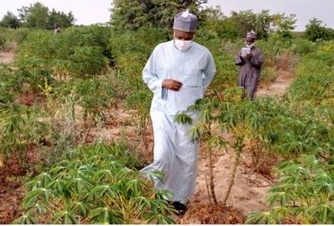
Despite concerted effort by the State Government to boost and modernize agriculture, it has largely remained at the rudimentary level with most of the farming communities producing at subsistence level. The problems of agriculture are aggravated by factors such as low level of technology and lack of access to credit on reasonable terms, increasing low level and duration of rainfall, fragmentation of farmland resulting from inheritance and population growth, which has continuously reduced and individual household farm size, inability to secure farm inputs at the right time and non-availability of improved which combined with low level of soil fertility which in turn in low yield per hectare, at about 40% of the optimum.
The situation is particularly aggravated by the absence of processing industries which are capable of taking up surpluses produced. In addition, while the production of stable foods such as rice, millet, sorghum and others increasing over the years, the production of cash crops decreased. Most families tend to consume what they produce as a result of expanding family size and other economic factors thereby reducing their sources of income.
COMMERCE
After agriculture, commerce is the largest employer of able bodies’ workforce in the state. Commerce is however, mostly dominated by distributive trade in manufactured goods and textiles although there is some level of activity in primary products. With an estimated poverty level of 72% the purchasing power of the citizenry is low. Consequently there is absence of large scale distributors and most of the supermarkets buy finished goods in Sokoto from major distributors for resale in the State.
Reference
https://www.kebbistate.gov.ng/about-kebbi-state
