Kaltungo local government area is in Gombe state, North-East geopolitical zone of Nigeria.
The headquarters of the LGA are in the town of Kaltungo.
Kaltungo LGA is made up of several towns and villages which include Munda, Gassol, Bajoga, Ashaka, Bage, Yayari, Damawako, Abuku, and Lambo Dashi.

The population of the area is estimated at 194,512 inhabitants with the LGA populated by members of different ethnic affiliations such as the Hausa, Tangale, kanuri and Fulani.
Hausa language is commonly spoken in the area while the religions of Islam and Christianity are widely practiced in the LGA. Kaltungo LGA is home to the Kaltungo Emirate with the area having a number of Chiefdoms such as the Tula chiefdom under it.
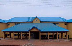
Notable landmarks in Kaltungo LGA include the General Hospital Kaltungo.
| Communities | Awak Gujuba Kaltungo Lakweme Popandi Tula Baule Tula Wange Tula Yiri Tures |
| Headquarters | Kaltungo |
| GPS Coordinates | 9°53′N 11°26′E / 9.883°N 11.433°E |
| Post Code | 770001 |
| Area | 881 km² |
| Population | 149,805 |
| Est. Males | 80377 |
| Est. Females | 69428 |
| Major Tribe | Kanuri, Kaltungo, Popandi, and Lakweme, Tangale, Tula Baule and Tula |
| Other Tribes | Fulani, Kamu, Waja, Hausa |
| Major Crops Produced | Sorghum, Maize and Millet, Beans |
| Major Livestock Produced | Cattle, Pigs, Goats and Chicken |
| Major Attractions | Killang Hills, Kaltungo |
| Other Attractions | Tula Caves, Tula Spring Water, Lakweme Spring Water, Tula Pass Plateau |
| Core Mineral | Granite |
| Comparative advantage products | ⋅ Groundnut ⋅ Gypsum ⋅ Kaolin ⋅ Limestone ⋅ Maize ⋅ Mango ⋅ Millet ⋅ Poultry ⋅ Sorghum ⋅ Tomatoes Gum Arabic Uranium Kwaranda Granite Gold |
Approximate distance of communities to Local and State headquarters
| Community | Distance from LGA Headquarters | Distance from State Headquarters |
| AWAK | 11.55KM | 71.57KM |
| GUJUBA | 13.21KM | 41.47KM |
| KALTUNGO | 0.KM | 63.85KM |
| LAKWEME | 15.20KM | 67.97KM |
| POPANDI | 3.26KM | 56.68KM |
| TULA BAULE | 22.41KM | 77.9KM |
Geography
Kaltungo LGA occupies a total area of 881 square kilometres with the area experiencing two major seasons which are the dry and the rainy seasons. The total precipitation in Kaltungo LGA is estimated at 1000 mm of rainfall per annum. The average wind speed in Kaltungo LGA is 10 km/h.
Economy
A number of animals are reared and sold in Kaltungo LGA and these include camels, cows, and rams. Farming is also an important feature of the economy of Kaltungo LGA with a number of crops such as sorghum, millet, beans, and rice grown in the area. Other important economic activities in Kaltungo LGA include trade, hunting, and crafts making.
LGA Council Wards
- Awak
- Bule / Kaltin
- Kaltungo East
- Kaltungo West
- Kamo
- Tula – Yiri
- Tula Baule
- Tula Wange
- Tungo
- Ture
List of Polling units in Kaltungo Local Government Area
There are 193 polling units in Kaltungo Local Government Area, namely:
- Aya, K. Mai Ang.
- Baba Galadima, K. Galadima
- Balamusa / Kway, K/j Balamusa
- Bambam, K. Bako
- Bandara, Bandara Pri. Sch.
- Bankgwe, Kofar Jauro Abubakar
- Bayam Down, K/ J Audi
- Bayam Up I, K/ J Ishiyaku
- Bayam Up Ii, K. J. Ishiyaku
- Bayunse / Bindidbin, K/j Yaya
- Bedbere, Kofar Waziri
- Bekuntin, K/j Bekunti
- Bekwalume, Bekwalume
- Beltibo, Kofar Sarki
- Biladira, Baule Pri. Sch.
- Bilakware I, Kasuwa Fwiti
- Bilakware Ii, Kasuwa Fwiti
- Bilatuku, Filantimeh
- Bilki Taman, K. Jauro
- Birwai, K. J. Shaibu
- Bule, Bule Pri. Sch.
- Bussa / Bayale, Basuwale
- Butami, K/j Butam
- Bwaitai, Baule Pri. Sch.
- Bwane, K. M/ Kma
- Dabewa, J/ K Bakari
- Dadiye, K. M. Kwen
- Daura, K. J. Daura
- Dogon Ruwa, K. M. Hussaini
- Dogon Ruwa, K/ J /dan Zaria
- Dogon Ruwa, Kofar S. Rafi
- Dogon Ruwa, Kofar Jauro Mani
- Dundaye, K. Namadi
- Dwale, Tul – Dwang
- Falang, K. J. Falang
- Fantami, Kofar Jauro Fantami
- Galadima Yiri, K. Sarki
- Galadima Yiri, G. Yiri Pri. Sch.
- Garin Bako Kofar Jauro Damance
- Garin Bako, Kofar J. Bako
- Garin Barau, Kofar Jauro Barau
- Garin Korau, Kofar J. Korau
- Garin Waziri/ Kalari, Jauro Hamidu
- Gujuba “a”, K.sarki
- Gujuba “b”, K. J. Bose
- Gujuba “c”, Dinge
- J / Madaki / J/ Nadaba, K. G. Gibir
- J. Abdu / J. Dinya / Jauro Umaru, Kofar Jauro Umar
- Jalingo, Jalingo Pri. Sch.
- Jalingo, Kofar Sarki
- Jauro Gotel, K. J. Umaru
- Jauro Saini, K/ J Saini
- Jauro Abdu, K/ J/ Abdu
- Jauro Ali / J. Hashimi, Kofar Jauro Ali
- Jauro Baba, K/j Baba
- Jauro Gale, K/ J Gale
- Jauro Yerima, Kofar Yerima
- Jongri /j/audi, Kofar Jauro
- Kalakorok, K. M. Unguwa
- Kalambu, Poma Daura
- Kalargo, Kanwuri
- Kalaring “a” I, Kalaring Pri. Sch
- Kalaring “b” Ii, Kalaring Pri. Sch.
- Kalaring “c”, Kofar M. Jibir
- Kalaring “d”, Kofar Waziri
- Kale Kwa, Kambidlabeliswa
- Kaleh “a” I, Kaleh Pri. Sch.
- Kaleh “b” Ii, Kaleh Pri. Sch.
- Kaltin “b”, Kaltin Pri. Sch.
- Kaltin, Kaltin Pri. Sch.
- Kaluwa, K. M. Kaluwa
- Kaluwa, K. Makera
- Kampandi “a”, Dispensary
- Kampandi “b”, Tul Lati
- Kan Gari , Kofar J. Musa
- Kan Gari Ii, Kofar J. Musa
- Kasarwaje, K. M. Alpinti
- Kashing`, Tul – Dong
- Kije, R. C. M. School
- Kogde, K. M. Kogde
- Kolwa, Poma B. Yakubu
- Konnu, Jalingo Pri. Sch.
- Korong, K. Bashari
- Kula Shine / Bwabwi Yang, Tula Pri. Sch.
- Kundulu, Latarin Pri. Sch. / Datibo
- Kundulum / Potwana, Yelwa Pri. Sch.
- Kunge, K. Galadima
- Kunini, Kofar Jauro Kunini
- Kutube I, K. J. Kutube
- Kutube Ii, K. J. Kutube
- Kutushe, Jalingo Pri. Sch.
- Kwabi Lake / Fun / J. Abdu, K/j Samaila
- Kwalashine, K. Galadima
- Kwalashine, Kwalashine Pri. Sch.
- Kwalashine, Kofar Fada
- Kwalashine, Ung. Fulani
- Kwallam, Baule Pri. Sch.
- Kwarsu “a”, G. Yiri Pri. Sch.
- Kwarsu, K. M. Kalaku
- Kwarsu, K. Yerima
- Kwen, K. M. Kwen
- Ladibin “a”, General Hospital
- Ladibin “b”, L. G. Secretariat
- Lafia / Taule, Lafia Pri. Sch.
- Laikuli, Tul – Mangoro
- Laitatshine Kofar Jauro Yabawo
- Lakoling “a”, Kalorgu Pri. Sch.
- Lakoling “b”, Kakunji
- Lakoling “c” I, K. Baba Dauda
- Lakoling “d” Ii, K. Baba Dauda
- Lakweme, Lakweme Pri. Sch.
- Lambara, Tul – Kwalak
- Lawonglong, Tul – Dong
- Layiro / Gujuba, K. Mai Anguwa
- Layiro / Posheren, Dispensary
- Layiro P. / Moiding, K. Galadima
- Layiro, Layiro Pri. Sch.
- Limbe “a”, Pri. Sch.
- Limbe “b”, Tul Dong
- Lojuro, Filantimeh
- Luggayidi, K. J. Luggayidi
- Lungeri / Yelwa, Lungeri Pri. Sch.
- Mahuta, K. Sarkin Pawa
- Mararraba, Mararraba
- Moiding, K. Mai Anguwa
- Nahuta, Nahuta Pri. Sch.
- Nasarawa “a”, Kaltungo Area Court
- Nasarawa “b”, Viewing Centre
- Nasarawa “c”, Kaltungo Pri. Sch.
- Nasarawa “d”, Kaltungo Area Court
- Nasarawa “d”, L. E. A. Dispensary
- Nyiti Nyibir, Mosso Pri. Sch.
- Okbaganje, Poma Baba Inuwa
- Okdembe, Tul Kunji
- Okra “a”, K. Baba Yakubu
- Okra “b”, K. Mai Ang.
- Pidimmotong, Tul – Kunji
- Pidmoki “a ” I, T. / Waja Area Court
- Pidmoki “b ” Ii, T. / Waja Area Court
- Pidmoki “c ” Ii, Tul Dwang
- Podi, K. M. Podi
- Pokajang, Poma Abnow
- Pokwanli “a”, Poma Baba Bula
- Pokwanli “b”, Tul Lati
- Pokwara, Tulkambido
- Pondingding, Tul – Kambodo
- Pongwaram, Tul -kambido
- Popandi “a”, Popandi Pri. Sch.
- Popandi “b”, K. Mai Anguwa
- Popandi “c” K. Mai Anguwa
- Poshereng “a”, K. M. Galadima
- Poshereng “b”, K. Kwara
- Potwana, K.m Ari
- Purmai, Purmai Pri. Sch.
- Sabon Gari, S. G. Pri. Sch.
- Sabon Layi, K. M. Kwen
- Sakauri, K. Jauro
- Saliyawa, K.j. Saliyawa
- Shenge / Shenge, K. J. Mai Tumbi
- Silawanghe, Kofar Jauro
- Soblong, Primary School
- Store, K. M. Unguwa
- Surkwam, K/ J Surkwam
- Tanduru, Poma B. Yakubu
- Tanga, Annex Primary School
- Taule / Dalan, Lafia Pri. Sch.
- Tayo Primary School
- Tiye / Bussam, Baswale
- Ture Okwaldi, Dwang
- Ture Okwaldi, K. Mai Unguwa
- Ture Balam “a” I, Balam Pri. Sch.
- Ture Balam “b” Ii, Balam Pri. Sch.
- Ture Kwe “a”, K. M. Ung. Kwe
- Ture Mai, Ture Mai Pri. Sch.
- Ture Okra, K. M. Ung
- Ture Pandi “a” I , Pandi Pri. Sch.
- Ture Pandi “b” Ii, Pandi Pri. Sch.
- Ubandoma, Primary School
- Ung. Halilu / Mission, K. Halilu
- Ung. Ma Aikata, Ung. Ma Aikata
- Ung. Sarki Ii, Yiri Pri. Sch.
- Ung. Sarki I, Yiri Pri. Sch.
- Wuli “a”, Kal Gomo
- Wuli “b”, Tul Twal
- Yabde / B. Baka, Kofar J. Yelman
- Yakubu/kwale Kofar J Ladir
- Yakwale, Baule Pri. Sch.
- Yelmine, K. Jauro
- Yelwa Birwai, J/ K Turmi
- Yelwa, Kofar Sarki
- Yeri Bwara, Primary School
- Yoriyo, Yoriyo / Lobwi
- Zange, K/ J Yahya
Gombe
Gombe is one of the 36 states of Nigeria. It is located in the north eastern part of the country.
The state was created out of Bauchi state on 1st October 1996 by Sani Abacha’s administration.
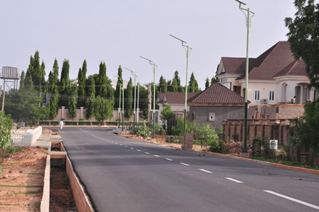

Its creation was a fulfilment of the aspiration of the people who for long, had passionately craved for a state of their own out of the then Bauchi state.
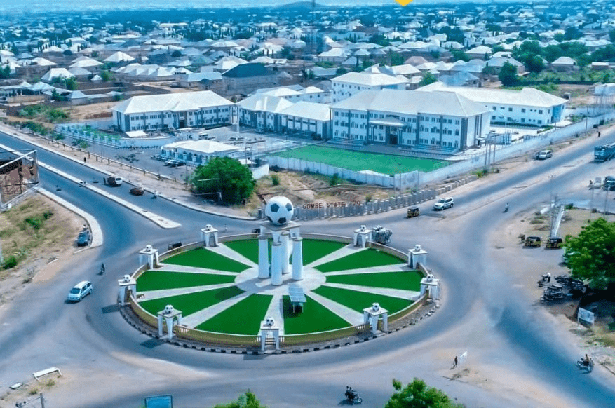

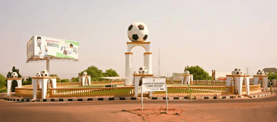
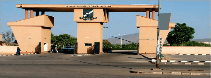
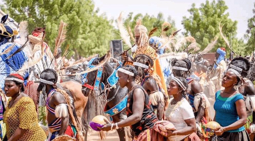
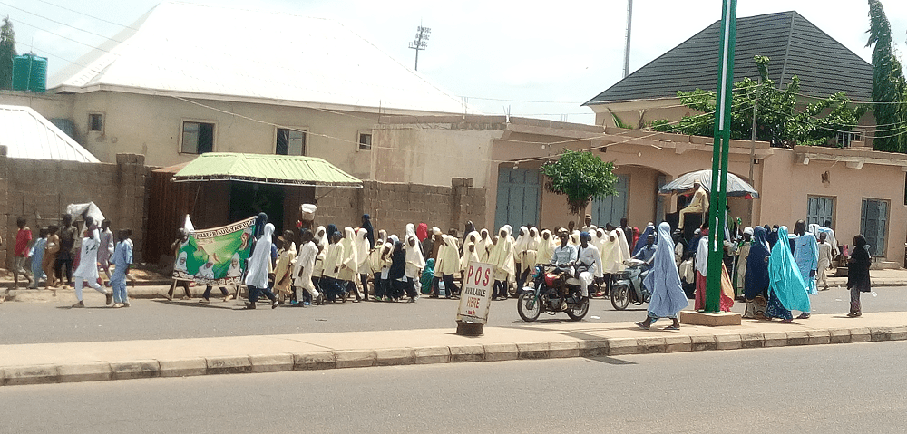
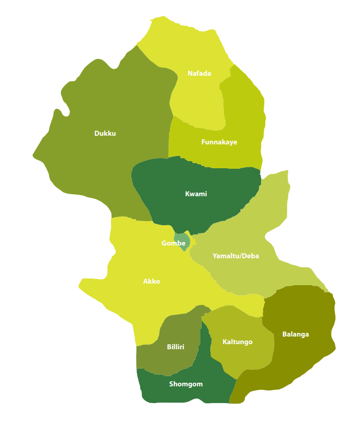
Gombe State has eleven Local Government Areas (LGA) namely, Akko, Balanga, Billiri, Dukku, Funakaye, Gombe, Kaltungo, Kwami, Nafada, Shongom, and Yamaltu Deba.
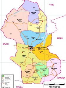
The following are administrative maps of Gombe State showing the local government areas
Historically, Gombe state is a fusion of two distinct groups of people, comprising the people of Gombe North and the ethnic grouping of Gombe South.
Gombe is located on latitude 9”30’ and 12”30’N, Longitude 8”5’and 11”45’E.
It has borders with Borno, Yobe, Adamawa, Taraba, and Bauchi states.
The State climate is generally warm, with temperatures not exceeding 300c during the months of March-May considered to be the hottest months. The following table gives other profile of the jewel state.
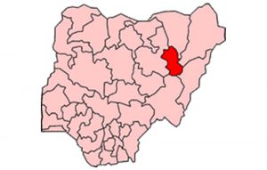
The following Map indicates in red the position of Gombe in relation to the thirty six (36) states of the federation.
The Emirate government, which had its Head quarters in Gombe Abba, was formed to effectively control what constitutes a larger part of the Gombe State, until the advent of the British in the early 20th century.
Under the British, the state was administered through the mechanism of two administrative units, i.e. Gombe Native Authority and Tangale Waja Native Authorities. The two Authorities constituted Gombe Division during the Colonial era. However, with independence in 1960 and the subsequent military administration, many changes occurred which led to the emergence of local government authorities. Thus, between 1976 and the present, the then two authorities had metamorphosed into the present 11 local governments.
Capital: Gombe
Land area: The State occupies a total land area of about 20,265sqkm.
Climate: Warm, exceeding 40″c during the hottest month (March – May)
Topography: Mainly mountainous, undulating and Hilly to the South-East and flat open plains in the Central, North, North-East, West and North-West.
Location: Latitude 9”30’ and 12”30’N, Longitude 8”5’and 11”45’E. The state lies in the centre of North east Geopolitical Zone of Nigeria. It shares common boundaries with Adamawa and Taraba State to the South, Bauchi State to the West, Borno State to the East and Yobe State to the North.

Power: The State is served by the PHCN National grid through the North-East PHCN substation located in Gombe State capital
Roads: Five(5) Federal trunk “A” roads connect the State Capital with all parts of the Country. Twonship roads have been constructed in the State capital and all the major towns.
Airport: The State has an International Airport which is also surrounded by four (4) International Airport, located in Kano, Jos, Yola and Maiduguri.
Major towns :Gombe the capital, Bajoga, Billiri, Kaltungo, Kumo, Dukku and Deba.
Ethnic CompositionMulti-ethnic, mainly made up of Fulani, Tangale, Waja, Bolawa, Tera,Jukun, Jara, Pero, Tula, Cham, Lunguda, Dadiya, Kamo, Awak, Kanuri, Hausa, Yoruba and Igbo.
Language spoken: English is the official language, but as much as Hausa remain the commercial language amongst the people of the state, Fulfulde, Tangale, Tera, Waja, and Kanuri are commonly spoken.
Vegetation: Gombe is generally a Guinea Savannah grassland with concentration of wood lands in the South East and South West.
Rainfall: Annual Average of 850mm.
