Full list of population size of Nigeria states. From largest to smallest
Based on 2006 Census figures
State
Population
Kano
9,383,682
Lagos
9,013,534
Kaduna
6,066,562
Katsina
5,792,578
Oyo
5,591,589
Rivers
5,185,400
Bauchi
4,676,465
Jigawa
4,348,649
Benue
4,219,244
Anambra
4,182,032
Borno
4,151,193
Delta
4,098,391
Niger
3,950,249
Imo
3,934,899
Akwa Ibom
3,920,208
Ogun
3,728,098
Sokoto
3,696,999
Ondo
3,441,024
Osun
3,423,535
Kogi
3,278,487
Zamfara
3,259,846
Enugu
3,257,298
Kebbi
3,238,628
Edo
3,218,332
Plateau
3,178,712
Adamawa
3,168,101
Cross River
2,888,966
Abia
2,833,999
Ekiti
2,384,212
Kwara
2,371,089
Gombe
2,353,879
Yobe
2,321,591
Taraba
2,300,736
Ebonyi
2,173,501
Nasarawa
1,863,275
Bayelsa
1,703,358
Federal Capital Territory
1,405,201
Total
140,003,542
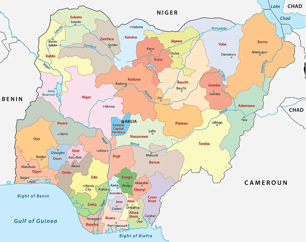
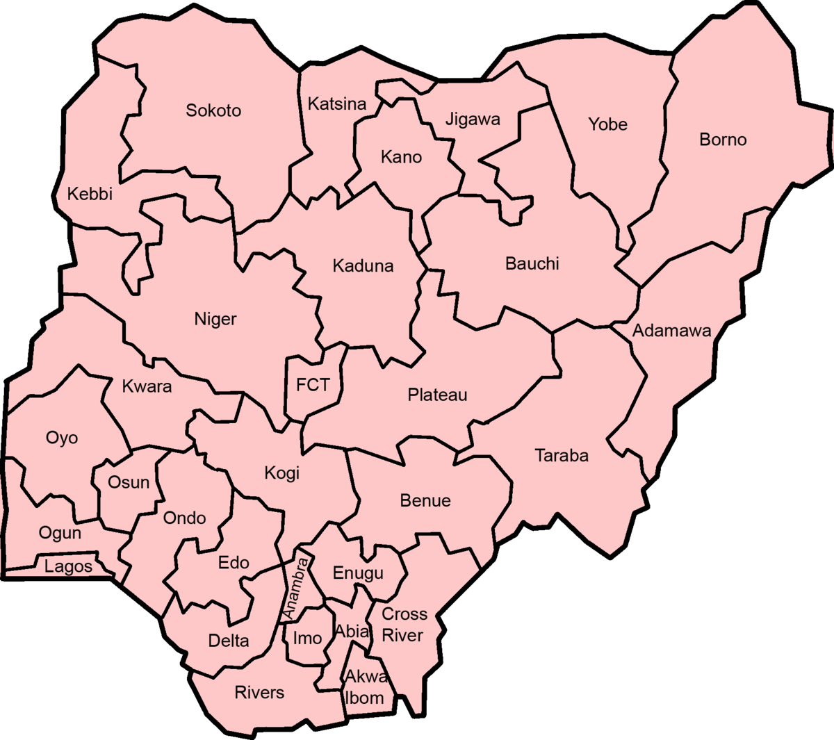
Maps of Nigeria’s 36 states & Abuja
States creation, reformation
By the time that Nigeria got independence it was a federation of the three regions, namely:
Western Eastern Northern
Later on another region was added, the Mid-Western Region.
The Mid-Western Region was formed from the Western Region in 1966, and Lagos, the capital, was effectively governed as an unofficial fourth region outside the bounds of the Western Region.
This brought the number of regions to 4 as follows:
Western Mid-Western Western Northern
Under the short-lived military government of Aguiyi-Ironsi, Nigeria was reorganized under a central government. Following a coup which resulted in Aguiyi-Ironsi’s deposition and assassination, Nigeria was reorganized as a federal country again with three of the regions being divided into newer entities and all first-level subdivisions being renamed as states.
Western Region was divided into: Lagos and Western states.
Eastern Region was divided into: East-Central, Rivers, and South-Eastern states;
Northern Region was divided into: Benue-Plateau, Kano, Kwara, North-Central, North-Eastern, and North-Western (Sokoto) states
1976 reformation of Nigeria’s federating units
In 1976, six years after the end of the civil war, the states were further reorganized:
State boundaries and names were also reorganized.
Benue-Plateau state divided into: Benue and Plateau states.
East-Central state divided into: Anambra and Imo states. Federal Capital Territory (Abuja) formed from parts of Niger and Plateau states.
North-Eastern state divided into: Bauchi, Borno, and Gongola states. Niger (Minna) state split from Sokoto.
Western state divided into: Ogun, Ondo, and Oyo states
States of Nigeria from 1987-1991
Akwa Ibom state created from Cross River; Katsina state created from Kaduna
States of Nigeria from 1991-1996
Abia State created from Imo; Bendel State divided into Delta and Edo; Enugu State created from Anambra; Gongola State divided into Adamawa and Taraba; Jigawa State created from Kano; Kebbi State created from Sokoto; Kogi State formed from parts of Benue and Kwara; Osun State created from Oyo; Yobe State created from Borno.
States of Nigeria from 1996
Bayelsa State created from Rivers; Ebonyi State was formed from parts of Abia and Enugu; Ekiti State created from Ondo; Gombe State created from Bauchi; Nasarawa State created from Plateau; Zamfara State was created from Sokoto.
Population size of Ghana districts. From smallest to largest Ghana’s 10 least populated districts are: KadjebiSouth TonguAhafo Ano NorthBuilsaAsuogyamanZabzugu TataleBongoBawku WestEjura SekyedumaseSene DistrictPopulationKadjebi52,001South Tongu64,852Ahafo Ano North71,856Builsa75,376Asuogyaman75,948Zabzugu Tatale77,496Bongo77,894Bawku West80,575Ejura Sekyedumase81,119Sene81,468Nadowli81,874Asutifi83,638Berekum83,661Lawra85,442Fanteakwa85,772Yilo…
Smallest states in Nigeria by population The 10 least populated states of Nigeria are: Federal Capital Territory (FCT), AbujaBayelsaNasarawaEbonyiTarabaYobeGombeKwaraEkitiAbia Full list of population size of Nigeria…
10 smallest states of Nigeria by land area The 10 smallest states of Nigeria by land area are: LagosAnambraAbiaImoEkitiEbonyiAkwa IbomEnuguFederal Capital TerritoryOsun Full list of Nigeria states by…
Smallest Angola province by land size The smallest province in Angola by land area is Luanda with 2,417 km2. 10 smallest provinces in Angola by land…
Population of areas in Western Tigray Zone. From largest to smallest From most to least populated areas in Western Tigray Zone: Kafta Humera-Wereda Tsegede-Wereda Welkayit-Wereda Humera /Town/-Wereda WeredaPopulationKafta Humera-Wereda138,053170,155Tsegede-Wereda128,448Welkayit-Wereda84,041Humera /Town/-Wereda48,323Western Tigray-Zone484,979…