| NAME | LOCATION |
|---|---|
| Kainji Lake National Park | New-Bussa/Ibbi |
| Pissa Cave | Pissa |
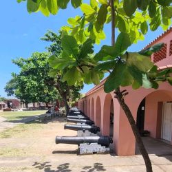
| Kisra Museum | New Bussa |
| Kainji Hydro-Electric Dam Complex | Kainji |
| Awuru Rapid Falls | Awuru |
| National Institute for Freshwater Fisheries Research | New Bussa |
| Federal College of Wild Life Management | New Bussa |
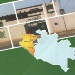
Borgu, a community in Niger State, Nigeria, is one of the oldest kingdoms in Northern Nigeria. Borgu kingdom is said to be over 1000 years old.

MINERAL RESOURSES FOUND IN BORGU
1. Gold
2. Clay
3. Copper
4. Iron
5. Felsper
6. Lead
7. Limestone
8. Cassertrite
9. Columbite
10. Tantalite
CROPS COMMONLY FOUND IN BORGU

| CROPS | APEX PERIOD OF CULTIVATION |
|---|---|
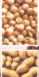
| Rice (low land) | June – December |
| Rice (up land) | May – December |
| Cassava | August – December |
| Sorghum | May – January |
| Groundnut | May – December |
| Millet | April – December |
| Sheanut | June – August |
| Cotton | June – December |
| Beans | June – December |
| Yam | March – December |
HOTEL DIRECTORY: NEW BUSSA TOWN
| NAME OF HOTEL | TEL. NO | TYPE OF ROOM | NO | FACILITIES AVAILABLE |
|---|---|---|---|---|
| Hydro Hotel 26, Wawa Road, Off F.G.G.C | 0803884540 | Single Double Suite | 24 9 5 | Fridge, T.V., A/C. Dish, Conference Hall, Multipurpose |
| White House Guest House 34, Benue Road, New Bussa | 08057214283 | Double | 8 | Fan |
| Kainji Motel Niger Crescent Camp | 08038082144 | Single Double | 19 | T.V., Fridge, Dish |
| Bramotola Hotel Ibadan Way New Bussa | Single | 11 | AC | |
| Park Way Hotel Wawa Road, New Bussa | 08054414673 | Single Double | 5 | A/C., T.V. |
The history of Bussawa is closely related to the story of Borgu. One Kisra, a legendary figure said to be a maternal uncle of the Prophet Kisra was said to be at the head of immigration from Arabia, although some historical accounts suggest that himself never reached the Niger. He was said to have caused tremendous stir by refusing to accept the reforms of the Prophet after which struggle, he was forced to cross to Africa and eventually transverse the continent and settled on the By the time Kisra and his followers reached Borgu the Niger area was said to be practically uninhabited There were however few hunters who lived in small villages and considerable number of Yorubas, Kisra was received by the inhabitants and settlement of himself and his followers was entirely peaceful.
From the death of Kisra at Bussa, until the middle of eighteenth century a gap exist The names of one or two kings are remembered though the dates at where they reigned are now forgotten The first chief from whom the successor can be trace was Named KISERU BRODI whose son Yerima Bussa had encounter with Habe rulers of the North was succeeded by KITORO KUNAIDI Kizagga and-Kignara sons of Yerima Bussa followed. On the death of Kignara no one could be found to accept the SAROTA (leadership) This may be due to the traditional method of succession of the Bussa of which ascension to the throne is by open contest between eligible princes. The one who wins the contest automatically ascends to the vacant stool. The new emir could be either son of late, brother or uncle.
However, Kifoyide, full brother of Kignara was said to have persuaded his younger brother Kitoro to accept the throne. Kitoro ruled for about forty years, from about 1793 to 1835 during which time Mango Park arrived. He was said to have given Kitoro a silver medal, which has been carefully preserved by succeeding kings of Bussa. Kitoro was succeeded by the eldest son of Kizagga, Kisaru Dogo of whose reign little is known. Upon his death, Dogo ascended the throne. From the reign of Pwegunu Bewalaki, to the emergence of kignara 11 or Dan Toro and subsequently Kisaru Dogo, Kitoro 11 or Gani and theothers, internal squabbles among the ruling class, internecine wars of the Fulani Islamic Reformist Movements, as well as coming of the colonialists, greatly affected the remaining history of Bussawa. The British which finally controlled the area known today as Borgu Emirate introduced a lot of administrative changes among which is a selection committee for the Emir of Borgu. In 1902, the selection committee selected its first Emir for Borgu stool.
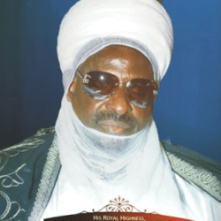
Consequently, Borgu has two ruling houses in Bussa, for the Emirship of Borgu namely Gbemusu and Fu’i ruling houses. Alhaji Haliru Dan Toro who is from Gbemusu ruling house is the 315th Emir of Borgu.
Niger
Niger is a State located in central Nigeria and its capital city is Minna.
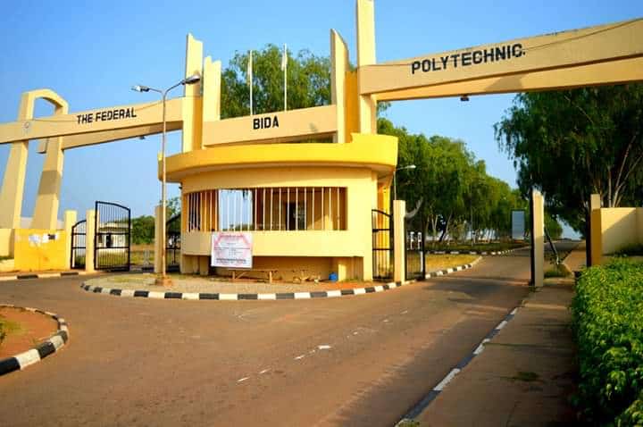
Other top cities in Niger State include Bida, Suleja and Kontagora.
The State has an expansive land area and it’s close to the nation’s capital, Abuja.

Creation: It was created out of the defunct North Western state on 3rd February, 1976.
Location: Situated in the North central geo-political zone.
Administrative areas: The State comprises 25 Local Government Areas grouped into 3 administrative zones: A, B, C with each zone having 8, 9 and 8 Local Government Areas (LGAs) respectively.
List of Local Government Areas
Niger State has 25 Local Government Areas, namely:
- Agaie
- Agwara
- Bida
- Borgu
- Bosso
- Chanchaga
- Edati
- Gbako
- Gurara
- Katcha
- Kontagora
- Lapai
- Lavun
- Magama
- Mariga
- Mashegu
- Mokwa
- Munya
- Paikoro
- Rafi
- Rijau
- Shiroro
- Suleja
- Tafa
- Wushishi
Local Government Areas and their headquarters
The Local Government Areas in Niger State and their headquarters are:
| SN | LGA | HEADQUARTERS |
| 01 | Agaie | Agaie |
| 02 | Agwara | Agwara |
| 03 | Bida | Bida |
| 04 | Borgu | New Bussa |
| 05 | Bosso | Maikunkele |
| 06 | Edati | Enagi |
| 07 | Gurara | Gawu Babangida |
| 08 | Gbako | Lemu |
| 09 | Katcha | Katcha |
| 10 | Kontagora | Kontagora |
| 11 | Lapai | Lapai |
| 12 | Lavun | Kutigi |
| 13 | Mariga | Bangi |
| 14 | Mokwa | Mokwa |
| 15 | Magama | Nasko |
| 16 | Mashegu | Mashegu |
| 17 | Munya | Sarkin Pawa |
| 18 | Paikoro | Paiko |
| 19 | Rafi | Kagara |
| 20 | Rijau | Rijau |
| 21 | Shiroro | Kuta |
| 22 | Suleja | Suleja |
| 23 | Tafa | Sabon-Wuse |
| 24 | Wushishi | Wushishi |
| 25 | Minna | Minna |
Boundaries: Niger State shares its borders with republic of Benin (West), Zamfara State (North), Kebbi (North-West), Kogi (South), Kwara (South West), Kaduna (North-East) and the FCT (South-East).
Land area, the largest among Nigerian states: Niger State is one of the largest states in Nigeria covering about 86,000km2 (or about 8.6million hectares) representing about 9.3% of the total land area of the country.
Major rivers: Niger State’s major rivers are: Niger, Kaduna, Gbako, Eko, Gurara, Ebba, Ega, Mariga and their tributaries.

Fishes: The common fishes found in these rivers are: Nile Perch (Lates) Trunck fish, Cat fish, Osteoglosid, Tilapia, Synodontis, Tiger fish, Moon fish, Mormyrid and Electric fish. By the 2006 census, the State’s population is 3,950,249 comprising 2,032,725 males and 1,917,524 females.

Ethnic groups: The easily identifiable major ethnic groups are Nupes, Hausa, Gbagyi, Kadara, Koro, Bassa, Kamuku, Ingwai, Fangu, Kambari, Dukkawa, Fulani, Abewa, Bisan, Gungawa, Bauchi, Bariba, Urah, Boko, Bokobaro, Bauchnu, Achifawa, Dakarkari, Kakanda, Ganagana, and Dibo and numerous non native tribes.
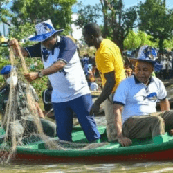
Economic activities: The major economic activity is agriculture: farming, fishing, and cattle rearing.
The other economic activities (though limited in scale) include banking, trading, transportation, local arts and crafts with Bida, the heart land of the Nupes, famous for its brass work. These activities constitute the means of livelihood of the people of Niger State in addition to public service.
Reference: nigerstate.gov.ng/about-niger
