Where the Americas’ Rivers Meet the Sea: Coast-by-Coast
Every river in the Americas ends in one of four places: the Arctic, the Atlantic, the Pacific, or a basin with no outlet to the sea. This guide sorts the hemisphere’s coastal rivers by where their mouths sit, country by country, and corrects the errors that crept into the widely shared source list it is built on.
The four coasts are drawn like this:
Arctic Ocean: from Cape Prince of Wales in Alaska east to Cape Chidley in Labrador, including Hudson Bay.
Atlantic Ocean: from Cape Chidley south to Cape Virgins in Patagonia, including the Caribbean Sea and the Gulf of Mexico.
Pacific Ocean: from Cape Prince of Wales south to Cape Virgins.
Endorheic basins: drainage areas whose water never reaches an ocean.
Only rivers that reach the sea are listed, not their tributaries. Coordinates mark each river’s mouth and are given as degrees, minutes and seconds (N/S, E/W). The Atlantic’s coastline, counting its marginal seas, measures about 111,866 km against about 135,663 km for the Pacific.
Arctic Ocean coast
Only three territories in the Americas have rivers that reach the Arctic: Canada, the United States (Alaska) and Greenland. The Mackenzie is the giant of the group, emptying into the Beaufort Sea, while Hudson Bay collects the Nelson, Churchill and a string of Manitoba and Nunavut rivers. Along Alaska’s North Slope, short braided rivers drain straight into the Beaufort and Chukchi seas.
River
Region (mouth)
Water body reached
Mouth
Mackenzie
Northwest Territories, Canada
Beaufort Sea
68°56′23″N 136°10′22″W
Horton
Northwest Territories, Canada
Beaufort Sea
69°56′01″N 126°48′10″W
Thomsen
Northwest Territories, Canada
Castel Bay, Viscount Melville Sound
73°59′41″N 119°43′27″W
Back
Nunavut, Canada
Arctic coast
67°16′00″N 95°15′00″W
Nanook
Nunavut, Canada
Hadley Bay, Viscount Melville Sound
71°36′00″N 107°46′59″W
Wolf
Nunavut, Canada
Expedition Fjord, Strand Bay, Sverdrup Channel
79°23′00″N 91°07′00″W
Chesterfield Inlet
Nunavut, Canada
Hudson Bay
63°32′24″N 91°04′48″W
Dawson Inlet
Nunavut, Canada
Hudson Bay
61°50′00″N 93°25′00″W
Maguse
Nunavut, Canada
Hudson Bay
61°17′N 94°05′W
Tha-anne
Nunavut, Canada
Hudson Bay
60°31′00″N 94°38′00″W
Thlewiaza
Nunavut, Canada
Hudson Bay
60°28′59″N 94°40′00″W
Caribou
Manitoba, Canada
Hudson Bay
59°19′30″N 94°44′07″W
Seal
Manitoba, Canada
Hudson Bay
59°04′19″N 94°47′56″W
North Knife
Manitoba, Canada
Hudson Bay
58°57′01″N 94°36′47″W
South Knife
Manitoba, Canada
Hudson Bay
58°53′55″N 94°35′56″W
Churchill
Manitoba, Canada
Hudson Bay
58°47′45″N 94°12′15″W
Nelson
Manitoba, Canada
Hudson Bay
57°05′05″N 92°30′08″W
Severn
Ontario, Canada
Hudson Bay
55°59′N 87°38′W
Albany
Ontario, Canada
James Bay
52°17′00″N 81°30′59″W
Firth
Yukon, Canada
Beaufort Sea
69°33′00″N 139°30′00″W
Kongakut
Alaska, US
Beaufort Sea
69°46′35″N 141°42′16″W
Aichilik
Alaska, US
Beaufort Sea
69°50′24″N 141°07′34″W
Jago
Alaska, US
Beaufort Sea
70°06′34″N 143°18′23″W
Okpilak
Alaska, US
Beaufort Sea
70°04′40″N 144°03′09″W
Hulahula
Alaska, US
Beaufort Sea
70°03′54″N 144°04′57″W
Sadlerochit
Alaska, US
Camden Bay, Beaufort Sea
70°01′22″N 144°26′08″W
Canning
Alaska, US
Camden Bay, Beaufort Sea
70°04′42″N 145°33′56″W
Shaviovik
Alaska, US
Beaufort Sea
70°12′16″N 147°16′50″W
Kadleroshilik
Alaska, US
Foggy Island Bay, Beaufort Sea
70°12′26″N 147°36′27″W
Kuparuk
Alaska, US
Beaufort Sea
70°25′28″N 148°52′15″W
Colville
Alaska, US
Beaufort Sea
70°26′46″N 150°21′28″W
Ikpikpuk
Alaska, US
Smith Bay, Beaufort Sea
70°49′25″N 154°18′09″W
Topagoruk
Alaska, US
Admiralty Bay, Beaufort Sea
70°45′24″N 155°55′35″W
Meade
Alaska, US
Beaufort Sea
70°54′12″N 155°57′27″W
Kuk
Alaska, US
Chukchi Sea
70°36′29″N 160°06′40″W
Utukok
Alaska, US
Chukchi Sea
70°02′49″N 162°27′26″W
Kokolik
Alaska, US
Chukchi Sea
69°46′15″N 162°59′48″W
Kukpowruk
Alaska, US
Chukchi Sea
69°36′57″N 163°01′06″W
Pitmegea
Alaska, US
Chukchi Sea
68°54′53″N 164°37′32″W
Kukpuk
Alaska, US
Chukchi Sea
68°24′57″N 166°22′37″W
Kivalina
Alaska, US
Kivalina Lagoon, Chukchi Sea
67°49′03″N 164°40′46″W
Børglum Elv
Greenland
Arctic coast
82°11′00″N 30°20′00″W
Minturn Elv
Greenland
Baffin Bay
78°48′07″N 69°17′47″W
Two changes from the source list: the Firth River’s mouth is in Yukon, not Alaska, and the Back River’s mouth is in Nunavut, not the Northwest Territories. Fish Creek (Alaska) is omitted because the source gave no mouth or route for it.
Atlantic coast: South America and the Caribbean
The Atlantic’s coast is cut by bays, gulfs and seas, and many rivers reach it indirectly. Cuban, Haitian and most Central American rivers empty into the Caribbean Sea, which opens onto the Atlantic; the Mississippi and Rio Grande reach it through the Gulf of Mexico. This section covers the southern half, from Tierra del Fuego north to the Caribbean. Rivers are listed north to south or in coastal order.
Argentina and Uruguay
The Río de la Plata is an estuary shared by Argentina and Uruguay; the Paraná and Uruguay rivers feed it. The Rio Grande, in Tierra del Fuego, appeared twice in the source with slightly different coordinates and is now listed once.
River
Mouth
Río de la Plata (Argentina and Uruguay)
35°40′S 55°47′W
Uruguay (Uruguay and Argentina)
34°12′S 58°18′W
Paraná
34°00′05″S 58°23′37″W
Quequén Grande
38°30′33″S 58°44′03″W
Sauce Grande
38°59′34″S 61°05′47″W
Napostá
38°47′31″S 62°14′18″W
Sauce Chico
38°47′00″S 62°18′00″W
Colorado
39°42′54″S 62°07′52″W
Negro
41°01′50″S 62°47′23″W
Chubut
43°20′32″S 65°03′18″W
Deseado
47°45′39″S 65°53′56″W
Santa Cruz
50°08′S 68°21′W
Coig
50°57′00″S 69°10′00″W
Gallegos
51°35′40″S 68°58′30″W
Grande (Tierra del Fuego)
53°47′21″S 67°40′56″W
Fuego
54°00′18″S 67°37′13″W
The Chuí Stream, on the Uruguay–Brazil border, reaches the Atlantic at 33°44′37″S 53°22′09″W.
Brazil
Brazil’s Atlantic rivers are listed by state, north to south. The São Francisco, which the source listed under both Bahia and Sergipe, appears once, at the Alagoas–Sergipe border. The Vaza-Barris is moved to Sergipe, where its mouth near Aracaju lies. The source list is not exhaustive: major rivers such as the Paraíba do Sul and the Doce are not in it.
River
State (mouth)
Mouth
Calçoene
Amapá
2°30′25″N 50°49′15″W
Flechal
Amapá
2°08′N 50°42′W
Macari
Amapá
1°52′N 50°31′W
Araguari
Amapá
1°15′00″N 49°55′00″W
Amazon
Amapá
0°42′28″N 50°05′22″W
Gurupí
Pará / Maranhão
1°07′01″S 46°03′18″W
Parnaíba
Maranhão / Piauí
2°45′01″S 41°49′15″W
Guaju
Paraíba / Rio Grande do Norte
6°29′16″S 34°58′06″W
Goiana
Pernambuco
7°33′11″S 34°49′58″W
Jaboatão
Pernambuco
8°13′31″S 34°55′35″W
Ipojuca
Pernambuco
8°24′39″S 34°58′04″W
Sirinhaém
Pernambuco
8°36′40″S 35°02′45″W
Una
Pernambuco
8°51′40″S 35°07′48″W
Mundaú
Pernambuco
8°54′S 35°09′W
Salgado
Alagoas
9°04′S 35°14′W
Manguaba
Alagoas
9°09′S 35°18′W
Tatuamunha
Alagoas
9°14′S 35°21′W
Meirim
Alagoas
9°32′51″S 35°37′07″W
Prataji
Alagoas
9°34′S 35°39′W
São Miguel
Alagoas
9°51′S 35°54′W
Jequiá
Alagoas
10°02′57″S 36°01′51″W
Coruripe
Alagoas
10°09′30″S 36°09′03″W
São Francisco
Alagoas / Sergipe
10°29′59″S 36°23′44″W
Japaratuba
Sergipe
10°44′30″S 36°51′02″W
Sergipe
Sergipe
10°57′40″S 37°02′00″W
Vaza-Barris
Sergipe
11°10′17″S 37°09′49″W
Real
Sergipe / Bahia
11°27′S 37°21′W
Itapicuru
Bahia
11°47′S 37°32′W
Pojuca
Bahia
12°35′50″S 38°01′49″W
Jequiriçá
Bahia
13°13′S 38°56′W
Tijuípe
Bahia
14°25′S 39°01′W
Almada
Bahia
14°46′31″S 39°03′06″W
Una
Bahia
15°13′47″S 39°00′00″W
Pardo
Bahia
15°39′S 38°57′W
Jequitinhonha
Bahia
15°51′00″S 38°51′27″W
João de Tiba
Bahia
16°15′04″S 39°00′39″W
Buranhém
Bahia
16°27′24″S 39°03′54″W
Frades
Bahia
16°41′22″S 39°06′17″W
Caraíva
Bahia
16°47′59″S 39°08′39″W
Jucuruçu
Bahia
17°23′S 39°12′W
Itanhém
Bahia
17°32′S 39°12′W
Caravelas
Bahia
17°44′38″S 39°11′12″W
Peruípe
Bahia
17°54′S 39°21′W
Mucuri
Bahia
18°05′37″S 39°32′49″W
The Guianas
The three Guianas are drained by short, wide rivers running north to the Atlantic. The Courantyne marks the Guyana–Suriname border and the Maroni the Suriname–French Guiana border; the Oyapock separates French Guiana from Brazil.
Guyana
Waini: 8°23′25″N 59°50′14″W
Moruka: 7°40′08″N 58°46′55″W
Pomeroon: 7°37′N 58°45′W
Essequibo: 7°02′N 58°27′W
Demerara: 6°48′44″N 58°10′12″W
Mahaica: 6°43′N 57°55′W
Mahaicony: 6°34′N 57°48′W
Abary: 6°33′N 57°44′W
Berbice: 6°17′N 57°32′W
Suriname
Courantyne (with Guyana): 5°57′18″N 57°04′46″W
Nickerie: 5°57′28″N 56°59′21″W
Coppename: 5°48′00″N 55°55′00″W
Saramacca: 5°51′00″N 55°53′00″W
Suriname: 5°55′37″N 55°09′37″W
Maroni (with French Guiana): 5°44′45″N 53°58′06″W
French Guiana
Mana: 5°43′44″N 53°50′17″W
Counamama: 5°32′42″N 53°17′25″W
Sinnamary: 5°26′14″N 52°59′47″W
Kourou: 5°09′10″N 52°37′45″W
Rivière de Cayenne: 4°55′23″N 52°20′56″W
Mahury: 4°52′09″N 52°14′08″W
Approuague: 4°41′01″N 51°57′41″W
Oyapock (with Brazil): 4°14′08″N 51°36′53″W
Venezuela and Colombia
The Orinoco, shared by Venezuela and Colombia, builds a large delta that opens onto the Gulf of Paria and the Atlantic at 8°37′N 62°15′W. The Tocuyo (11°03′29″N 68°20′16″W) and Unare (10°05′20″N 65°11′12″W) drain to the Caribbean coast. Colombia’s Magdalena reaches the Caribbean at 11°07′N 74°51′W.
Caribbean islands
Cuba: all coastal rivers reach the Caribbean; the major one is the Cauto, 20°32′57″N 77°14′30″W.
Haiti: the Artibonite reaches the Caribbean at 19°15′N 72°47′W.
Dominican Republic: the Dajabón (19°42′07″N 71°45′31″W) and Yaque del Norte (19°50′24″N 71°41′13″W) flow to the Atlantic.
Barbados, Atlantic side: Bruce Vale (St Andrew, 13°14′59″N 59°33′29″W), Joes (St Joseph, 13°13′00″N 59°32′00″W) and Long Pond (St Andrew, 13°15′06″N 59°33′20″W).
Barbados, Caribbean side: Constitution (St Michael, 13°05′44″N 59°37′03″W) and Indian (St Michael, 13°06′38″N 59°37′35″W).
Bahamas: many tidal creeks, and one river, the Goose River (24°21′N 78°06′W).
Central America (Caribbean slope)
All of Belize’s coastal rivers drain to the Caribbean. Costa Rican and Honduran basins drain to either the Caribbean or the Pacific; the source list names no individual Caribbean rivers for Belize, Costa Rica or Honduras.
Nicaragua
Coco (with Honduras): 15°00′N 83°08′W
Ulang: 14°27′00″N 83°14′00″W
Wawa: 14°13′38″N 83°34′43″W
Kukalaya: 13°39′08″N 83°37′11″W
Layasiksa: 13°38′56″N 83°36′54″W
Prinzapolka: 13°24′21″N 83°34′02″W
Río Grande de Matagalpa: 12°54′N 83°32′W
Kurinwás: 12°47′33″N 83°39′18″W
Wawasang: 12°33′15″N 83°44′47″W
Kukra: 11°54′00″N 83°49′00″W
Escondido: 12°05′12″N 83°44′57″W
Punta Gorda: 11°30′32″N 83°46′26″W
Maíz: 11°17′34″N 83°52′28″W
Indio: 10°56′31″N 83°43′11″W
San Juan: 10°56′23″N 83°41′54″W
Panama
Sixaola (with Costa Rica): 9°34′20″N 82°33′54″W
Calovebora: 8°47′17″N 81°12′45″W
Chagres (Panama Canal): 9°19′N 80°00′W
Atlantic coast: North America and the Gulf of Mexico
North America’s Atlantic rivers run from Newfoundland to south Florida, then around into the Gulf of Mexico. The U.S. seaboard is the densest stretch: dozens of short tidal rivers thread the marshes of Georgia and South Carolina, while larger rivers such as the Hudson, Delaware, Potomac and Susquehanna feed bays and harbors.
Canada
River
Province (mouth)
Mouth
Bald Head
Newfoundland and Labrador
47°19′23″N 52°44′32″W
St. Lawrence
Quebec (Gulf of St. Lawrence)
49°30′N 64°30′W
Saint John
New Brunswick (Bay of Fundy)
45°16′N 66°04′W
St. Mary’s
Nova Scotia
45°06′19″N 61°57′55″W
LaHave
Nova Scotia
44°22′02″N 64°28′47″W
Mersey
Nova Scotia
44°02′59″N 64°44′21″W
Barrington
Nova Scotia
43°34′03″N 65°34′43″W
United States, Atlantic seaboard
Rivers run north to south. Where the source named a bay or sound, it is shown in the third column. Border rivers are listed under both states.
River
State (mouth)
Water body
Mouth
Kennebec
Maine
Gulf of Maine
43°44′06″N 69°46′26″W
Mousam
Maine
Gulf of Maine
43°20′40″N 70°30′54″W
Piscataqua
Maine / New Hampshire
Portsmouth Harbor
43°03′22″N 70°42′11″W
Connecticut
Connecticut
Long Island Sound
41°16′20″N 72°20′03″W
Hudson
New York / New Jersey
Upper New York Bay
40°41′48″N 74°01′42″W
Delaware
Delaware / New Jersey
Delaware Bay
39°25′13″N 75°31′11″W
Susquehanna
Maryland
Chesapeake Bay
39°32′35″N 76°04′32″W
Potomac
Maryland / Virginia
Chesapeake Bay
37°59′57″N 76°14′59″W
Machipongo
Virginia
Eastern Shore
37°33′17″N 75°47′54″W
Cockle Creek
Virginia
Eastern Shore
37°54′54″N 75°26′39″W
North Landing
Virginia
Currituck Sound
36°35′43″N 76°03′35″W
Pamlico
North Carolina
Pamlico Sound
35°19′06″N 76°25′58″W
Cape Fear
North Carolina
Atlantic
33°53′08″N 78°00′46″W
Little
South Carolina
Atlantic
33°50′45″N 78°32′49″W
Santee
South Carolina
Atlantic
33°07′49″N 79°15′32″W
Wando
South Carolina
Charleston Harbor
32°48′58″N 79°54′40″W
Cooper
South Carolina
Charleston Harbor
32°45′43″N 79°54′14″W
Ashley
South Carolina
Charleston Harbor
32°45′46″N 79°55′44″W
Stono
South Carolina
Atlantic
32°38′13″N 80°00′54″W
Kiawah
South Carolina
Atlantic
32°38′21″N 80°01′15″W
Edisto
South Carolina
Atlantic
32°39′16″N 80°23′17″W
Ashepoo
South Carolina
Atlantic
32°29′25″N 80°25′25″W
Combahee
South Carolina
Atlantic
32°30′31″N 80°30′34″W
Coosaw
South Carolina
Atlantic
32°29′01″N 80°28′29″W
Morgan (Gut)
South Carolina
Atlantic
32°27′10″N 80°28′22″W
Story (Gut)
South Carolina
Atlantic
32°19′59″N 80°31′01″W
Beaufort
South Carolina
Atlantic
32°16′22″N 80°39′32″W
Broad
South Carolina
Atlantic
32°17′41″N 80°42′17″W
May
South Carolina
Atlantic
32°11′50″N 80°47′22″W
New
South Carolina
Atlantic
32°04′24″N 80°52′14″W
Wright
South Carolina
Atlantic
32°02′59″N 80°54′27″W
Savannah
Georgia / South Carolina
Atlantic
32°02′16″N 80°51′00″W
Bull
Georgia
Atlantic
31°58′48″N 80°55′41″W
Halfmoon
Georgia
Atlantic
31°57′35″N 80°56′31″W
Wilmington
Georgia
Atlantic
31°55′16″N 80°56′15″W
Odingsell
Georgia
Atlantic
31°51′34″N 81°00′24″W
Ogeechee
Georgia
Atlantic
31°50′01″N 81°01′39″W
Bear
Georgia
Atlantic
31°43′35″N 81°09′08″W
Medway
Georgia
St. Catherines Sound
31°43′00″N 81°10′38″W
North Newport
Georgia
Atlantic
31°41′50″N 81°10′57″W
South Newport
Georgia
Atlantic
31°33′17″N 81°11′40″W
Sapelo
Georgia
Atlantic
31°32′11″N 81°16′37″W
Mud
Georgia
Atlantic
31°32′07″N 81°14′31″W
Duplin
Georgia
Atlantic
31°24′52″N 81°18′00″W
North
Georgia
Atlantic
31°24′05″N 81°20′45″W
South
Georgia
Atlantic
31°22′02″N 81°18′35″W
Altamaha
Georgia
Atlantic
31°18′57″N 81°17′05″W
Hampton
Georgia
Atlantic
31°12′57″N 81°18′21″W
Frederica
Georgia
Atlantic
31°12′10″N 81°24′07″W
Mackay
Georgia
Atlantic
31°09′26″N 81°25′48″W
Brunswick
Georgia
Atlantic
31°07′13″N 81°25′35″W
Little Satilla
Georgia
Atlantic
31°02′12″N 81°27′07″W
Satilla
Georgia
Atlantic
30°59′01″N 81°27′29″W
Cumberland
Georgia
Atlantic
30°53′32″N 81°30′21″W
St. Marys
Georgia / Florida
Atlantic
30°43′23″N 81°29′41″W
Nassau
Florida
Atlantic
30°30′48″N 81°26′20″W
Fort George
Florida
Atlantic
30°26′22″N 81°25′27″W
St. Johns
Florida
Atlantic
30°24′05″N 81°24′03″W
Matanzas
Florida
Atlantic
29°54′50″N 81°17′01″W
Halifax
Florida
Atlantic
29°04′25″N 80°55′22″W
Indian River
Florida
Atlantic
27°50′N 80°27′W
St. Lucie
Florida
Atlantic
27°10′10″N 80°11′09″W
Loxahatchee
Florida
Atlantic
26°56′58″N 80°06′26″W
Stranahan
Florida
Atlantic
26°06′07″N 80°07′09″W
Oleta
Florida
Biscayne Bay
25°56′N 80°08′W
Little
Florida
Biscayne Bay
25°51′03″N 80°11′27″W
Miami
Florida
Biscayne Bay
25°46′14″N 80°11′06″W
The Pee Dee River (South Carolina) reaches the Atlantic through Winyah Bay. The source gave coordinates that fall well inland, so no mouth is shown here.
Gulf of Mexico
Three rivers flow to the Gulf and are listed apart from the Atlantic seaboard.
River
Location (mouth)
Mouth
Mississippi
Louisiana, US
29°09′04″N 89°15′12″W
Rio Grande
US / Mexico
25°57′22″N 97°08′43″W
Hillsborough
Florida, US (Tampa Bay)
27°56′31″N 82°27′29″W
The source placed the Mississippi under the Atlantic seaboard and called the Tampa-area river the “Hillsboro”; both are fixed here.
Pacific coast
The Pacific side is steeper and shorter-run than the Atlantic: the Andes and the Sierra Madre push most rivers into the ocean within a few hundred kilometers of their sources. This part covers Canada, the United States and Mexico; Central and South America follow below. The Bering Sea and the Gulf of California are counted as Pacific waters.
Canada
Skeena (British Columbia): 54°08′15″N 130°05′40″W
Fraser (British Columbia): 49°10′40″N 123°12′45″W
United States
The source list gave Alaska, then California, Oregon and Washington. Here they run north to south. The Columbia, on the Oregon–Washington line, comes first among the lower-48 rivers.
Alaska
River
Water body
Mouth
Peaceful
Bering Sea
52°49′31″N 173°10′56″E
Yukon
Bering Sea
62°35′55″N 164°48′00″W
Nome
Norton Sound, Bering Sea
64°53′06″N 165°14′05″W
Kuskokwim
Kuskokwim Bay, Bering Sea
60°04′59″N 162°20′02″W
Nushagak
Nushagak Bay
58°47′58″N 158°37′57″W
Joshua Green
Bristol Bay, Bering Sea
55°23′30″N 162°29′10″W
Meshik
Bristol Bay, Bering Sea
56°48′32″N 158°39′46″W
Aniakchak
Aniakchak Bay
56°45′49″N 157°29′43″W
Karluk
Shelikof Strait
57°34′18″N 154°27′44″W
Copper
Copper Bay
60°23′19″N 144°57′39″W
Bering
Gulf of Alaska
60°09′59″N 144°14′59″W
Seal
Gulf of Alaska
60°02′27″N 143°30′40″W
Yahtse
Gulf of Alaska
59°51′48″N 141°23′36″W
Situk
Gulf of Alaska
59°26′07″N 139°32′48″W
Alsek
Dry Bay, Gulf of Alaska
59°07′40″N 138°37′14″W
Washington and Oregon
The source listed more than 100 small Oregon creeks, many without coordinates and several repeated (Little Creek, Johnson Creek and China Creek each appear more than once). Only the named rivers are kept here.
River
State
Water body
Mouth
Waatch
Washington
Pacific
48°20′37″N 124°40′31″W
Sooes
Washington
Pacific
48°19′27″N 124°39′27″W
Ozette
Washington
Pacific
48°10′53″N 124°42′34″W
Quillayute
Washington
Pacific
47°54′30″N 124°38′32″W
Goodman Creek
Washington
Pacific
47°49′21″N 124°30′45″W
Hoh
Washington
Pacific
47°44′58″N 124°26′21″W
Kalaloch Creek
Washington
Pacific
47°36′25″N 124°22′35″W
Queets
Washington
Pacific
47°32′40″N 124°21′22″W
Raft
Washington
Pacific
47°27′42″N 124°20′34″W
Quinault
Washington
Pacific
47°20′58″N 124°17′59″W
Moclips
Washington
Pacific
47°14′52″N 124°13′10″W
Copalis
Washington
Pacific
47°07′34″N 124°10′47″W
Willapa
Washington
Willapa Bay
46°42′27″N 123°51′02″W
Columbia
Oregon / Washington
Pacific
46°14′39″N 124°03′29″W
Necanicum
Oregon
Pacific
46°00′41″N 123°55′39″W
Nehalem
Oregon
Pacific
45°39′29″N 123°56′04″W
Miami
Oregon
Tillamook Bay
45°33′35″N 123°53′37″W
Tillamook
Oregon
Tillamook Bay
45°29′15″N 123°54′06″W
Kilchis
Oregon
Tillamook Bay
45°29′46″N 123°51′53″W
Wilson
Oregon
Tillamook Bay
45°28′44″N 123°53′24″W
Trask
Oregon
Tillamook Bay
45°28′13″N 123°52′57″W
Nestucca
Oregon
Pacific
45°11′03″N 123°57′26″W
Salmon
Oregon
Pacific
45°02′48″N 124°00′22″W
Siletz
Oregon
Pacific
44°54′12″N 124°00′41″W
Yaquina
Oregon
Pacific
44°36′44″N 124°01′04″W
Alsea
Oregon
Pacific
44°25′21″N 124°04′51″W
Yachats
Oregon
Pacific
44°18′30″N 124°06′28″W
Siuslaw
Oregon
Pacific
44°01′01″N 124°08′14″W
Siltcoos
Oregon
Pacific
43°52′25″N 124°09′14″W
Umpqua
Oregon
Pacific
43°40′09″N 124°12′18″W
Coos
Oregon
Pacific
43°21′45″N 124°10′25″W
Coquille
Oregon
Pacific
43°07′25″N 124°25′48″W
New
Oregon
Pacific
43°00′02″N 124°27′30″W
Sixes
Oregon
Pacific
42°51′13″N 124°32′38″W
Elk
Oregon
Pacific
42°47′35″N 124°31′32″W
Rogue
Oregon
Pacific
42°25′21″N 124°25′45″W
Chetco
Oregon
Pacific
42°02′43″N 124°16′14″W
Winchuck
Oregon
Pacific
42°00′18″N 124°12′55″W
California
River
Water body
Mouth
Smith
Pacific
41°56′10″N 124°12′12″W
Klamath
Pacific
41°32′49″N 124°05′00″W
Redwood Creek (Humboldt County)
Pacific
41°17′32″N 124°05′31″W
Mad
Pacific
40°56′31″N 124°08′06″W
Eel
Pacific
40°38′29″N 124°18′44″W
Mattole
Pacific
40°18′08″N 124°21′14″W
Noyo
Pacific
39°25′40″N 123°48′33″W
Navarro
Pacific
39°11′32″N 123°45′40″W
Russian
Pacific
38°27′02″N 123°07′46″W
Sacramento
San Francisco Bay (via the Delta)
38°03′48″N 121°51′10″W
San Joaquin
San Francisco Bay (via Suisun Bay)
38°04′00″N 121°51′04″W
Redwood Creek (Marin County)
Pacific
37°51′35″N 122°34′40″W
San Lorenzo
Monterey Bay
36°57′51″N 122°00′45″W
Pajaro
Monterey Bay
36°51′00″N 121°48′35″W
Salinas
Monterey Bay
36°44′58″N 121°48′13″W
Santa Maria
Pacific
34°58′15″N 120°39′01″W
Santa Ynez
Pacific
34°41′31″N 120°36′07″W
Santa Clara
Pacific
34°14′07″N 119°15′49″W
Los Angeles
Pacific
33°45′23″N 118°11′20″W
San Gabriel
Pacific
33°44′33″N 118°06′56″W
Santa Ana
Pacific
33°37′41″N 117°57′31″W
Santa Margarita
Pacific
33°13′55″N 117°24′58″W
San Luis Rey
Pacific
33°12′08″N 117°23′32″W
San Diego
Pacific
32°45′37″N 117°12′45″W
Mexico
Mexico’s Pacific rivers are listed north to south. The source listed the Chacala River under “Mexico” as a state, which is not a coastal state; its coordinates put the mouth in Jalisco. The Atoyac River (Guerrero) is omitted because the source’s coordinates for it are nearly identical to the Balsas’s.
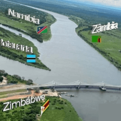
Is there a point where 4 countries meet There is a point where 4 Southern African countries meet. It is called Kazungula. In the northern part of Botswana,…
Where four countries meet Zambezi River Kazungula is the place where four countries meet Zambezi River In the northern part of Botswana, four countries (Zambia, Botswana,…
Sea ports development in Nigeria Port operations and development in Nigeria began in the middle of the 19th century. The effort towards the provision of…