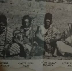
List of Niger State SMGs (Secretaries to Military Government), SSGs (Secretaries to State Government) & Heads of Service.
| SN | NAME | DESIGNATION | REMARK |
| 1. | Abdulkareem Lafene | S.M.G | Military Era (1976) |
| 2. | Alh. Suleiman Liman | S.M.G | Military Era (1976 – 1979) |
| 3. | Ambassador James T. Kolo | H.O.S | Military Era (1979 – 1981) |
| 4. | Alh. Shehu Ahmadu Katcha | H.O.S | Civilian Era (Aug 1982 – Oct 1982) |
| 5. | Malam Ibrahim Aliyu | S.S.G | Civilian Era (1979 -1983) |
| 6. | Dr. Musa Abdullahi | S.S.G | Civilian Era (1983) |
| 7. | Amb. AdulRahman Gara | S.M.G | Military Era (1983 – 1986) |
| 8. | Engr. Mamman Muhammad mni | S.S.G | Military Era 9th April 1987 – Jan 1992) |
| 9. | Mallam Nuhu Galadima Kuta | S.S.G | Civilian Era (1992 – Jan 1994) |
| 10. | Alh. Abdulkadir Ibrahim Gudugi mni | S.S.G | Jan. 1994 – March 1998 |
| 11. | Alh. Nuhu Bawa | S.S.G | March 1998 – March 1999 |
| 12. | Alh. Salihu Madalla Ahmed | S.S.G | March 1999 – May 1999 |
| 13. | Alh. Dahiru Awaisu Kuta | S.S.G | May 1999 – May 2002 |
| 14. | Alh. Nuhu Bawa | H.O.S | March 1999 – Oct. 2002 |
| 15. | Comrade Moh’d Adams Erana | S.S.G | June 2002 – May 2007 |
| 16. | Alh Hassan Yahaya | H.O.S | Nov. 2002 – Aug. 2004 |
| 17. | Alh. Abdulkadir Usman | H.O.S | Aug 2004 – July 2007 |
| 18. | Dr. Muhammed Kuta Yahaya | S.S.G | May 2007 – date |
| 19. | Alhaji Abdullahi Umar Danyaya | H.O.S | July 2007 – date |
Previous Governors of Niger State, Nigeria from 1976 when the State was created
| SN | NAME | PERIOD | REMARK |
| 1. | Navy Commander Murtala Nyako | Feb. 1976- 1977 | Military Governor |
| 2. | Navy Commander Ebitu Ukiwe | 1977-1978 | Military Governor |
| 3. | Col. Ola Oni | 1978 – 1979 | 1st Military Administrator |
| 4. | Mal Muhammad Awwai Ibrahim | Oct. 1979 – Dec. 1983 | 1st civilian governor |
| 5. | Col. David A.B. Mark | Jan. 1984 – Aug 1988 | Military governor |
| 6. | Lt. Col. Garba Ali Muhammed | Aug. 1986 – 1987 | Military Governor |
| 7. | Col. Mohammed Lawan Gwadabe | Jan. 1987 – 1992 | Military Governor |
| 8. | Dr. Musa Muhammed Inuwa | Jan. 1992 – Nov. 1993 | 2nd Civilian Governor |
| 9. | Col. Cletus K. Emein | Dec. 1993 – Aug 1996 | Military Administrator |
| 10. | C.P. Simeon O. Oduoye | 14th Aug 1996 – Aug 1998 | Military Administrator |
| 11. | Col. Habibu Idris Shuiabu | Aug 1998 – May 1999 | Military Administrator |
| 12. | Engr. Abdulkhadir A. Kure | May 1999 to May 2007 | 3rd Civilian Governor |
| 13. | Dr. Mu’azu Babangida Aliyu | May 2007 to – | 4th Civilian Governor |
Niger State
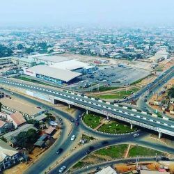
Niger is a State located in central Nigeria and its capital city is Minna.
Other top cities in Niger State include Bida, Suleja and Kontagora.
The State has an expansive land area and it’s close to the nation’s capital, Abuja.

Creation: It was created out of the defunct North Western state on 3rd February, 1976.
Location: Situated in the North central geo-political zone.
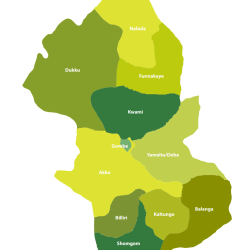
Administrative areas: The State comprises 25 Local Government Areas grouped into 3 administrative zones: A, B, C with each zone having 8, 9 and 8 Local Government Areas (LGAs) respectively.
List of Local Government Areas
Niger State has 25 Local Government Areas, namely:
- Agaie
- Agwara
- Bida
- Borgu
- Bosso
- Chanchaga
- Edati
- Gbako
- Gurara
- Katcha
- Kontagora
- Lapai
- Lavun
- Magama
- Mariga
- Mashegu
- Mokwa
- Munya
- Paikoro
- Rafi
- Rijau
- Shiroro
- Suleja
- Tafa
- Wushishi
Local Government Areas and their headquarters
The Local Government Areas in Niger State and their headquarters are:
| SN | LGA | HEADQUARTERS |
| 01 | Agaie | Agaie |
| 02 | Agwara | Agwara |
| 03 | Bida | Bida |
| 04 | Borgu | New Bussa |
| 05 | Bosso | Maikunkele |
| 06 | Edati | Enagi |
| 07 | Gurara | Gawu Babangida |
| 08 | Gbako | Lemu |
| 09 | Katcha | Katcha |
| 10 | Kontagora | Kontagora |
| 11 | Lapai | Lapai |
| 12 | Lavun | Kutigi |
| 13 | Mariga | Bangi |
| 14 | Mokwa | Mokwa |
| 15 | Magama | Nasko |
| 16 | Mashegu | Mashegu |
| 17 | Munya | Sarkin Pawa |
| 18 | Paikoro | Paiko |
| 19 | Rafi | Kagara |
| 20 | Rijau | Rijau |
| 21 | Shiroro | Kuta |
| 22 | Suleja | Suleja |
| 23 | Tafa | Sabon-Wuse |
| 24 | Wushishi | Wushishi |
| 25 | Minna | Minna |
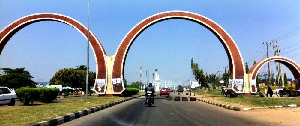
Boundaries: Niger State shares its borders with republic of Benin (West), Zamfara State (North), Kebbi (North-West), Kogi (South), Kwara (South West), Kaduna (North-East) and the FCT (South-East).
Land area, the largest among Nigerian states: Niger State is one of the largest states in Nigeria covering about 86,000km2 (or about 8.6million hectares) representing about 9.3% of the total land area of the country.
Major rivers: Niger State’s major rivers are: Niger, Kaduna, Gbako, Eko, Gurara, Ebba, Ega, Mariga and their tributaries.

Fishes: The common fishes found in these rivers are: Nile Perch (Lates) Trunck fish, Cat fish, Osteoglosid, Tilapia, Synodontis, Tiger fish, Moon fish, Mormyrid and Electric fish. By the 2006 census, the State’s population is 3,950,249 comprising 2,032,725 males and 1,917,524 females.

Ethnic groups: The easily identifiable major ethnic groups are Nupes, Hausa, Gbagyi, Kadara, Koro, Bassa, Kamuku, Ingwai, Fangu, Kambari, Dukkawa, Fulani, Abewa, Bisan, Gungawa, Bauchi, Bariba, Urah, Boko, Bokobaro, Bauchnu, Achifawa, Dakarkari, Kakanda, Ganagana, and Dibo and numerous non native tribes.
Economic activities: The major economic activity is agriculture: farming, fishing, and cattle rearing.
The other economic activities (though limited in scale) include banking, trading, transportation, local arts and crafts with Bida, the heart land of the Nupes, famous for its brass work. These activities constitute the means of livelihood of the people of Niger State in addition to public service.
Reference: nigerstate.gov.ng/about-niger
