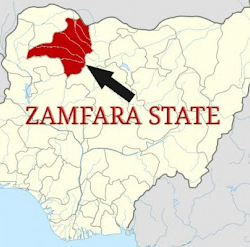
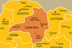
Anka, a local government area (LGA) in Zamfara State, Nigeria, holds a vital position both geographically and historically within the region. With its administrative headquarters located in the town of Anka, this LGA plays a significant role in the political, economic, and cultural landscape of the state. Established in a region known for its rich natural resources and traditional governance, Anka continues to be a focal point for development efforts in Nigeria’s northwest.
- Geographic Location and Coordinates
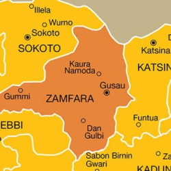
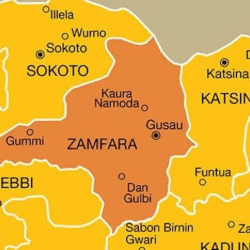
Anka lies at the coordinates 11°59′N 6°02′E, placing it in the western part of Zamfara State. This strategic location makes it an essential hub for connecting various neighboring regions.
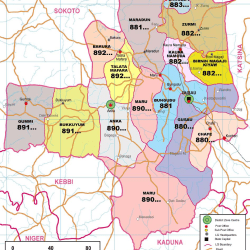
To the north, it borders Bakura and Talata Mafara LGAs; to the east and south, it is bordered by Maru LGA; and to the west, it shares a boundary with Bukkuyum LGA and the state of Sokoto. These connections make Anka an important link between Zamfara and its surrounding territories.
- Overview of Zamfara State
Zamfara State, where Anka is located, is one of Nigeria’s northern states. Created in 1996 from Sokoto State, Zamfara has since become known for its rich cultural heritage and agricultural activities. Anka contributes significantly to the state’s economy, particularly through gold mining and subsistence farming. The state operates under a Sharia-based legal system, which is integrated into its governance, adding a layer of cultural specificity to the region’s identity.
- Size and Population of Anka LGA
Covering an area of 2,746 square kilometers, Anka is among the larger LGAs in Zamfara State. According to the 2006 census, it had a population of 142,280 people. While the exact population today may have shifted, these figures highlight the area’s relatively low population density, a factor that influences both its social structure and economic activities.
- Administrative Structure of Anka
Anka LGA is governed from its headquarters in the town of Anka, which acts as the administrative center for the surrounding districts and communities. The governance structure follows Nigeria’s typical local government system, with a Chairman leading the administrative body. This structure supports the implementation of local policies, facilitates infrastructure development, and addresses the welfare needs of the population.
- Political Boundaries of Anka
Anka’s boundaries are defined by its neighboring regions and states. To the north, it is bounded by Bakura and Talata Mafara LGAs, while Maru LGA lies to its east and south. To the west, Anka shares a border with Bukkuyum LGA and Sokoto State. These borders have political, economic, and cultural implications, as they influence trade routes, migration patterns, and the spread of culture within the region.
- Climate of Anka
Anka experiences a semi-arid climate, typical of the northern Nigerian savannah. The area sees a significant variation in temperature and rainfall across the year. The rainy season occurs from May to October, bringing necessary moisture for agricultural activities, while the dry season, from November to April, is marked by higher temperatures and lower humidity. This climate affects both the livelihood of the people, who depend on agriculture, and the infrastructure, which must withstand harsh conditions.
- Economic Activities
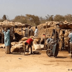
The economy of Anka is primarily driven by agriculture and mining. Farming is the mainstay of most residents, with crops such as millet, sorghum, and maize being commonly cultivated. Livestock farming, including cattle, goats, and poultry, is also prevalent. However, Anka is perhaps best known for its role in gold mining, particularly in the Bagega community. Small-scale mining operations provide employment and income for many, although the industry has also brought challenges such as environmental degradation and health hazards due to unsafe mining practices.
- Education in Anka LGA
Education in Anka has seen both progress and setbacks. The local government has made efforts to increase primary school enrollment, but challenges persist. Many children in rural areas struggle to access quality education due to poor infrastructure, a shortage of trained teachers, and inadequate funding. Non-governmental organizations (NGOs) and government initiatives have sought to improve education standards, but much work remains to be done to ensure that all children in the area receive the education they need to break the cycle of poverty.
- Health and Social Services
Healthcare services in Anka are limited, with only a few government-run clinics and health centers scattered across the LGA. Access to clean water, sanitation, and basic medical care remains a challenge, especially in the more remote communities. The region has been affected by various public health issues, including outbreaks of diseases like cholera and malaria. Government initiatives, often supported by international aid, are gradually improving healthcare infrastructure, but significant gaps remain.
- Key Districts and Communities
Anka LGA is made up of several districts and communities, each contributing to the cultural and economic fabric of the area. These include Dan Galadima, Bagega, Waramu, Wuya, Yar’sabaya, Magaji, Sabon-Birni, Matseri, and Barayar-Zaki. Bagega, in particular, is notable for its gold mining activities, while other districts are primarily agricultural. Each community has its own unique customs, traditions, and local governance structures that influence how the broader LGA operates.
- Postal and Administrative Codes
Anka’s postal code is 890, a crucial identifier for mail and administrative purposes. Additionally, Anka is recognized by the ISO 3166 code NG.ZA.AN, which reflects its official status within the Nigerian administrative framework. These codes are not just symbolic; they play an essential role in logistics, government services, and communication within and outside the region.
- Local Government Leadership
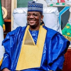
The local government area of Anka is led by a Chairman, who oversees the implementation of policies, development projects, and community welfare programs. The Chairman’s leadership is crucial for addressing the myriad of challenges faced by the region, from infrastructure development to improving social services. Leadership in Anka also involves traditional rulers, whose influence remains strong in local governance.
- Transportation and Infrastructure
Transport infrastructure in Anka is underdeveloped, with many roads in poor condition, particularly during the rainy season. The lack of paved roads hampers economic activities and access to essential services. While the local government has made efforts to improve infrastructure, including road construction and maintenance, the challenges posed by the region’s geography and limited resources make this a difficult task
