Distance of Akko communities, Akko LGA headquarters and Gombe town
Approximate distance of Akko communities, Akko LGA headquarters and Gombe town, the state capital
Community
Distance from LGA Headquarters
Distance from State Headquarters
Amada-Akko
48.14KM
20.50km
Dundado
27.98KM
12.63km
Gamawa
9.39KM
17.60km
Gona
25.67KM
11.12km
Kashere
43.85KM
45.81km
Kembu
29.91KM
29.91km
Kidda
33.59KM
33.59km
Kumo
0.KM
28.03km
Lafiya-Mango
34.91KM
8.31km
Shango
33.58KM
6.95km
Shongo-Hamma
32.42KM
4.95km
Tumpure
33.2KM
5.72km
Wuro-Yayangari
7.99KM
19.14km
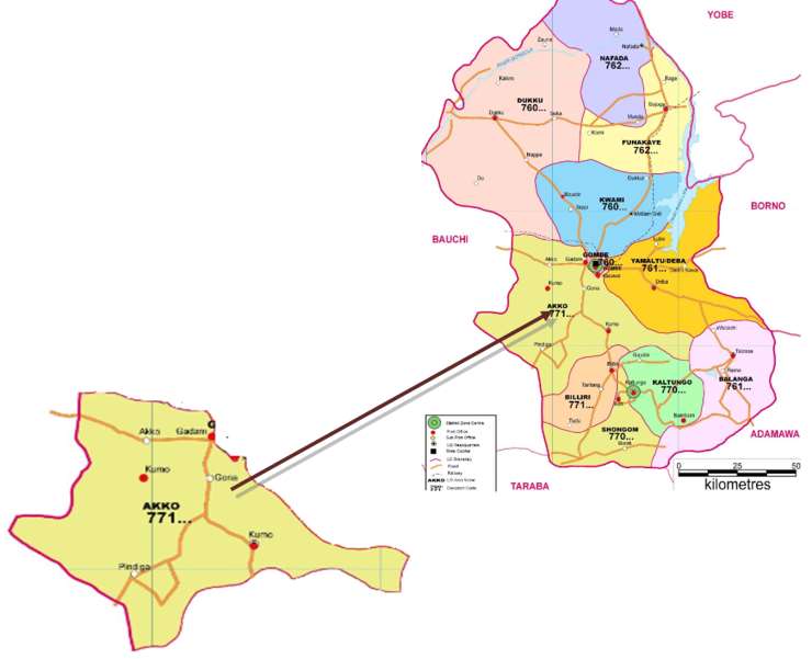
Akko local government area is one of eleven local government areas in Gombe state which is located in the Northeast geopolitical zone of Nigeria.
With its headquarters in the town of Kumo, the Akko LGA consists of towns and villages which include Garin Garba, Kembu, Dongol, Kombani, Pindiga, Gokoru, and Wuru Siddiki.
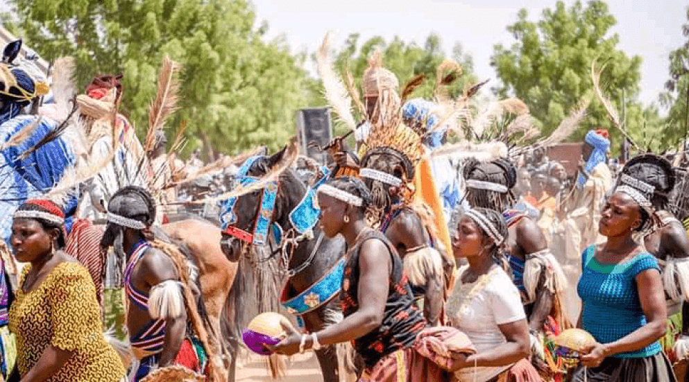
The major tribes in Akko LGA are the Hausa and the Fulani with the Hausa and the fufulde languages spoken widely in the area.
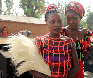
Festivals celebrated in Akko LGA are Eku and Tangra festivals among others while popular landmarks within the area include Pindiga hills.
Akko local government area covers a total 2627 km square and has an estimated humidity of 39 percent while wind speed of the area is pegged at 8km/h. The average temperature of Akko LGA is estimated at 30 degrees centigrade while the dry and the rainy seasons are the two main seasons in the area.
ECONOMY
Agriculture and commerce are key features of the economic life of Akko LGA with markets such as the Tike, Babbar Kusawa, and the Tashar Gwari markets attracting thousands of buyers and sellers to the area.
Gombe
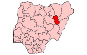
Gombe is one of the 36 states of Nigeria. It is located in the north eastern part of the country.
The state was created out of Bauchi state on 1st October 1996 by Sani Abacha’s administration.
Its creation was a fulfilment of the aspiration of the people who for long, had passionately craved for a state of their own out of the then Bauchi state.
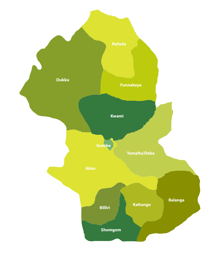
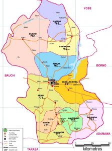
Gombe State has eleven Local Government Areas (LGA) namely, Akko, Balanga, Billiri, Dukku, Funakaye, Gombe, Kaltungo, Kwami, Nafada, Shongom, and Yamaltu Deba.
The following are administrative maps of Gombe State showing the local government areas
Historically, Gombe state is a fusion of two distinct groups of people, comprising the people of Gombe North and the ethnic grouping of Gombe South.
Gombe is located on latitude 9”30’ and 12”30’N, Longitude 8”5’and 11”45’E.
It has borders with Borno, Yobe, Adamawa, Taraba, and Bauchi states.
The State climate is generally warm, with temperatures not exceeding 300c during the months of March-May considered to be the hottest months. The following table gives other profile of the jewel state.
The following Map indicates in red the position of Gombe in relation to the thirty six (36) states of the federation.
The Emirate government, which had its Head quarters in Gombe Abba, was formed to effectively control what constitutes a larger part of the Gombe State, until the advent of the British in the early 20th century.
Under the British, the state was administered through the mechanism of two administrative units, i.e. Gombe Native Authority and Tangale Waja Native Authorities. The two Authorities constituted Gombe Division during the Colonial era. However, with independence in 1960 and the subsequent military administration, many changes occurred which led to the emergence of local government authorities. Thus, between 1976 and the present, the then two authorities had metamorphosed into the present 11 local governments.
Capital: Gombe
Land area: The State occupies a total land area of about 20,265sqkm.
Climate: Warm, exceeding 40″c during the hottest month (March – May)
Topography: Mainly mountainous, undulating and Hilly to the South-East and flat open plains in the Central, North, North-East, West and North-West.
Location: Latitude 9”30’ and 12”30’N, Longitude 8”5’and 11”45’E. The state lies in the centre of North east Geopolitical Zone of Nigeria. It shares common boundaries with Adamawa and Taraba State to the South, Bauchi State to the West, Borno State to the East and Yobe State to the North.
Power: The State is served by the PHCN National grid through the North-East PHCN substation located in Gombe State capital
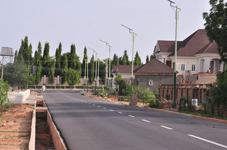
Roads: Five(5) Federal trunk “A” roads connect the State Capital with all parts of the Country. Twonship roads have been constructed in the State capital and all the major towns.
Airport: The State has an International Airport which is also surrounded by four (4) International Airport, located in Kano, Jos, Yola and Maiduguri.
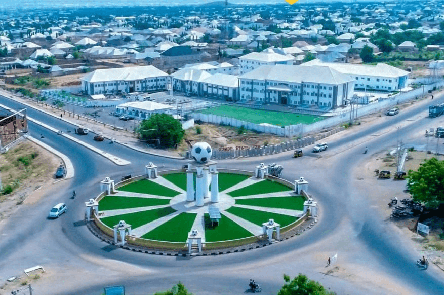
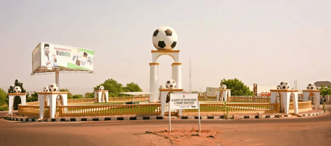
Major towns :Gombe the capital, Bajoga, Billiri, Kaltungo, Kumo, Dukku and Deba.
Ethnic CompositionMulti-ethnic, mainly made up of Fulani, Tangale, Waja, Bolawa, Tera,Jukun, Jara, Pero, Tula, Cham, Lunguda, Dadiya, Kamo, Awak, Kanuri, Hausa, Yoruba and Igbo.
Language spoken: English is the official language, but as much as Hausa remain the commercial language amongst the people of the state, Fulfulde, Tangale, Tera, Waja, and Kanuri are commonly spoken.
Vegetation: Gombe is generally a Guinea Savannah grassland with concentration of wood lands in the South East and South West.
Distance of Funakaye communities, LGA headquarters and Gombe town, the state capital Approximate distance of Funakaye communities, LGA headquarters and state capital CommunityDistance from LGA HeadquartersDistance from State HeadquartersASHAKA GARI9.45KM78.01KMBAGE12.34KM78.93KMBAJOGA0 KM71.12KMRIBADU32.4KM45.44KMWAWA34.28KM57.54KMWUROBAPPARU14.58KM76.37KM Funakaye is…
Distance of Kwami communities, LGA headquarters and Gombe State capital Approximate distance between communities to the Local and State headquarters CommunityDistance from LGA HeadquartersDistance from State HeadquartersKwami49.5KM13.53KMMalam Sidi0.KM25.92KMBojude58.7KM32.65KMTappi53KM26.68KMDoho7.9KM19.14KMDukul22KM43.84KM Kwami Local…
Distance of communities, Nafada LGA and Gombe State capital Approximate distance between the communities to the LGA and State capital CommunityDistance from LGA HeadquarterDistance from State HeadquartersBarwo Wunde8.14KM91.65KMNafada0. KM97.88KMJigawa33.56KM126.36KMBarwo…
List of communities in Gombe LGA, Gombe State Major communities in Gombe Local Government Area of Gombe State, Nigeria are: Bajoga Shamaki Dawaki Bolari Fantami Jekadafari London Maidoruwa…
Gombe Local Government Areas and their headquarters The Local Government Areas (LGA) in Gombe State and their headquarters are: SNLGAHeadquarters1AkkoKumo2BalangaTalasse3BilliriBilliri4DukkuDukku5FunakayeBajoga6GombeGombe7KaltungoKaltungo8KwamiMalam Sidi9NafadaNafada10ShongomBoh11Yamaltu-DebaDeba Gombe state comprises 11 of these…
List of Local Government Areas in Gombe State and their headquarters Gombe State Local Government Areas and their headquarters, administrative capitals LGAHeadquartersAkkoKumoBalangaTallaseBilliriBilliriDukkuDukkuFunakayeBajogaGombeGombeKaltungoKaltungoKwamiMallam SidiNafadaNafadaShomgomBohYamaltu/DebaDeba Map of Gombe State showing Local Government Areas…
AKKO LOCAL GOVERNMENT Akko local government area is one of eleven local government areas in Gombe state which is located in the Northeast…
LIST OF LGA CHAIRMEN IN GOMBE STATE The swearing-in ceremony of the Caretaker Committee Chairmen for the 11 Local Government Areas (LGAs) in Gombe State, Nigeria took…


 and Fufu (the headquarters of Ilorin South LGA)")


")


