Botswana is administratively divided into districts to support governance, service delivery, planning, and development across the country. These districts form the backbone of public administration and help ensure that government services reach both urban and rural populations efficiently. Botswana’s district system reflects the country’s geography, settlement patterns, and economic activities.
Broadly, Botswana’s districts fall into four main categories: rural districts, urban districts (cities and towns), special administrative areas, and mining or township authorities.
Rural Districts
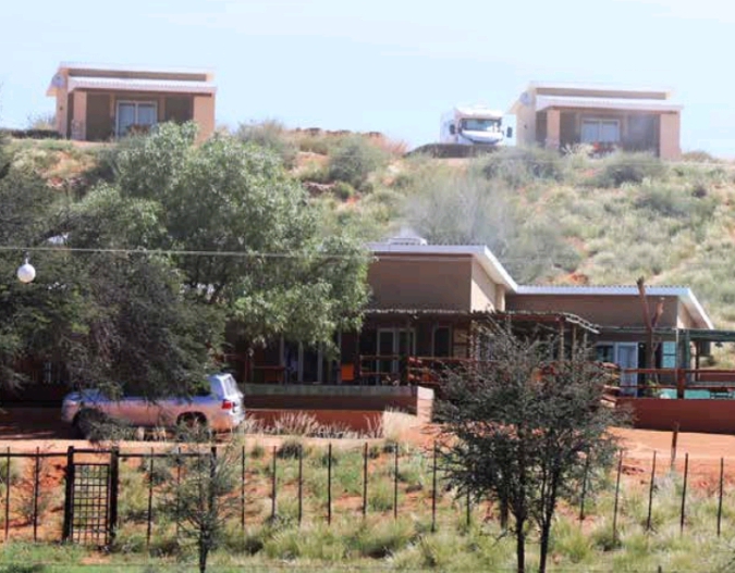
Rural districts cover most of Botswana’s land area and include the majority of villages. Examples include Central District subdivisions (such as Central Serowe/Palapye and Central Mahalapye), Kweneng East and West, Ngwaketse and Ngwaketse West, Kgatleng, Chobe, Ghanzi, and the Kgalagadi North and South districts. These districts are administered by district councils and are responsible for local development, primary education, clinics, roads, and community services. Livestock farming, subsistence agriculture, tourism, and wildlife management are key economic activities in many of these areas.
Urban Districts (Cities and Towns)
Urban districts include Botswana’s cities and towns such as Gaborone City, Francistown City, Lobatse, Selibe Phikwe, Jwaneng, Orapa, and Sowa. These districts are more densely populated and economically specialised. They are governed by town or city councils and focus on urban infrastructure, housing, waste management, industrial development, and commercial services. Urban districts are the main drivers of economic growth and employment.
Special Administrative Areas
Some districts have unique administrative roles due to geography or land use. The Central Kgalagadi Game Reserve and parts of Ngamiland Delta fall into this category. These areas prioritise conservation, tourism, and environmental management, with limited permanent settlement. Administration here balances human activity with wildlife and ecosystem protection.
Districts and Development Planning
Districts play a central role in Botswana’s national development planning. Population size, settlement patterns, and economic potential within each district guide decisions on infrastructure investment, health facilities, schools, water supply, and electricity expansion. Larger districts with fast-growing settlements face challenges such as land pressure and service demand, while sparsely populated districts focus on access, connectivity, and sustainability.
Botswana’s district system provides an effective framework for managing a large country with a relatively small and widely dispersed population. By dividing the nation into clearly defined districts, Botswana promotes balanced development, local participation, and efficient governance, ensuring that both urban centres and rural communities are included in national progress.
More
List of largest cities, towns and districts in Botswana The largest cities, towns and districts in Botswana according to population size are: RankNameCity, Town or DistrictPopulation 20221GaboroneGaborone246,3252FrancistownFrancistown103,4173MogoditshaneKweneng District88,0044MaunNorth-West District85,3505MolepololeKweneng…
List of Botswana’s 17 Districts Botswana is divided into 17 major areas: 10 administrative districts, 2 cities, and 5 towns. These are administered by local…
List of Botswana Villages and their Districts NGWAKETSE DISTRICT Kanye Ranaka Lotlhakane West Gasita Lorolwana Kgomokasitwa Pitseng Lekgolobotlo Seherelela Lotlhakane Sese Sesung Magotlhwane Segwagwa Manyana Dipotsana Diabo…
Ghana districts. Population, size of land area and capitals of districts The districts of Ghana and their population, land area and capitals are as follows: DistrictPopulationArea (km.²)CapitalAbura-Asebu-Kwamankese90,093324Abura-DunkwaAccra1,659,136185AccraAdansi East129,3251,380New EdubiaseAdansi West235,680828ObuasiAfigya Sekyere117,653770AgonaAfram…
Botswana Districts and their Capitals Botswana’s Administrative District System Botswana is a unitary state whose territorial administration is structured to balance centralized governance with effective…
List of Mbeya Districts List of Districts of Mbeya Region, 2016 BusokeloChunyaKyelaMbaraliMbeyaMbeya CityRungwe Map of Mbeya region, Tanzania List of Districts of Mbeya Region,…
List of Ghana districts and land area in kilometre square Ghana districts and land area in kilometer square DistrictArea (km²)Abura-Asebu-Kwamankese324Accra185Adansi East1,380Adansi West828Afigya Sekyere770Afram Plains3,559Agona632Ahafo Ano North593Ahafo Ano South1,126Ahanta West636Ajumako/Enyan/Esiam483Akatsi1,077Akwapim North544Akwapim…
List of Ghana districts from largest to smallest Ghana’s largest districts by land area are: West GonjaBoleEast GonjaSissalaSeneKintampoWaGushiegu KaragaWassa Amenfi DistrictArea (km²)West Gonja17,317Bole9,631East Gonja9,351Sissala7,781Sene6,657Kintampo6,566Wa5,859Gushiegu Karaga5,761Wassa Amenfi4,987Wenchi4,939West Mamprusi4,892Sekyere East4,516Atebubu4,407Yendi4,230Nanumba4,178Juabeso…
List of Ghana districts from smallest to largest Ghana’s smallest districts by land area are: Cape CoastAccraNew JuabenKumasiAbura-Asebu-KwamankeseKwabreAkwapim SouthShama Ahanta EastKomenda-Edina-Eguafo-Abirem DistrictArea (km.²)Cape Coast135Accra185New Juaben216Kumasi299Abura-Asebu-Kwamankese324Kwabre356Akwapim South362Shama Ahanta East384Komenda-Edina-Eguafo-Abirem396Keta412South…
List of Kogi senatorial districts Kogi State consists of three senatorial districts, namely: Kogi Western Senatorial District Kogi Central Senatorial District Kogi Eastern Senatorial District…
List of Ghana districts and capitals Ghana districts and capitals are: DistrictCapitalAbura-Asebu-KwamankeseAbura-DunkwaAccraAccraAdansi EastNew EdubiaseAdansi WestObuasiAfigya SekyereAgonaAfram PlainsDonkorkromAgonaSwedruAhafo Ano NorthTepaAhafo Ano SouthMankransoAhanta WestAgona NkwantaAjumako/Enyan/EsiamAjumakoAkatsiAkatsiAkwapim NorthAkropongAkwapim SouthNsawamAmansie EastBekwaiAmansie…
List of Tanzania districts The districts of Tanzania are: ArumeruArushaBabatiBagamoyoBariadiBiharamuloBukoba RuralBukoba UrbanBukombeBundaChakeChunyaDodoma RuralDodoma UrbanGeitaHaiHanangHandeniIgungaIlalaIlejeIlemelaIrambaIringa RuralIringa UrbanKahamaKaragweKaratuKaskazini ‘A’Kaskazini ‘B’KasuluKatiKibahaKibondoKigoma RuralKigoma UrbanKilindiKiloloKilomberoKilosaKilwaKinondoniKisaraweKishapuKitetoKondoaKongwaKorogweKusiniKwimbaKyelaLindi RuralLindi UrbanLiwaleLudewaLushotoMafiaMagharibiMaguMaketeManyoniMasasiMaswaMbaraliMbeya RuralMbeya UrbanMbingaMboziMbuluMeatuMicheweniMisungwiMjiniMkoaniMkurangaMonduliMorogoro…
List of Tanzania districts and capitals The districts of Tanzania and their capitals are: DistrictCapitalArumeruAkheriArushaArushaBabatiBabatiBagamoyoChalinzeBariadiBariadiBiharamuloBiharamulo MjiniBukoba RuralBukobaBukoba UrbanBukobaBukombeUshiromboBundaBundaChakeChake ChakeChunyaMakongorosiDodoma RuralDodomaDodoma UrbanDodomaGeitaKalangalalaHaiHai MjiniHanangGananaHandeniChanikaIgungaIgungaIlalaIlalaIlejeItumbaIlemelaIlemelaIrambaSheluiIringa RuralIringaIringa UrbanIringaKahamaKahama MjiniKaragweKayangaKaratuKaratuKaskazini ‘A’MkokotoniKaskazini…
List of districts of Tanzania by land area. From largest to smallest The districts of Tanzania by land area from largest to smallest are: DistrictArea (Km²)Mpanda45,843Liwale36,084Songea Rural33,825Manyoni28,620Chunya27,065Ulanga23,681Urambo21,299Sikonge21,000Tabora Urban20,104Iringa Rural19,898Simanjiro18,851Tunduru18,778Kiteto16,305Mbarali16,000Kibondo15,722Kilosa14,245Monduli14,070Dodoma Rural14,004Kilwa13,920Kilombero13,577Ngorongoro13,460Rufiji13,339Kondoa13,210Sumbawanga Rural12,836Singida Rural12,164Morogoro…
List of Tanzania districts by population size. From least to most populated Tanzania districts by population size from least to most populated are: DistrictPopulationKusini31,853Mafia40,557Lindi Urban41,075Pangani43,920Kaskazini ‘B’52,492Kati62,391Liwale75,128Bukoba Urban80,868Chake82,998Micheweni83,266Kaskazini ‘A’84,147Mtwara Urban92,156Mkoani92,473Kisarawe95,323Wete102,060Makete105,775Iringa Urban106,371Musoma Urban107,855Ileje109,847Singida Urban114,853Mwanga115,145Ruangwa124,009Ludewa128,155Ngorongoro129,362Songea…