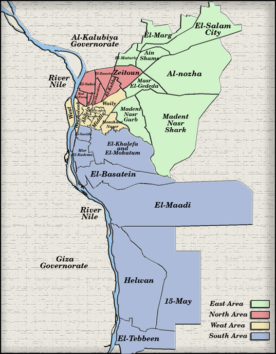
Map of Cairo, Egypt Showing East, West, North and South
📌 1. Geographic Location and the Grand Capital
Cairo is located in northern Egypt, on the eastern bank of the Nile River, just south of the Nile Delta.
The city extends across several governorates within “Greater Cairo,” including Giza and Shubra El-Kheima, with a population of approximately 20 million in the metropolitan area.
Map of Cairo
🏙️ 2. Urban Division and Key Districts
Cairo includes various areas: “Downtown” at the heart of the capital, Gezira (Zamalek and Maadi Island), Giza on the western bank, and newer districts like Heliopolis and Nasr City.
Historic Cairo – “Islamic Cairo”: Features important Islamic and Coptic landmarks such as Fustat, the Citadel, and the old city, which has been a UNESCO World Heritage Site since 1979.
🏞️ 3. The Nile and Corniche
The Nile River runs through the center of the city and is a defining element of Cairo’s identity and transport. The Corniche El Nil (Nile Promenade) stretches from north to south and includes the newly developed “Ahl Misr Walkway,” designed to encourage pedestrian activity and leisure.
The corniche was first fully constructed in 1955 during the era of President Gamal Abdel Nasser and has since undergone major improvements, including walking paths and bike lanes.
🚇 4. Public Transportation
Cairo Metro is the first subway system in Africa and the Middle East, covering three lines with a total length of about 107 km and 84 stations, serving over 2.2 million passengers daily.
In addition to the metro, buses, trains, and taxis serve different population segments, with ongoing projects aimed at improving urban connectivity.
🎯 5. Tourist Landmarks
Maps highlight the locations of key attractions such as:
The Egyptian Museum, the Sphinx, and the Giza Pyramids to the west
Khan El Khalili bazaar, the Citadel, and historic Islamic quarters in central Cairo
Greater Cairo and Zamalek Island in the middle of the Nile
Walking maps include tourist routes covering Islamic, Coptic, and Jewish quarters, such as the Coptic District and the Hanging Church, with recommended walking tours.
🗺️ How to Use the Map Practically
Identify your district: Downtown, Heliopolis, Giza, etc.
Review transport options: use the metro to avoid congestion, and enjoy Nile views along the Corniche.
Plan your route based on your interests: ancient landmarks, walking tours, museums, or Nile activities.
Map of Ebonyi showing Afikpo North Afikpo North Afikpo North Afikpo North is a Local Government Area of Ebonyi It’s headquarters and largest town is Afikpo…
IJEBU-NORTH-EAST LOCAL GOVERNMENT The Local Government came into being on 13th December 1996,having been carved out of Ijebu-ode Local Government it is bounded…
PUBLIC PRIMARY SCHOOLS IN OVIA NORTH EAST ADOLOR PS EKIADOLORADOLOR PS EVBOROAGBONMONBA PS AGBONMONBAAKEN PS UGBINNEHAKUGBE PS NIFORAKUGBE P/S ONUMU-AKPAMAAKENZUA PS UHENA.C.S EKEHUANA.C.S ISIHORARO PS UNIAROARUGIE PS…
PUBLIC PRIMARY SCHOOLS IN ESAN NORTH EAST Afuda P/S EgbeleAfuda Idigun P/SAmedokhian P/SArue P/SAtani P/SAKUGBE P/S ONUMU-AKPAMAEbhojie P/SEbulen P/SEfandion P/SEgbele P/SEguare P/SEko-IbadinEko-Omonua P/SEror P/SEwoiki P/SEwoyi P/SIdigun Amedokhian…
North West North West lies in the north of South Africa on the Botswana border, fringed by the Kalahari Desert in the…
Ibadan North West Local Government Area Ibadan North West Local Government was created in 1991 by the then Military Head of State, Maj. Gen. Ibrahim Gbadamosi…
South West Population according to Zone and Wereda Population of South West Region, Ethiopia, according to Zone and Wereda South West Region4,197,164• South Omo-Zone822,458Selamago38,678Debub Ari324,464Semen Ari92,679Hamer83,533Bena Tsemay73,206Dasenech73,220Male113,353Nyangatom23,326• Sheka-Zone314,447Masha64,082Anderacha35,615Yeki214,749•…
List of South West Weredas and Zones Weredas and Zones of South West Region, Ethiopia South Omo-Zone SelamagoDebub AriSemen AriHamerBena TsemayDasenechMaleNyangatom Sheka-Zone MashaAnderachaYeki Keffa-Zone SayilemGesha DekaGewataGimboMenjiwoTeloadaChetaDechaChenaBitaBonga Bench…
List of South West Region Zones and Weredas (Towns) South West Region administrative areas: Zones and Weredas (Towns) South West Region South Omo Zone SelamagoDebub AriSemen AriHamerBena TsemayDasenechMaleNyangatom Sheka…


")


