Plateau is a state in north central Nigeria named after the Jos Plateau, a mountainous area in the north of the state with captivating rock formations.
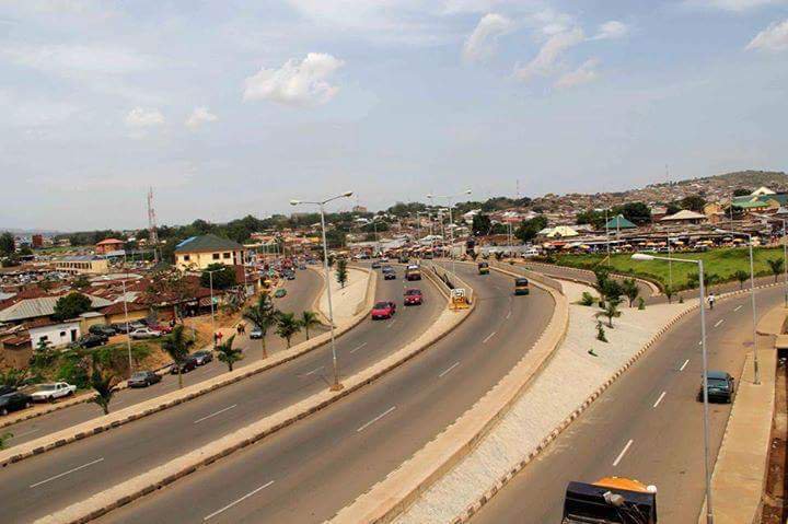
Jos, Plateau state capital
It’s prominent for it’s cool weather, tin mining and variety of foods including Irish potatoes.
Capital: Jos Local Government Areas: 17 Total land area: 27,147 Km2 Vegetation: Tropical Savannah
Plateau State was created on 3 February 1976 from the old Benue-Plateau State.
In 1996, Plateau State further subdivided to create Nasarawa State, which was carved out of the western half of Plateau State.
It is adjacent to Bauchi State to the Northeast, Kaduna to the Northwest, Nasarawa State to the South West, and Taraba State to the South East.
The State is nick named “Home of Peace and Tourism”.
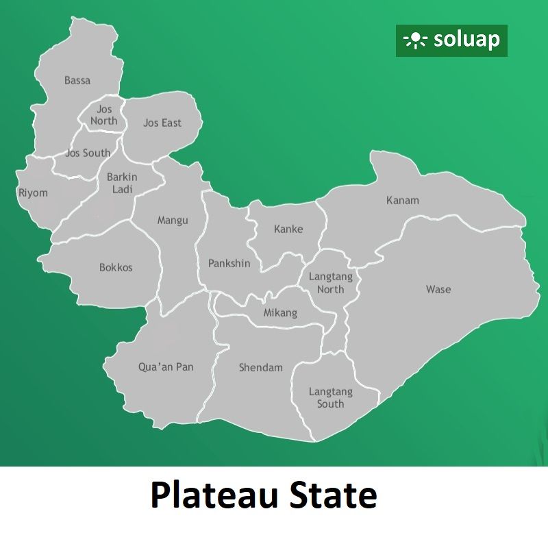
Map of Plateau State showing Local Government Areas
List of Local Government Areas of Plateau State
Barkin Ladi Bassa Bokkos Jos-East Jos-North Jos-South Kanam Kanke Langtang North Langtang South Mangu Mikang Pankshin Qua’an Pan Riyom Shendam Wase
Barkin Ladi Barkin Ladi (or Barakin Ladi) is a Local Government Area where Plateau State Polytechnic is located. The school is in the LGA’s capital town also known as Barkin Ladi.
Headquarter: Barkin Ladi Area: 1,032 km². Languages: Barkin Ladi are Berom, Foron & Gashish.
Bassa It’s a Local Government Area in the north of Plateau State bordering Kaduna and Bauchi States.
Plateau State NYSC orientation camp address The address of the NYSC orientation camp in Plateau State is: NYSC Permanent Orientation Camp, Mangu, Mangu Local Government Area,…
LGA in Plateau State The LGAs (Local Government Areas) in Plateau State, Nigeria are: Barkin Ladi Bassa Bokkos Jos East Jos North Jos South…
List of Local Government Areas in Plateau State and their headquarters Plateau State Local Government Areas and their headquarters, administrative capitals LGAHeadquartersBassaBassaBarkin LadiBarkin LadiBokkosBokkosJos EastAngwareJos NorthJosJos SouthBukuruKankeKwaliKanamDengiLangtang NorthMabudiLangtang SouthLangtangManguManguMikangTunkusPankshinPankshinQua’an PanBaapRiyomRiyomShendamShendamWaseWase Map…
Maps of Plateau State Map of Plateau State showing the 3 major political areas, senatorial districts (The 3 areas are separated with colors.) Maps…
Plateau State Maps Map of Nigeria showing Plateau and other states Map of Plateau state showing the 3 senatorial districts and the local…
Nok culture, Plateau state Plateau state has a very rich cultural heritage. The Nok culture one of the earliest iron smelting cultures dating between…
Plateau State Local Government Areas Barkin LadiBassaBokkosJos-EastJos-NorthJos-SouthKanamKankeLangtang NorthLangtang SouthManguMikangPankshinQua’an PanRiyomShendamWase