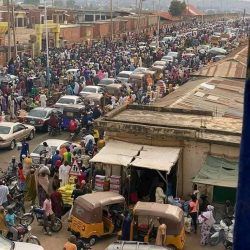
Over 70% of the population of Minna lives in the slums and squatter settlements. These areas include:
- Sabongari;
- Maitumbi;
- Chanchaga;
- Unguwar Kaje;
- Barikin Sale;
- Dutsen Kuran Gwari;
- Kpagungu;
- Tudun Fulani;
- Soje;
- Sauka ka Huta;
- Limawa;
- Unguwar Daji;
- Keteren Gwari
- Makera
- Kwangila;
- Maikunkele
- Unguwar Biri
- Unguwar Masa
- Fadipe
- Hanyar Gwari
These areas had been characterized by congestion; poor access with hardly any vehicular access anddrainage; substandard housing; poor and rapidlydeteriorating environmental conditions; large quantities ofuncollected and rotting garbage etc.

They pose a major health risk to the entire residents of Minna and are responsible for a large percentage of illegalities to do with connections to water supply, electricity etc.
They are the hotbed of all manner of social vices afflicting thetown. They, in all honesty, represent the failure of successivegovernments of the state to properly manage thedevelopment of Minna in particular and the other urban areasof the state.
These areas will continue to constitute themselves as thesource of the inefficiency of Minna, which is expected to bethe engine of the socio-economic development of the state,that is suppose to account for more than 60% of its GDP.
Their in-congruencies not withstanding, it is found that theyhave very effective Community Based Organizations (CBOs)who are involved in providing the residents variety of serviceson a self sustaining basis. For example they provide themsecurity (Vigilante groups); waste management service;mediation in the event of dispute between households etc.The Community/Ward Heads command more respect amongthe residents than the Local Government Councilors andeven Chairmen. The CBOs represent viable units aroundwhom the renewal of the areas can be predicated.
In line with the vision of government, it is convincing enoughthat first and foremost, it is wise to start by addressing thegrowing problems of these slum areas and eliminate theprobability that these areas will continue to constitute majorimpediments.
Fortunately, there are several of good practices, globally, for the state to predicate it on upgrading and renewal projects . For instance, a committee was inaugurated to enforce environmental sanitation in the State. In addition, it is strategically designed to ensure: A approach, stakeholders in each slum area to be identified and sensitized on the plan of the Niger State Government to upgrade and renew the areas; Stakeholders will be mobilized to actively participate in the generation of requisite data that will facilitate the upgrading; Stakeholders will be part of the preparation of upgrading and renewal plans and the decisions on the houses to be affected by the exercise; In the event of any resettlement of persons to be affected by the exercise, the stakeholders will have the opportunity to select their members and in determining there settlement terms and conditions; etc
Niger
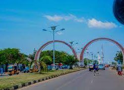
Niger is a State located in central Nigeria and its capital city is Minna.
Other top cities in Niger State include Bida, Suleja and Kontagora.
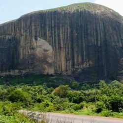
The State has an expansive land area and it’s close to the nation’s capital, Abuja.
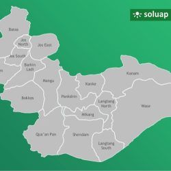
Administrative areas: The State comprises 25 Local Government Areas grouped into 3 administrative zones: A, B, C with each zone having 8, 9 and 8 Local Government Areas (LGAs) respectively.

In line with the constitution of the Federal Republic of Nigeria, two levels of government exist in the State; the State Government and the Local Government Councils.
Creation: It was created out of the defunct North Western state on 3rd February, 1976.
Location: Situated in the North central geo-political zone.
Boundaries: Niger State shares its borders with republic of Benin (West), Zamfara State (North), Kebbi (North-West), Kogi (South), Kwara (South West), Kaduna (North-East) and the FCT (South-East).
Land area, the largest among Nigerian states: Niger State is one of the largest states in Nigeria covering about 86,000km2 (or about 8.6million hectares) representing about 9.3% of the total land area of the country.
Major rivers: Niger State’s major rivers are: Niger, Kaduna, Gbako, Eko, Gurara, Ebba, Ega, Mariga and their tributaries.

Fishes: The common fishes found in these rivers are: Nile Perch (Lates) Trunck fish, Cat fish, Osteoglosid, Tilapia, Synodontis, Tiger fish, Moon fish, Mormyrid and Electric fish. By the 2006 census, the State’s population is 3,950,249 comprising 2,032,725 males and 1,917,524 females.

Ethnic groups: The easily identifiable major ethnic groups are Nupes, Hausa, Gbagyi, Kadara, Koro, Bassa, Kamuku, Ingwai, Fangu, Kambari, Dukkawa, Fulani, Abewa, Bisan, Gungawa, Bauchi, Bariba, Urah, Boko, Bokobaro, Bauchnu, Achifawa, Dakarkari, Kakanda, Ganagana, and Dibo and numerous non native tribes.
Economic activities: The major economic activity is agriculture: farming, fishing, and cattle rearing.
The other economic activities (though limited in scale) include banking, trading, transportation, local arts and crafts with Bida, the heart land of the Nupes, famous for its brass work. These activities constitute the means of livelihood of the people of Niger State in addition to public service
Reference: nigerstate.gov.ng/about-niger
