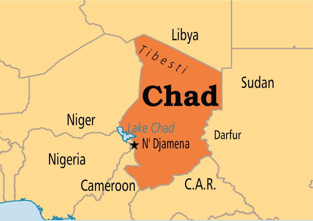
Chad is located between 7° and 24° north latitude and 13° and 24° east longitude. It is the link between the Maghreb and Central Africa. Covering 1,284,000 km2, Chad is the 5th largest country in Africa after Sudan, Algeria, the Democratic Republic of Congo and Libya.
It shares borders with Libya to the north, Sudan to the east, Cameroon, Niger and Nigeria to the west.
Due to its geographical position, south of the Tropic of Cancer and in the heart of the African continent, Chad is marked by an increased continentality, of which the economic slump is one of the consequences.
It is a country that is doubly landlocked from within and from without. Externally, Chad has no outlet to the sea. Harcourt Port in Nigeria, the nearest port, is 1,700 km from N’djamena, the capital. At the internal level, Chad has only 664 km of permanent asphalt roads and 1,609 km of permanent modern earth roads (Chad, 2005), and communications between the different parts of the country are sometimes difficult or impossible for several months because of rain-fed floods, which make some of them impassable. In general, the best route for heavy products is by inland waterway. The country’s two rivers, the Chari and the Logone, are the main river arteries, but there is the problem of water levels between the dry and rainy seasons. In the dry season, these rivers are paralyzed to navigation.
Chad has a succession of climates: Sudanian in the south with a semi-humid tropical regime, then gradually Sahelian and Saharan.
Republic of Chad
The Republic of Chad is a country in Africa. The landlocked country is bordered by Libya to the north, Sudan to the east, the Central African Republic to the south, Cameroon to the southwest, Nigeria to the southwest (at Lake Chad), and Niger to the west.
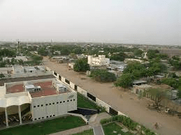
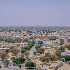
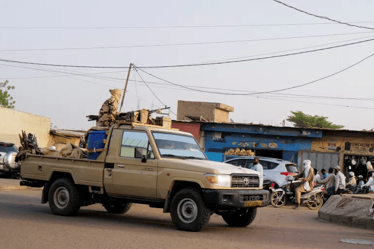
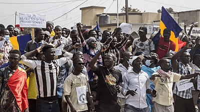
N’Djamena, the capital of ChadN’DjamenaN’DjamenaSecurity people patrol Chad’s capital N’Djamena following the battlefield death of President Idris Deby in N’Djamena, Chad on April 26, 2021 [Zohra Bensemra/Reuters]
Chad has a population of 16 million and 1.6 million live in the capital and largest city of N’Djamena.
With a total area of about 1,284,000 km2 (496,000 sq mi), Chad is the 5 largest country in Africa and the 20 largest in the world by area.
Capital: N’Djamena
Independence day: August 11, 1960
Calling code: +235
Currency: CFA franc (XAF)
Official language: French, Arabic
Area: 1,284,000 km2
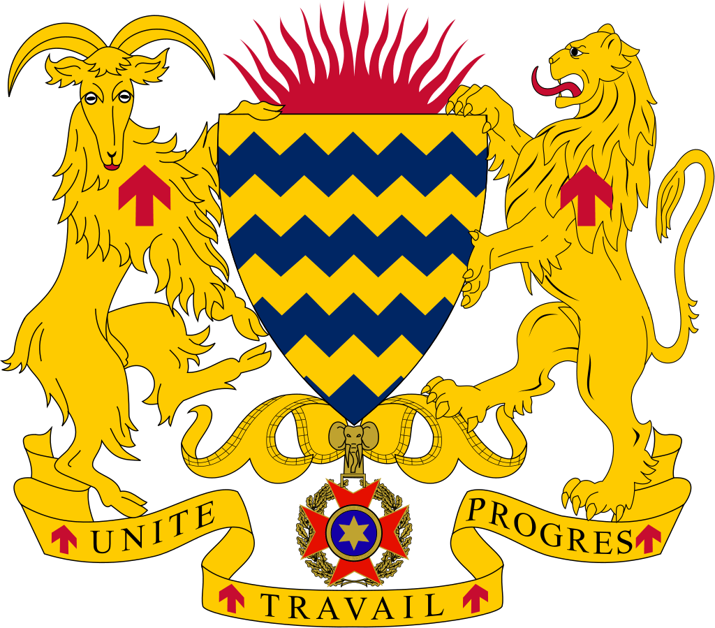
FlagCoat of arms
It is home to over 200 different ethnic and linguistic groups.
Islam (55.1%) and Christianity (41.1%) are the main religions practiced in Chad.
Chad is largely a semi-desert country. It is rich in gold, uranium and petroleum.
It became an oil-producing nation in 2003, with the completion of a $4bn pipeline linking its oilfields to terminals.
Despite its abundant resources, Chad is still faced with poverty and food insecurity. Close to half of the population (47%) lives below the poverty line.
The country ranks the 2nd lowest in the Human Development Index, with 0.394 in 2021 placed 190th, and is one of the poorest and most corrupt countries in the world.
Most of its inhabitants live in poverty as subsistence herders and farmers.
Since 2003 crude oil has become the country’s primary source of export earnings, superseding the traditional cotton industry. Chad has a poor human rights record, with frequent abuses such as arbitrary imprisonment, extrajudicial killings, and limits on civil liberties by both security forces and armed militias.
Chad’s post-independence history has been marked by instability and violence, mostly from tension between the mainly Arab-Muslim north and the predominantly Christian south.
However, it suffers from inadequate infrastructure, and internal conflict with rebels in the north, exacerbated by a jihadist insurgency across the Sahel region and Lake Chad Basin.
Regions
Chad has 23 regions, Departments and Sub-prefectures.
The subdivision of regions came as part of the decentralization process when the government abolished the previous 14 prefectures.
The regions of Chad are:
Bahr el Gazel
Batha
Borkou
Chari-Baguirmi
Ennedi-Est
Ennedi-Ouest
Guéra
Hadjer-Lamis
Kanem
Lac
Logone Occidental
Logone Oriental
Mandoul
Mayo-Kebbi Est
Mayo-Kebbi Ouest
Moyen-Chari
N’Djamena (capital)
Ouaddaï
Salamat
Sila
Tandjilé
Tibesti
Wadi Fira
Ethnic groups
Chad has more than 200 distinct ethnic groups. In the south live sedentary people such as the Sara, the nation’s main ethnic group, whose essential social unit is the lineage. In the Sahel sedentary peoples live side by side with nomadic ones, such as the Arabs, the country’s second major ethnic group. The north is inhabited by nomads, mostly Toubous.
The ethnic composition of Chad, based on 2009 Census, is as follows:
26.6% Sara
12.9% Arab
8.5% Kanembu
7.2% Masalit
6.9% Toubou
4.8% Masa
3.7% Bidiyo
3.7% Bulala
3.0% Maba
2.6% Daju
2.5% Mundang
2.4% Gabri
2.4% Zaghawa
2.1% Fula
2.0% Tupuri
1.6% Tama
1.4% Karo
1.3% Bagirmi
1.0% Masmaje
2.6% other Chadian
0.7% foreign
More
Chad Basin National Park Chad Basin National Park is situated within the ancient Kanem-Borno Empire (present day Borno and Yobe States). The Empire was…
Chad Basin Natural Park, Chingurmi-Duguma Chad Basin Natural Park, Chingurmi-Duguma is in Borno State, Nigeria. The park has three parts. In the Chingurmi-Duguma area of…
GIFMIS Code for Lake Chad Research Institute The GIFMIS Codes for Lake Chad Research Institute are: SNREVENUE NUMBERREVENUE ITEM DESCRIPTION11000075762SALE OF SEEDS21000075775TENDER FEES31000075788RENT Reference: gifmis.gov.ng/grr-number/ GIFMIS Government…
Chad flag The flag of Chad has three equal vertical bands of blue (hoist side), gold, and red; the flag combines the…
Chad ethnic groups Chad has more than 200 distinct ethnic groups. In the south live sedentary people such as the Sara, the nation’s…
List of Chad regions Chad has 23 regions. The creation of additional provinces which brought the total to 23. This was done as part…
The 2 rivers of Chad Chad has two rivers, namely: Chari and Logone. The country’s two rivers, Chari and Logone, are the main river arteries,…
Chad economy Chad is often described as one of the poorest countries in the world. For long, its economy has been dominated…
Regions of Chad Chad comprises 23 regions, namely: Bahr el Gazel Batha Borkou Chari-Baguirmi Ennedi-Est Ennedi-Ouest Guéra Hadjer-Lamis Kanem Lac Logone Occidental Logone…
List of Chad regions by population, from least to most populated Regions of Chad according to size of population, from least to most populated are: RegionPopulation (2023)Tibesti52,626Ennedi-Ouest109,753Borkou154,865Ennedi-Est175,321Bahr el Gazel407,256Salamat470,256Kanem505,839Lac509,258Sila591,300Batha748,395Wadi Fira792,394Guéra824,161Mayo-Kebbi Ouest858,593Hadjer-Lamis870,231Chari-Baguirmi884,924Moyen-Chari902,311Mandoul1,002,346Tandjilé1,007,812Logone…
List of Chad regions and their capitals The 23 regions of Chad and their capitals are: Batha … Ati Chari-Baguirmi … Massenya Hadjer-Lamis … Massakory Wadi Fira…
Least populated regions of Chad The 10 least populated regions of Chad are: Tibesti Ennedi-Ouest Borkou Ennedi-Est Bahr el Gazel Salamat Kanem Lac Sila Batha…
Most populated regions of Chad The 10 most populated regions of Chad are: N’Djamena (capital of Chad) Logone Oriental Mayo-Kebbi Est Ouaddaï Logone Occidental Tandjilé Mandoul…
10 Largest regions of Chad Republic The 10 largest regions of Chad Republic are: Batha Chari-Baguirmi Hadjer-Lamis Wadi Fira Bahr el Gazel Borkou Ennedi-Est Ennedi-Ouest Guéra…
Largest regions of Chad The largest regions of Chad by size of land area are: RegionEst. area (sq km)Batha93,732Chari-Baguirmi47,226Hadjer-Lamis31,376Wadi Fira56,362Bahr el Gazel58,525Borkou271,513Ennedi-Est81,696Ennedi-Ouest117,686Guéra62,678Kanem70,516Lac20,543Logone Occidental8,969Logone Oriental24,119Mandoul17,761Mayo-Kebbi…
World Heritage Sites in Chad UNESCO World Heritage Sites in Chad are: Lakes of Ounianga Ennedi Massif: Natural and Cultural Landscape > View other UNESCO…
Chad regions and departments The Republic of Chad has regions which are further divided into departments. The regions and their departments are: RegionDepartmentsBathaBatha Est, Batha…
Ghana districts. Population, size of land area and capitals of districts The districts of Ghana and their population, land area and capitals are as follows: DistrictPopulationArea (km.²)CapitalAbura-Asebu-Kwamankese90,093324Abura-DunkwaAccra1,659,136185AccraAdansi East129,3251,380New EdubiaseAdansi West235,680828ObuasiAfigya Sekyere117,653770AgonaAfram…