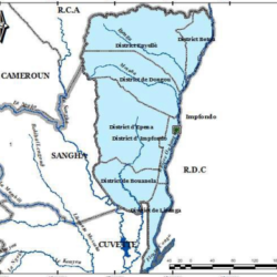
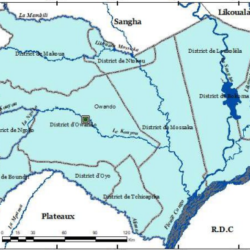
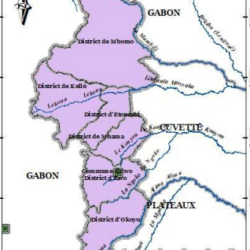
Likouala is one of the departments in the Republic of Congo, located in the northern part of the country. Known for its vast wetlands, dense forests, and rich biodiversity, Likouala is bordered by the Democratic Republic of Congo to the east. The region is characterized by its river systems, including the Congo and Ubangi rivers, which play a crucial role in transportation and the local economy.
Here’s an outline of the districts and municipalities within Likouala:
Districts and Municipalities of Likouala
- Betou
- Description:
Betou is a key district near the border with the Central African Republic. It is an important area for trade and hosts a significant population of refugees due to its proximity to conflict zones in neighboring countries. - Economic Activity:
Fishing, small-scale farming, and cross-border trade dominate the local economy.
- Description:
- Bouanela
- Description:
Bouanela is a quieter district with a focus on traditional lifestyles. Its economy relies on subsistence agriculture and small-scale logging.
- Description:
- Dongou
- Description:
Dongou is noted for its strategic location near waterways, making it a hub for river transport. - Key Features:
The district has a mixture of rural settlements and natural reserves.
- Description:
- Enyelle
- Description:
A remote district known for its pristine natural landscapes. Enyelle is less populated, and conservation efforts are prominent due to the area’s ecological significance.
- Description:
- Epena
- Description:
Epena is surrounded by dense rainforests and wetlands. The district is rich in biodiversity and offers opportunities for ecotourism and conservation projects. - Challenges:
Limited infrastructure and access pose challenges to development.
- Description:
- Impfondo (Commune)
- Description:
Impfondo, the departmental capital, is both a commune and a district. It serves as the administrative and economic center of Likouala. - Significance:
The town has better infrastructure compared to other districts and acts as a gateway for commerce, education, and healthcare in the region.
- Description:
- Impfondo (District)
- Description:
The larger district surrounding the commune of Impfondo. It includes rural and semi-urban areas that contribute to the department’s economy through agriculture and fishing.
- Description:
- Liranga
- Description:
Located near the confluence of major rivers, Liranga is known for its picturesque landscapes and traditional riverine communities. - Economic Activity:
Fishing and transportation on the Congo River are vital for the local economy.
- Description:
Key Features of Likouala
- Natural Resources:
Likouala is endowed with vast rainforests, rivers, and wetlands. These resources make it a hotspot for biodiversity and a target for conservation efforts. - Challenges:
The region faces challenges like limited infrastructure, healthcare access, and educational facilities. Seasonal flooding and its remote location add to these difficulties. - Opportunities:
Ecotourism, sustainable logging, and cross-border trade hold significant potential for future development.

Likouala’s unique geography and its districts contribute significantly to the cultural and economic fabric of the Republic of Congo.
