Niger is a State located in central Nigeria and its capital city is Minna.
Other top cities in Niger State include Bida, Suleja and Kontagora.
The State has an expansive land area and it’s close to the nation’s capital, Abuja.
Zuma rock is a large monolith, an igneous intrusion composed of gabbro and granodiorite, located in Niger State, Nigeria
Creation: It was created out of the defunct North Western state on 3rd February, 1976.
Location: Situated in the North central geo-political zone.
Administrative areas: The State comprises 25 Local Government Areas grouped into 3 administrative zones: A, B, C with each zone having 8, 9 and 8 Local Government Areas (LGAs) respectively.
List of Local Government Areas
Niger State has 25 Local Government Areas, namely:
Agaie
Agwara
Bida
Borgu
Bosso
Chanchaga
Edati
Gbako
Gurara
Katcha
Kontagora
Lapai
Lavun
Magama
Mariga
Mashegu
Mokwa
Munya
Paikoro
Rafi
Rijau
Shiroro
Suleja
Tafa
Wushishi
Local Government Areas and their headquarters
The Local Government Areas in Niger State and their headquarters are:
SN
LGA
HEADQUARTERS
01
Agaie
Agaie
02
Agwara
Agwara
03
Bida
Bida
04
Borgu
New Bussa
05
Bosso
Maikunkele
06
Edati
Enagi
07
Gurara
Gawu Babangida
08
Gbako
Lemu
09
Katcha
Katcha
10
Kontagora
Kontagora
11
Lapai
Lapai
12
Lavun
Kutigi
13
Mariga
Bangi
14
Mokwa
Mokwa
15
Magama
Nasko
16
Mashegu
Mashegu
17
Munya
Sarkin Pawa
18
Paikoro
Paiko
19
Rafi
Kagara
20
Rijau
Rijau
21
Shiroro
Kuta
22
Suleja
Suleja
23
Tafa
Sabon-Wuse
24
Wushishi
Wushishi
25
Minna
Minna
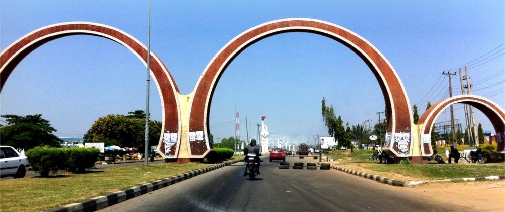
Minna Township City Gate
Boundaries: Niger State shares its borders with republic of Benin (West), Zamfara State (North), Kebbi (North-West), Kogi (South), Kwara (South West), Kaduna (North-East) and the FCT (South-East).
Land area, the largest among Nigerian states: Niger State is one of the largest states in Nigeria covering about 86,000km2 (or about 8.6million hectares) representing about 9.3% of the total land area of the country.
Major rivers: Niger State’s major rivers are: Niger, Kaduna, Gbako, Eko, Gurara, Ebba, Ega, Mariga and their tributaries.
Hydro electric power dam Niger State, Nigeria
Fishes: The common fishes found in these rivers are: Nile Perch (Lates) Trunck fish, Cat fish, Osteoglosid, Tilapia, Synodontis, Tiger fish, Moon fish, Mormyrid and Electric fish. By the 2006 census, the State’s population is 3,950,249 comprising 2,032,725 males and 1,917,524 females.
Gurara waterfalls. It’s located in Gurara, a Local Government Area of Niger State, North Central Nigeria
Ethnic groups: The easily identifiable major ethnic groups are Nupes, Hausa, Gbagyi, Kadara, Koro, Bassa, Kamuku, Ingwai, Fangu, Kambari, Dukkawa, Fulani, Abewa, Bisan, Gungawa, Bauchi, Bariba, Urah, Boko, Bokobaro, Bauchnu, Achifawa, Dakarkari, Kakanda, Ganagana, and Dibo and numerous non native tribes.
Economic activities: The major economic activity is agriculture: farming, fishing, and cattle rearing.
The other economic activities (though limited in scale) include banking, trading, transportation, local arts and crafts with Bida, the heart land of the Nupes, famous for its brass work. These activities constitute the means of livelihood of the people of Niger State in addition to public service.
Reference: nigerstate.gov.ng/about-niger
More
First class emirs in Niger State DESIGNATIONThe designation of first class emirs in Niger State is as follows: Estu Nupe, Chairman, Niger State council of Chiefs…
Local government areas in Niger State The 25 local government areas in Niger State, Nigeria are: Agaie Agwara Bida Borgu Bosso Chanchaga Edati Gbako Gurara Katcha…
Niger State of Nigeria Niger State, one of the 36 states of Nigeria was created out of the defunct North Western state on 3rd…
List of Local Government Areas in Niger State and their headquarters Niger State Local Government Areas and their headquarters, administrative capitals LGAHeadquartersAgaieAgaieAgwaraAgwaraBidaBidaBorguNew BussaBossoMaikunkeleChanchagaMinnaEdatiEnagiGbakoLemuGuraraGawuKatchaKatchaKontagoraKontagoraLapaiLapaiLavunKutigiMagamaNaskoMokwaMokwaMarigaBangiMasheguMasheguMuyaSarkin PawaPaikoroPaikoRafiKagaraRijauRijauShiroroKutaSulejaSulejaTafaWuseWushishiWushishi Map of Niger State showing Local Government…
Tribes and ethnic groups in Niger State The three most populated ethnic groups in Niger State are:NupeGbagyiHausa Others include:KadaraKoroBarabaKakandaGanaganaDiboKambariKamukuPanguDukkawaGwada And Ingwai Niger State also has numerous settlers…
LGA in Niger State The LGAs (Local Government Areas) in Niger State, Nigeria are: Agaie Agwara Bida Borgu Bosso Chanchaga Edati Gbako Gurara Katcha…
NIGER STATE GOVERNORS FROM 1976 Governors of Niger State, Nigeria from 1976 when the State was created. SNNAMEPERIODREMARK1.Navy Commander Murtala NyakoFeb. 1976- 1977Military Governor2.Navy Commander…
Location of Niger State Niger State lies on longitude 11.30° North latitude 3.20° East. Kaduna State and FCT are on its borders to the…
List of emirates in Niger State The 8 emirates in Niger State, Nigeria are: Bida Kontagora Borgu Suleja Agaie Lapai Minna Kagara More on Niger State…