Jigawa is a state in northern Nigeria. It was carved out from Kano State.
Jigawa state was created on Tuesday August 27, 1991, when the Federal Military Government under General Ibrahim Babangida announced the creation of nine additional states in the country bringing the total number of states then to thirty. The announcement was given a legal backing through the State Creation and Transitional Provisions Decree No. 37 of 1991.
The name Jigawa is a Hausa word used to describe a vast loamy but non-marshy soil.
Land area Total land area of about 22,410sq Km.
Bondaries It is bordered on the West by Kano State, on the East by Bauchi and Yobe States and on the North by Katsina and Yobe States and the Republic of Niger.
Ethnic composition The state is mainly populated by the Hausa, Fulani, Mangawa, Badawa and Ngizimawa which are dialects of the Kanuri language.
They constitute significant percentages in Birniwa, Guri and Kiri kasamma local government areas.
There are other settled tribes both from within and outside Nigeria inhibiting in almost all the local government areas of the state with the highest concentration in the state capital.
Administrative structure With a centrally controlled government from the state capital Dutse, the state has twenty seven (27) local government council’s three senatorial Districts, eleven Federal constituencies and thirty (30) state assembly constituencies as enshrined in the 1999 constitution of the federal Republic of Nigeria.
Traditional structure The state is divided into five emirates each administered by a traditional ruler called Emir (sarki) with District Heads, Village Heads and Ward Heads assisting them. The Emirs and District Heads, unlike other public functionaries, do not exercise political power but serve as custodians of culture and advisers to the government on traditional and religious affairs. All the Emirs are first class title holders.
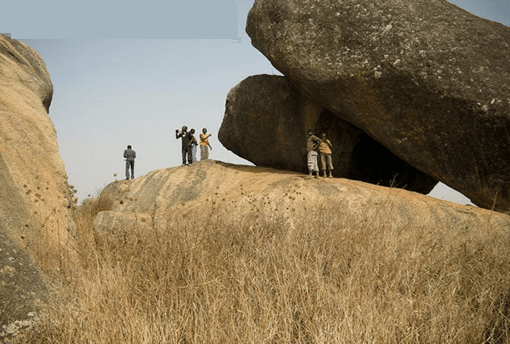
Topography The topography of the state is generally flat with the northern, central, and eastern parts covered with undulating sand dunes running in the Southwest to Northeast direction. The area around the state capital Dutse is very rocky with some low hills. The southern and western parts of the state around Birnin Kudu and Kazaure have the highest elevations with hills as high as 600 millimeters above sea level. The state is bisected by the Hadejia River and traverses the state from the west to the east through Hadejia-Nguru wetlands and empties into Lake Chad.
Location coordinates The state lies between latitudes 11oN and 13oN and longitudes 8oE and 10o35\\’E
Climate With a tropical climate while the temperature varies at different times. High temperatures are normally recorded between the months of April and September.
The daily minimum and maximum temperatures are 15 degree and 35 degree Celsius.
Rainfall The rainy season lasts from May to September with average rainfall of between 600 millimeters to 1000 millimeters. The southern part of the state has a higher rainfall percentage than the northern part.
Vegetation zone The state is situated within the Sudan savannah vegetation zone, but there are traces of Guinea savannah in the southern part of the state. Its total forest covers about 5% due to rainfall characteristics and deforestation due primarily to use of wood for cooking.
Local governments areas The state has 27 Local Government Area Councils headed by elected chairmen and assisted by councilors elected on the platform of a political party.
The implementation of programmes of each local government is the joint responsibility of councilors with various portfolios who constitute the council with the executive chairman as supervisor and a vice assisting.
Reference jigawastate.gov.ng
More
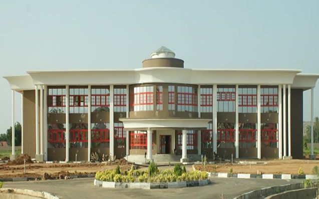
Higher Education Institutions In Jigawa State Federal University, Dutse Husaini Ajamu Polytechnic, Kazaure Jigawa State Polytechnic, Dutse College Of Education, Gumel Binyaminu Usman Polytechnic, Hadejia Jigawa…
Jigawa Local Governments Areas Auyo Birniwa Babura Buji Birnin Kudu Dutse Gumel Gwaram Gwiwa Gagarawa Guri Garki Hadejia Jahun Kiri Kasamma Kafin Hausa Kazaure…
List of Local Government Areas in Jigawa State and their headquarters Jigawa State Local Government Areas and their headquarters, administrative capitals LGAHeadquartersAuyoAuyoBaburaBaburaBiriniwaBiriniwaBirnin KuduBirnin KuduBujiGantsaDutseDutseGagarawaGagarawaGarkiGarkiGumelGumelGwaramGwaramGuriGuriGwiwaGwiwaHadejiaHadejiaJahunJahunKaugamaKaugamaKafin HausaKafin HausaKiyawakiyawaKiri KasamaKiri KasamaKazaureKazaureMaigatariMaigatariMigaMigaMalam MadoriMalam MaduriRingimRingimRoniRoniSule TankarkarSule…
Jigawa State NYSC orientation camp address The address of the NYSC orientation camp in Jigawa State is: NYSC Permanent Camp, opposite Army Barrack, Fanisua Dutse Local…
GIFMIS Code for Federal Medical Centre, Jigawa The GIFMIS Codes for Federal Medical Centre, Jigawa are: SNREVENUE NUMBERREVENUE ITEM DESCRIPTION11000075652CASE FOLDER21000075665CONSULTANCY FEE31000075607Tender Fee41000075636Admission Fee51000075649ANTE NATAL CARE61000097588YARIMA LTD…
Jigawa State of Nigeria Jigawa State, established in August 1991 from the former Kano State, is among Nigeria’s 36 states. It lies in the…
Maps of Jigawa Jigawa is a state in northern Nigeria. It was carved out from Kano State. Jigawa state was created on Tuesday…
Jigawa markets Markets in Jigawa by LGA (Local Government Area) and the market days AUYOAuyo – Friday BABURAKanya – TuesdayBabura – FridayManga…
Construction sector, Jigawa economy The Construction sector in Jigawa state recorded a nominal value added of N32,312.66 million in 2013 and grew by –12.24%…