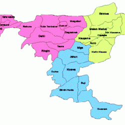
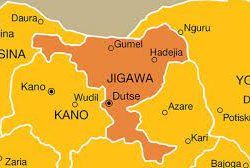
Jigawa State is one of the thirty-six States that constitute the Federal Republic of Nigeria. It is situated in northwestern part of the country between Latitudes 11.00 N to 13.00 N and Longitudes 8.00 E to 10.15 E. Kano and Katsina States border Jigawa to the west, Bauchi State to the east and Yobe State to the northeast. To the north, Jigawa shares an international border with Republic of Niger, which is a unique opportunity for cross-border trading activities. Government readily took advantage of this by initiating and establishing a Free-Trade Zone at the Border town of Maigatari.



Topography
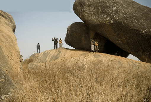
The State has a total land area of approximately 24,742 square kilometers. Its topography is generally characterized by undulating land, with sand dunes of various sizes spanning several kilometers in parts of the State. The southern part of Jigawa comprises the Basement Complex while the northeast is made up of sedimentary rocks of the Chad Formation. The main rivers are Hadejia, Kafin Hausa and Iggi Rivers with a number of tributaries feeding extensive marshlands in northeastern part of the State. Hadejia – Kafin Hausa River traverses the State from west to east through the Hadejia-Nguru wetlands and empties into Lake Chad Basin.
Climate
Jigawa enjoys a Tropical climate characterized by two main seasons – the rainy season brought by the humid south westerly breezes from the far away Atlantic coast of West Africa (May to September); and the “harmattan” dry season, of dusty north easterly winds of the Sahara Desert (from November to April). Maximum temperatures (up to about 40 C) are recorded between the months of March to September, whereas lower temperatures, especially at nighttime during the harmattan season, are sometimes as low as 11 C between October and February. There is a substantial daytime/nighttime temperature variation during this period. Annual rainfall is between 600mm to 1,000mm with an average of about 650mm over the last few years.
Vegetation
Most parts of the State lie within the Sudan Savannah with elements of Guinea Savannah in the southern part.
Total forest in the State is very much below the national average of 14.8%. Due to both natural and human factors, forest cover is being depleted, making northern part of the State highly vulnerable to desert encroachment. The State enjoys vast fertile arable land to which almost all tropical crops could adapt, thus constituting one of its highly prized natural
Population dynamics
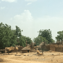
About 6.5 million people inhabit Jigawa State. An earlier 2016 projection by the National Bureau of Statistics put the population of the State at almost 5.83 million. According to MNCH 2 Records, Life expectancy as at 2018 was about 47.8 years for males and 48.5 for females. The state has one of the highest total fertility rates in the country estimates at about 8.5 children per woman of childbearing age in 2016 (NBS Statistical Bulletin). Although population of the State is predominantly rural (90%), the distribution in terms of sex is almost equal between male (50.8% and female 49.2%). This pattern of population distribution is same across various constituencies in the State and between urban and rural
areas.
The socio-cultural situation in Jigawa State could be described as homogeneous with Hausa/Fulani found in all parts of the State. Kanuri are largely found in Hadejia Emirate, with some traces of Badawa mainly in its Northeastern parts. Even though each of the three dominant tribes has continued to maintain its ethnic identity, Islam and a long history of inter-marriage have continued to bind them together.


Government
Jigawa State – which was created out of old Kano State in August 1991 – is one of the 36 States in Federal Republic of Nigeria. As per 1999 Constitution of Federal Republic of Nigeria, the State comprises 27 Local Government Councils, which are divided into 30 State Constituencies, grouped into 11 Federal Constituencies and 3 Senatorial Districts.
In line with the democratic setting in the country, the governments at both the State and Local Government levels are elected, and comprise an Executive with a unicameral legislature. The State legislature has 30 elected members each representing one of the State Constituencies. To complete the State governance structure, there is an independent State Judiciary as the third arm of Government.
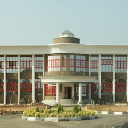
The State Government administrative apparatus is organized into Ministries, Extra ministerial Departments and Parastatals, which are located in the State Capital (some MDAs such as Ministries of Education, Water Agencies and JARDA), have Zonal Offices located across the three Senatorial districts in the State.
Reference
jigawastate.gov.ng
