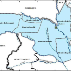
Kouilou, also known as Kwilu or Kuilu, is one of the most significant administrative regions in the Republic of the Congo. Stretching along the country’s coastline, the department is celebrated for its historical, cultural, and geographical importance.
Geography and Location
Kouilou covers an area of 13,650 square kilometers. As of early 2023, the department was home to approximately 97,362 residents, making it a region with a low population density compared to its size.
- Borders:
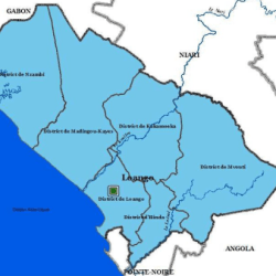
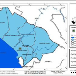
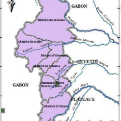
- National Borders: Niari Department and the commune of Pointe-Noire.
- International Borders: Gabon to the northwest and the Cabinda region of Angola to the south.
- Kouilou-Niari River: The department shares its name with the Kouilou-Niari River, a key geographical feature that influences its ecosystem and serves as a natural resource.
Historical Background
Previously, Hinda served as the capital of Kouilou. However, since 2011, the town of Loango has been designated as the administrative capital, reflecting efforts to centralize governance in this coastal department.
Administrative Divisions
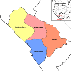
Kouilou is divided into six districts, which streamline governance and local administration:
- Hinda District
- Madingo-Kayes District
- Mvouti District
- Kakamoeka District
- Nzambi District
- Loango District
Each district plays a crucial role in managing local development and facilitating service delivery to the population.


Economic and Cultural Importance
Kouilou’s location along the coast makes it pivotal for trade, fishing, and tourism. The department also holds cultural significance, especially with its proximity to Pointe-Noire, the Republic of the Congo’s economic hub.
