Lagos is Nigeria’s most populated and richest state.
While Abuja is the administrative capital, Lagos is the commercial capital of the country.
Lagos State was created on May 27, 1967 by virtue of State (Creation and Transitional Provisions) Decree No. 14 of 1967, which restructured Nigeria’s Federation into 12 States.
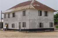
First storey building in Lagos and in Nigeria
Prior to this, Lagos Municipality had been administered by the Federal Government through the Federal Ministry of Lagos Affairs as the regional authority, while the Lagos City Council (LCC) governed the City of Lagos. Equally, the metropolitan areas (Colony Province) of Ikeja, Agege, Mushin, Ikorodu, Epe and Badagry were administered by the Western Region.
The State took off as an administrative entity on April 11, 1968 with Lagos Island serving the dual role of being the State and Federal Capital.
However, with the creation of the Federal Capital Territory of Abuja in 1976, Lagos ceased to be the capital of the State which was moved to Ikeja. Equally, with the formal relocation of the seat of the Federal Government to Abuja on 12th December, 1991, Lagos ceased to be Nigeria’s political capital. Nevertheless, Lagos remains the nation’s economic and commercial capital.
CREATION
Lagos State was created on May 27, 1967 by virtue of State (Creation and Transitional Provisions) Decree No. 14 of 1967, which restructured Nigeria’s Federation into 12 States.
Prior to this, Lagos Municipality had been administered by the Federal Government through the Federal Ministry of Lagos Affairs as the regional authority, while the Lagos City Council (LCC) governed the City of Lagos. Equally, the metropolitan areas (Colony Province) of Ikeja, Agege, Mushin, Ikorodu, Epe and Badagry were administered by the Western Region.
The State took off as an administrative entity on April 11, 1968 with Lagos Island serving the dual role of being the State and Federal Capital.
However, with the creation of the Federal Capital Territory of Abuja in 1976, Lagos ceased to be the capital of the State which was moved to Ikeja. Equally, with the formal relocation of the seat of the Federal Government to Abuja on 12th December, 1991, Lagos ceased to be Nigeria’s political capital. Nevertheless, Lagos remains the nation’s economic and commercial capital. According to extant political records, “Lagos is to the people of Nigeria, what the head is to the body of an individual.”
VEGETATION, CLIMATE, DRAINAGE, WATER BODIES
The dominant vegetation of the State is the swamp forest consisting of the fresh water and mangrove swamp forests both of which are influenced by the double rainfall pattern of the State, which makes the environment a wetland region.
Generally, the State has two climatic seasons: Dry (November-March) and Wet (April-October).
The drainage system of the State is characterized by a maze of lagoons and waterways which constitutes about 22 percent of 787 sq kms (75,755 hectares) of the State total landmass.
The major water bodies are the Lagos and Lekki Lagoons, Yewa and Ogun Rivers. Others are Ologe Lagoon, Kuramo Waters, Badagry, Five Cowries and Omu.
POPULATION
Although Lagos State is of the smallest state in Nigeria, yet it has the highest population, which is over five percent of the national estimate.
According to the 1991 national census, the State has a population of 5,725,116 out of a national estimate of 88,992,220. However, based on a UN study and the State Regional Master Plan, the State is estimated to have above 12 million inhabitants. Out of this population, Lagos metropolitan area is occupied by over 85 percent on an area that is 37 percent of the land area of Lagos State.
The rate of population growth is about 300,000 persons per annum with a population density of about 1,308 persons per sq. kilometer.
In the built up urban areas of metropolitan Lagos, the average density is 20,000 persons per square kilometer. In an recent UN study (1999), the city of Lagos is expected to hit the 24.5 million population mark and thus be among the ten most populous cities in the world by the year 2015.
PEOPLE
Lagos State is inhabited by the Aworis and Ogus in Ikeja and Badagry Divisions respectively, with the Ogus being found mainly in Badagry.
While the indigenous population of Lagos are Aworis, there is, nevertheless, an admixture of other pioneer immigrant settlers collectively call Lagosians but more appropriately the Ekos.
The indigenes of Ikorodu and Epe Divisions are mainly the Ijebus with pockets of Ek-o-Awori settlers along the coastland and riverine areas.
While the State is essentially a Yoruba speaking environment, it is nevertheless a socio-cultural melting pot attracting both Nigerians and foreigners alike.
The situation is attributable to its sound economic base and socio-political importance, which induced a high rate of rural-urban migration to the State metropolitan region.
ADMINISTRATIVE DIVISIONS
With a territorial land area of 356,861 hectares, Lagos State is made up of five administrative divisions, namely Lagos (Eko), Ikeja, Ikorodu, Epe and Badagry.
The divisions were created in May 1968 by virtue of the promulgation of Administrative Divisions (Establishment) Edict No. 3 of April 1968.
The divisions are further divided into 57 local government areas in order to bring governance, development and participatory democracy nearer to the people.
• BADAGRY
The Division is made up of four local government areas: Ojo, Amuwo-Odofin, Ajeromi-Ifelodun and Badagry which also serves as the divisional headquarters.
Badagry enjoys a pride of place in history especially as regards early European contacts with West Africa. By virtue of being a coastal town, Badagry was a major slave outpost and market during the pre-colonial era. It was also the first place in Nigeria where Christianity was preached in 1842. The Agia Cenotaph is a monumental reminder of this act. The original name of the town, Agbede greme, means Agbede’s farm in Ogu language.
The word, “Agbede greme” was later coined to Agbadarigi by the Yoruba settlers and later changed to Badagry by the European slave merchants.
Major settlements in the Division include: Badagry, Ajara, Iworo-Ajido, Akarakumo, Gbaji, Aseri, Egan, Agarin, Ahanfe, Epe, Posi, Mowo, Itoga, Ebiri, Ekunpa, Aradagun, Berekete, Mosafejo, Gayingbo-Topo, Kankon, Moba, Popoji, Oranyan, Tafi-Awori, Yeketome, Ipota, Seme, Iyagbe, Ajegunle, Aiyetoro, Festac and Satellite Towns, Iba, Kirikiri, Agboju-Amuwo, Okokomaiko, Ojo, Amukoko, Alaba-ore, Ijofin, Igbanko, Imore, Ijegun, Odan Group of villages and part of Agara.
• EPE
The division is divided into two local government areas vis; Epe and Ibeju-Lekki with Epe serving as the divisional headquarters.
Epe lies about 89kms north-east of the City of Lagos. Urakaloye was the man reputed to be the ancestral founder of Epe, a name derived from black ants, which invaded Urakaloye’s hunting home-stead.
Hence, the town’s name, Epe, means the forest of black ants. Epe division consists of Epe, Agbowa-Ikosi, Ilara, Odo-Ayandelu, Igbodu, Ejinrin, Poka, Itoikin, Idotun, Ita-Oko, Omi, Temu Ise and Debojo. Others are Apawa, Aba-Titun, Abomite, Afere, Apakin, Abalaye Orogantigan, Kayetoro Eleko, Yegunda, Okunraya, Keta, Arapagi, Aiyeteju, Okunfolu, Osoroko, Olomowewe, Ibeju-Lekki, Akodo, Otolu, Magbon-Alade, Oriba, Iwerekin, Iberekodo, Idado, Igando-Orudu, Tiye, Awoyaya, Ite-Omi, Bogije, Siriwon, Idaso, Orimedu, Olorunkoya, Ojota, Ode-Ifa, Ofin, Igbesibi and Igbolomi, among others.
A peculiar feature of Epe is the presence of a long range of hills, which demarcates the coastal town into equal parts. However, in Ibeju-Lekki, artisanal fishing, sandy beach and coconut fringed Atlantic coastlines are distinctive characteristics of the environment, which has enormous tourism potentials.
Fishing and farming form the major occupations of the inhabitants of the Division, which also includes the Eko-Aworis.
• IKEJA
Ikeja division consists of eight local government authorities namely: Agege, Ifako-Ijaiye, Kosofe, Mushin, Alimosho, Oshodi-Isolo, Somolu and Ikeja which serves as both the seat of the State Government and also the divisional headquarters.
Ikeja, the state capital and administrative nerve center of Lagos State Government, is located 80kms north of Lagos. The division has a concentration of both medium and large scale industries within the Mushin-Isolo-Oshodi and greater Ikeja Industrial Complex, while also having a large agricultural area in its rural Alimosho, Kosofe and Agege districts.
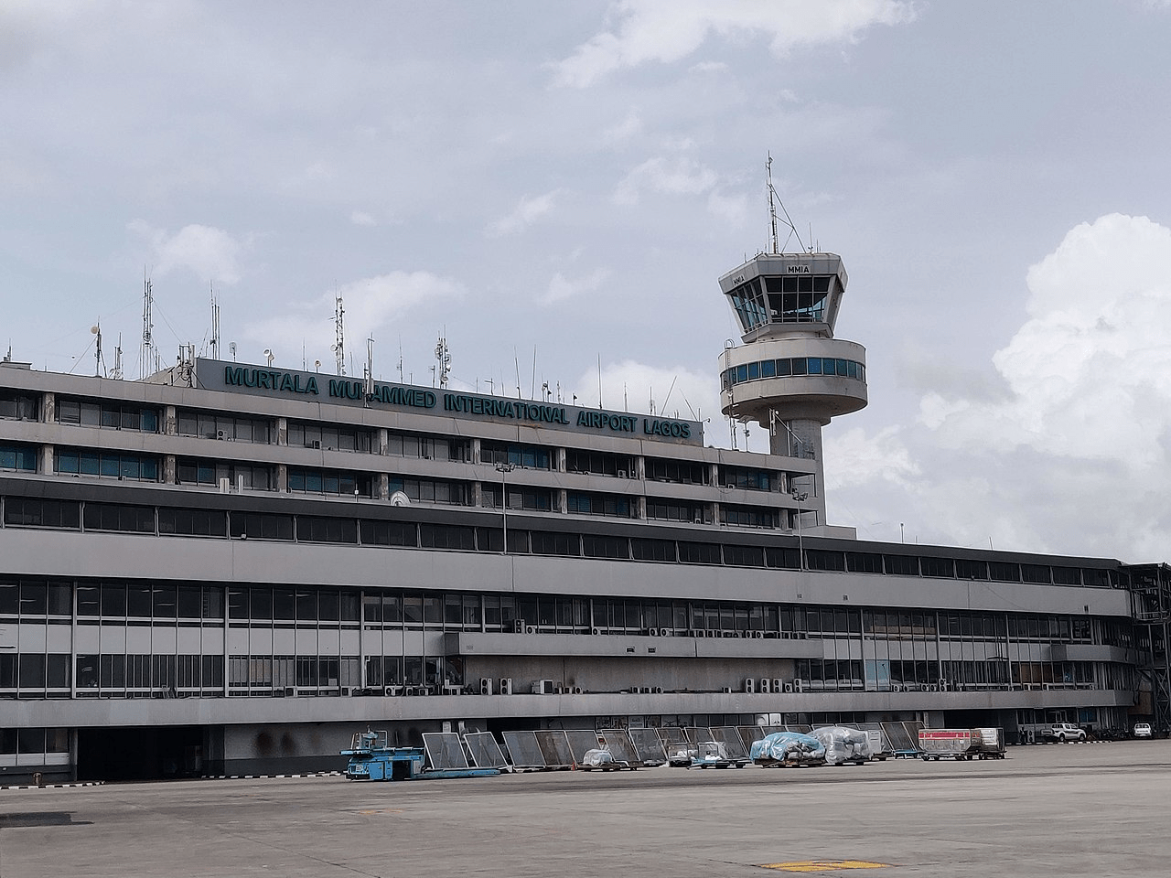
A fledging Central Business District (Alausa/Agidingbi) and Nigeria’s biggest and busiest International Airport (Muritala Mohammed Airport) are situated in the divisional headquarters, Ikeja.
There are over fifty settlements in the division including Isolo, Isheri-Osun, Ikotun, Isheri-Olofin, Meiran, Ejigbo, Egan, Ketu, Ojota, Shangisha, Oworonshoki, Mushin, Abesan, Egbe, Igando, Idimu, Ayobo, Iju, Ifako, Agboyi, Ikosi, Okota, Somolu, Ipaja, Oregun, Isheri-Oke, Oshodi, Oke-Afa, Ojodu, Ogudu, Bariga, Ilupeju, Obanikoro, Akowonjo, Agege, Ijegun, Itire, Ikate, Odi-Olowo, Shasha, Mende, Ikeja and Alimosho.
• IKORODU
Ikorodu lies approximately 36km north of Lagos and derives its name from ‘Oko Odu’ meaning vegetable farm. This farmland was the place first settled by Oga, the crown prince of a Remo King and supposed founder of the town. Hence, the reference to the town as Ikorodu Oga.
The division, by virtue of its location, serves as the gateway to the country’s hinterland and thus an active commercial center and national broadcasting gangway as the transmitters of the Federal Radio Corporation of Nigeria (FRCN), Voice of Nigeria (VON) and those of the State Broadcasting Corporation, LSBC (Radio Lagos/Eko F.M. and LTV), are located there.
The population of the division consists predominately of the Ijebu Remo group that inhabits Ikorodu, Igbogbo, Imota, Ijede, Maya Adio, Isiu, Igbokuta, Ewu-Elepe, Baiyeku, Oreta, Ofin Gberigbe, and Igbalu. However, along the riverine fringes of Ipakodo, Ibese, Majidun and other coastal communities, there is a strong presence of Eko-Awori population.
The indigenes of the division are mostly traders and farmers. Fishing also thrives, especially along the Lagos Lagoon foreshore where there is a lighter port terminal at Ipakodo.
• LAGOS (EKO)
The core of the State and a highly urbanized division consisting of five local government Islets: Lagos Island, Lagos Mainland, Surulere, Apapa and Eti-Osa with the City of Lagos being the pivot of an ever expanding Greater Lagos and the divisional headquarters.
The center and most developed of this chain of Islands is Lagos Island which is called “Eko” by the indigenes. The name ‘Lagos’ is a Lagis de Curamo’ on account of its wetland topography. The Island is the cultural watershed of the White Cap (Idejo) Chieftaincy and metropolitan Lagos with the Oba of Lagos as the paramount monarch and primus inter pares of the State traditional authorities.
Lagos is the chief commercial, financial and maritime nerve-center of Nigeria with seaports at Apapa, Tincan Island, Roro Terminal Ports and Ijora Container Terminal and an ever-expanding Central Business District Tinubu and Victoria Island.
As the economic capital and major port of Africa’s most populous nation, Lagos has attracted immigrants from all over Nigeria and beyond, as well as commercial entrepreneurs and industries from Africa, Europe, Asia and the Americas.
Major Settlements in the Division are Tarkwa Bay, Victoria Island (Iru), Lagos Island, Ikoyi, Obalende, Otto, Ijora, Apapa, Ebute-Metta, Yaba, Iddo, Sangotedo, Mayegun, Ogombo, Ogoyo, Okun-Ibeju, MO-Akinlade, Moba, Alaguntan, Ado, Lamgbasa, Ilasan, Igbo-Efon, Ikota and Ikate-Elegushi.
Lagos
Lagos is the commercial capital of Nigeria and the most populated city in the country and Africa.
Ikoyi
It was the administrative capital of Nigeria until December 1991 following the government’s decision to move the capital to Abuja in the centre of the country.
Lagos is a major African financial centre and is an economic hub.
The city has been described as the cultural, financial, and entertainment capital of Africa, and is a significant influence on commerce, entertainment, technology, education, politics, tourism, art, and fashion.
Lagos is also among the top ten of the world’s fastest-growing cities and urban areas.
The megacity has the fourth-highest GDP in Africa and houses one of the largest and busiest seaports on the continent.
The Lagos metropolitan area is a major educational and cultural centre in Sub Saharan Africa.
Cathedral Church of Christ Marina, Lagos is an Anglican cathedral on Lagos Island, Lagos, Nigeria.
Lagos emerged as a home to the Awori tribe of the Yoruba of West Africa islands, which are contained in the present day Local Government Areas (LGAs) of Lagos Island, Eti-Osa, Amuwo-Odofin and Apapa.
Due to rapid urbanisation, the city expanded to the west of the lagoon to include areas in the present day Lagos Mainland, Ajeromi-Ifelodun, and Surulere.
This led to the classification of Lagos into two main areas: the Island, which was the original city of Lagos, and the Mainland, which it has since expanded into.
This city area was governed directly by the Federal Government through the Lagos City Council, until the creation of Lagos State in 1967, which led to the splitting of Lagos city into the present-day seven Local Government Areas (LGAs), and an addition of other towns (which now make up 13 LGAs) from the then Western Region to form the state.
Third Mainland Bridge across the Lagos Lagoon
The islands are separated by creeks, fringing the southwest mouth of Lagos Lagoon, while being protected from the Atlantic Ocean by barrier islands and long sand spits such as Bar Beach, which stretch up to 100 km east and west.
However, the state capital was later moved to Ikeja in 1976, and the federal capital moved to Abuja in 1991.
Market
Even though Lagos is still widely referred to as a city, the present-day Lagos, also known as “Lagos Metropolitan Area” is an urban agglomeration or conurbation, consisting of 16 LGAs including Ikeja, the state capital of Lagos State.
Ferry terminal
This conurbation makes up 37% of Lagos State total land area, but houses about 85% of the state’s total population.
Airport
The business district of Lagos is home to Tinubu Square, named after the aristocratic slave trader Efunroye Tinubu. Lagos contains Murtala Muhammed International Airport, named after Nigerian president Murtala Muhammad, and is one of the busiest African airports. Lagos National Stadium has hosted various international sports events such as the 1980 African Cup of Nations.
People of Lagos State People from virtually all the ethnic groups in Nigeria inhabit Lagos State. However, the indigenous people of the State maintain…
Lagos State government structure The Government of Lagos State is made up of three statutory organs: The Executive The Legislature The Judiciary An Executive…
Military governors of Lagos State Past military governors of Lagos from Brigadier Mobolaji Johnson, 1967, when Lagos State was created, to Col. Muhammed Buba Marwa,…
LAGOS STATE GOVERNOR’S OFFICE Lagos State came into existence on May 27, 1967 through Decree No. 14 promulgated by the Federal Military Government. Major…
Lagos State NYSC orientation camp address The address of the NYSC orientation camp in Lagos State is: NYSC Permanent Orientation Camp, Iyana Ipaja, Agege, Lagos State.…
A BRIEF HISTORY OF LAGOS STATE Lagos State, located in southwestern Nigeria, is the smallest by land area but one of the most significant states in…
LAGOS STATE NAMES OF SCHOOLS, YEARS OF APPROVAL AND ADDRESSES NAME OF SCHOOLYEAR OF APPROVALADDRESSBarton College2023104 Egbe Road, Ejigbo, IkotunChessington College2023Plot 24, Ogba Road, Alhaja 2 Bus Stop, Shiaba AgegeDanbath College2023Wale Tijani Close, Off Yewa Road, Isawo, IkoroduGovera Secondary School202326, Zion Way Off Olowo Ila Bus Stop, Egan by Lasu Isheri Road, EganHarbottle College20231, Barrister Ihua Street, Olumo junction, Igbe Road, Igbogbo, IkoroduHoneyland College20232, Adebisi Oyenola Street, Idado Estate, Igbo-EfonJNISSI High School (Junior)2023S4TC Medium Housing Estate, Ijaiye, OgbaKingstars College2023Kingstars schools Along Iworo-Ajido Road, Mosafejo-Aradagun, BadagryLolly-Kay College202321, Agbelekale Street, Mafoluku, OshodiMagnify Science Secondary School202318/20, Kolawole Street, BadagryMoral Esteem College20231, Cletus Adobu Street, Fidiso Estate, Abijoh-LekkiNew Ocean Comprehensive High School202370/72, Alaja Road, Megida, AyoboOlanike Dairo Secondary School (Senior)202313, Strachan Lane, Off Strachan Street Orlando, Igbosere roadPark Royal College202386, Marine Road, Apapa GRA.Reigning Diadem College202339, Agura Gberigbe Road, Iyana Odo bus stop, Agura, IkoroduWhitespring College2023Alhaja Aduke Abiodun Street, Off New road, AlausaYecco Eminent College202320, Ade Onabanjo Anuoluwa Street, Abule Panu, Offin, IgbogboABBA COTERIE COLLEGE20221, Davies Crescent, Via TOS Benson Road, Ebute Ipakodo, IkoroduBIGGA HIGH SCHOOL2022Plot 20, Block D, Unity Avenue, Agbede, Olosugbo, IkoroduBIMSTAR COLLEGE202229, Old Ota Road, Ilapo, Off AIT Road, AlagbadoBORN TO-SHINE COLLEGE20224, Rotimi Olaide Street, IdimuCANADIAN GATEWAY HIGH SCHOOL2022107, Ago Palace Way, Okota-Isolo 102214CISTO ACADEMY HIGH SCHOOL202227, Ola Street, Off Asalu Bus Stop, Abaranje Road, IkotunDGF COLLEGE202215, Barr. Olabisi Kolawole Road, Off Amoke Soderu Street, Aruna, IkoroduDOSLAND COLLEGE2022Block 26, Plot 17, Community Road, Ilapo Estate, AlagbadoFAJIP COLLEGE202216, Olu Adebayo Street, Oke AfaGOLDEN WAY COLLEGE202233-37 ROAD 4, 3rd Avenue, Peace Estate, Baruwa, IpajaGREAT OAK COLLEGE202211, Ajagungbade Street, Off Daoudu, Mafoluku, OshodiINSPIRA COLLEGE202229-35 Gberigbe Road, Gbodu, IkoroduINTERGUIDE HIGH SCHOOL20226/8 Toyin Street, Ikeja, LagosJUSEK COLLEGE20225, Agbojojoye Street, Amuwo Odofin, LagosKEENLANE COLLEGE202240, Anite Cresent, Off Godmon Street, OkotaMIKOCHART SECONDARY SCHOOL2022157, Governor’s Road, Emmanuel Bus Stop, IkotunOGUNBOYEJO ADEOLA MEMORIAL COLLEGE20224 & 6 Akpofure Street, Off Araromi Road, Adamo, IkoroduPEDRISI COLLEGE20225, Pedrisi Road, Ogoyo, Off Mobil Road, AjahRASOL PRIVATE COLLEGE202212, Modupe Shitta Street, Off Liasu RoadSIMID COLLEGE202222, Jubril Olabisi Street, Off Idimu Road, EjigboSOLON COLLEGE202229, Onilewura Street, Off Liasu Road, Egbe, IkotunTENDERTOUCH INTELLECTUALS COLLEGE2022322 Road, J-Close, Festac Town,THE CARDINAL HIGH SCHOOL202211/17 Oluwasanmi Adefioye Street, Off Princess Abiola Way, Idimu-Ikotun RoadTHE TENETS COLLEGE (JUNIOR)20227, Tunde Popoola Street, Isokan Estate, Oriokuta, IkoroduTSI COLLEGE2022Plot 156, 11…
Lagos State New Towns Development Authority The Lagos State New Towns Development Authority is a Lagos State Government Agency that develops new towns with functional infrastructure…
List of Local Government Areas in Lagos State and their headquarters Lagos State Local Government Areas and their headquarters, administrative capitals LGAHeadquarters AgegeAgegeAjeromi-IfelodunAjeromi/IfelodunAlimoshoIkotunAmuwo-OdofinFestac TownApapaApapaBadagryBadagryEti-OsaIkoyiEpeEpeIkoroduIkoroduIfako-IjayeIfakoIkejaIkejaIbeju/LekkiAkodoKosofeKosofeLagos IslandLagos IslandLagos MainlandLagos MainlandMushinMushinOshodi-IsoloOshodi/IsoloOjoOjoShomoluShomoluSurulereSurulere Map of Lagos…


")


