List of Rivers in the Philippines: Luzon, Visayas, Mindanao
The Philippines is an archipelagic country made up of thousands of islands, and its rivers are an important part of its geography, ecosystems, agriculture, transportation, communities, and freshwater resources. The country’s rivers range from large drainage systems extending across several provinces to smaller waterways that serve particular towns, cities, and watersheds.
Below is the complete list arranged by island group/region, with continuous serial numbers within each group and tributaries shown beneath their parent rivers.
Rivers of the Philippines by Region
Luzon
River
1
Abra River
2
Abulog River
3
Agno River
4
Angat River
5
Apayao River
6
Bay River
7
Bicol River
8
Cagayan River
9
└─ Chico River
10
└─ Ilagan River
11
└─ Magat River
12
└─ Pinacanauan River
13
└─ Siffu River
14
└─ Mallig River
15
Calumpang River (Batangas)
16
Ifugao River
17
Mabato River
18
Mangangate River
19
Marikina River
20
Morong River
21
Pagsanjan River
22
Pampanga River
23
Pangil River
24
Pansipit River
25
Parañaque River
26
Pasig River
27
└─ San Juan River
28
└─ Taguig River
29
San Juan River
30
San Cristobal River
31
Santa Cruz River
32
Sapang Baho River
33
Siniloan River
34
Tarlac River
35
Tullahan River
36
Tunasan River
37
Umiray River
38
Wawa River
Luzon total: 38 listed rivers and tributaries
Visayas
River
1
Aklan River
2
Banica River
3
Hilabangan River
4
Ilog River
5
Iloilo River
6
Jalaur River
7
Loboc River
8
Panay River
9
Silmugi River
10
Subangdaku River
Visayas total: 10 rivers
Mindanao
River
1
Agus River
2
Agusan River
3
└─ Umayam River
4
Buayan River
5
Cagayan River (Cagayan de Oro)
6
└─ Bubunaoan River
7
└─ Kalawaig River
8
└─ Tagite River
9
Davao River
10
└─ Salug River
11
Guagua River
12
Malungon River
13
Mindanao River
14
└─ Pulangi River
15
└─ Bobonawan River
16
└─ Tigwa River
17
└─ Manupali River
18
└─ Muleta River
19
└─ Sawaga River
20
└─ Maradugao River
21
└─ Kabacan River
22
└─ Buluan River
23
└─ Allah River
24
Tagum River
25
Libuganon River
26
Tagoloan River
Mindanao total: 26 rivers and tributaries
Complete Numbered List
Island Group
River
1
Luzon
Abra River
2
Luzon
Abulog River
3
Luzon
Agno River
4
Luzon
Angat River
5
Luzon
Apayao River
6
Luzon
Bay River
7
Luzon
Bicol River
8
Luzon
Cagayan River
9
Luzon
Chico River
10
Luzon
Ilagan River
11
Luzon
Magat River
12
Luzon
Pinacanauan River
13
Luzon
Siffu River
14
Luzon
Mallig River
15
Luzon
Calumpang River
16
Luzon
Ifugao River
17
Luzon
Mabato River
18
Luzon
Mangangate River
19
Luzon
Marikina River
20
Luzon
Morong River
21
Luzon
Pagsanjan River
22
Luzon
Pampanga River
23
Luzon
Pangil River
24
Luzon
Pansipit River
25
Luzon
Parañaque River
26
Luzon
Pasig River
27
Luzon
San Juan River
28
Luzon
Taguig River
29
Luzon
San Juan River
30
Luzon
San Cristobal River
31
Luzon
Santa Cruz River
32
Luzon
Sapang Baho River
33
Luzon
Siniloan River
34
Luzon
Tarlac River
35
Luzon
Tullahan River
36
Luzon
Tunasan River
37
Luzon
Umiray River
38
Luzon
Wawa River
39
Visayas
Aklan River
40
Visayas
Banica River
41
Visayas
Hilabangan River
42
Visayas
Ilog River
43
Visayas
Iloilo River
44
Visayas
Jalaur River
45
Visayas
Loboc River
46
Visayas
Panay River
47
Visayas
Silmugi River
48
Visayas
Subangdaku River
49
Mindanao
Agus River
50
Mindanao
Agusan River
51
Mindanao
Umayam River
52
Mindanao
Buayan River
53
Mindanao
Cagayan River (Cagayan de Oro)
54
Mindanao
Bubunaoan River
55
Mindanao
Kalawaig River
56
Mindanao
Tagite River
57
Mindanao
Davao River
58
Mindanao
Salug River
59
Mindanao
Guagua River
60
Mindanao
Malungon River
61
Mindanao
Mindanao River
62
Mindanao
Pulangi River
63
Mindanao
Bobonawan River
64
Mindanao
Tigwa River
65
Mindanao
Manupali River
66
Mindanao
Muleta River
67
Mindanao
Sawaga River
68
Mindanao
Maradugao River
69
Mindanao
Kabacan River
70
Mindanao
Buluan River
71
Mindanao
Allah River
72
Mindanao
Tagum River
73
Mindanao
Libuganon River
74
Mindanao
Tagoloan River
For geographical purposes, Philippine rivers are commonly discussed according to the country’s three major island groups: Luzon, the Visayas, and Mindanao. The national hydrological system includes 18 major river basins recognized for water-resource and flood-management purposes. These include the Cagayan, Mindanao, Agusan, Pampanga, Agno, Abra, Pasig-Marikina-Laguna de Bay, Bicol, Abulog, Tagum-Libuganon, Ilog-Hilabangan, Panay, Tagoloan, Agus, Davao, Cagayan de Oro, Jalaur, and Buayan-Malungon basins.
Among the country’s major waterways, the Cagayan River is generally identified as the longest river in the Philippines. It flows through northern Luzon and empties into the Philippine Sea. Other major river systems include the Mindanao River system, Agusan River, Pampanga River, Agno River, and Abra River.
The following is a regional list of rivers in the Philippines, including major rivers and tributaries.
Rivers in Luzon
Luzon contains some of the country’s largest river systems. Its rivers drain mountainous areas, agricultural plains, urban centers, and coastal regions. The Cagayan River, Pampanga River, Agno River, Abra River, and Bicol River are among the major river systems associated with Luzon. The Cagayan basin is particularly extensive and is the largest of the country’s major river basins.
Abra River
The Abra River is one of northern Luzon’s significant river systems. It is associated with the Abra River Basin, one of the 18 major river basins recognized in the Philippines. The river and its watershed are important to communities and agricultural areas in the Cordillera and adjoining parts of northern Luzon.
Abulog River
The Abulog River, also spelled Abulug in some references, is located in northern Luzon. Its watershed is recognized separately as the Apayao-Abulug major river basin in current PAGASA hydrological monitoring.
Agno River
The Agno River is one of the major rivers of Luzon and is associated with the Agno River Basin. The basin is one of the 18 major river basins monitored for hydrological conditions in the Philippines.
Angat River
The Angat River is an important waterway in Central Luzon. Its watershed is particularly significant because of the Angat system and its role in water resources and flood management. PAGASA lists the Angat as a major sub-basin within its national hydrological monitoring system.
Apayao River
The Apayao River is located in northern Luzon and is associated geographically and hydrologically with the Apayao-Abulug river system.
Bay River
The Bay River is a river in the southern part of Luzon associated with the Laguna de Bay area and surrounding communities.
Bicol River
The Bicol River is one of the major river systems in the Bicol region. The Bicol River Basin is one of the 18 major river basins recognized for national hydrological monitoring.
Cagayan River
The Cagayan River is the longest river in the Philippines. Sources commonly give its length as approximately 505 kilometers, while some general geographical references give a figure of about 520 kilometers depending on measurement methodology. It flows across northern Luzon before reaching the Philippine Sea.
The Cagayan River has an extensive drainage basin covering parts of several provinces. Its tributaries include:
Chico River
Ilagan River
Magat River
Pinacanauan River
Siffu River
Mallig River
The Cagayan River Basin is the largest of the Philippines’ major river basins by drainage area. A Philippine government reference lists the basin at approximately 27,280 square kilometers and the river length at 505 kilometers.
Calumpang River
The Calumpang River of Batangas is an important waterway in Batangas Province. It passes through urban and residential areas and ultimately connects the inland drainage of Batangas with the coastal environment.
Ifugao River
The Ifugao River is associated with the mountainous landscapes of the Cordillera region, where steep terrain produces numerous streams and tributaries that contribute to larger watersheds.
Mabato River
The Mabato River is one of the rivers included among Luzon’s regional waterways.
Mangangate River
The Mangangate River is a waterway in Luzon and forms part of the network of rivers and drainage channels serving communities in the island’s lowland areas.
Marikina River
The Marikina River is one of the best-known waterways in Metro Manila. It forms part of the Pasig-Marikina-Laguna de Bay hydrological system, one of the country’s 18 major river basins.
The river is particularly important to flood management in the metropolitan area because its watershed is connected with densely populated communities.
Morong River
The Morong River is a river in Luzon included among the region’s waterways.
Pagsanjan River
The Pagsanjan River is located in Laguna and is associated with the river systems draining toward Laguna de Bay. It is also widely known for the natural scenery and tourism areas along its course.
Pampanga River
The Pampanga River is one of the largest river systems in Luzon and one of the country’s major river basins. It drains a large portion of Central Luzon before reaching Manila Bay. The Pampanga Basin is among the major river basins monitored by PAGASA.
Pangil River
The Pangil River of Laguna is another waterway in the Laguna area and forms part of the extensive network of rivers flowing toward the Laguna de Bay drainage system.
Pansipit River
The Pansipit River is located in Batangas and provides an important connection between the waters of Taal Lake and Balayan Bay. Its geographical setting makes it an important part of the hydrology of the Taal Lake area.
Parañaque River
The Parañaque River is an urban waterway in Metro Manila. Like many waterways in the metropolitan region, it is closely associated with urban drainage, flood management, and the movement of water toward Manila Bay.
Pasig River
The Pasig River is one of the most recognizable rivers in the Philippines. It flows through Metro Manila and historically provided an important waterway connecting Laguna de Bay with Manila Bay. The Pasig River is part of the Pasig-Marikina-Laguna de Bay river basin, which is one of the country’s 18 major river basins.
Its tributaries include:
San Juan River
Taguig River
San Juan River
The San Juan River is a major tributary within the metropolitan river system. It passes through heavily urbanized areas and ultimately contributes to the Pasig River system.
San Cristobal River
The San Cristobal River is located in Laguna and forms part of the waterways draining toward Laguna de Bay.
Santa Cruz River
The Santa Cruz River is another river associated with Laguna and its extensive lake drainage network.
Sapang Baho River
The Sapang Baho River is an urban waterway in Luzon associated with the Metro Manila and Laguna de Bay drainage environment.
Siniloan River
The Siniloan River is located in Laguna and is part of the region’s network of waterways draining toward Laguna de Bay.
Tarlac River
The Tarlac River is located in Central Luzon and serves as an important local waterway within the agricultural and urban landscapes of Tarlac Province.
Tullahan River
The Tullahan River is an urban river in Metro Manila. It forms part of the interconnected drainage system serving densely populated communities in the metropolitan area.
Tunasan River
The Tunasan River is a waterway in the southern portion of Metro Manila, contributing to the drainage network associated with the Laguna de Bay region.
Umiray River
The Umiray River is located in eastern Luzon and is associated with the mountainous watershed extending toward the Pacific coast.
Wawa River
The Wawa River is associated with the mountainous area of Rizal Province and the Marikina watershed. The river and its surrounding landscape are particularly important in discussions of water resources and watershed protection.
Rivers in the Visayas
The Visayas is the central island group of the Philippines and contains numerous rivers distributed across Panay, Negros, Cebu, Bohol, Leyte, Samar, and other islands. The region’s waterways include both large river systems and shorter rivers that flow directly from mountainous interiors to surrounding seas.
Several Visayan rivers are also associated with major river basins recognized by the Philippine government, including the Panay, Jalaur, and Ilog-Hilabangan basins.
Aklan River
The Aklan River is one of the important rivers of Panay Island. It flows through Aklan Province and is associated with the agricultural and natural landscapes of northwestern Panay.
Banica River
The Banica River is a river in the Visayas associated with Negros Island. It is among the regional waterways that contribute to the island’s local drainage systems.
Hilabangan River
The Hilabangan River is an important river in the Visayas and forms part of the Ilog-Hilabangan major river basin. The basin is one of the 18 major Philippine river basins monitored by PAGASA.
Ilog River
The Ilog River is located in Negros and is closely associated with the Ilog-Hilabangan river system. Its watershed is important to the surrounding agricultural and lowland areas.
Iloilo River
The Iloilo River is an important waterway in Iloilo Province on Panay Island. It is closely connected with Iloilo City and the coastal environment of Iloilo Strait.
The river has historically played an important role in commerce, settlement, fisheries, transportation, and the development of Iloilo’s urban waterfront.
Jalaur River
The Jalaur River is one of the principal rivers of Panay Island. It is associated with the Jalaur River Basin, one of the Philippines’ 18 major river basins.
The river system is important to agriculture and water resources in Iloilo Province.
Loboc River
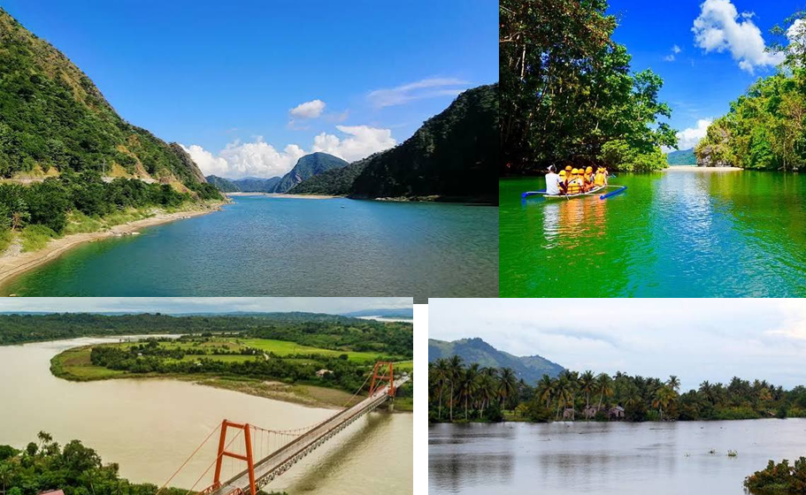
The Loboc River is one of the best-known rivers of Bohol. It flows through the island’s tropical landscape and is widely recognized for its scenic river environment.
The river is surrounded by forested and rural landscapes in portions of its course and has become an important destination for river-based tourism in Bohol.
Panay River
The Panay River is a major waterway of Panay Island. The Panay River Basin is recognized as one of the country’s major river basins, reflecting the river’s importance to the island’s water resources.
Silmugi River
The Silmugi River is located in Cebu and is one of the waterways included in listings of rivers in the Visayas.
Subangdaku River
The Subangdaku River is located in Southern Leyte. It is one of the rivers contributing to the drainage systems of the eastern Visayas.
Rivers in Mindanao
Mindanao contains some of the largest and most extensive river systems in the Philippines. Among its major waterways are the Agusan River, Mindanao River, Pulangi River, Agus River, Davao River, Tagum River, and Tagoloan River.
The Mindanao River Basin is one of the country’s largest river basins, while the Agusan Basin is another major hydrological system. PAGASA also recognizes Agus, Davao, Tagum-Libuganon, Cagayan de Oro, Buayan-Malungon, and Tagoloan among the country’s 18 major river basins.
Agus River
The Agus River is located in northern Mindanao and is particularly important to the hydrology of Lanao del Sur and Lanao del Norte. The river is associated with the Agus River Basin, one of the major river basins monitored nationally.
The Agus system is also associated with Lake Lanao and the waterways flowing toward Iligan Bay.
Agusan River
The Agusan River is one of the largest rivers in Mindanao and one of the country’s principal river systems. It flows through the Agusan Valley before reaching Butuan Bay.
The Agusan River Basin is one of the 18 major river basins in the Philippines. Government references give the river a length of approximately 350 kilometers, although figures can vary slightly according to measurement methodology.
Its listed tributary in this river group is:
Umayam River
The Umayam River is an important tributary associated with the Agusan watershed.
Buayan River
The Buayan River is located in southern Mindanao and is associated with the Buayan-Malungon major river basin. PAGASA identifies Buayan-Malungon as one of the country’s 18 major river basins.
Cagayan River of Cagayan de Oro
The Cagayan River of Cagayan de Oro is a separate river from the Cagayan River of northern Luzon. It flows through or near Cagayan de Oro City and is commonly referred to as the Cagayan de Oro River.
The Cagayan de Oro River Basin is one of the 18 major river basins recognized for national hydrological monitoring.
Its listed tributaries include:
Bubunaoan River
Kalawaig River
Tagite River
The Philippine Department of Environment and Natural Resources also lists the Cagayan de Oro River among classified water bodies in Region X.
Davao River
The Davao River is a major waterway in southeastern Mindanao and is associated with the Davao River Basin. The Davao Basin is one of the country’s 18 major river basins.
Its listed tributary is:
Salug River
Guagua River
The Guagua River is a river of Mindanao included among the island’s regional waterways.
Malungon River
The Malungon River is associated with the Buayan-Malungon river system in southern Mindanao. The Buayan-Malungon basin is one of the major river basins recognized by PAGASA.
Mindanao River
The Mindanao River, also known as the Rio Grande de Mindanao, is one of the largest river systems in the Philippines. Government references list the Mindanao River Basin as having a drainage area of approximately 23,169 square kilometers and a river length of about 373 kilometers.
The system encompasses a complex network of tributaries and sub-river systems across central and southern Mindanao.
Pulangi River
The Pulangi River is one of the most important tributaries of the Mindanao River system. It flows through central Mindanao and is a major waterway of Bukidnon and neighboring areas.
The Pulangi system includes several tributaries:
Bobonawan River
Tigwa River
Manupali River
Muleta River
Sawaga River
The Pulangi River is also significant in the broader Mindanao drainage system because it contributes substantial water flow to the Mindanao River.
Maradugao River
The Maradugao River is a tributary within the broader Mindanao River drainage system.
Kabacan River
The Kabacan River is another tributary associated with the Mindanao River system and the agricultural landscapes of central Mindanao.
Buluan River
The Buluan River is a river in central Mindanao and forms part of the extensive network of waterways connected with the Mindanao drainage system.
Allah River
The Allah River is another significant tributary associated with the Mindanao River system. Its watershed extends through areas of central and southern Mindanao.
Tagum River
The Tagum River is an important river in southeastern Mindanao. It is associated with the Tagum-Libuganon major river basin, one of the 18 major river basins recognized by PAGASA.
The river contributes to the drainage system around Tagum and surrounding areas before reaching the coastal environment.
Libuganon River
The Libuganon River is associated with the Tagum-Libuganon river system. The Tagum-Libuganon Basin is one of the country’s designated major river basins.
Tagoloan River
The Tagoloan River is located in northern Mindanao and is associated with the Tagoloan River Basin. PAGASA recognizes the Tagoloan Basin as one of the Philippines’ 18 major river basins.
The Department of Environment and Natural Resources also lists the Tagoloan River among classified water bodies in Region X, with the river extending through parts of Misamis Oriental and Bukidnon.
The Importance of Philippine Rivers
Rivers in the Philippines have geographical, ecological, agricultural, economic, and social importance. Because the country has a mountainous terrain and receives substantial seasonal rainfall, rivers provide natural pathways through which water moves from upland watersheds toward lakes, bays, seas, and other lowland environments.
Rivers and Agriculture
Agriculture depends heavily on freshwater resources. River systems supply water to farming areas, particularly in major agricultural plains such as Central Luzon and the river valleys of northern and central Mindanao.
Large river basins also provide fertile floodplains where sediments deposited by rivers can contribute to productive agricultural landscapes.
Rivers and Flood Management
Rivers are also central to flood management. During periods of intense rainfall, river channels and their surrounding watersheds receive large quantities of runoff. When rainfall exceeds the capacity of waterways, flooding can occur in downstream communities.
PAGASA maintains hydrological monitoring for the country’s 18 major river basins and provides basin-level flood information. These include the Pampanga, Agno, Bicol, Cagayan, Pasig-Marikina-Laguna de Bay, Abra, Cagayan de Oro, Ilog-Hilabangan, Jalaur, Panay, Tagum-Libuganon, Apayao-Abulug, Agusan, Agus, Buayan-Malungon, Davao, Mindanao, and Tagoloan basins.
Rivers and Cities
Many Philippine cities developed near rivers because waterways historically provided access to transportation, water, food, agriculture, trade, and settlement.
The Pasig River, for example, has played a major role in the historical development of Metro Manila. The Iloilo River is closely associated with Iloilo City’s waterfront, while the Cagayan de Oro River is a defining geographic feature of Cagayan de Oro.
Other cities and communities across the country have similarly developed around river valleys, deltas, and coastal river mouths.
Rivers and Biodiversity
Philippine rivers support freshwater ecosystems and provide habitats for fish, aquatic plants, birds, amphibians, reptiles, insects, and other organisms. River ecosystems are connected to surrounding forests, wetlands, agricultural lands, lakes, estuaries, and coastal waters.
Healthy upland forests are particularly important because they influence how rainfall enters river systems. Vegetation can reduce erosion and help regulate runoff, while degraded watersheds can contribute to increased sedimentation and faster surface runoff.
Rivers and Tourism
Several Philippine rivers have become destinations for nature-based tourism. The Loboc River in Bohol, for example, is widely known for its scenic landscapes and river tourism. Rivers in Luzon and Mindanao also support activities such as rafting, kayaking, sightseeing, fishing, and ecotourism.
The recreational value of a river often depends on the condition of the surrounding watershed. Clean water, intact vegetation, attractive landscapes, and healthy aquatic ecosystems can all contribute to a river’s tourism potential.
Major River Systems of the Philippines
The country’s largest river systems demonstrate the geographical diversity of the archipelago.
The Cagayan River is the longest river and has the largest drainage basin. The Mindanao River has one of the country’s largest drainage areas, followed by the Agusan River and Pampanga River systems. A Philippine government reference lists the Cagayan, Mindanao, Agusan, and Pampanga basins as the four largest among the country’s major river basins by drainage area.
River system
Island group
Approximate length
Cagayan River
Luzon
505 km
Mindanao River
Mindanao
373 km
Agusan River
Mindanao
350 km
Pampanga River
Luzon
260 km
Agno River
Luzon
206 km
Abra River
Luzon
181 km
Pasig-Marikina-Laguna de Bay system
Luzon
78 km
Bicol River
Luzon
136 km
Abulog River
Luzon
175 km
Tagum-Libuganon system
Mindanao
89 km
Ilog-Hilabangan system
Visayas
178 km
Panay River system
Visayas
152 km
Tagoloan River
Mindanao
106 km
Agus River
Mindanao
36 km
Davao River
Mindanao
150 km
Cagayan de Oro River
Mindanao
90 km
Jalaur River
Visayas
123 km
Buayan-Malungon system
Mindanao
64 km
The figures in this table are basin or river-system figures from a Philippine government reference and may differ from measurements used in other geographical sources.
Complete Regional List of Rivers
The rivers covered here are grouped below according to the three major island groups.
Luzon
Abra River
Abulog River
Agno River
Angat River
Apayao River
Bay River
Bicol River
Cagayan River
Chico River
Ilagan River
Magat River
Pinacanauan River
Siffu River
Mallig River
Calumpang River (Batangas)
Ifugao River
Mabato River
Mangangate River
Marikina River
Morong River
Pagsanjan River
Pampanga River
Pangil River
Pansipit River
Parañaque River
Pasig River
San Juan River
Taguig River
San Juan River
San Cristobal River
Santa Cruz River
Sapang Baho River
Siniloan River
Tarlac River
Tullahan River
Tunasan River
Umiray River
Wawa River
Visayas
Aklan River
Banica River
Hilabangan River
Ilog River
Iloilo River
Jalaur River
Loboc River
Panay River
Silmugi River
Subangdaku River
Mindanao
Agus River
Agusan River
Umayam River
Buayan River
Cagayan River (Cagayan de Oro)
Bubunaoan River
Kalawaig River
Tagite River
Davao River
Salug River
Guagua River
Malungon River
Mindanao River
Pulangi River
Bobonawan River
Tigwa River
Manupali River
Muleta River
Sawaga River
Maradugao River
Kabacan River
Buluan River
Allah River
Tagum River
Libuganon River
Tagoloan River
The rivers of the Philippines form an interconnected network extending from the mountainous interiors of Luzon, the Visayas, and Mindanao to the country’s bays, seas, lakes, and coastal wetlands. Some, such as the Cagayan, Pampanga, Agno, Abra, Agusan, Mindanao, and Pulangi, are large regional systems, while others serve primarily local watersheds and communities.
These rivers are more than geographic features. They support agriculture, freshwater ecosystems, settlements, water resources, flood-management systems, transportation, fisheries, and tourism. Their watersheds also connect upland forests with lowland communities and coastal environments.
The national importance of these waterways is reflected in the Philippines’ system of 18 major river basins, which provides a framework for hydrological monitoring, flood forecasting, water-resource management, and environmental planning.
Taken together, the rivers listed across Luzon, the Visayas, and Mindanao illustrate the extensive and geographically diverse freshwater network that runs through the Philippine archipelago.
List of Rivers in Ogun State Ogun State is drained by fast flowing coastal rivers and empty into the lagoons of Lagos State. The most important…
List of Rivers State High Court Judges The judicial arm of the Rivers State government has authority and responsibility for the interpretation and application of the state’s…
List of Local Government Areas in Rivers State and their headquarters Rivers State Local Government Areas and their headquarters, administrative capitals LGAHeadquartersAhoada EastAhoadaAndoniNgoAbua/OdualAbuaAsari-ToruBugumaAkuku ToruAbonnemaAhoada WestAkinimaBonnyBonnyDegemaDegemaElemeElemeEmuohaEmuohaEtcheOkehiGokanaKporIkwerreIsiokpoKhanaBoriObio/AkporRumuodoOgu/BoloOguOgba/Egbema/NdoniOmokuOkrikaOkrikaOmummaEberiOpobo/NkoroOpobo TownOyigboAfamPort-HarcourtPort-HarcourtTaiSakpenwa Map of Rivers State showing…
List of 25 Local Government Areas in Rivers State and their headquarters The 25 Local Government Areas in Rivers State and their headquarters LGAHeadquartersPort HarcourtPort HarcourtObio-AkporRumuodumayaOkrikaOkrikaOgu–BoloOguElemeNchiaTaiSakpenwaGokanaKporKhanaBoriOyigboAfamOpobo–NkoroOpobo TownAndoniNgoBonnyBonnyDegemaDegemaAsari-ToruBugumaAkuku-ToruAbonnemaAbua–OdualAbuaAhoada WestAkinimaAhoada EastAhoadaOgba–Egbema–NdoniOmokuEmohuaEmohuaIkwerreIsiokpoEtcheOkehiOmumaEberi Rivers State Rivers…
List of Cities in the Philippines Complete list of all 149 cities in the Philippines, organized by region with province or area, city classification and 2024…
List of Ethnic Groups in Philippines Ethnic Groups in the Philippines: A Guide to Its Diverse Population Ethnic groups in the Philippines, from Tagalog and Visayan…