The land area of a country has always been a key element in defining its geographic, economic, and political significance. Land area influences not only natural resource availability and economic potential but also population density, regional climate, and biodiversity. In this detailed guide, we’ll explore the land areas of countries worldwide, examine which are the largest and smallest, and delve into the unique aspects of various regions.
Understanding Land Area and Its Measurement
Land area is the total space within the boundaries of a country, usually measured in square kilometers or square miles. This measurement is typically limited to land, excluding bodies of water within a country’s territory. Accurate measurement requires modern tools like Geographic Information Systems (GIS), which allow for precise mapping and spatial data analysis.
Largest Countries by Land Area
1. Russia – The World’s Largest Country
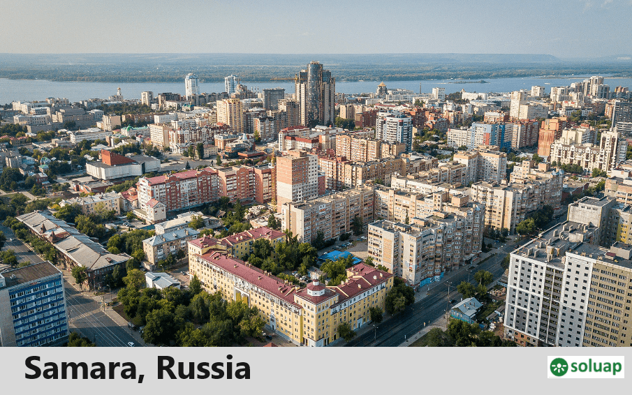
Russia stands out as the largest country in the world, with a land area of approximately 17.1 million square kilometers. Stretching across Europe and Asia, it spans multiple time zones and boasts a diverse landscape, including vast forests, tundra, and mountainous regions.

2. Canada
Canada, with a land area of 9.98 million square kilometers, ranks as the second-largest country. Known for its stunning natural beauty, Canada is home to expansive forests, prairies, and Arctic tundra, with a significant portion of its territory consisting of freshwater lakes.
3. United States
The United States follows with a land area of 9.63 million square kilometers, covering a wide variety of climates and geographies. From the deserts of Arizona to the forests of the Pacific Northwest, the U.S. has one of the most diverse landscapes in the world.
4. China
China, with 9.6 million square kilometers, is the largest country in Asia by land area. China’s topography includes everything from deserts to fertile plains, with unique features such as the Gobi Desert and the Himalayas.
5. Brazil
Covering 8.5 million square kilometers, Brazil is the largest country in South America. The Amazon Rainforest, which dominates much of Brazil’s landscape, contributes to the country’s significant ecological influence and biodiversity.
6. Australia
Australia has a land area of 7.68 million square kilometers and is the largest country in Oceania. Known for its arid deserts, tropical rainforests, and distinctive wildlife, Australia has a vast yet sparsely populated landmass.
7. India
India covers 3.29 million square kilometers and is characterized by a vast range of ecosystems, from the Himalayas in the north to the coastal regions in the south. India’s dense population and rich biodiversity make it a globally important nation in both human and ecological terms.
Smallest Countries by Land Area
1. Vatican City
As the world’s smallest country, Vatican City covers only 44 hectares (0.17 square miles). Located within Rome, it serves as the headquarters of the Roman Catholic Church and the residence of the Pope.
2. Monaco
Monaco, covering just 2 square kilometers, is located on the French Riviera and is renowned for its luxurious lifestyle, casinos, and status as a tax haven.
3. Nauru
Nauru is an island country in Micronesia, with a land area of 21 square kilometers. It is known for its phosphate resources and is one of the least-visited countries due to its remote location and limited infrastructure.
4. Tuvalu
Tuvalu covers about 26 square kilometers and consists of a series of low-lying islands in the Pacific Ocean. Rising sea levels pose an ongoing threat to the country’s existence.
Land Area by Continent
Africa
Africa spans approximately 30.37 million square kilometers and is the second-largest continent by both area and population. With vast deserts like the Sahara and fertile regions like the Congo Basin, Africa’s land area includes significant ecological and cultural diversity.
Asia
Asia, the largest continent, covers 44.58 million square kilometers. Home to the world’s tallest mountains (the Himalayas) and most populous countries, such as China and India, Asia’s land area allows for a vast array of climates and ecosystems.
Europe
Europe’s land area is about 10.18 million square kilometers. Although smaller in comparison to other continents, it has a high population density and significant historical and cultural landmarks.
North America
North America covers 24.71 million square kilometers. With varied landscapes from Canada’s tundra to the tropical forests in Central America, the continent holds a diversity of climates and biomes.
South America
South America has an area of 17.84 million square kilometers and is known for the Amazon Rainforest, the Andes Mountains, and a predominantly tropical climate.
Oceania
Oceania includes Australia and the Pacific islands, covering 8.52 million square kilometers. Its land area consists mainly of oceanic islands, with unique biodiversity and ecosystems.
The Importance of Land Area for Countries
Population Density and Land Area
Countries with large land areas often have lower population densities, allowing for more natural resource distribution. For example, Canada’s low population density allows it to maintain vast wilderness areas, while smaller countries like Monaco face space constraints that result in high population densities.
Economic Impact
A large land area can provide a country with abundant natural resources, supporting industries like agriculture, mining, and tourism. However, land area alone doesn’t determine economic power; factors like infrastructure, governance, and resource management play crucial roles.
Climate and Land Usability
Climate affects how land can be used within a country. For example, Russia’s northern areas have limited agricultural use due to harsh winters, while Brazil’s tropical climate supports the Amazon Rainforest, making it a biodiversity hotspot.
Geographic Information Systems (GIS) in Land Area Mapping
GIS technology has revolutionized the way countries measure and manage their land areas. By collecting data from satellites and other sources, GIS allows for detailed mapping, resource tracking, and land management, making it easier to monitor environmental changes.
Environmental Challenges Related to Land Area
The vastness of a country’s land area often poses unique environmental challenges. Deforestation, desertification, and urban sprawl can affect larger countries, especially those with diverse ecosystems. Smaller countries, particularly island nations, are at higher risk from climate change, as rising sea levels threaten to reduce their land area.
FAQs on Land Area of Countries
- What is the largest country by land area?
- Russia, covering 17.1 million square kilometers.
- Which country has the smallest land area?
- Vatican City, with just 0.17 square miles.
- Why does Canada have such a low population density?
- Canada’s large land area and harsh northern climates result in low population density, with most Canadians living near the U.S. border.
- How does land area affect a country’s economy?
- A large land area can provide more resources, but economic success also depends on how those resources are managed and the country’s development infrastructure.
- Is land area the same as landmass?
- Land area refers to the measured space within a country’s borders, while landmass generally refers to the total land surface of a continent or region.
- Which continent has the largest land area?
- Asia, with 44.58 million square kilometers.


