The Nunguraba (Lunguda) people who today inhabit Guyuk Local Government Area of Adamawa State and parts of Gombe State originated from the Middle East.
They migrated from there during the general dispersal of races of the world from the area. They moved west ward in direction of sunset with the aim of reaching it. They realized the futility of this exercise, when they reached Wanda a small flat land on Lunguda Plateau in the present day Gombe State. In search of land for Agricultural purposes, migrated to their present day location.
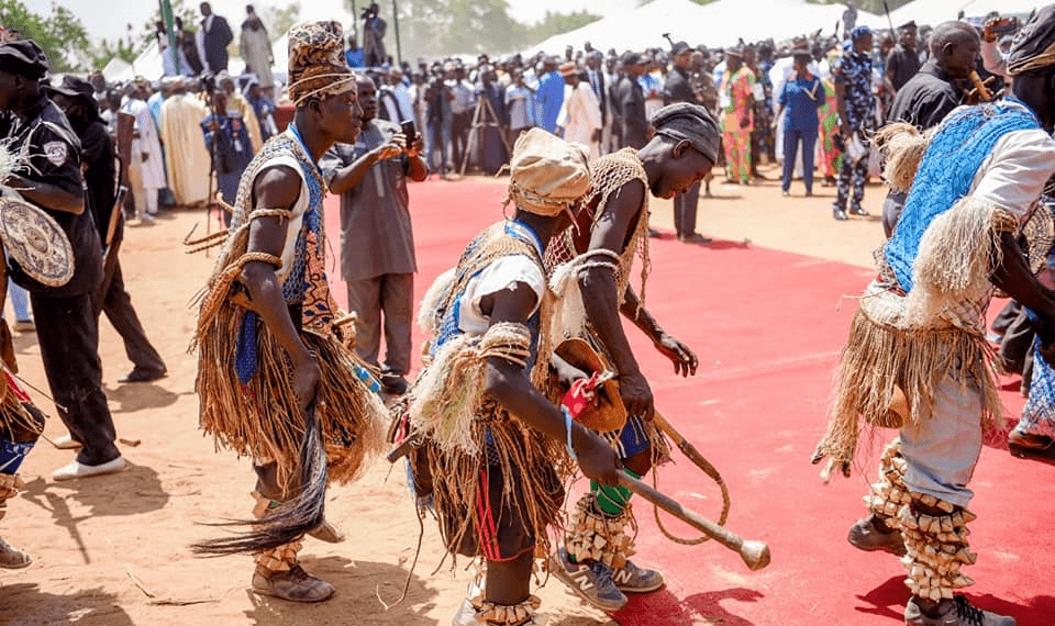
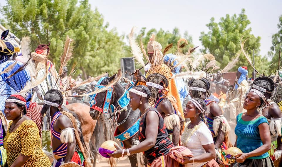
Like many ethnic groups of Nigeria the Lunguda people had no centrally recognized authority structure before the advent of colonial rule. They lived in small form of clannish loose confederation with each clan having its own head. They were however bounded by one language and tradition. “Nunguraya” as the people call themselves, means interwoven or interconnected. The people are one. As a result of their oneness there existed a form of defense pact among all the various villages. These defense pacts kept the Lunguda people consistently undefeated throughout the era of inter tribal warfare.
There was also the acknowledgement of the rain making priest in Lamza. Guyuk, Kurnyi and Wala Lunguda. In 1904 however the Lunguda nation engaged the white man in a fierce battle in BanjirThis war nearly broke the fighting spirit of the Lunguda Man because of the superiority of the fire-emanating weapons of the white man. In other words the white man only subdued them.
A district council was formed in 1948 under the leadership of Grema Parku, this council was the first nationally accepted rule by the Lunguda man. The council consisted of seven villages: Dukul, Guyuk, Banjiram, Kola, Gwanah, Lokoro and Bobini. It had Mallam Grema Parku as its Chairman. He represented the District in the Numan native authority in that capacity. The year 1948 marked the beginning of the formal coming together of the Lunguda people under some form of central adminstration in the area.
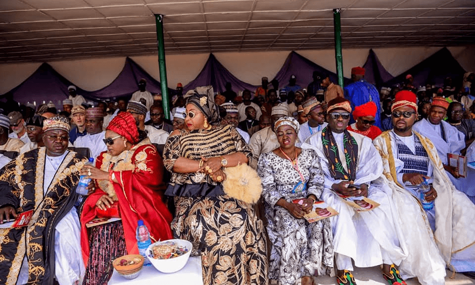
The idea of having a paramount chief among the Lunguda was giving serious consideration in 1954, when the colonial administration wanted to present 3rd Class staff of office to each of the District Heads in Nu man native authority, so as to boast the chieftaincy status of these areas. Referendum was conducted after which the ruling house of Guyuk was on unanimously accepted to produce a candidate.
After serious of meetings by the “Bilamaha” and “Nakatebehe” King makers of the whole Lunguda villages Mallam Yoila Jarangalu emerged as the popular candidate in 1956
The Chieftaincy of Lunguda is rotated between two ruling clans “Bongsibe” and “Bwongkubebe” Mallam Yoila who belong to the Bonsibe was installed in 1957. Thus was the first Lunguda Chief to be presented third class staff of office.
Today however the chiefdom has seven district heads and closed to sixty villages.
The LGA has a population of approximately 70,526 in 1991.
The heterogenous makeup of the approximately 1000 square kilometre land area consists of Lunguda, Waja, Fulani, Bura Lalaand Kanakuru.
The major language spoken is Lunguda.
There are also a variety of types of social organisations from the land based hierarchical systems of Lunguda to kinship-oriented patterns of the Fulani cattle rearers.
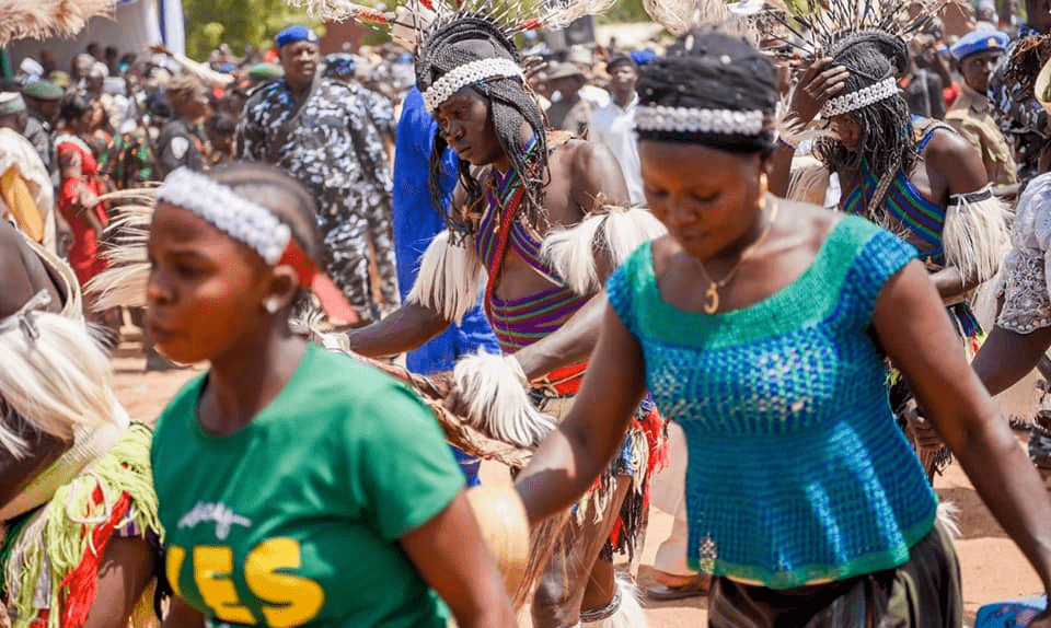
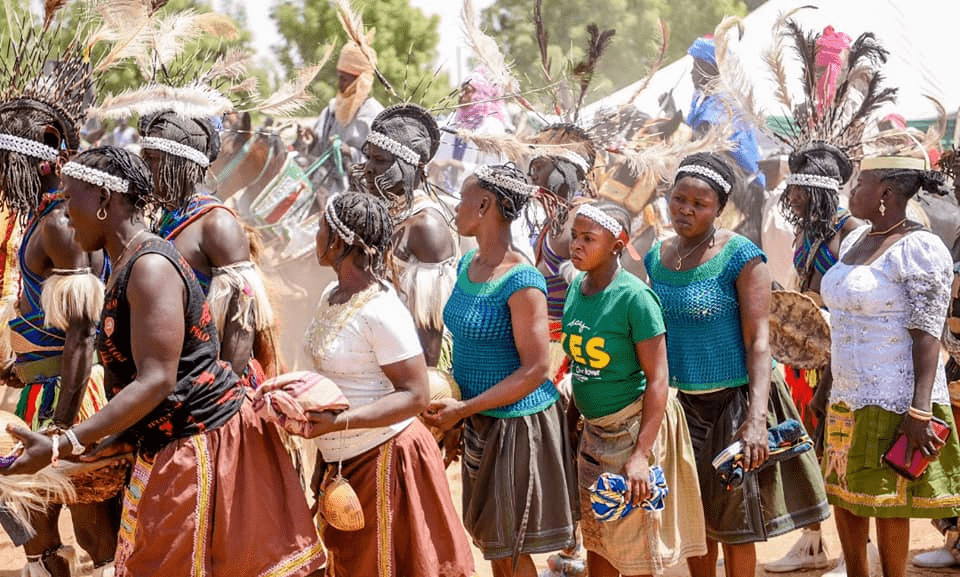
With the population split between more than 10 distinctethnic groups. the LGA presents a rich ethnological, linguistic and cultural mosaic.
The LGAwas formerly known as Longuba Native Authority District until its creation in 1976, following the Dasuki Report on Local Govemment Administration in Nigeria.
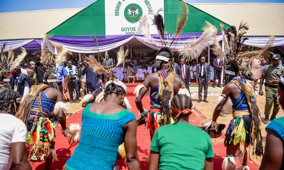
Guyuk LGA and Lunguda
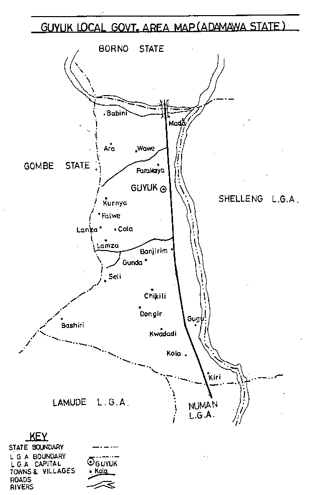
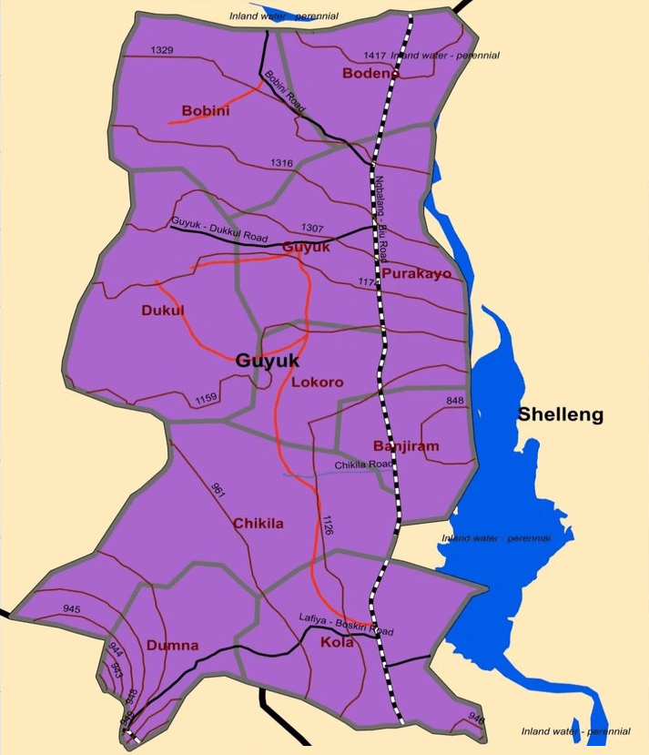
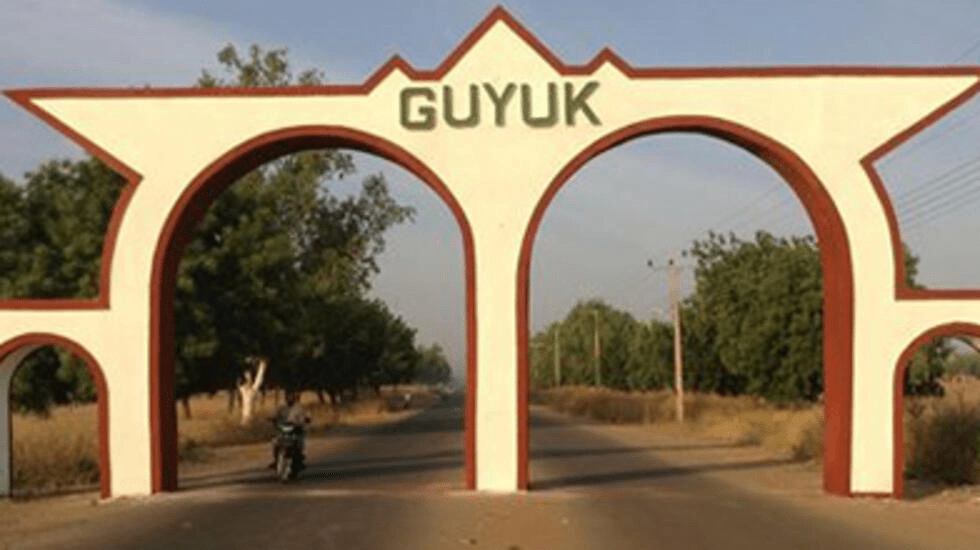
Guyuk Local Government Area is located at the north western part of Adamawa state and is bounded in the west by Gombe state, in the east by Shellong Local Government Area, in the north by Borno state and in the south by Lamurde and Numan Local Government Areas.
Guyuk LGA has 10 wards
The 10 Districts of Guyuk LGA are:
Bobini Banjiram Chikila Dukul Guyuk Dunma Bodeno Lokoro Purokayo Kola
Villages of Guyuk LGA
Arah Bodeno Dakiti Doma Dumburi Fulani Gadajuga Gargijik Gimakurje Gorotoro Jabi Kambila Katte Kukumli Labaram Lakati Libbo Dutse Mada Mittim Shumshi Vanera Wadafa Wawi Wurotuge Wuroyanka Zaunan-Bako
Councillors are elected to represent each of these wards at the Legislative Arms of the LGA.
Village heads, who are usually the oldest person in the community, are appointed and are in the employment of the LGA
An important geographical feature of the Local Government Area is River Gongola which separates the Local Govemment Area from Numan and Lamurde Local Government Areas.
Other featuresare the hills and plateaux found all over the Local Government Area.
The settlement pattern is along the flood plain of River Gongola and on the top of Lunguda plateau.
The Local Government Area has a tropical climate of Sahel type with main seasons notably long dry and short rainy seasons.
The weather is usually hot during the months of March to June in the lower plateau.
Vegetation are few and scattered over the area.
The valley and hilly terrain of the LGA exhibits considerable variation in culture, topography and environment.
More
Cameronian Tiv people Tiv people are in countries like US, Britain among several others. However Tiv are indigeneous, native citizens in two countries:…