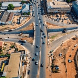
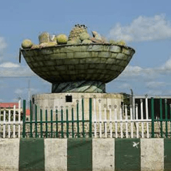
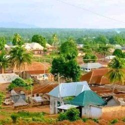
Adamawa is a state in Nigeria. The capital and largest city is Yola.
The State was created on 27th August, 1991. It is located in the North Eastern part of the country. Prior to its creation in 1991, it was part of the North Eastern State from 1967 to February 1976 and Gongola State 1976 – 1991.
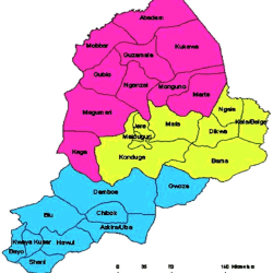
Adamawa shares border with Gombe State to the North, and Borno State to the North East, while to the West it is bordered with Taraba State as well as the Republic of Cameroon to the East.
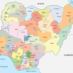
> List of Council Wards, Local Government Areas (LGAs) and States in Nigeria
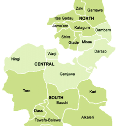
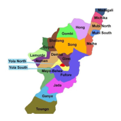
Adamawa’s 226 Council Wards and 21 Local Government Areas are:
Demsa
Bille
Borrong
Demsa
Dilli
Dong
Dwam
Gwamba
Kpasham
Mbula Kuli
Nassarawo Demsa
Fufore
Beti
Farang
Fufore
Gurin
Karlahi
Mayo Ine
Pariya
Ribadu
Uki Tuki
Wuro Bokki
Yadim
Ganye
Bakari Guso
Gamu
Ganye I
Ganye II
Gurum
Jaggu
Sangasumi
Sugu
Timdore
Yebbi
Girei
Dakri
Damare
Gereng
Girei I
Girei Ii
Jera Bakari
Jera Bonyo
Modire/ Vinikilang
Tambo
Wuro Dole
Gombi
Boga/ Dingai
Duwa
Ga’anda
Gabun
Garkida
Gombi North
Gombi South
Guyaku
Tawa
Yang
Guyuk
Banjiram
Bobini
Bodeno
Chikila
Dukul
Dumna
Guyuk
Kola
Lokoro
Purokayo
Hong
Bangshika
Daksiri
Garaha
Gaya
Hildi
Hong
Hushere Zum
Kwarhi
Mayo Lope
Shangui
Thilbang
Uba
Jada
Danaba
Jada I
Jada II
Koma I
Koma II
Leko
Mapeo
Mayokalaye
Mbulo
Nyibango
Yelli
Lamurde
Dubwangun
Gyawana
Lafiya
Lamurde
Mgbebongun
Ngbakowo
Opalo
Rigange
Suwa
Waduku
Madagali
Babel
Duhu/ Shuwa
Gulak
Hyambula
K/Wuro Ngayandi
Madagali
Pallam
Shelmi / Sukur/ Vapura
Wagga
Wula
Maiha
Belel
Humbutudi
Konkol
Maiha Gari
Manjekin
Mayonguli
Pakka
Sorau ‘A’
Sorau ‘B’
Tambajam
Mayo – Belwa
Bajama
Binyeri
Gangfada
Gengle
Gorobi
Mayo Farang
Mayo-Belwa
Nassarawo Jereng
Ndikong
Ribadu
Tola
Yoffo
Michika
Bazza Margi
Futudou / Futules
Garta / Ghunchi
Jigalambu
Madzi
Michika I
Michika II
Minkisi/ Wuro Ngiki
Moda / Dlaka / Ghenjuwa
Munkavicita
Sina / Kamale / Kwande
Sukumu / Tillijo
Thukudou / Sufuku / Zah
Tumbara / Ngabili
VI / Boka
Wamblimi / Tilli
Mubi North
Bahuli
Betso
Digil
Kolere
Lokuwa
Mayo Bani
Mijilu
Muchalla
Sabon Layi
Vimtim
Yelwa
Mubi South
Dirbishi/Gandira
Duvu/ Chaba/ Girburum
Gella
Gude
Kwaja
Lamorde
Mugulbu/ Yadafa
Mujara
Nassarawo
Nduku
Numan
Bare
Bolki
Gamadio
Imburu
Kodomti
Numan I
Numan II
Numan III
Sabon Pegi
Vulpi
Shelleng
Bakta
Bodwai
Gundo
Gwapopolok
Jumbul
Ketembere
Kiri
Libbo
Shelleng
Tallum
Song
Dirma
Dumne
Gudu Mboi
Kilange Funa
Kilange Hirna
Sigire
Song Gari
Song Waje
Suktu
Waltandi
Zumo
Toungo
Dawo I
Dawo II
Gumti
Kiri I
Kiri II
Kongin Baba I
Kongin Baba II
Toungo I
Toungo II
Toungo III
Yola North
Ajiya
Alkalawa
Doubeli
Gwadabawa
Jambutu
Karena
Limawa
Luggere
Nassarawo
Rumde
Yelwa
Yola South
Adarawo
Bako
Bole Yolde Pate
Makama ‘A’
Makama ‘B’
Mbamba
Mbamoi
Namtari
Ngurore
Toungo
Yolde Kohi
Adamawa Local Governments and their headquarters
The 21 Local Government Areas in Adamawa State and their headquarters are:
| LGA | Headquarters |
| Demsa | Demsa |
| Fufore | Fufore |
| Ganye | Ganye |
| Girei | Girei |
| Gombi | Gombi |
| Guyuk | Guyuk |
| Hong | Hong |
| Jada | Jada |
| Lamurde | Lamurde |
| Madagali | Madagali |
| Maiha | Maiha |
| Mayo-Belwa | Mayo-Belwa |
| Michika | Michika |
| Mubi North | Mubi |
| Mubi South | Gella |
| Numan | Numan |
| Song | Song |
| Shelleng | Shelleng |
| Toungo | Toungo |
| Yola North | Jimeta |
| Yola South | Yola |
Adamawa is diverse with many ethnic nationalities. Those nationalities have various ways of life. Adamawa is one of the most ethnically diverse in Nigeria, with over 100 indigenous groups, such as the Mumuye, Bwatiye, Kilba, Marghi, and many others.

The State has a total area of 39,742.12 square kilometers. This is about 4.4 percent of the land area of Nigeria. The 2005 projected population of the State is 3,106,585, giving population density of 68 persons per square kilometer.
The State lies between 8O0 N and 11N and longitude 11.50 and 13.50 E. The State generally is characterized by many rivers; the major one is the River Benue whose source is from the highlands of the Cameroon and flows southwards to join the River Niger.
