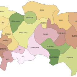
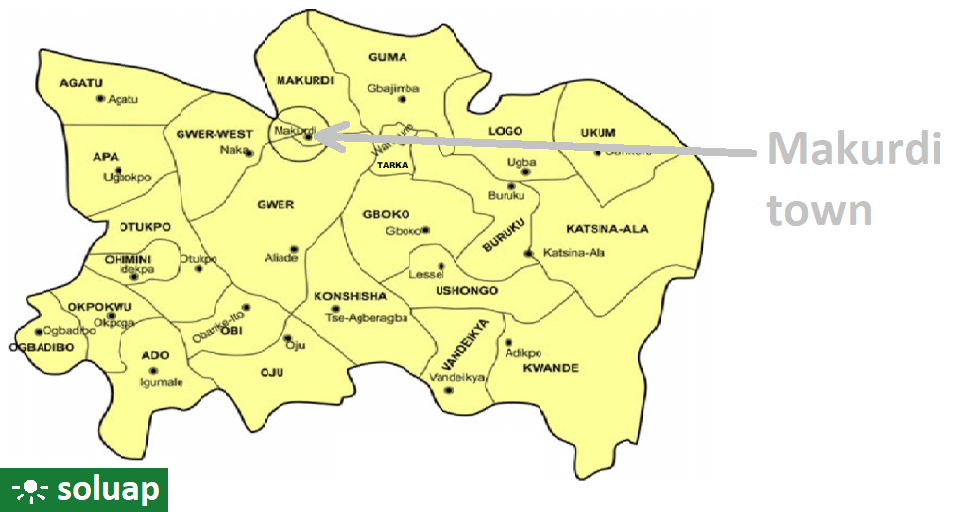
The Local Government Areas (LGA) in Benue State and headquarters are:
- LGA: ADO
Headquarters: Igumale - AGATU
Obagaji - APA
Ugbokpo - BURUKU
Buruku - GBOKO
Gboko - GUMA
Gbajimba - GWER
Aliade - GWER-WEST
Naka - KATSINA-ALA
Katsina-Ala - KONSHISHA
Tse-Agberagba - KWANDE
Adikpo - LOGO
Ugba - MAKURDI
Makurdi - OBI
Obarike-Ito - OGBADIBO
Otukpa - OHIMINI
Idekpa - OJU
Oju - OKPOKWU
Okpoga - OTUKPO
Otukpo - TARKA
Wannune - UKUM
Sankera - USHONGO
Lessel - VANDEIKYA
Vandeikya
| LGA | HEADQUARTERS |
| ADO | Igumale |
| AGATU | Obagaji |
| APA | Ugbokpo |
| BURUKU | Buruku |
| GBOKO | Gboko |
| GUMA | Gbajimba |
| GWER | Aliade |
| GWER-WEST | Naka |
| KATSINA-ALA | Katsina-Ala |
| KONSHISHA | Tse-Agberagba |
| KWANDE | Adikpo |
| LOGO | Ugba |
| MAKURDI | Makurdi |
| OBI | Obarike-Ito |
| OGBADIBO | Otukpa |
| OHIMINI | Idekpa |
| OJU | Oju |
| OKPOKWU | Okpoga |
| OTUKPO | Otukpo |
| TARKA | Wannune |
| UKUM | Sankera |
| USHONGO | Lessel |
| VANDEIKYA | Vandeikya |
Benue State
Benue is a state in Nigeria.
Its name is taken from the major river in the state: River Benue.
The state is one the six states that make up Nigeria’s North-Central geopolitical zone along with the Federal Capital Territory.
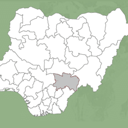
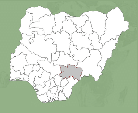
It is located in the Middle Belt region of Nigeria and shares an international boundary with the Republic of Cameroon to the Southeast and interstate boundaries with Nasarawa State to the North, Taraba State to the East, Enugu, Ebonyi and Cross River States to the South, and Kogi State to the West.
Creation: February 3, 1976.
Capital: Makurdi.
Major Cities: Makurdi, Gboko Otukpo, Katsina-Ala, Zaki-Biam, Ukum and Adikpo.
Local Government Areas (LGAs): Ado, Agatu, Apa, Buruku, Gboko, Guma, Gwer East, Gwer West, Katsina-Ala,Konshisha, Kwande, Logo,Makurdi, Obi, Ogbadibo, Ohimini, Oju, Okpokwu, Otukpo, Tarka, Ukum, Ushongo, Vandeikya
Ethnic Profile: Tiv, Idoma, Igede, Etulo, Abakwa, Jukun, Hausa, Akweya and Nyifon.
The Tiv are the dominant ethnic group, occupying fourteen (14) local government areas, while the Idoma and Igede occupy the remaining nine local government areas.
Economic Profile: Its major agricultural produce include yam, rice, beans, cassava, potatoes, maize, soya beans, sorghum, millet and cocoyam. The state also accounts for over 70% of Nigeria’s soya beans production.
Geographic Location: Its geographic coordinates are longitude 7° 47’ and 10° 0’ East. Latitude 6° 25’ and 8° 8’ north; and shares boundaries with five other states namely: Nassarawa to the north, Taraba to the east, Cross-River to the south, Enugu to the south-west and Kogi to the west. The State also shares a common boundary with the Republic of Cameroun on the south-east.
Landmass: 34,058.3 sq km (13,150 sq mi) – 12th of 27
Benue State covers an area of 34,058.3 square kilometres. It lies at latitude 5°25’ North and longitude 7°30’ East.
Benue gets its name from the Benue River which flows through Makurdi, the state’s capital. The state was originally part of the Northern Region in the three-region structure of 1954. With the creation of twelve federal states by General Yakubu Gowon’s military government in 1967, Benue-Plateau State was established. In 1976 the military government of General Murtala Muhammed created nineteen states out of the existing twelve and Benue-Plateau State was split into Benue and Plateau States.
The Road-Railway Bridge (also known as the Old Bridge) in Makurdi was the first bridge that linked the north and south of Nigeria. It was built in 1932.
PEOPLE
There are several ethnic groups in Benue State: the largest are the Tiv, Idoma, and Igede people.
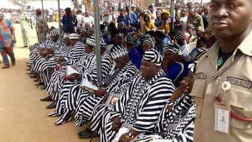
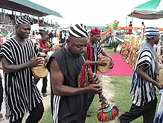
The main religion in the state is Christianity. Traditional religions are also practiced by some of its inhabitants.
MAJOR TOWNS AND CITIES
Makurdi (capital), Gboko, Otukpo, Katsina-Ala, Zaki Biam, Vandeikya, Obi, Okpokwu, and Otukpa.
