LIST OF WARD IN KWAMI LOCAL GOVERNMENT AREA

There are 10 wards in Kwami Local Government Area, namely:
  1. Bojude
  2. Daban Fulani
  3. Doho
  4. Dukul
  5. Gadam
  6. Jurara
  7. Komfulata
  8. Kwami
  9. Malam Sidi
  10. Malleri

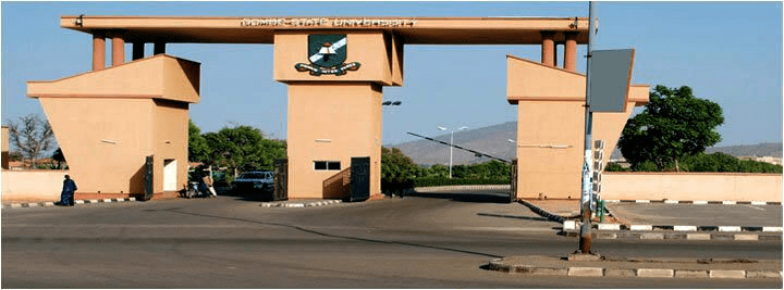
Kwami Local Government Area is in Gombe state, North-east Nigeria and has its headquarters is the town of Mallam Sidi.

KWAMI LOCAL GOVERNMENT DEMOGRAPHY

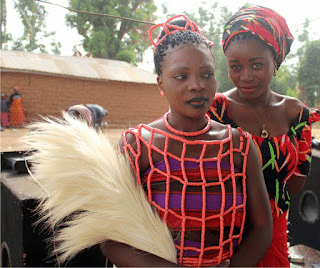
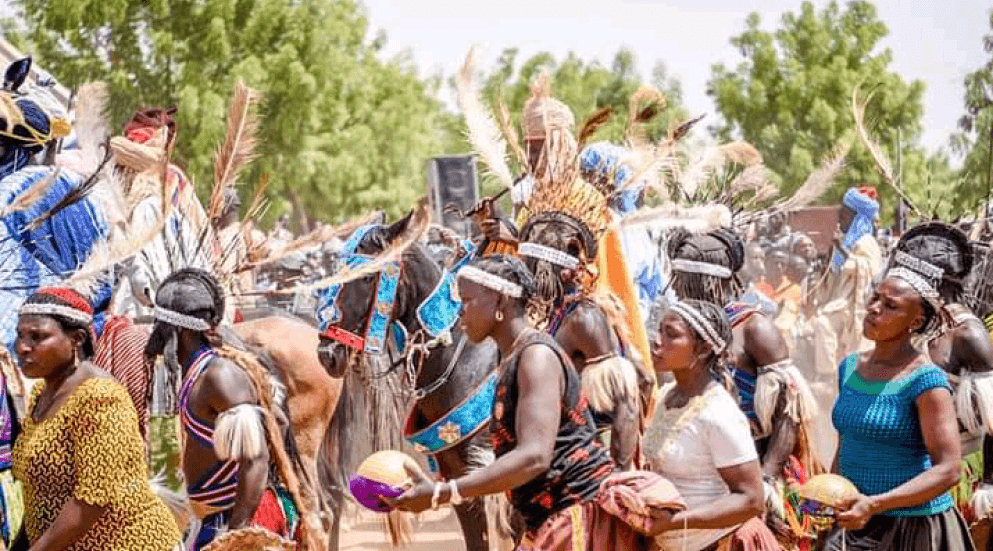
Kwami LGA is made up of several towns and villages such a Habiya, Roddo, Dukku, Maiko, Tita, Maleri, Kolori, and Jurara. The estimated population of Kwami LGA is put at 195, 812 inhabitants with the vast majority of the area’s populace made up of members of the Kwami tribe. The Kwami language is widely spoken in the area while the religions of Islam and Christianity are commonly practiced in the LGA. Notable landmarks in Kwami LGA include the NYSC permanent Orientation Camp.

CommunitiesKwami
Gadam
Malam Sidi
Bojude
Tappi
Doho
Dukul 
HeadquartersMalam Sidi
GPS Coordinates10°30′N 11°15′E / 10.5°N 11.25°E
Post Code760003
Area1,787 km²
Major TribeBolewa
Other TribesFulani, Karekare, Hausa, Kanuri, and Tera
Major Crops ProducedCotton ⋅ ⋅ Groundnut ⋅ Maize ⋅ Okro
Major Livestock ProducedCattle, Sheep, Goats and Poultry
Major AttractionsDadima Fishing Villages
Other AttractionsGamji Shamshanu, Grain Silos, Sand Dunes
Core Mineral Diatomite
Comparative Vantage ProductsBall clay ⋅ Coal ⋅ Cotton ⋅ Diatomite ⋅ Groundnut ⋅ Gypsum ⋅ Limestone ⋅ Livestock ⋅ Maize ⋅ Okro ⋅ Poultry ⋅ Uranium

Approximate distance between the communities to the Local and State headquarters

CommunityDistance from LGA HeadquartersDistance from State Headquarters
Kwami49.5KM13.53KM
Malam Sidi0.KM25.92KM
Bojude58.7KM32.65KM
Tappi53KM26.68KM
Doho7.9KM19.14KM
Dukul22KM43.84KM

GEOGRAPHY

Kwami LGA sits on a total area of 1,787 square kilometres and lies on the banks of Lake Dadinkowa. The area witnesses two major seasons which are the dry and the rainy seasons. The average temperature in Kwami LGA is put at 32 degrees centigrade.

ECONOMY

A number of economic activities are engaged in by dwellers of the Kwami LGA and these include farming and trade. The area is known for the cultivation of a number of crops such as beans and millet while the LGA also hosts several markets where an inexhaustible number of commodities are bought and sold. A number of domestic animals are also reared and sold in Kwami LGA.

LIST OF POLLING UNITS IN KWAMI LOCAL GOVERNMENT AREA

There are 206 polling units in Kwami Local Government Area.
  1. Abba Nanami, K. / Mai Unguwa
  2. Alagarno, Alagarno Pri. Sch.
  3. Alluger, Dispensary
  4. Ardo Abdu, K. Ardo Abdu
  5. Ardo Daba, Kofar Aji
  6. Ardo Daba, Kofar Ardo Daba
  7. Baba Dala, Kwami Pri. Sch.
  8. Babadala, Kofar Babadala
  9. Babadala, Kofar Babadala
  10. Babadala, Kofar Kosuma
  11. Babadala, Kwami Pri. Sch.
  12. Babadala, Maternity
  13. Bafuya, Bafuya Pri. Sch.
  14. Bagadu, Kofar Jauro Bagadu
  15. Bamayi Ii, Kofar Jauro Bamayi
  16. Bamayi Birin, Bamayi Birin
  17. Bamayi I, Kofar Jauro Bamayi
  18. Bappa Tukur, Kofar Bappa Tukur
  19. Bappate, Kofar Jauro
  20. Bele, Kofar Sarkin Bele
  21. Bemi, Bemi Maternity
  22. Biributu, Biributu Pri. Sch.
  23. Bomala J. Hamidu, Kofar Jauro Hamidu
  24. Bomala, Bomala Pri. Sch.
  25. Bomala, Kofar M. Unguwa
  26. Bukkati, Kofar Bukkati
  27. Bula Barde, Bula Pri. Sch.
  28. Bulama Dauda, Sabon Gadam Pri. Sch.
  29. Bulturi, Bulturi Pri. Sch.
  30. Busum, Kofar Jauro Busum
  31. Chiroma, Kofar Chiroma
  32. Damba Barde, K. Sarkin Damba Barde
  33. Dan Buram, Kofar Sarkin Daba
  34. Daniya Sarki, Kofar Daniya Sarki
  35. Daniya Sarki, Kofar Sarki Daniya
  36. Dawaki, Kofar J/ Dawaki
  37. Dinawa Bakka, K. J. Dinawa Bakka
  38. Dinawa Pantami, Kofar Jauro
  39. Dinawa, Dinawa
  40. Diri, Kofar Sarkin Diri
  41. Dokari, Kofar Jauro Dokari
  42. Dumbona, Dunbona
  43. Durokono, Durokono Pri. Sch.
  44. Feshare, Kofar Jauro Baba
  45. Gabanni, Kofar Sarki Gabanni Kofar Jauro
  46. Gabuka, Gabukka Pri. Sch.
  47. Gafara Galadima, Kofar Gafara Galadima
  48. Gafara Madaki, Gafara Madaki
  49. Gaji Bauchi, Gaji Bauchi Pri. Sch.
  50. Galadima Gerkwami, K. Galadima
  51. Galadima, Dispensary
  52. Galadima, Kofar Jauro
  53. Gamadadi, Kofar Jauro Baita
  54. Ganjuwa, Ganjuwa
  55. Ganjuwa, Kofar S/ Ganjuma
  56. Garin Abbas, K. J. Garin Abbas
  57. Garin Alkali, Kofar Jauro
  58. Garin Bunu, K. J. Garin Bunu
  59. Garin Dalla, K / Dallai Bapeto
  60. Garin Jauro Bayo, Kofar Jauro Bayo
  61. Garin Tuguji, Kofar Jauro Tuguji
  62. Garin Wakili, Garin Wakili Pri. Sch.
  63. Garin Wakili, K. J. Garin Wakili
  64. Garin Yuguda, Kofar Jauro Yuguda
  65. Gerema, Kofar Gerema
  66. Gerkwami, Gerkwami Pri. Sch.
  67. Girema, Kofar Galadima
  68. Girgam, K/ Sarkin Girgam
  69. Gwaram, Gwaram Kalagari
  70. Hamma Lule, Primary School
  71. Iyma Kalajanga, Kofar Sarkin Kalajanga
  72. Jada Dukul, Jada Dukul
  73. Jada, Kofar Jauro
  74. Jalingo, Jalingo Pri. Sch.
  75. Jamji I, Jamji Pri. Sch.
  76. Jamji I, Kofar Sarkin Jamji
  77. Jamji Ii, Jamji Pri. Sch.
  78. Jamji Ii, Kofar Sarkin Jamji
  79. Jamji Zongoma Amsani, Kofar Zongoma Amsan
  80. Jauro Yaya, Kofar Jauro Yaya
  81. Jauro Ahmadu / Wuro Tann, Kofar Jauro Ahamadu
  82. Jauro Ahmadu, Kofar J/ Ahmadu
  83. Jauro Bello, Kofar Jauro Bello
  84. Jauro Bose, Jauro Bose
  85. Jauro Bose, Jauro Bose Pri. Sch.
  86. Jauro Dalil, Kofar Jauro Dalil
  87. Jauro Gabdo, Kofar Jauro Gabdo
  88. Jauro Gambo, Kofar Jauro Gambo
  89. Jauro Haji, Kofar Jauro Haji
  90. Jauro Isa, Kofar Jauro Isa
  91. Jauro Kawu, Kofar Jauro Kawu
  92. Jauro Malam, Jauro Malam
  93. Jauro Manga, Kofar Jauro Manga
  94. Jauro Mauwada, Jauro Mauwda Pri. Sch.
  95. Jauro Sabo, Kofar Jauro Sabo
  96. Jauro Tinda, Kofar Jauro Tinda
  97. Jauro Yaro, Kofar Jauro Yaro
  98. Jauro Yaya, Kofar Jauro Yaya
  99. Jurara, Jurara Pri. Sch.
  100. Jurara, Kofar Sarkin Jurara
  101. Kalagari (arikime), Kofar Jauro Arikime
  102. Kan Giwa, K/ Sarkin Kan Giwa
  103. Kobozo, Kobozo Pri. Sch.
  104. Kofar Ajiya, Adult Educ. Office
  105. Kofar Ajiya, M/ Sidi Area Court
  106. Kofar Ajiya, M/ Sidi Pri. Sch.
  107. Kofar Jauro Yaya Bagoggo, Kofar Jauro Yaya Bagoggo
  108. Kolori, Kolori Pri. Sch.
  109. Kurugu ( Malam Tafida), Pri. Sch.
  110. Kyari Madaki, Kofar S/ Kyari
  111. Lantaiwa, Kofar Jauro Lantaiwa
  112. Madaki Jamji, Kofar Jauro
  113. Madaki, Area Court
  114. Madaki, Kofar Madaki
  115. Madaki, Kofar Shugaba Adamu
  116. Madaki, Malleri Pri. Sch.
  117. Madugu Yashi, Madugu Yashi Pri. Sch.
  118. Magumari, Kofar S/ Magumari
  119. Mai Ung. Madu, Kofar Madugu
  120. Mai Ung. Yerima, Kofar Yerima
  121. Mai Ung., Kofar Ajiya
  122. Mai Ung., Kofar Sarkin Dohe
  123. Majeri, Kofar Majeri
  124. Makera, Makera
  125. Malam Bappah, Kofar Jauro Bappah
  126. Malam Dalli, Kofar Mallam Dalli
  127. Malam Jamji, Madukellumi
  128. Malam Kachalla, Kofar Jauro Maigoro
  129. Malam Maji, K. Malam Maji
  130. Malko, Malko Pri. Sch.
  131. Mallam Bappah, Kofar Mallam Bappa
  132. Masuri, Kofar Masuri
  133. Mettako, Kofar M/ung. Mettako
  134. Nahuta Kanuri, Kofar J/ Nahuta
  135. Nasarawa, Kofar Jauro Nasarawa
  136. Ngaji Majjoru, Kofar Jauro Abdu
  137. Ngaji Majjoru, Kofar Jauro Gambo
  138. Ngaji, Kofar Sarkin Dawo
  139. Njokhire, Kofar Jauro Njokhire
  140. Pawo, Kofar Galadima
  141. Sabon Gari, Kofar J/ Sabon Gari
  142. Sabon Garin Kwami, K. Jauro
  143. Sarki Jore, Kofar Sarki Jore
  144. Sarkin Dinawa, Dinawa Pri. Sch.
  145. Sarkin Jurara, Jurara Dispensary
  146. Sarkin Kom, Kom Dispensary
  147. Sarkin Kufayi, Kufayi Dispensary
  148. Sarkin Kulum, Kofar Sarkin Kulum
  149. Sarkin Kwami, K/ Sarkin Kwami
  150. Sarkin Noma Kulum, Kofar S/ Noma
  151. Sarkin Tappi, Kofar Sarkin Tappi
  152. Shangayari, Kofar Shangayari
  153. Shanin Fulani, K. /j. Shanin Fulani
  154. Shanin Tera, K. /j. Shanin Tera
  155. Sharifuri, Kofar Jauro
  156. Shong S / Yaki, Shongo Pri. Sch.
  157. Shongo Dirango, Shongo Dirango
  158. Sittamane, Kofar Jauro Sittamane
  159. Tafida Musa, Kofar Tafida Musa
  160. Tale, K. Jauro Tale
  161. Tanna, Kofar Tanna
  162. Tedo Gadam, Kofar Mai Ung. Kosuma
  163. Tinda Sabuwa, Kofar Jauro Tinda Sabuwa
  164. Tinda Bappa, Kofar Jauro Bappa
  165. Titi, Titi Pri. Sch.
  166. Tudun Wada, Pri. Sch. Kwami
  167. Ung. Chiroma, Kofar Chiroma Tappi
  168. Ung. Dan Buran, Daba Pri. Sch.
  169. Ung. Galadima, Doho Pri. Sch.
  170. Ung. Galadima, Kofar Galadima
  171. Ung. Makwalla, Kofar M / Ung. Makwalla
  172. Ung. Makwalla, Kofar Musa Mallam
  173. Ung. Waziri, Primary School
  174. Ung. Yerima, Daba Pri. Sch.
  175. Ung. Yerima, Maternity
  176. Ung. Yerima, Maternity
  177. Walama, Walama
  178. Wudel, Kofar Jauro Wudel
  179. Wuro Bundu, K. Jauro
  180. Wuro Dole, Dispensary
  181. Wuro Dole, Wuro Dole Pri. Sch.
  182. Wuro Dole, Wuro Dole Pri. Sch.
  183. Wuro Jabe, Wuro Jabe Pri. Sch.
  184. Wuro Johe, Wuro Johe Pri. Sch.
  185. Wuro Koha (mettako), Kofar Jauro Yahaya
  186. Wuro Tara, Wuro Tara Pri. Sch.
  187. Yalwa Yame, Kofar Yelwa Yame
  188. Yankari, K. Sarkin Yankari
  189. Yayari, Kofar Alh. Yayari
  190. Yelwa Tafida, Kofar Yelwa Tafida
  191. Yelwa Umaru, Kofar Yelwa Umaru
  192. Yerima Goje, K. /yerima Goje
  193. Yerima Gomboni, K. Yerima Gambo
  194. Yerima Kagum, Kofar Yerima Kagum
  195. Yerima, Dispensary
  196. Yerima, Kofar M/ung. Yerima
  197. Yerima, Kofar Sarkin Dukul
  198. Yerima, Kofar Yerima
  199. Zambe, Kofar Moh’d. S / Zambe
  200. Zangoma Kurugu, Kurugu Pri. Sch.
  201. Zangoma Abba, Kofar Zangoma Abba
  202. Zangoma Gaji, Kofar Jauro Yabu
  203. Zangoma Kyari, Zangoma Pri. Sch.
  204. Zangoma West, Zangoma West
  205. Zongoma Adamu, Zongoma Adamu
  206. Zongoma Mamman, Zongomza Pri. Sch.

Gombe is one of the 36 states of Nigeria. It is located in the north eastern part of the country.

The state was created out of Bauchi state on 1st October 1996 by Sani Abacha’s administration.

Its creation was a fulfilment of the aspiration of the people who for long, had passionately craved for a state of their own out of the then Bauchi state.

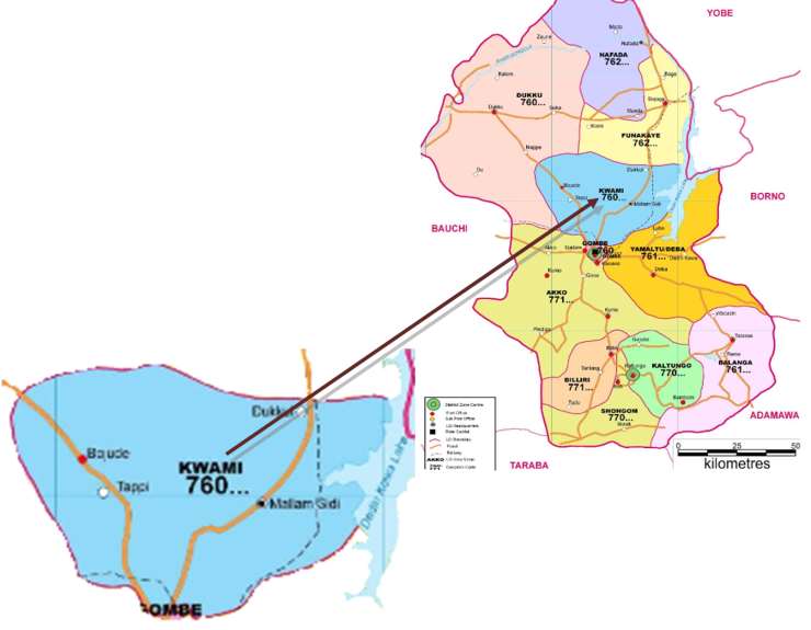
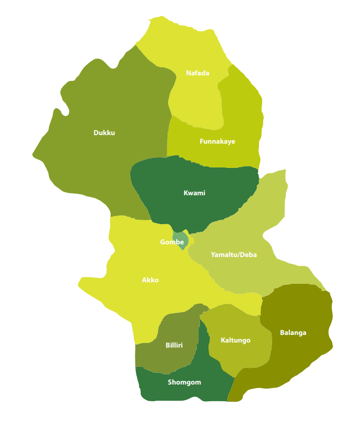
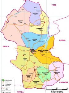
Gombe State has eleven Local Government Areas (LGA) namely, Akko, Balanga, Billiri, Dukku, Funakaye, Gombe, Kaltungo, Kwami, Nafada, Shongom, and Yamaltu Deba.

The following are administrative maps of Gombe State showing the local government areas

Gombe-State-Postcode-Map

Historically, Gombe state is a fusion of two distinct groups of people, comprising the people of Gombe North and the ethnic grouping of Gombe South.

Gombe is located on latitude 9”30’ and 12”30’N, Longitude 8”5’and 11”45’E.

It has borders with Borno, Yobe, Adamawa, Taraba, and Bauchi states.

The State climate is generally warm, with temperatures not exceeding 300c during the months of March-May considered to be the hottest months. The following table gives other profile of the jewel state.

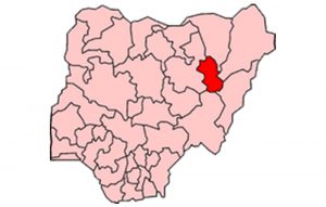
The following Map indicates in red the position of Gombe in relation to the thirty six (36) states of the federation.

Map of Nigeria Showing Gombe

The Emirate government, which had its Head quarters in Gombe Abba, was formed to effectively control what constitutes a larger part of the Gombe State, until the advent of the British in the early 20th century.

Under the British, the state was administered through the mechanism of two administrative units, i.e. Gombe Native Authority and Tangale Waja Native Authorities. The two Authorities constituted Gombe Division during the Colonial era. However, with independence in 1960 and the subsequent military administration, many changes occurred which led to the emergence of local government authorities. Thus, between 1976 and the present, the then two authorities had metamorphosed into the present 11 local governments.
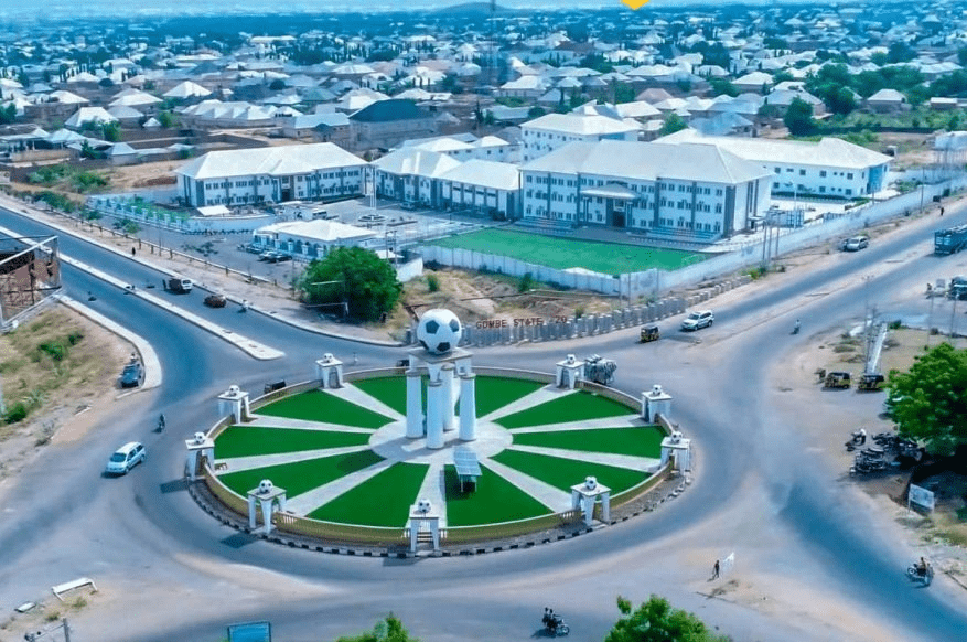
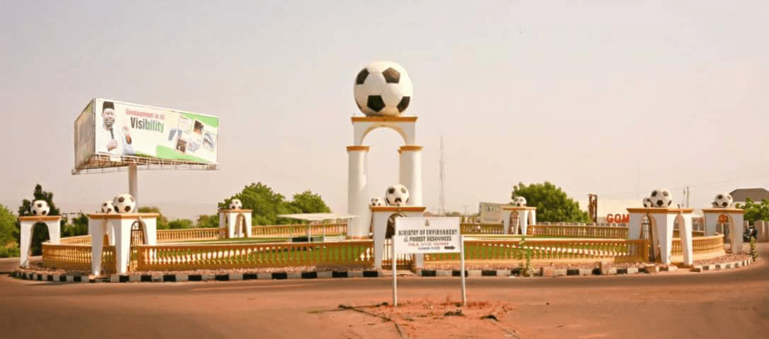
Capital: Gombe

Land area: The State occupies a total land area of about 20,265sqkm.

Climate: Warm, exceeding 40″c during the hottest month (March – May)

Topography: Mainly mountainous, undulating and Hilly to the South-East and flat open plains in the Central, North, North-East, West and North-West.

Location: Latitude 9”30’ and 12”30’N, Longitude 8”5’and 11”45’E. The state lies in the centre of North east Geopolitical Zone of Nigeria. It shares common boundaries with Adamawa and Taraba State to the South, Bauchi State to the West, Borno State to the East and Yobe State to the North.

Power: The State is served by the PHCN National grid through the North-East PHCN substation located in Gombe State capital

Roads: Five(5) Federal trunk “A” roads connect the State Capital with all parts of the Country. Twonship roads have been constructed in the State capital and all the major towns.

Airport: The State has an International Airport which is also surrounded by four (4) International Airport, located in Kano, Jos, Yola and Maiduguri.

Major towns :Gombe the capital, Bajoga, Billiri, Kaltungo, Kumo, Dukku and Deba.

Ethnic CompositionMulti-ethnic, mainly made up of Fulani, Tangale, Waja, Bolawa, Tera,Jukun, Jara, Pero, Tula, Cham, Lunguda, Dadiya, Kamo, Awak, Kanuri, Hausa, Yoruba and Igbo.

Language spoken: English is the official language, but as much as Hausa remain the commercial language amongst the people of the state, Fulfulde, Tangale, Tera, Waja, and Kanuri are commonly spoken.

Vegetation: Gombe is generally a Guinea Savannah grassland with concentration of wood lands in the South East and South West.

Rainfall: Annual Average of 850mm.