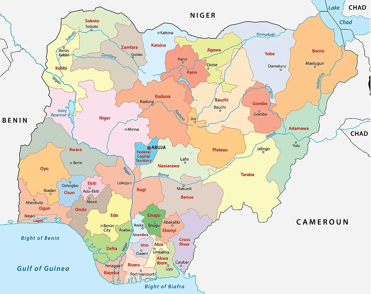
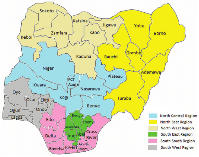
Map of Nigeria showing states and senatorial zones
States creation, reformation
By the time that Nigeria got independence it was a federation of the three regions, namely:
Western Eastern Northern
Later on another region was added, the Mid-Western Region.
The Mid-Western Region was formed from the Western Region in 1966, and Lagos, the capital, was effectively governed as an unofficial fourth region outside the bounds of the Western Region.
This brought the number of regions to 4 as follows:
Western Mid-Western Western Northern
Under the short-lived military government of Aguiyi-Ironsi, Nigeria was reorganized under a central government. Following a coup which resulted in Aguiyi-Ironsi’s deposition and assassination, Nigeria was reorganized as a federal country again with three of the regions being divided into newer entities and all first-level subdivisions being renamed as states.
Western Region was divided into: Lagos and Western states.
Eastern Region was divided into: East-Central, Rivers, and South-Eastern states;
Northern Region was divided into: Benue-Plateau, Kano, Kwara, North-Central, North-Eastern, and North-Western (Sokoto) states
1976 reformation of Nigeria’s federating units
In 1976, six years after the end of the civil war, the states were further reorganized:
State boundaries and names were also reorganized.
Benue-Plateau state divided into: Benue and Plateau states.
East-Central state divided into: Anambra and Imo states. Federal Capital Territory (Abuja) formed from parts of Niger and Plateau states.
North-Eastern state divided into: Bauchi, Borno, and Gongola states. Niger (Minna) state split from Sokoto.
Western state divided into: Ogun, Ondo, and Oyo states
States of Nigeria from 1987-1991
Akwa Ibom state created from Cross River; Katsina state created from Kaduna
States of Nigeria from 1991-1996
Abia State created from Imo; Bendel State divided into Delta and Edo; Enugu State created from Anambra; Gongola State divided into Adamawa and Taraba; Jigawa State created from Kano; Kebbi State created from Sokoto; Kogi State formed from parts of Benue and Kwara; Osun State created from Oyo; Yobe State created from Borno.
States of Nigeria from 1996
Bayelsa State created from Rivers; Ebonyi State was formed from parts of Abia and Enugu; Ekiti State created from Ondo; Gombe State created from Bauchi; Nasarawa State created from Plateau; Zamfara State was created from Sokoto.
More on Nigeria
Nigeria is a country in Africa, a regional power on the continent and an emerging power on the international scene.
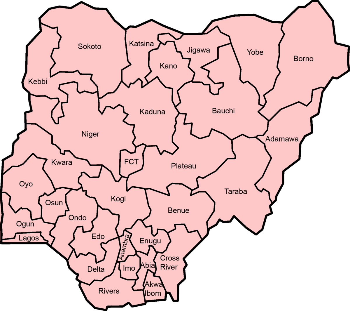
It has 36 states and a Federal Capital Territory, Abuja.
Having being divided into states, the country is further divided into 774 Local Government Areas (LGAs).
The LGAs are under the control of their respective states.
The country has the largest economy in Africa.
Nigeria’s population is over 230 million, making it number 1 most populated country in Africa, and number 6 in the world.
Tiv people of Nigeria
It covers an area of 923,769 square kilometres (356,669 sq mi).
It is situated between the Sahel to the north and the Gulf of Guinea to the south in the Atlantic Ocean.
Abuja City Gate
Nigeria borders Niger in the north, Chad in the northeast, Cameroon in the east, and Benin in the west.
It is often referred to as the Giant of Africa owing to its large population and economy and is considered to be an emerging market by the World Bank.
National Assembly buildingMaitama, Abuja with Hilton Hotel’s high-rise building in the foreground
The largest city in Nigeria is Lagos, one of the largest metropolitan areas in the world and the largest in Africa.
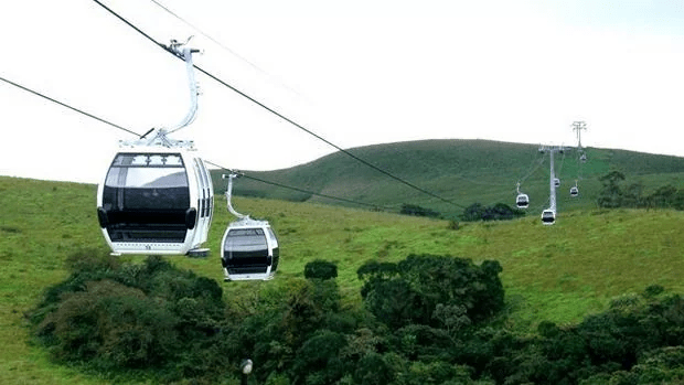
CalabarObudu Mountain Resort
The official language is English, chosen to facilitate linguistic unity at the national level.
Nigeria is a multinational state inhabited by more than 250 ethnic groups speaking 500 distinct languages, all identifying with a wide variety of cultures.
More
State and capital, Nigeria The states and capitals of the Federal Republic of Nigeria are: Abia – Umuahia Adamawa – Yola Akwa Ibom -…
Nigeria’s 36 States and capital The 36 States and capitals in Nigeria are: Abia (Umuahia) Adamawa (Yola) Akwa Ibom (Uyo) Anambra (Awka) Bauchi (Bauchi) Bayelsa…
Distance of Funakaye communities, LGA headquarters and Gombe town, the state capital Approximate distance of Funakaye communities, LGA headquarters and state capital CommunityDistance from LGA HeadquartersDistance from State HeadquartersASHAKA GARI9.45KM78.01KMBAGE12.34KM78.93KMBAJOGA0 KM71.12KMRIBADU32.4KM45.44KMWAWA34.28KM57.54KMWUROBAPPARU14.58KM76.37KM Funakaye is…
Distance of Kwami communities, LGA headquarters and Gombe State capital Approximate distance between communities to the Local and State headquarters CommunityDistance from LGA HeadquartersDistance from State HeadquartersKwami49.5KM13.53KMMalam Sidi0.KM25.92KMBojude58.7KM32.65KMTappi53KM26.68KMDoho7.9KM19.14KMDukul22KM43.84KM Kwami Local…
Distance of communities, Nafada LGA and Gombe State capital Approximate distance between the communities to the LGA and State capital CommunityDistance from LGA HeadquarterDistance from State HeadquartersBarwo Wunde8.14KM91.65KMNafada0. KM97.88KMJigawa33.56KM126.36KMBarwo…
Makurdi, the Benue State capital Makurdi, the state capital was established in the early twenties and gained prominence in 1927 when it became the headquarters…
List of Cameroon regions and their capital The 10 regions of Cameroon regions and their capital are: RegionCapitalAdamawaNgaoundéréCentreYaoundéEastBertouaFar NorthMarouaLittoralDoualaNorthGarouaNorthwestBamendaSouthEbolowaSouthwestBueaWestBafoussam 10 regions of Cameroon Cameroon comprises ten regions,…
Botswana capital and currency The capital of Botswana is Gaborone and the currency is Pula. Gaborone (pronounced GAH-bə-ROH-nee) is also largest city of Botswana…


 and Fufu (the headquarters of Ilorin South LGA)")


 and their headquarters")


