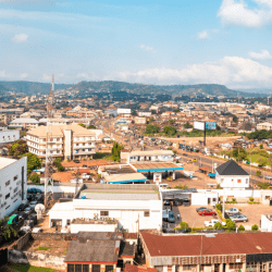
Enugu State derives its name from the capital city, ENUGU (top of the hill) which is regarded as the oldest urban area in the Igbo speaking area of Southeast Nigeria.
The city owes its geopolitical significance to the discovery of coal in 1909 by a team of British geologists.
The discovery of the solid mineral in the area brought about the emergence of a permanent cosmopolitan settlement which influenced the construction of a railway line to link the Enugu coal fields with the sea port in Port Harcourt for the export of the mineral.
As of 1917 Enugu had acquired township status and assumed strategic importance to British interests. Foreign businesses began to move into Enugu, the most notable of which were John Holt, Kingsway Store, United Bank of West Africa and United Africa Company.
By 1929, Enugu had become the capital of the former Eastern Region, and has since then retained its old status as the regional industrial and business hub as well as the political capital and rallying point of the Igbo people.
Enugu
Enugu is a state in the South Eastern part of Nigeria. The capital city of the state also has the same name: Enugu.


The state shares borders with Abia State to the South, Ebonyi State to the East, Benue State to the Northeast, Kogi State to the northwest and Anambra State to the West.


Though a land-locked State, Enugu, the capital city, is located approximately 2 1/2 driving hours away from Port Harcourt, Calabar and warri, all coastal cities with major shipping ports. Enugu is also located within an hour s drive from Onitsha and 2 hours drive from Aba, both of which are trading centres in Nigeria. The city is also located within 5 driving hours from Abuja and 7 driving hours from lagos, the administrative and commercial headquarters of Nigeria respectively.

Lying partly within the semi-tropical rain forest belt of the south, the State spreads (through a land area of approximately 8727.1km2 ) towards the north with its physical features changing gradually from tropical rain forest to open wood-land and then to the Savannah. Apart from a chain of low hills, running through Abakaliki (Ebonyi state) in the east to Nsukka in the north-west, and then southwards through Enugu and Agwu, the rest of the state is made up of low land separated by numerous streams and rivulets the major ones of which are the Adada River and the Oji River.
The mean temperature in Enugu State in the hottest month of February is about 36.20C (97.160F), while the minimum temperature of about 20.30C (68.540F) is recorded in November. The lowest rainfall of about 0.16cm3 is normal in February, while the highest is about 35.7cm3 in July. Enugu has a good soil and climate, sitting at about 223 meters above sea level, and the soil is well drained.

LGAs in Enugu State
The LGAs (Local Government Areas) in Enugu State, Nigeria are:
- Aninri
- Awgu
- Enugu East
- Enugu North
- Enugu South
- Ezeagu
- Igbo-Etiti
- Igbo-Eze North
- Igbo-Eze South
- Isi-Uzo
- Nkanu East
- Nkanu West
- Nsukka
- Oji-River
- Udenu
- Udi
- Uzo-Uwani


