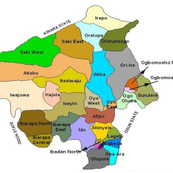
Local Government Areas (LGA) in Ondo State and their headquarters are:
| LGA | Headquarters |
| Akoko North-East | Ikare |
| Akoko North-West | Oke-Agbe |
| Akoko South-East | Oka |
| Akoko South-West | Isua |
| Akure North | Iju/Itaogbolu |
| Akure South | Akure |
| Ese-Odo | Igbekebo |
| Idanre | Owena |
| Ifedore | Igbaraoke |
| Ilaje | Igbokoda |
| Ile-Oluji/Oke-igbo | Ile-Oluji |
| Irele | Irele |
| Odigbo | Ore |
| Okitipupa | Okitipupa |
| Ondo East | Bolorunduro |
| Ondo West | Ondo |
| Ose | Ifon |
| Owo | Owo |
Ondo State
Ondo is a state in Nigeria.
Official Name
Ondo State of Nigeria

Appellation
Sunshine State
Date of Creation
February, 1976

State Capital
Akure
Festivals
Ogun, Olokun, Igogo, Egungan, Ajagbo, Orosun, Arigiya, Boat Regatta and Mare.
Population
3,460,877 comprising 1,745.057 Male and 1,715,820 female(as at 2006)
Languages
Yoruba, Ijaw and English (Official Language) and several dialects of the sub-groups.
People
The indigenes are predominantly Yoruba namely: the Akoko, Akure, Apoi, Idanre, Ijaw, Ikale, Ilaje, Ondo and the Owo. Ondo crop of educated elites has led to its being classified as one of the most educationally advanced states in Nigeria. The people are mostly subsistence farmers, fishermen and traders.
The life pattern of the people represents an embodiment of culture, ranging from the local foodstuff to the mode of dressing, dancing, wood crafts, such as carved house post and decorated doors. The Culture of Ondo State people speaks volume. Antiquities and artifacts are also preserved in palaces of traditional rulers some of which have been declared as National Monuments.
Location
The state lies between longitudes 4″30″ and 6″ East of the Greenwich Meridian, 5″45″ and 8″ 15″ North of the Equator. This means that the state lies entirely in the tropics.

18 Local Government Areas
Ondo State, made up of 18 Local Government Areas is located in the South Western Zone of Nigeria.

Boundaries
Ondo state is bounded in the North by Ekiti/Kogi State; in the East by Edo State; in the West by Oyo and Ogun States and in the South by the Atlantic Ocean.
Land Area:
14,788.723 square kilometers.
Vegetation
The state enjoys generally, luxuriant vegetation. A high forest zone (or rain forest) is found in the south, while the northern fringesis mostly sub- savannah forest.
Climate
The climate is tropical with two distinct seasons viz the rainy season (April-October) and the Dry season (November-March). The temperature through out the year ranges from 21C-29C while humidity is relatively high. The annual rain fall varies from 2.000mm in the southern parts to 1150mm in the northern areas. The rainfall decreases in amount and distribution from the coast to the hinterland.
Natural resources
Extensive fertile soil suitable for agriculture with sub- savannah forest suitable for cattle gazing in the Northern fringes. Vast forest resources, variety of timber species e.g Teak, Gmelina, Masionia e.t.c. Ondo State is the largest producer of Cocoa in Nigeria. Other cash crops grown in the state include rubber, cashew, kolanut, palm oil etc.
Mineral resources
Oil and Gas; Ondo State produces 12% of Nigeria’s total output, other mineral resources found in the state are quartz sand, clay, granite, limestone talc, kaoline, coal, columbite, rock, tin, bitumen. ( the second largest deposit in the world ) many rivers, ocean fronts, and the longest coast line in Nigeria.
