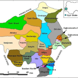
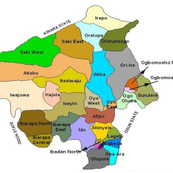
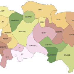
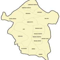
Local Government Areas (LGA) and their headquarters in Oyo State are:
| SN | LGA | Headquarters |
| 1 | ATISBO | TEDE |
| 2 | EGBEDA | EGBEDA |
| 3 | IBADAN NORTH | AGODI GATE |
| 4 | IBADAN NORTH-EAST | IWO ROAD |
| 5 | IBADAN NORTH-WEST | ONIREKE |
| 6 | IBADAN SOUTH-EAST | MAPO |
| 7 | IBADAN SOUTHWEST | RING ROAD |
| 8 | IBARAPA CENTRAL | IGBO ORA |
| 9 | IBARAPA EAST | ERUWA |
| 10 | IBARAPA NORTH | AYETE |
| 11 | IDO | IDO |
| 12 | ISEYIN | ISEYIN |
| 13 | ITESIWAJU | OTU |
| 14 | IWAJOWA | IWERE-ILE |
| 15 | KAJOLA | OKEHO |
| 16 | LAGELU | IYANA-OFFA |
| 17 | OGBOMOSO NORTH | KINNIRA |
| 18 | OGBOMOSO SOUTH | AROWOMOLE |
| 19 | OGO-OLUWA | AJAAWA |
| 20 | OLORUNSOGO | IGBETI |
| 21 | OLUYOLE | IDI-AYUNRE |
| 22 | ONA-ARA | AKANRAN |
| 23 | OORELOPE | IGBOHO |
| 24 | SAKI EAST | AGO-AMODU |
| 25 | SAKI WEST | SAKI |
| 26 | SURULERE | IRESAADU |
| 27 | AFIJIO | JOBELE |
| 28 | ATIBA | OFAMETA |
| 29 | ORIIRE | IKOYI ILE |
| 30 | OYO EAST | KOSOBO |
| 31 | OYO SOUTH EAST | APAARA OYO |
| 32 | OYO WEST | OJONGBODU |
| 33 | IREPO | KISI |
33 Local Governments Areas
Oyo State consists of 33 Local Governments and 29 Local Council Development Areas. Local Government Areas are: Afijio, Akinyele, Atiba, Atisbo, Egbeda, Ibadan North, Ibadan North-East, Ibadan North-West, Ibadan South-East, Ibadan South West, Ibarapa Central, Ibarapa East, Ibarapa North, Ido, Irepo, Iseyin, Itesiwaju, Iwajowa, Kajola, Lagelu, Ogbomoso North, Ogbomoso South, Ogo-Oluwa, Olorunsogo,Oluyole, Ona-Ara, Oorelope, Oriire, Oyo East, Oyo West, Saki East, Saki West and Surulere.
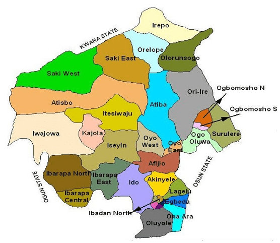
29 Local Council Development Areas
The Local Council Development Areas (LCDAs) are: Aare Latosa, Afijio West, Ajorosun, Akinyele East, Akinyele South, Akinyele West, Akorede, Araromi, Atisbo South, Ibadan East, Ibadan South East, Ibadan West, Ibarapa North-East, Ibarapa North-West, Ifeloju, Iganna, Inukan, Irepodun, Iseyin South, Iwa, Lagelu North, Ogbomoso Central, Ogbomoso South-West, Ogo-oluwa West, Oke’badan, Omi Apata, Surulere North, Surulere South, Wewe.
Topography
The topography of the State is of gentle rolling low land in the south, rising to a plateau of about 40metres. The State is well drained with rivers flowing from the upland in the north-south direction.
The landscape consists of old hard rocks and dome shaped hills, which rise gently from about 500 meters in the southern part and reaching a height of about 1,219 metres above sea level in the northern part.
Climate
Oyo State has an equatorial climate with dry and wet seasons and relatively high humidity. The dry season lasts from November to March while the wet season starts from April and ends in October. Average daily temperature ranges between 25 °C (77.0 °F) and 35 °C (95.0 °F), almost throughout the year. The vegetation pattern of Oyo State is that of rain forest in the south and guinea savannah in the north. Thick forest in the south gives way to grassland interspersed with trees in the north.
Agriculture
The climate in the State favours the cultivation of crops like Maize, Yam, Cassava, Millet, Rice, Plantain, Cocoa tree, Palm tree and Cashew. There are a number of Government Farm Settlements in Ipapo, Ilora, Sepeteri, Eruwa, Ogbomosho, Iresaadu, Ijaiye, Akufo and Lalupon.
Reference
old.oyostate.gov.ng/ about-oyo-state/
