Imo State derives its name from Imo River, which takes its course from the Okigwe/Awka upland. It lies within latitudes 4°45’N and 7°15’N, and longitude 6°50’E and 7°25’E.
It occupies the area between the lower River Niger and the upper and middle Imo River. The state is bounded on the east by Abia State, on the west by the River Niger and Delta State; and on the north by Anambra State, while Rivers State lies to the south. Imo State covers an area of about 5,100sq km.
Religion
There is freedom of worship in Imo State and religion occupies a central place in the lives of the people. The people are predominantly Christians of different denominations. Some people in the state still practice traditional religions.
Relief and Drainage
Imo State is underlain by the Benin Formation of coastal plain sands. This formation, which is of late Tertiary age, is rather deep, porous, infertile and highly leached. In some areas like Okigwe, impermeable layers of clay occur near the surface, while in other areas, the soil consists of lateritic material under a superficial layer of fine grained sand.
Rivers are few with vast inter fluves which are characterized by dry valleys that carry surface drainage in periods of high rainfall. The phenomenal monotony of the terrain may be accounted for by the absence of any tectonic disturbances and by the homogeneity of the rock structure.
The main streams draining the state are Imo, Otamiri, Njaba and Ulasi rivers, all of which have very few tributaries. With the exception of Imo River, which runs through the area underlain by the Imo Shales? Other rivers rise within the coastal plain sands. Generally, river valleys constitute the major physical features, which are often marshy.
Rainfall
The undulating nature of the interfluves gives rise to numerous depressions especially in the northeast Rainfall distribution is bimodal, with peaks in July and September and a two week break in August. The rainy season begins in March and lasts till October or early November. From March to May, there are violent storms which destroy crops and houses. Rainfall is often at its maximum at night and during the early morning hours. However, variations occur in rainfall amount from year to year. Annual rainfall varies from 1,990 mm to 2,200.
Temperatures
Temperatures are similar all over the state. The hottest months are January to March, with the mean annual temperature above 20°C. The influence of the harmattan lasts for about nine weeks (i.e. from late December to late February).Imo State has an average annual relative humidity of 75 per cent which is highest during the rainy season, when it rises to about 90 per cent. The high temperature and humidity experienced in the state favour luxuriant plant growth, which produce the Imo State’s rich and beautiful vegetation of the tropical rain forest.
Vegetation
Economic trees like the iroko, mahogany, obeche, gmelina, bamboo, rubber and oil palm pre dominate. But due to high population density, most of the state has been so farmed and degraded that the original vegetation has disappeared. Thus farmers are forced into marginal lands, a situation aggravated by the rising demand for fuel-wood. Deforestation has triggered off acute soil erosion especially in the Okigwe Orlu axis.
Population & Land Use
Imo State has a population of about 4.8 million persons. The population density varies from 230 persons per sq. km. in Oguta/Egbema area, to about 1,400 persons per sq. km. in Mbaise, Orlu, Mbano and Mbaitoli areas.
This high population density has led to intensified pressure on land, forests and other natural resources, leading to increasing rural poverty which is characteristic of densely populated rural areas.Fallow period rarely exceeds one year and in some areas continuous cropping is the rule. Low crop yield and loss of land to erosion have combined to induce people to migrate in search of jobs and even farmland in other parts of the country.
Rural Settlement Patterns
The population of Imo State is predominantly rural. Some of the most densely settled areas of Nigeria are found in Imo State, where a direct relationship exists between population density and the degree of dispersal of rural settlement.
Imo State NYSC orientation camp address The address of the NYSC orientation camp in Imo State is: NYSC Temporary Orientation Camp Former Girl’s Model Secondary School…
Education in Imo State Imo State is one of the states in Nigeria with a high literacy rate. The prestige of a family is…
Imo State Libraries The central library of Imo state was establish on 12th of November 1976 and the official opening was performed by…
Universities & Colleges in Imo State There are seven postsecondary institutions in the state, three are owned by Imo State Government while four are owned by…
INDUSTRIES IN IMO STATE Imo State is has abundant natural resources. These include crude oil, lead, zinc, white clay, fine sand, limestone and natural…
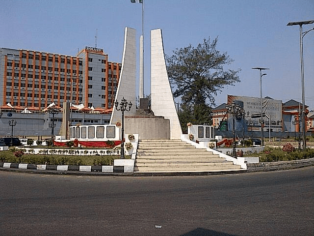
Prominent places in Imo State Popular places of tourist attraction in Imo State, Nigeria Oguta Lake and Golf Resort Located about 40km away from Owerri,…
Tourist places in Imo State Tourist places in Imo State, Nigeria include: Oguta Lake and Golf Resort Located about 40km away from Owerri, this motel…
Tourist places in Imo State, Nigeria Oguta Lake and Golf Resort Located about 40km away from Owerri, this motel and tourist resort is a 3-star hotel…
IMO STATE JUDICIARY The Judicial arm of Government in Imo state is made up of the high Court of Justice and Customary Court…
LGA in Imo State The LGAs (Local Government Areas) in Imo State, Nigeria are: Abo-Mbaise Ahiazu-Mbaise Ehime-Mbano Ezinihitte Ideato North Ideato South Ihitte/Uboma Ikeduru…
Imo State Constituencies List of Imo State Constituencies, House of Assembly Areas Okigwe Nwangele Owerri Municipal Ngor-Okpala Ideato South Onuimo Isiala Mbano Ikeduru…
Past Governors of Imo State Rear Admiral (retired) Ndubuisi Godwin Kanu 15 March 1976 – 1977 Rear Admiral Ndubuisi Godwin Kanu (rtd) was became military governor of Imo…
Imo State Past Governors Rear Admiral (retired) Ndubuisi Godwin Kanu 15 March 1976 – 1977 Rear Admiral (retired) Ndubuisi Godwin Kanu was appointed military governor of Imo…


 History")


